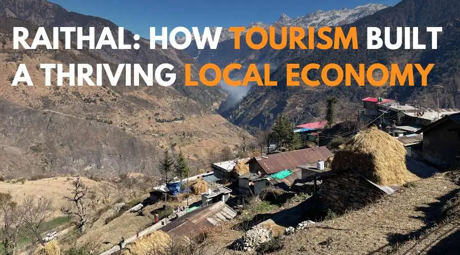
Overview
Surya Top Trek is a thrilling journey, fulfilling all your trekking dreams. Located in the Barahat mountain range at an elevation of 12900 ft. Surya Top can be reached as an extension of Dayara Bugyal Trek. Situated in the Garhwal Himalayas of Uttarkashi district,
Surya Top is the new member of the most loved trekking places. What makes Surya Top exciting is the final steep summit climb and a thrilling walk through the meandering ridges. The climb is not technical, but it will test your endurance level, so be prepared.
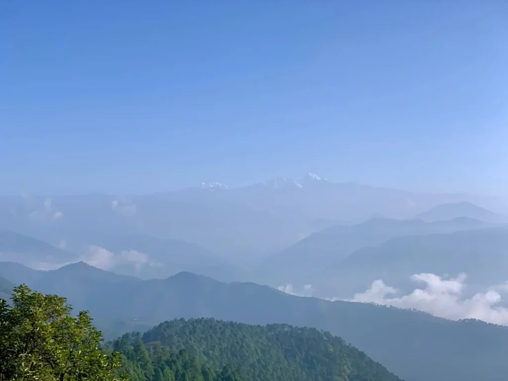
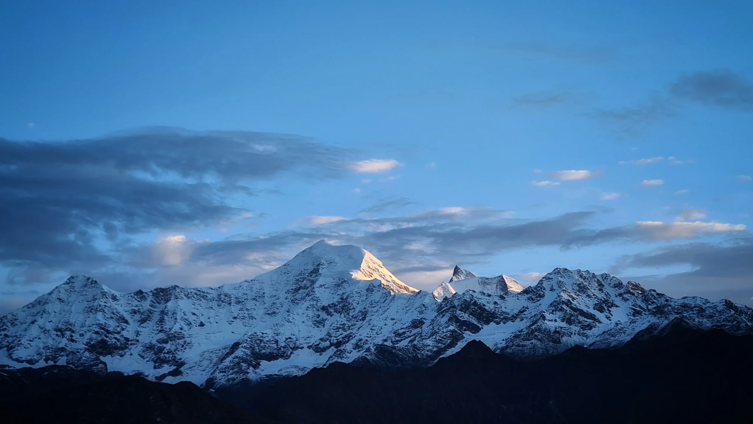
A hike through the dense forest of Deodar, Rhododendron, and the brown oaks of Moru and Kharsu takes you to the vast alpine meadows. Mindblowing views of peaks like Mt.Bandanpoonch, Kala Nag, and Gangotri peaks will leave you in awe.
Surya Top rewards you with never-before-closer looks at Gangotri Peaks on the right and Yamontri Peaks on the left. From the Top, enjoy the panoramic view of the Himalayas. You’ll feel like you can extend your hand and touch the peaks of Mt.Srikanta, Bhetiara ka Danda, etc.
Surya Top Trek gives you an opportunity to explore bugyals, dense forests, a ridge walk, and a summit climb.
Itinerary
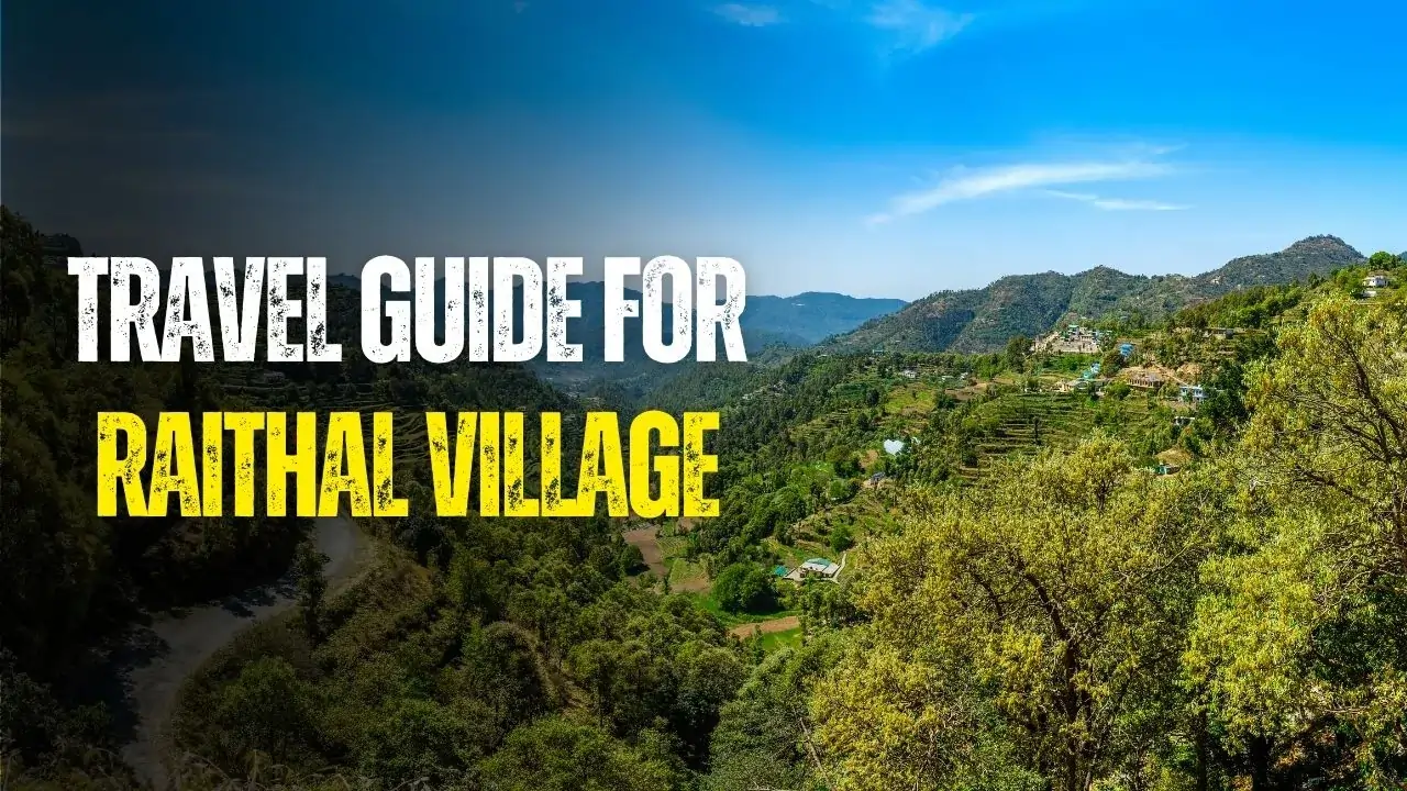
Day 1: Dehradun to Raithal Base Camp Drive
Drive Distance: 183 km
Drive Time: 6-7 hrs
Altitude: 7,100 ft
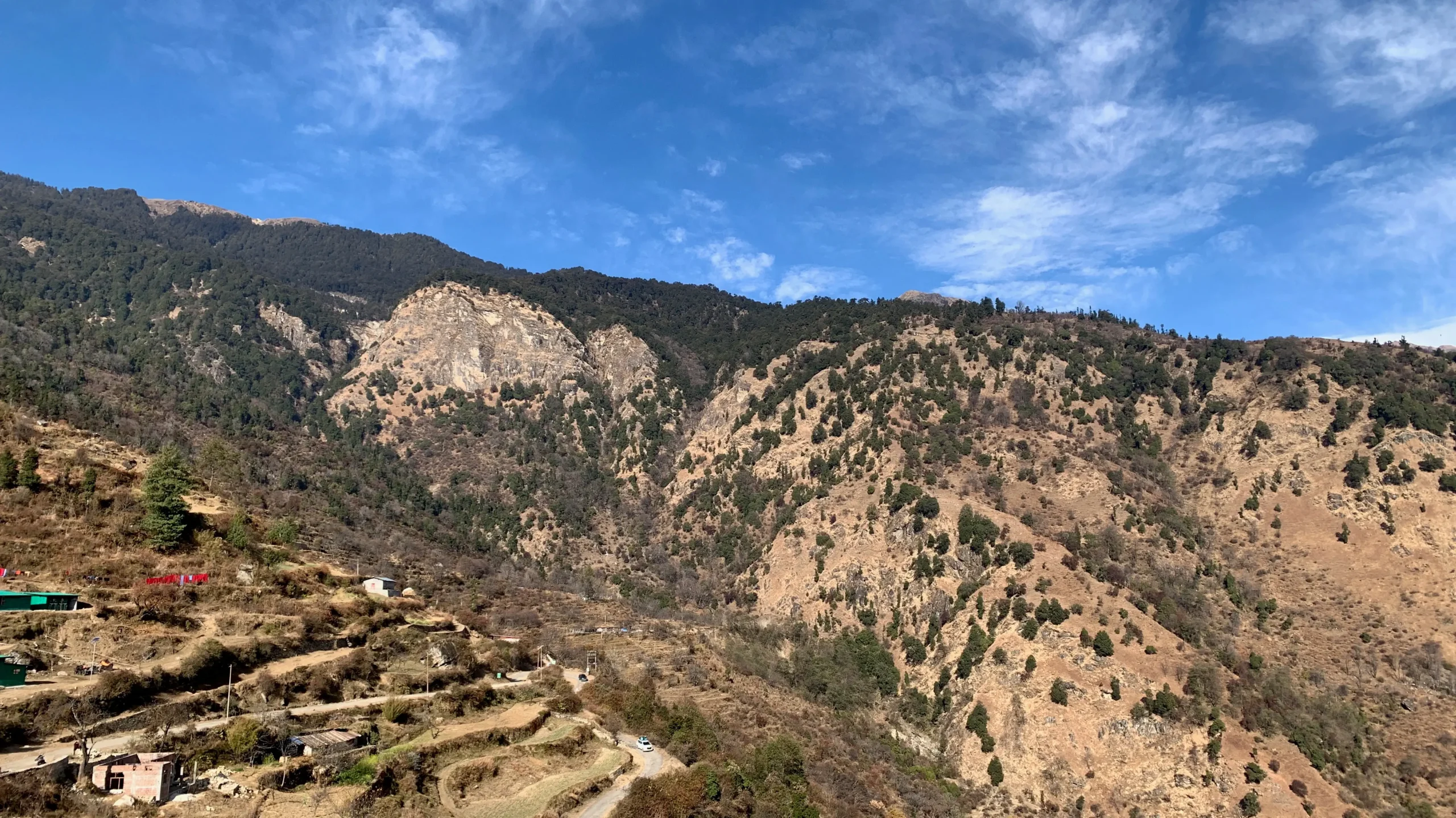
The first day is dedicated to reaching our base camp village – Raithal, also known as “Goat Village.” The only way to reach here is via shared taxi, private cab, or UTC bus. The route is filled with splendid views of the Garhwal Himalayas, lush forests, small towns, and famous ones like Mussoorie.
After crossing Mussoorie, you will come across a “Tingling Point (Moriana Top).” This point will grant you a clear view of various peaks like Mt.Srikantha, Mt Janauli, etc. On a very clear day, you can also witness Mt.Nanda Devi from this point as well.
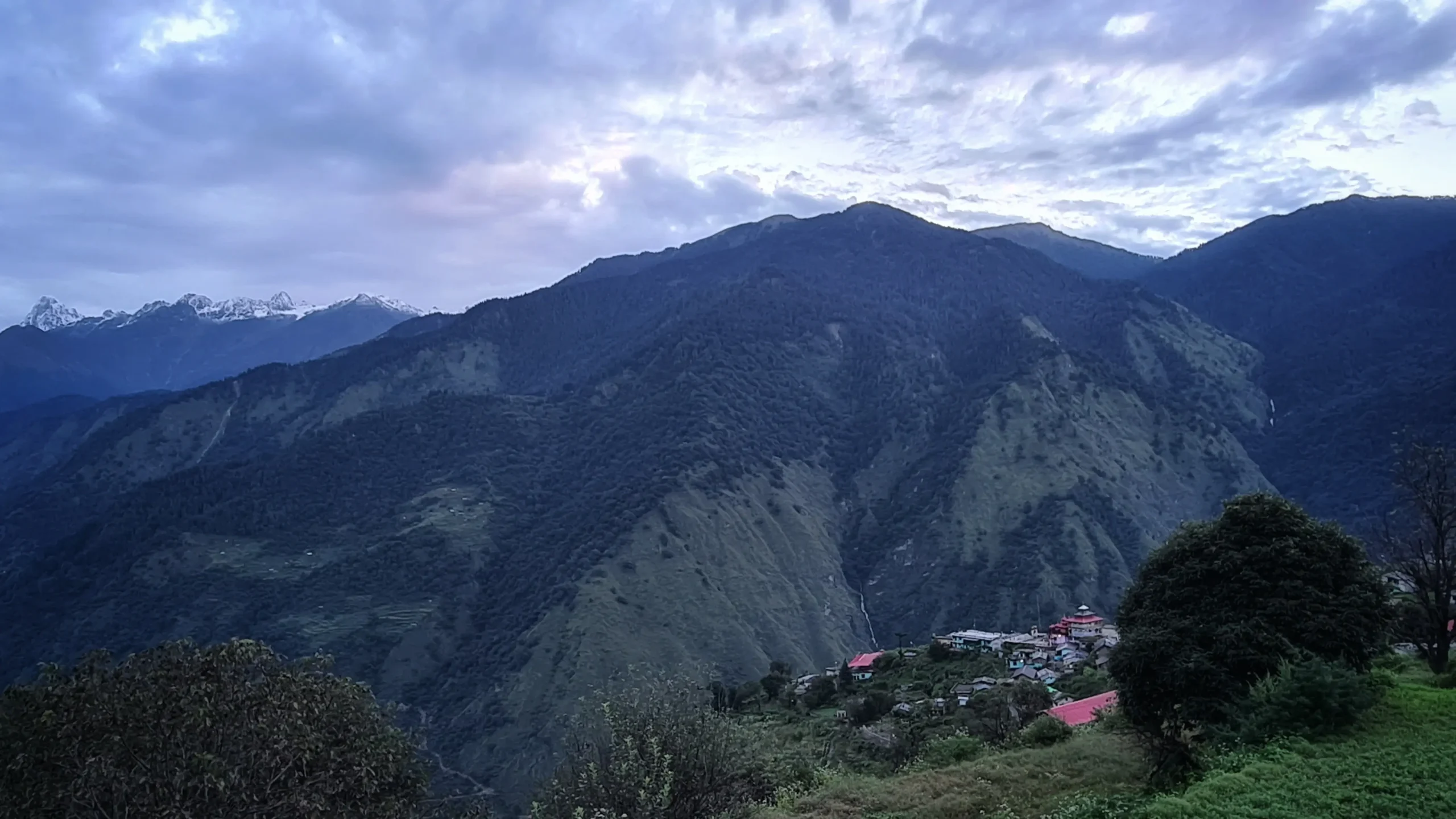
After we reach Raithal, the day is yours to enjoy. Experience the culture and traditions of locals. Explore the historical earthquake-resistant Panch Pura Bhavan, homestays, and ancient temples.
Trek Distance & Time: 6 km, 5-6 hours
Altitude Gain: 3,586 ft
Altitude: 10,728 ft
The real footwork starts from here. In the beginning, you’ll find the lush forest-covered trail; unlike other hilly areas, you’ll not find Pine trees here. The well-paved stone trails will help you enjoy the natural surroundings instead of looking for the right path.
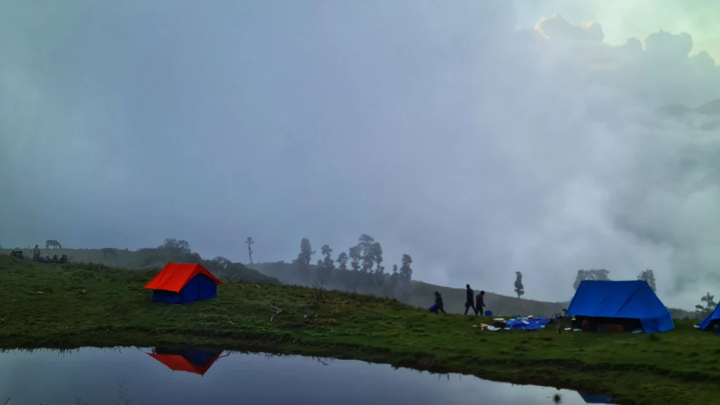
After walking for 4 km, you’ll come across the water point at Gui. Take a rest and drink some water here. Don’t miss a tree dedicated to Naag Devta and the twin lakes of Gui. At Gui, you’ll find hut-like structures called “Channi,” made by local people for temporary shelter and cattle herding. Some people prefer a short hike to the Gui Campsite and staying the night in Channi to experience local life by paying the owners.
Read other interesting facts about Gui Hike.
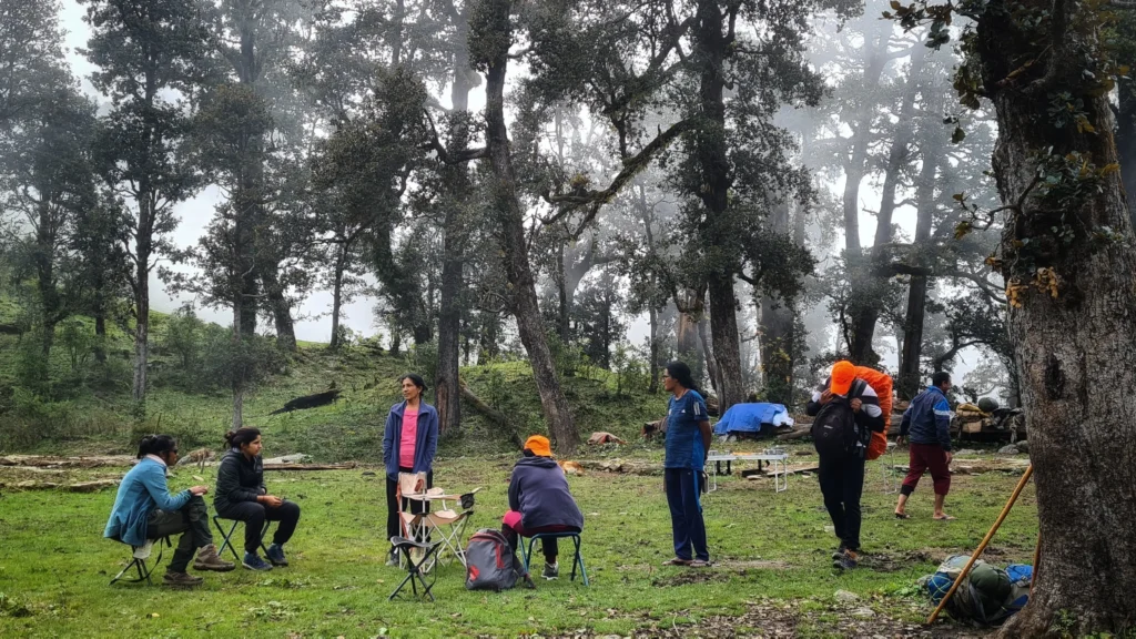
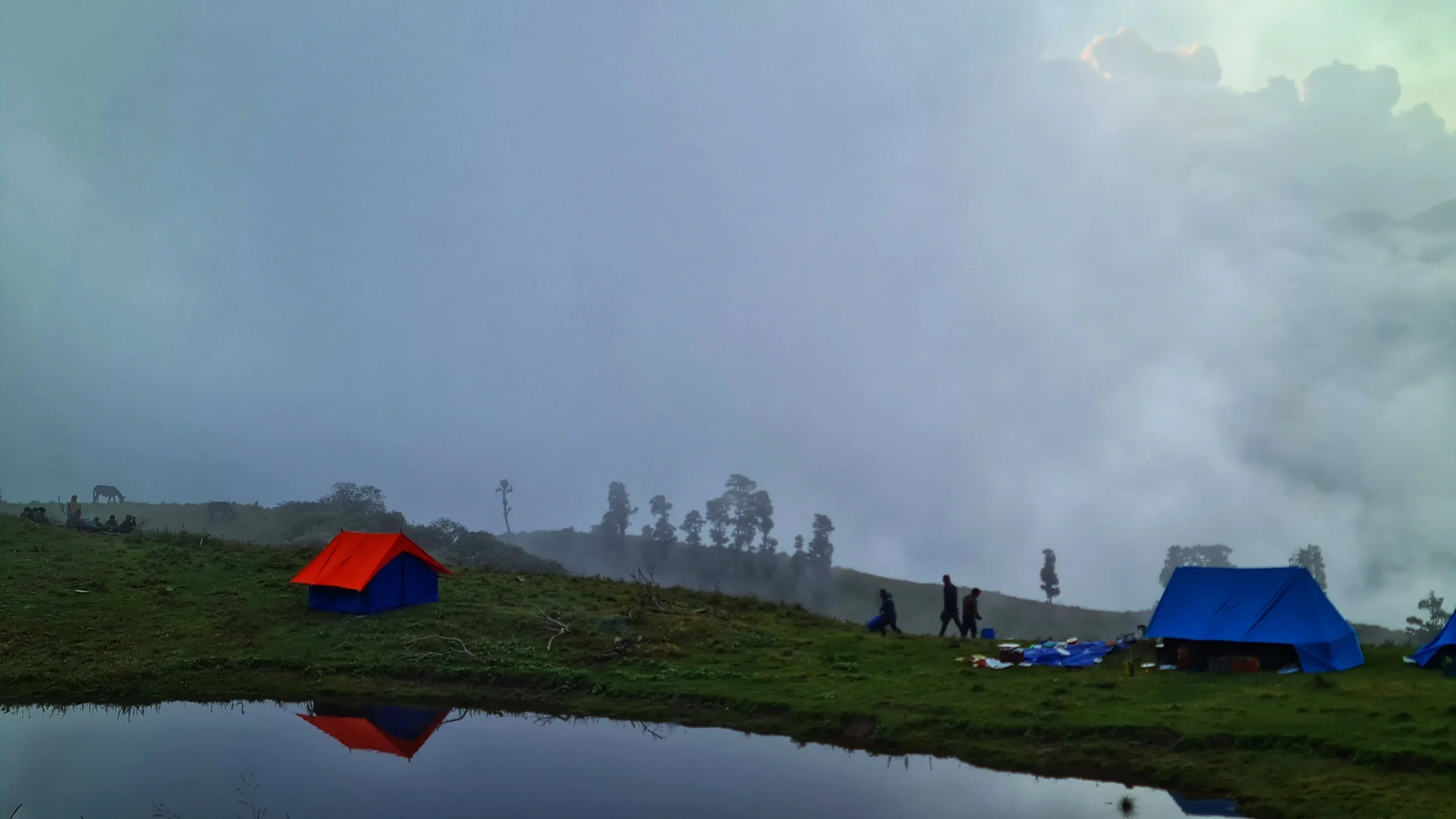
Our Chilapada campsite will be just a 2 km hike away from Gui. After reaching Chilapada, you’ll able to see the clear views of peaks, which won’t be so clear through the forest.
We will spend the night there, enjoy the hot food, share some stories, and sleep tight. The next day, we will need to get up early to start our hike refreshed.

Trek Distance: 7 km, 5-6 hours
Altitude: 11,900 ft
Altitude Gain: 1,200 ft
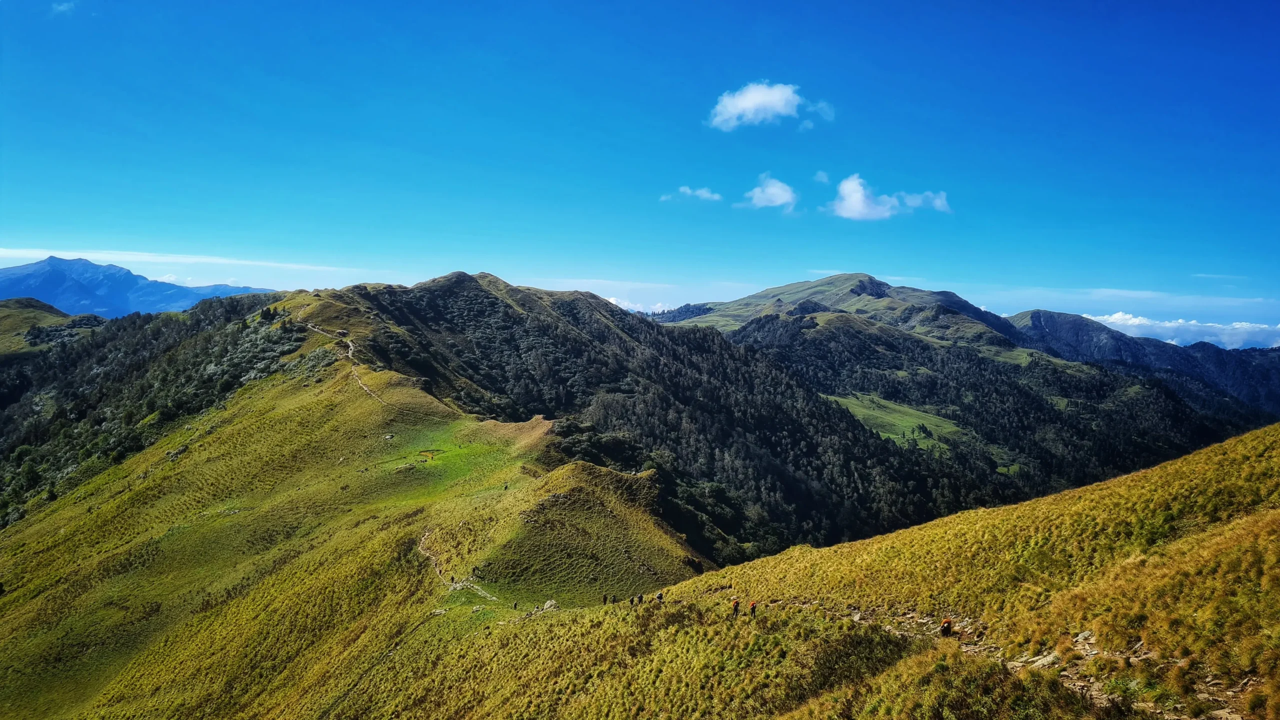
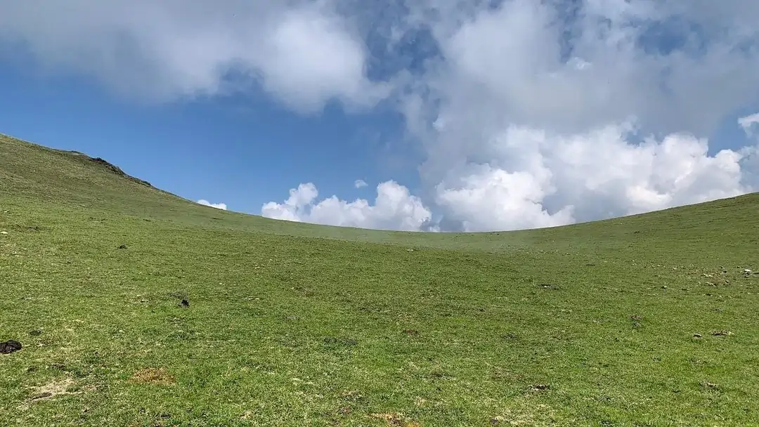
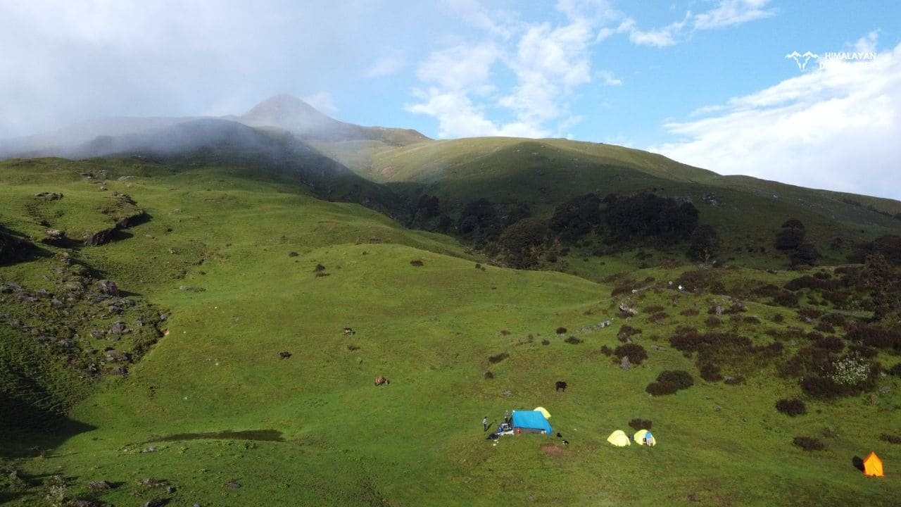
After hiking for approx 3 km, you’ll find your surroundings clear of the forest and vast alpine meadows of Dayara. After a steep ascent of 1 km, you will reach Dayara Top. From the Top you can enjoy a 360° view of the whole bugyal. There’s no doubt that Dayara Bugyal is incredible on its own, and many trekkers find themselves overwhelmed by this. What many don’t realise is that by walking a few more kilometres, you’ll find something grander waiting for you.
After walking for a few kilometres, we will reach Devkund, our campsite. Devkund translates to “Pond of Deities.” a seasonal pond offering the stunning reflection of Mt. Bandarpunch while stargazing.
The thrill is not over yet; you might spot wildlife animals like Barasingha, Brown bears, etc., but be careful and don’t disturb them.
Total Trek distance & Time: 5 km, 3-4 hrs
Altitude: 11,862 ft
Siyari, or Syari, is a small bugyal with an exquisite view of the Jogin Peaks group, such as Sphetic Pristwar, Kirti Stambh and Meru. Communities like Van Gujjars and locals use this land for cattle herding.
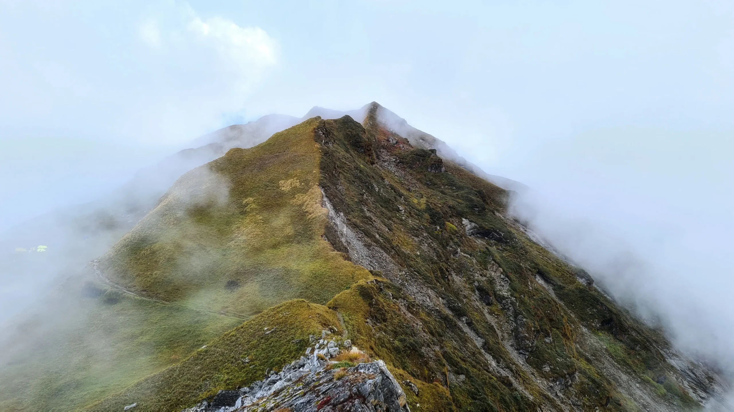
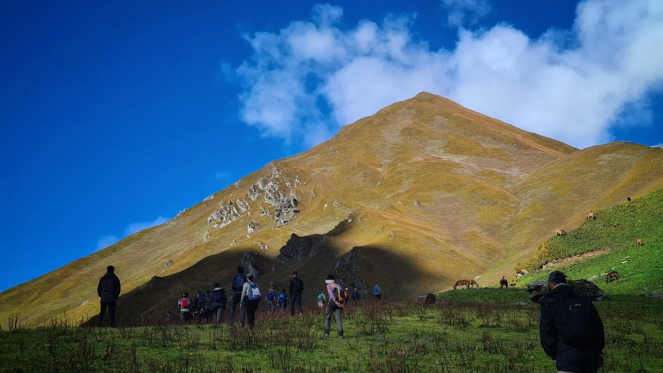
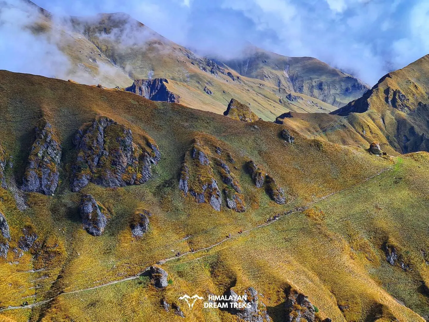
Devkund to Siyari is a ridge walk with a mixed gradient terrain of steep and flat grounds. The ridge walk starts with a gradual descent in the beginning to an easy walk for a break in the middle then an ascend to our goal to Surya Top.
This trail grants you views of the Dodital Range, Darwa Top, and the Eastern side of the Yamunotri Himalayas. Keep a look for different flora and fauna on your way.
Facts – Siyari Bugyal further connects you with Gidara Bugyal; you can extend your trek and cover both the bugyals.

Total Trek distance & Time: 8 km, 9-10 hrs
Altitude Gain/Loss: 11,862 ft to 12,950 ft, then 11,830 ft
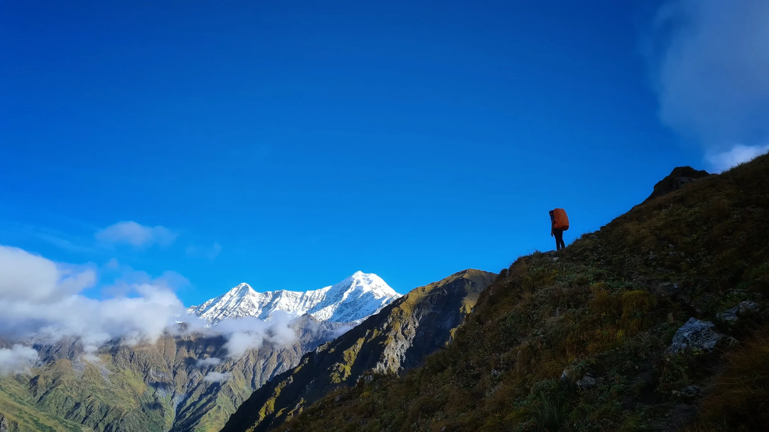
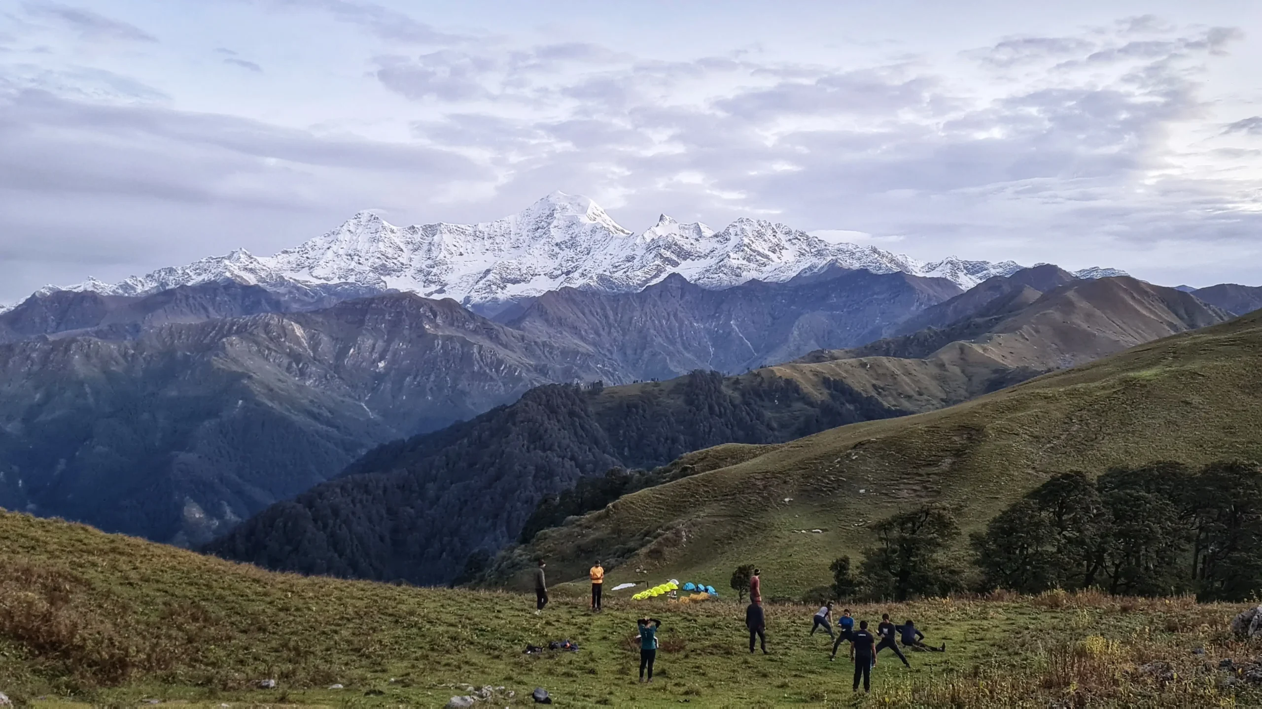
After reaching the Top, you will know the hype around this place. It literally takes you to the clouds and closer to several peaks. The closeness will give you the illusion that you can jump and land on other peaks like Mt.Bandapoonch and Kalanag.
This is the most awaited part of the trek. From Siyari, after walking a while, you’ll come across ridges to walk on. This is not a straight ridge but a serpentine one, which will add more fuel to your desire to reach the Top. The thrill will continue as you have to do a steep climb to reach the summit of Surya Top. Don’t worry; the climb won’t require any technical support, but it will test your physical endurance.
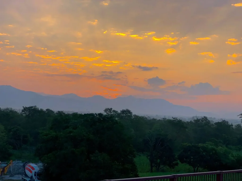
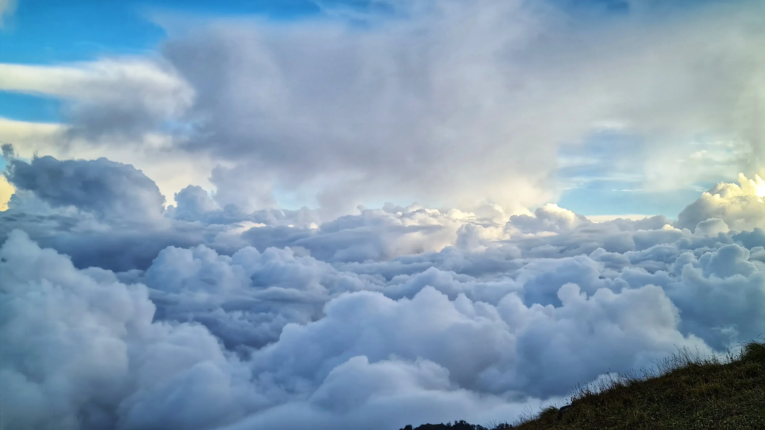
We will wake up early and start the trek to chase that sunrise in the mountains. We don’t want you to miss the red-orange colour scheme of the early hours in snow cascaded mountain. The scene will change into golden hour near sunrise on the Great Himalayas.
After enjoying and clicking many photos and videos, we will start our descent to Devkund.
We will take the much-deserved rest and spend the night under the starry sky in Devkund.
Total Trek distance & Time: 10 km, 5-6 hrs
After the thrill and adventure, you now descend leisurely and enjoy the vast grasslands of Dayara. As the path remains the same, you won’t find it difficult to walk down.
After reaching Raithal village, you can take the rest. In case you missed exploring the village on Day 1, then you can do it now.
Drive Distance & Time: 183 km, 6-7 hrs
Bid farewell to Raithal, Dayara Bugyals, and Suryal Top with a promise to visit again soon.
After enjoying a hot breakfast, we will leave for Dehradun and reach there by late afternoon.
Trek Package
Price Inclusion
Stay: 2 Nights stay in Raithal and 4 nights camping
Meals: Meals from Day 1 dinner to Day 7 breakfast
Trek Equipment: All essential trek equipment is included, such as sleeping bags, kitchen and dining tents, utensils, mattresses, personal tents, toilet tents, and crampons (if needed).
Forest Entry and Permits: All required fuel charges, tolls, forest entry fees, and permits are covered.
Trek Staff: A qualified, professional team, including a mountaineering-certified trek leader, guide, cook, and support staff, will accompany you.
Emergency Kit: First aid medical kits, oxygen cylinders, and stretchers are provided for safety.
Price Exclusion
Travel Insurance
Meals during the transportation
5% GST is not included
Offloading charges for backpack or personal luggage
Any expenses arising due to emergencies, delays, or unforeseen situations
Items or services not mentioned in the Price Inclusions section
Transportation from Dehradun to the base camp and back to Dehradun
Any personal expenses
Check the booking procedure here, including details on booking deposits, payment terms, refund and the cancellation policy.
Best Time to Visit
The best seasons for the Surya Top Trek are Summer, Spring, and Autumn. You can witness snow at the Top in all seasons as it is at high altitudes.
Pro Tip: To experience the chill of winter, you should trek between mid-March and to Starting of April.
Months: End of April to end of June
Temperature: Day – 15℃ to 18℃ ; Night – can drop to 2℃
The climate conditions are perfect for the trek as there will be no snow or hard cold weather to combat. You can summit the Top easily with beautiful views and the fragrance of maple, oak, and deodar in the air.
Another advantage is having the clear Dayara Meadows to yourself under the warm sun rays. At this time, the bugyals are warm and crisp with clear views.
Remember—Due to forest fires, pollens, dust particles, etc., the atmosphere can become hazy, and views can be unclear.
Months: Mid-September to October
Temperature: Day – 12℃ to 15℃ ; Night – can drop to -2℃
Autumn is the best season to capture the clearest images of peaks. Autumn is neither too hot nor cold but a perfect combination to enjoy your trek with magnificent views of the Himalayas.
You will witness the beautiful hues of brown and golden in Dayara Bugyal as trees start shedding their leaves. The path will be covered in a blanket of brown and red with the fragrance of maple and deodar in the air.
Months: Mid-March to April
Temperature: Day – 13℃ to 17℃ ; Night – can drop to 0℃
Spring brings the color back into the meadows, giving you a perfect color combination with the white backdrop of the Himalayas. Enjoy the snow at Surya Top without enduring brutal cold, as the snow will slowly start melting by the end of April.
As the extension of Dayara Bugyal, you’ll witness the colorful blooms of Rhododendrons in bright pink and orange shades. The whole bugyal will be full of life, greenery, and colors.
Surya Top Trek gives you the chance to spend 2 days in Dayara Bugyal and relish in nature.
Difficulty Level of Surya Top
The Surya Top trek is a “moderate” level trek. Treks which are longer in days with a few steep ascend and climb, fall under moderate level. Our itinerary takes 4-5 days to complete the Surya Top trek so that you can get used to high altitude and changing environments and acclimatise your body.
The climb to Surya Top is steep but not technical as there are no moraine or boulders in the path. But to do the climb, you need stamina and endurance.
It is advised to start following a proper routine and train your body to be fit. A healthy body will not only take you up to the Top easily but also help you with Altitude Sickness.
Exercising regularly and being fit will also improve your health and mood overall.
Trek Essentials [What to Pack]
- 45-60 Ltr Bag Pack With Rain Cover & Comfortable Straps
- Hot and Cold Water Bottle Like Borosil and Milton
- Energy Bar, Dry Fruits, and ORS
- Personal Medical Kit
- 1 Pair of Sunglasses (UV Protected)
- 1 Neck Gaiters (Buff)
- Tiffin Box
- 2/3 Full Sleeves (Non-Cotton)
- 1 Full Fleece T-Shirt
- 1 Fleece Jacket (Woolen or Sweater)
- 1 Down Feather/ Hollofil Jacket
- 1 Waterproof Jacket/ Poncho
- 1 Pair of Thermal Inners (Upper and Lower)
- 2 Trek Pants (Avoid Shorts and Denim Pants)
- 1 Pair of Waterproof Gloves
- 1 Pair of Woolen Gloves
- Sun Cap
- Woolen Cap
- 4 Pairs of Cotton Socks
- 1 Pair of Woollen Socks
- 1 Waterproof and High Ankle Trekking Shoes
- 1 Pair of Floaters
- Hand Sanitizer and Sunscreen Lotion
- Toothbrush and Toothpaste
- Toilet Paper
- Quick Dry Towel
- Lip Balm and Antibacterial Powder
- Moisturizer
- Aadhaar Card, Pan, or Passport for Applying Permit
- Trek Insurance
- Medical Certificate
- Self-Declaration Form
- Sleeping Bag
- Common Tent
- Mattress
- Dining Tent
- Camping Stool
- Walkie Talkie (For Team)
- Utensils
How To Reach
If you choose to reach Dehradun by flight, it is the easiest and quickest medium. However, the air flight does not take you directly to Dehradun, but to Jolly Grant Airport, the nearest airport from the city. It is located approximately 25 kilometers from the city center, where several domestic airlines operate regular flights to and from Dehradun. Upon landing at the airport, you can hire a taxi, vikram, or take bus to Dehradun.
It is recommended to book your tickets a month or two before your departure date. Last minute flight booking is usually higher than regular price.
If direct flights to Dehradun seem to be pricey, then it will be wise to take flights to Delhi as they are more affordable. From Delhi, you can reach Dehradun via state bus like UTC, or HRTC or use apps like Abhibus or Redbus. Railways and shared taxis are also good options.
Traveling by train is another great option to reach Dehradun. You can reach there within a short period as it is well-connected to major cities by train. The Dehradun Railway Station serves as the primary railway station while you can also always choose Haridwar Railway Station. You can book tickets on various trains connecting Dehradun to places like Delhi, Mumbai, Kolkata, and more.
You can also travel via road to Dehradun from your hometown. Dehradun is connected by National Highways from/to the major cities like Delhi, Kolkata, and Chadigarh. So it will not be a problem in getting a transportation to Dehradun; however, it might not be as quick as air flight.
Nevertheless, you can still enjoy the beautiful views of the Himalayan foothills during your ride.
Raithal is the point where we start our Dayara Bugyal Trek in Uttarakhand. It is approximately 183 kilometers away from Dehradun, which takes around 6 to 7 hours by public transportation. To reach Raithal you have to reach Uttarkashi first.
The bus to Uttarkashi leaves early in the morning around 5:30 am from Dehradun Hill station. You can also book your ticket online via the UTC portal. The average cost of the ticket is around 350 to 400 INR. Shared taxi option is also available.
If you are traveling via taxi, you will be charged around 400 to 500. You can hire a taxi from Rispana Pul and Parade Ground to Uttarkashi. Upon reaching Uttarkashi, you can rent another taxi to Raithal from Uttarkashi Taxi Stand. You must pay 100 to 150 INR to hire the taxi.
We have explained in detail how to reach Raithal Basecamp. Give it a read!
Map of Trail
More Info regarding Surya Top
Uttarakhand as a state is full of vibrant culture, traditions and many historical sights. Our base camp is not behind the richness of the same. Raithal might be a small village, but it has many wonders for you to witness. Experience the Garhwali culture, spirituality, and the way of living in Raithal.
Visit and solve the puzzle of the ASI-marked ruins of the Sun Temple with a mix of Buddhist relics. Other temples like Someshwar Devta temple and Bhagwati Devi temple hold a special place in the hearts of villagers. Villagers celebrate and organise festivals like Someshwar Devta Mela, Selku Fair, and Pandav Nritya/Leela, submerging in devotion to the Gods.
Another infamous festival you can witness is the “Butter Festival,” also known as “Andhuri Utsav”. It is celebrated to thank the deities for protecting them and their cattle from harsh weather and to pray for continued blessings.
The Panch Pura Bhawan is a 500-year-old building made by using a 1000-year-old Koti Banal Architecture. This bhavan withstood three earthquakes, including the devastating 1991 Uttarkashi Earthquake. You will find old wooden homes made of deodar wood in the villa, which will take you back in time.
If observant, you will find various species of flowers, animals, birds, etc in these areas. Being at a high altitude, these places create a perfect environment for flora and fauna to thrive and the footprint impression is also less. Flora and Fauna are also one the reasons we request you to follow the Leave No Trace principles while trekking.
A few notable species of flora are –
Trees – Trees make the magical forest of these areas, sheltering a large number of animals, birds, reptiles, flowers, butterflies, etc.
The common trees near bugyals at an elevation of 2000m to 3000m are Oak, Rhododendron and Deodar – a Himalayan Cedar. In the Sanskrit language, Deodar translates to “Devdāru”, meaning Wood of Gods or Timber of the Gods.
Beyond 3000 m, you’ll find Himalayan Birch or Bhojpatra trees whose leaves were used in ancient times for recording manuscripts.
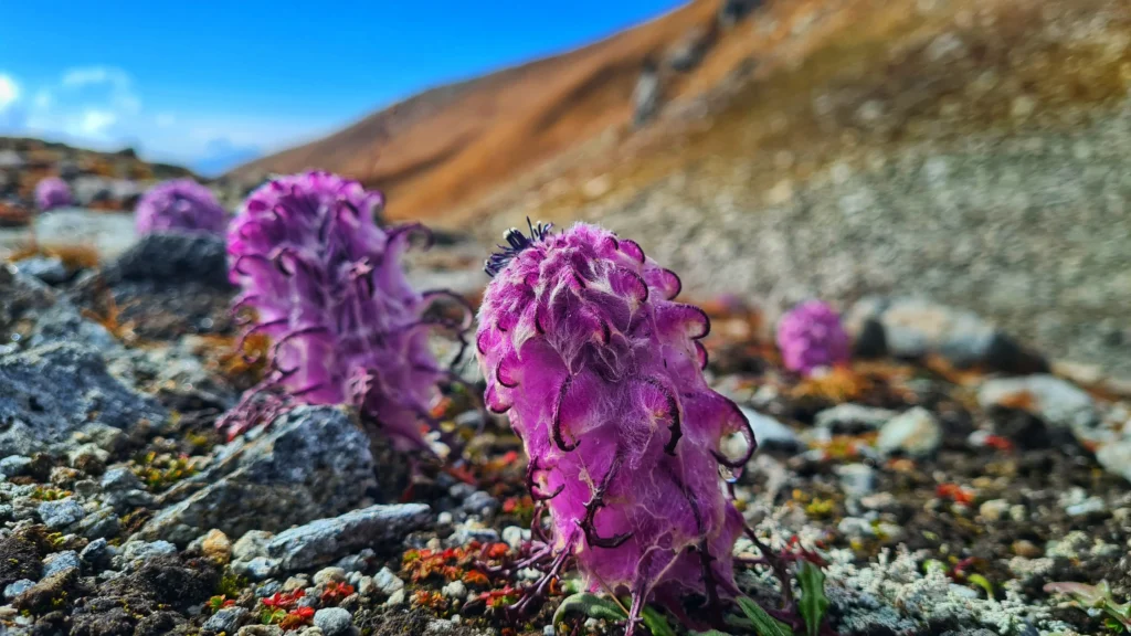
Flowers – Uttarakhand is famous for its valley of flowers and you’ll not be disappointed on this trek as well. Rare flowers like Blue poppy, also known as “Hemkamal” or snow lotus, will mesmerise you with its softness and strength to bloom even in the harsh terrains of the Himalayas.
Once in a year, you’ll find all the villagers going up in the high altitudes in search of an auspicious flower, “Brahmakamal” (State flower of Uttarakhand). Locals offer this flower to Someshwar Devta to seek happiness and prosperity. This flower only blooms at night once a year in the late summer or early autumn. This phenomenon makes it rare and a sight to behold.

In spring, you’ll find a prism of colours on your way as the Rhodendodrons flower blooms will welcome you with a colourful garland of oranges, red and pink. The bugyal presents various other varieties of flowers, such as orchids, marigolds, etc, in different shades.
Alpine Meadows – The vast grasslands of Dayara Bugyal and Siyari Bugyal present you with the chance to walk on a few of the highest alpine meadows in the country. These grasslands also serve as pasturelands for cattle herding.
Fauna
The forests shelter various animals, birds, butterflies, fishes, etc. You can spot Himalayan Langoors, Himalayan Griffon Vultures and if luck is on your side, maybe Snow Leopard as well. For birdwatchers, this can be a paradise as you can spot Monal, the state bird of Uttarakhand, Long-tail Minivet, Yellow Billed Chough, etc, on your way.
As we discussed earlier, the abundance of flowers is present here, so it’s natural for butterflies to follow in. Try to identify a few of butterflies like –
Peacock Pansy – golden coloured spotted with eye looking brown dots.
Red-base jezebel – Tweaked with red in inner corners followed by yellow and black outline.
Saturn – Moth – brown-coloured moth with 4 eye-like spots on the wings.
- Gangotri Dham – This temple is a part of Char Dham Shrines, the originating place of India’s longest river Ganga.
- Harshil Valley – One of Uttarakhand’s underrated places, Harsil Valley, is a cluster of 8 villages with scenic views, treks, temples and more.
- Nachiketa Tal – An unspoiled lake at an elevation of 8074 ft above sea level. This lake is just 29km away from Uttarkashi.
- Nelong Valley – This cold desert is also known as “Ladakh of Uttarakhand” because of its striking resemblance with Ladakh, Spiti and Lahaul.
- Kashi Vishwanath Temple – Situated on the banks of river Bhagirathi, this is among the oldest temples of Uttarakhand in Uttarkashi.
- Gangnani Hot Spring – A natural hot water spring, a perfect place to find peace and solace en route to Gangotri Dham.
SCI, Foreign Permit & Vehicle
HDT is registered with the IMF, and we can cater to the needs of SCL for Government Employees. According to the rule, the government of India provides its employees with a prospect where they’re allowed to apply for a 30-day special casual leave in a calendar year to do trekking, hiking, or whatever adventure pleases them.
Mail us at info@himalayandreamtreks.in or call us at +91 80896 93825, if you want to avail SCL.
For foreign nationals, permit charges are different, and hence the overall package price is different for foreign trekkers. Connect with us before booking your trek.
- For 4-6 people Ertiga/Bolero or equivalent vehicle.
- For 7 or more people, Force Traveller.
FAQs
Yes, the way to Surya Top crosses the whole expanse of Dayara Bugyal.
Around 10 km
Till Raithal, you’ll have good connectivity. Few connections like Airtel and Jio can be found till Gui.
Yes, given they are physically fit.
Yes, we can customize and include Giadara Bugyal, Bamsaru Pass, and Dodital Circuit as per your plan.


Leave a Comment