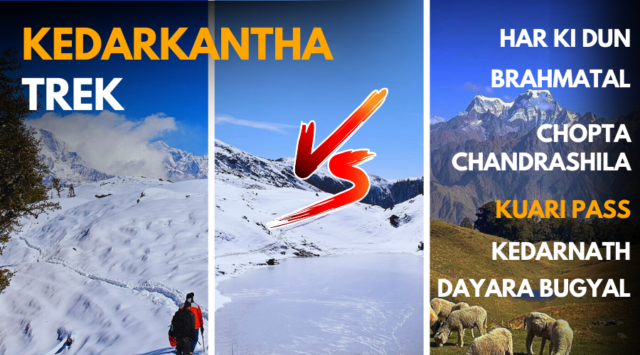
Desiring to go on a trek in Uttarakhand but confused among so many trekking destinations? If yes, then you are reading the right article.
Located within Govind Wildlife Sanctuary in Uttarkashi District, Kedarkantha trek is the most famous winter trek in India, and after completing this trek a lot of trekkers come to the point of what should be the next destination. Brahmatal, Kuari Pass, etc. might be some of the other treks in your consideration, so this article will give you an overview of these treks and how they look as compared with the Kedarkantha trek, whether you have done it or not, both kinds of the trekkers will find it helpful.
Additionally, in this Kedarkantha Vs Other Treks article, we shall unveil every significant detail about Brahmatal, Kuari Pass, Dayara Bugyal, Har Ki dun, Chopta Chandrashila, and Kedarnath trek. Through this, you will get an idea of the uniqueness and speciality of each trek in depth.
Table of Contents
Kedarkantha Trek: Standard Trek for Comparison
As we discussed above, the Kedarkantha trek is the standard trek to compare other 6 treks. Through Tabular Representation, you will see the comparison between Kedarkantha and other treks clearly. All the details like trek distance, difficulty level, basecamp, and many more, except Attractions are mentioned in the tables of each section. So here we are mentioning the Attractions of Kedarkantha Trek.

Attractions of Kedarkantha Trek
Juda ka Talab:
- You’ll find this pristine lake on the route to the Kedarkantha trek that will amuse you with its frozen charm.
- It is situated at an elevation of 2,700 m, and travellers love to camp near this lake.
- The story goes around when Lord Shiva once opened his wet locks; the droplets of water flowed out and led to the creation of this pond.
Kedarkantha Summit:
- This spellbinding Himalayan peak stands at an elevation of 12,500 ft.
- The trek also includes the Govind Wildlife Sanctuary, which is an ideal spot for a variety of flora and fauna.
- The temple at the summit enshrines the idols of Lord Shiva, his wife, Goddess Parvati, and his son, Lord Ganesha.
1. Kedarkantha Vs Brahmatal
Brahmatal Trek, being one of the best winter treks, gives good competition to the famous Kedarkantha Trek. So in this section of Kedarkantha Vs Brahmatal, Let’s compare these two beautiful treks of Uttarakhand.

Trek Overview
If we look at the Brahmatal Trek from a wide perspective, then compared to the Kedarkantha Trek, it’s a lengthy yet easy snow trek. Beginning from Lohajung, it takes about5 to 6 Days to complete this enthralling trek. Located at 12,250 ft, the Brahmatal trek is known for its charismatic lake, Bekaltal Brahmatal, and the tranquil views of famous peaks like Trishul, Nandaghunti, and Chaukhambha. Here’s the table depicting the clear differences and similarities of both treks.
| Parameter | Kedarkantha Trek | Brahmatal Trek |
| Altitude | 12,500 Ft. | 12,250 Ft. |
| Trek Distance | 20 Km | 24 Km |
| Days Required | 3 to 4 Days | 5 to 6 Days |
| Trek Difficulty Level | Easy to Moderate | Easy Winter Trek |
| Best time to trek | Winter | Winter |
| Basecamp | Sankri Village | Lohajung |
| Trek Category | Winter Trek & Beginner Friendly Trek | Winter Trek |
Best Season to trek
Similar to Kedarkantha, the best season to trek Brahmatal is December to March. As it’s a snow trek, the real joy of trekking is in these months only.
Weather and Temperature
| Season | Kedarkantha Trek | Brahmatal Trek |
| Summer | (6°C to 19°C) | (8°C to 22°C) |
| Winter | (-14°C to 1°C) | (-8°C to 6°C) |
| Autumn | (0°C to 15°C) | (-3°C to 19°C) |
| Spring | (2°C to 13°C) | (-2°C to 15°C) |
Attractions and Views
| Attractions of Kedarkantha Trek | Attractions of Brahmatal Trek |
| Juda Ka Talab Kedarkantha Summit | Bekaltal Lake Brahmatal Lake Jhandi top Gujreni Tilandi Top Brahmatal Summit |
As you can see in the Table, the Brahmatal Trek offers more attractive spots compared to the Kedarkantha Trek. So, at this parameter, Brahmatal trek leads.
Let us look at the highlights of the attractions of this trek.
Bekaltal Lake:
- From Lohajung, the base camp, Bekaltal Lake, is at a height of 2800m.
- Tourists often enjoy taking a brisk walk alongside this lake as it presents the serene views of oak and rhododendron forest.
- During winter, the lake gets frozen with a snow sheet, which enhances its charm.
Brahmatal Lake:
- The Brahmatal Lake is elevated at a height of 12,000 feet.
- A legend says Lord Brahma created this lake so that he could wet his finger to turn the pages of the Veda he was writing.
- The majestic lake offers great vistas of several mountain peaks; popularly, the Trishul and the Roopkund trails can also be seen from here.
Jhandi top:
- The other attraction in the trek is Jhandi Top, which is located almost at the heart of the trek.
- This meadow opens up to the views of Mt. Trishul on the right and Mt. Nanda Ghunti on the left.
- Moreover, it unveils the ridge, the Ronti Saddle, which connects these two above-mentioned mountain peaks.
Gujreni:
- The Gujreni is the first campsite of the Brahmatal Trek and is one of the most enthralling campsites in Uttrakhand.
- This landscape is completely encircled by alpine, conifer, cider, and oak forest.
- This picturesque meadow serves as an ideal spot for photography, and you can also spot several Himalayan wildlife.
Tilandi Top:
- The Tilandi top is situated at a height of 10,495 ft.
- During winter, this top turns into a snow paradise and makes the overall trek unforgettable.
- To enjoy nature at its best, you must witness either a sunrise or sunset from here.
Brahmatal Summit:
- The Brahmatal summit is the highest point of this trek at an elevation of 12,250 ft.
- The summit displays the best views of the famous mountain peaks, including Chaukhambha, Maiktoli, Neelkanth, etc.
| Peaks Visible from Kedarkantha Trek | Peaks Visible from Brahmatal Trek |
| Swargarohini, Kala Naag, Bandarpunch, Yamunotri Range, Ranglana | Trishul, Chaukhambha, Nanda Ghunti |
Ease of Reaching Basecamp
| Ease of Reaching Base Camp of Kedarkantha Trek | Ease of Reaching Base Camp of Brahmatal Trek |
| The base camp of Kedarkantha trek is Sankri Village at a distance of 189 Km from Dehradun. So it will take about 7-8 hours to reach the base camp from Dehradun by driving. | On the “Ease of Reaching Basecamp” parameter, the Brahmatal trek is a bit more challenging than the Kedarkantha Trek. Because the way to reach its Basecamp Lohajung starts from Rishikesh, and the distance between Rishikesh and Lohajung is about 245 Km away. Hence, it takes about 9-10 hours of drive to reach the base camp of Brahmatal Trek. |
Cultural and Historical Connection
| Kedarkantha Trek | Brahmatal Trek |
| The legend behind the formation of this land is related to a time when Lord Shiva, with his wife Parvati, came across the Garwahal region. Being struck with its enchanting beauty and tranquil nature, they decided to meditate here for a while and used it as their temporary home. The energy coming from Lord Shiva was so powerful that it gave birth to a plain around Kedarkantha. While celebrating their local festivals, the villagers often perform and tell these stories through their dances, skits, songs, etc. Moreover, it’s also believed that this region has served as the Safest place for different tribespeople. | The Brahmatal trek located in the Chamoli District of Uttarakhand is remembered to be the land of God. Its name in itself showcases its significance. As per Hindu mythology, the Brahmatal is the lake or the place where the Creator of the world, Lord Brahma ji, performed penance for several years. Thousands of devotees undertake this trek throughout the year, and on reaching the final summit, they pay their obeisance to the lake, which in winter is always frozen and beautiful beyond imagination. |
2. Kedarkantha Vs Kuari Pass
Kuari Pass, famous as one of the best winter trek and oldest trekking trails, is located in the Chamoli district in Uttarakhand. Passing through beautiful forests, the Kuari Pass trek exhibits a great high-altitude Meadow as well as a campsite. So, Let’s move forward and compare it with the Kedarkantha trek.

Trek Overview
Settled at 12,500 ft. altitude, this breathtaking trek Kuari Pass begins from Dhak village. Compared to Kedarkantha and Brahmatal, this trek is lengthy and moderately challenging. But the views and experiences that you will get rewarded while trekking will make your steps worth it.
| Parameter | Kedarkantha Trek | Kuari Pass Trek |
| Altitude | 12,500 ft. | 12,500 ft. |
| Trek distance | 20 Km | 33 Km |
| Days Required | 5 Days | 6 Days |
| Trek Difficulty Level | Easy to Moderate | Moderate |
| Best time to trek | Winter | Winter |
| Basecamp | Sankri Village | Dhak Village |
| Trek Category | Winter Trek | Winter Trek |
Best Season to trek
In general, Kuari Pass is among winter treks, so December to February is the best season to trek. However, if you like the monsoon season, in which there is greenery all around, then you can consider trekking here in July or August.
Weather and Temperature
| Season | Kedarkantha Trek | Kuari Pass Trek |
| Summer | (6°C to 19°C) | (7°C to 23°C) |
| Winter | (-14°C to 1°C) | (-7°C to 12°C) |
| Autumn | (0°C to 15°C) | (1°C to 17°C) |
| Spring | (2°C to 13°C) | (2°C to 14°C) |
Attractions and Views
| Attractions in Kedarkantha Trek | Attractions in Kuari Pass Trek |
| Juda Ka Talab, Kedarkantha Summit | Gorson Bugyal, Khullara Campsite, View of Giant Himalayan Peaks |
The Kuari Pass Trek is cocooned in the snowy ranges of the Garhwal Himalayas in Uttarakhand.
Gorson Bugyal:
- This Gorson Bugyal is an alpine meadow that is referred to as a Skiing spot at an altitude of 3,519 m.
- The trail to the Bugyal goes through the apple orchards and the forest of oak and Deodar trees.
- It offers majestic views of peaks such as Hathi Parvat, Nilgiri Parvat, Nanda Devi, and others.
Khullara Campsite:
- The Khullara campsite leads you to Kuari Pass while encompassing huge green meadows in summer and glaciers in winter.
- It delivers impeccable vistas of Mt. Dronagiri and other mountain peaks to its visitors.
- Near the campsite, you’ll also see varieties of some of the most rare flowers.
| Peaks Visible from Kedarkantha Trek | Peaks Visible from Kuari Pass Trek |
| Swargarohini, Kala Naag, Bandarpunch, Yamunotri Range, Ranglana | Dronagiri Parvat, Nanda Devi, Ghori Parvat, Hathi Parvat |
Ease of Reaching Basecamp
| Ease of Reaching Base Camp of Kedarkantha Trek | Ease of Reaching Base Camp of Kuari Pass Trek |
| The base camp of Kedarkantha trek is Sankri Village at a distance of 189 Km from Dehradun. So it will take about 7-8 hours to reach the base camp from Dehradun by driving. | Compared to the Kedarkantha trek, it takes more time to reach the base camp of the Kuari Pass trek. Firstly, you need to reach Joshimath from Rishikesh, which is approximately 250 km. Thereafter, on the second day, you need to drive 12 km more to reach Dhak Village from Joshimath. And from the Dhak Village, the trek kicks off. |
Cultural and Historical Connection
| Kedarkantha Trek | Kuari Pass Trek |
| The legend behind the formation of this land is related to a time when Lord Shiva, with his wife Parvati, came across the Garwahal region. Being struck with its enchanting beauty and tranquil nature, they decided to meditate here for a while and used it as their temporary home. The energy coming from Lord Shiva was so powerful that it gave birth to a plain around Kedarkantha. While celebrating their local festivals, the villagers often perform and tell these stories through their dances, skits, songs, etc. Moreover, it’s also believed that this region has served as the Safest place for different tribespeople. | This winter trek has a history related to the times of British India. The trek is also known as the Curzon Trail, and this carries a long story behind it. It is believed in 1905 when Lord Curzon was the Viceroy of India, he undertook this trek from Ghat to Kuari Pass, and the trail he followed has been called the Curzon Trail since then. On his way, he crossed five rivers, which are Mandakini, Pindar, Kaliganga, Bheriganga, and Dhauliganga. |
3. Kedarkantha Vs Dayara Bugyal
Dayara Bugyal, an incredible trek in Uttarkashi District leads trekkers to a beautiful alpine meadow that is Dayara Bugyal itself. Here, we shall compare the Kedarkantha Vs Dayara Bugyal trek and will look into the differences and similarities in a variety of important parameters.
Trek Overview
Starting from Raithal Village, the Dayara Bugyal trek is heightened at a comparatively lower altitude that is 12,400 ft. With an average distance of 22 Km, this trek is rising as a preferred choice among trekkers. Crossing the trails surrounded by deciduous and alpine trees, when you reach the top of Dayara Bugyal, the views from there are just heavenly.
| Parameter | Kedarkantha Trek | Dayara Bugyal Trek |
| Altitude | 12,500 ft. | 12,400 ft. |
| Trek Distance | 20 Km | 22 Km |
| Days Required | 3 to 4 Days | 3 to 4 Days |
| Trek Difficulty Level | Easy to Moderate | Easy |
| Basecamp | Sankri Village | Raithal Village |
| Best time to trek | Winter Season | Winter, Spring |
| Trek Category | Winter Trek | Beginner Friendly Trek |
Best Season to trek
The best season to trek for Dayara Bugyal trek is Winter and Spring. To snow lovers, it’s good to trek from December to February. Whereas for spring lovers, the best time to trek is from Late February to early April.
Weather and Temperature
| Season | Kedarkantha Trek | Dayara Bugyal Trek |
| Summer | (6°C to 19°C) | (7°C to 23°C) |
| Winter | (-14°C to 1°C) | (-6°C to 13°C) |
| Spring | (2°C to 13°C) | (3°C to 16°C) |
| Autumn | (0°C to 15°C) | (1°C to 18°C) |
Attractions and Views
| Attractions in Kedarkantha Trek | Attractions in Dayara Bugyal Trek |
| Juda Ka Talab Kedarkantha Summit | Barnala Lake Bakaria Top Gui Campsite |
Barnala Lake:
- Amidst the dense pine and oak forest, the lake sits beautifully and offers views of peaks such as Draupadi ka Danda, Shrikanth, Gangorti, etc.
- While ascending your way to Barnala Lake, the Gangotri range will be there before your eyes.
- During summer, the whole landscape transforms into a land of lush greenery with white and purple flowers.
Bakaria Top:
- The Bakaria top, the next stop of the Dayara Bugyal, is heightened at an elevation of 3,780 m.
- It unveils some of the magical sceneries of the alpine forests and Himalayan ranges.
- The most renowned Bandarpoonch Peak and the Draupadi ka Danda Peak are visible from any point at this top. On one of its sides, you can see the delightful hamlets of the valleys.
Gui Campsite:
- The Gui campsite is the first halt in the trek of the Dayara Bugyal and is the most serene location.
- Sunrise and sunset views from this campsite are unparalleled and will leave you stunned.
- This campsite is often covered in snow and lets you witness the serene beauty of Jaonli, the Gangotri range, Srikanth, and more.
| Peaks Visible from Kedarkantha Trek | Peaks Visible from Dayara Bugyal Trek |
| Swargarohini, Kala Naag, Bandarpunch, Yamunotri Range, Ranglana | Bandarpunch Janoli, SriKanth, Kala Naag, Draupadi ka Danda, Gangotri Range |
Ease of Reaching Basecamp
| Ease of Reaching Base Camp of Kedarkantha Trek | Ease of Reaching Base Camp of Dayara Bugyal Trek |
| The base camp of Kedarkantha trek is Sankri Village at a distance of 189 Km from Dehradun. So it will take about 7-8 hours to reach the base camp from Dehradun by driving. | The distance between the Basecamp of Dayara Bugyal Trek and Dehradun is about 183 Km, which is 2 Km less compared to the Kedarkantha Trek. You can cover this distance from Dehradun to Raithal in about 7-8 hours of drive. In short, Dayara Bugyal is the better trek on this parameter of ease of reaching basecamp. |
Cultural and Historical Connection
| Kedarkantha Trek | Dayara Bugyal Trek |
| The legend behind the formation of this land is related to a time when Lord Shiva, with his wife Parvati, came across the Garwahal region. Being struck with its enchanting beauty and tranquil nature, they decided to meditate here for a while and used it as their temporary home. The energy coming from Lord Shiva was so powerful that it gave birth to a plain around Kedarkantha. While celebrating their local festivals, the villagers often perform and tell these stories through their dances, skits, songs, etc. Moreover, it’s also believed that this region has served as the Safest place for different tribespeople. | In the Uttarkashi district of Uttarakhand, this pristine trek to Dayara Bugyal comprises an important local cultural festival called Anduri Utsav, or the Butter Festival. For the villagers of Raithal, this holds much more significance when they play with butter and buttermilk and not with colors. Besides, they also enjoy playing their local instruments, skits, and folk dances such as Thali Nritya, Chholiya, Jhora, etc. To witness the thrill of this festival, thousands of devotees come here every year to celebrate. |
4. Kedarkantha Vs Har ki Dun
Har ki Dun trek, resembling its name with the sacred land of Hari (God), is one of the fascinating treks of Garhwal. Its long trekking trail will expose you to forests, rivers, and other beautiful geographical landscapes. So let us do the comparison between Kedarkantha Vs Har Ki Dun trek and see the surprising distinctions.

Trek Overview
Har Ki Dun trek is comparatively lengthy but located at a lower altitude. Beginning from the same base camp, Sankri Village, this trek beholds the linkage with the mythological stories of Pandavas. Due to being a lengthy trek, it comes under the moderately challenging category, so you need to be physically prepared for this 44 km-long trek.
| Parameter | Kedarkantha Trek | Har Ki Dun Trek |
| Altitude | 12,500 ft. | 11,400 ft. |
| Trek Distance | 20 Km | 44 Km |
| Days Required | 3 to 4 Days | 7 Days |
| Trek Difficulty Level | Easy | Moderate Challenging |
| Basecamp | Sankri Village | Sankri Village |
| Best time to trek | Winter | Summer and Winter |
Best Season to trek
Har ki Dun trek fits both the Summer as well as Winter seasons. So, if you are fond of trekking amidst snow-covered trails, then plan the trek from December to Early February. On the contrary, if you wanna enjoy mountain beauty on bright days, then choose the summer season to hike.
Weather and Temperature
| Season | Kedarkantha | Har Ki Dun trek |
| Summer | (6°C to 19°C) | (7°C to 22°C) |
| Winter | (-14°C to 1°C) | (-7°C to 14°C) |
| Spring | (2°C to 13°C) | (3°C to 15°C) |
| Autumn | (0°C to 15°C) | (1°C to 17°C) |
Attractions and Views
| Attractions in Kedarkantha Trek | Attractions in Har Ki Dun Trek |
| Juda Ka Talab, Kedarkantha Summit | Kalkatidhar Meadow, Ruinsara Valley, Supin River Stretch, Osla Wooden Village |
Kalkatidhar Meadow:
- The Kalkatidhar meadow in this trek encompasses the trail covered with oak and pine forests. Moreover, the fertile Amarnath farms are also. Present there.
- Throughout the trek to this land, you’ll see the Supin River following you.
- From the top of the meadow, you can enjoy the exquisite view of mountain ranges such as Bandarpoonch and Swargrohini.
Osla Wooden Village:
- In the lap of the Har ki Dun valley lies this quaint village, Osla. The inhabitants of this village are very warm towards the visitors.
- The village comprises an ancient temple of Prince Duryodhana, which is believed to be at least 5000 years old.
- This charming hamlet is one of the treasured destinations for destinations, specifically due to its wooden houses and intricate carvings.
| Peaks Visible from Kedarkantha Trek | Peaks Visible from Har Ki Dun Trek |
| Swargarohini, Kala Naag, Bandarpunch, Yamunotri Range, Ranglana | Kala Naag, Ruinsara, Swargarohini, Bandarpunch, Jaundhar Glacier |
Ease of Reaching Basecamp
| Ease of Reaching Base Camp of Kedarkantha Trek | Ease of Reaching Base Camp of Har ki Dunl Trek |
| The base camp of Kedarkantha trek is Sankri Village at a distance of 189 Km from Dehradun. So it will take about 7-8 hours to reach the base camp from Dehradun by driving. | Ironically, the base camp of the Har Ki Dun trek and Kedarkantha trek is the same, Sankri Village. Hence, at this parameter, both the treks stand at the same position. |
Cultural and Historical Connection
| Kedarkantha Trek | Har ki Dun Trek |
| The legend behind the formation of this land is related to a time when Lord Shiva, with his wife Parvati, came across the Garwahal region. Being struck with its enchanting beauty and tranquil nature, they decided to meditate here for a while and used it as their temporary home. The energy coming from Lord Shiva was so powerful that it gave birth to a plain around Kedarkantha. While celebrating their local festivals, the villagers often perform and tell these stories through their dances, skits, songs, etc. Moreover, it’s also believed that this region has served as the Safest place for different tribespeople. | Har ki Dun trek entertains a great cultural and traditional significance. In the local language, it’s been called the Parvat or Ranwai Ghati, which is so close to the area of the Jaunsari Bawar tribe. And that’s the reason the trek is highly shaped by their customs, beliefs, folk songs or dances, and more. Kotagaon, which is the base point, has several wooden houses designed with ancient architecture and carvings of nature-related elements. On your way, you’ll see how villagers worship both Pandavas & Kauravas. In the valley, there are two fairs celebrated, one in January and the other in July, August, and September, which are widely popular. |
5. Kedarkantha Vs Chopta Chandrashila
Chopta Chandrashila trek, a whispering trek in Uttarakhand, is one of the spiritual treks in Uttarakhand. To know more about this ravishing trek, let us do a comparative analysis between Kedarkantha and Chopta Chandrashila.
Trek Overview
The trek at a high altitude but shorter distance is one of the best treks for beginners and adventurers. This is exactly how the Chopta Chandrashila trek is. Despite being at 12,000 ft altitude, it is only 7-8 km long. Besides this, it is connected with a few religious tales, and so its popularity is continuously rising among trekkers.
| Parameter | Kedarkantha Trek | Chopta Chandrashila Trek |
| Altitude | 12,500 ft | 12,000 ft. |
| Trek Distance | 20 Km | 8 Km |
| Trek Difficulty Level | Easy | Easy |
| Days Required | 3 to 4 Days | 3 Days |
| Basecamp | Sankri Village | Chopta Village |
| Best time to trek | Winter | Summer, Winter |
| Trek Category | Winter trek | Beginner Friendly Trek |
Best Season to trek
Chopta Chandrashila Trek is one of the all-season friendly treks. Except for the Monsoon season, you can plan to trek to Chandrashila at any month of the year. In winter, you will get to enjoy the snowy beauty of the trek, while in Summer, Spring and Autumn season, the trek will look full of greenery, fresh vibe, and sunshine.
Weather and Temperature
| Season | Kedarkantha Trek | Chopta Chandrashila Trek |
| Summer | (6°C to 19°C) | (6°C to 20°C) |
| Winter | (-14°C to 1°C) | (-8°C to 11°C) |
| Spring | (2°C to 13°C) | (3°C to 14°C) |
| Autumn | (0°C to 15°C) | (0°C to 16°C) |
Attractions and Views
| Attractions in Kedarkantha Trek | Attractions in Chopta Chandrashila Trek |
| Juda Ka Talab, Kedarkantha Summit | Deoria Tal, Omkar Ratneshwar Temple, Garhwal Valley |
Deoria Tal :
- This placid lake is located at an altitude of 2,438 m, serving grand views.
- In the surroundings of this lake, there is a lush green meadow encircled by tall and young snow-capped mountain peaks, such as Chaukambha.
Omkar Ratneshwar Temple:
- On the way to Chandrshila summit, the Omkar Ratneshwar temple is almost built the same as the Kedarnath and Tungnath temples of Lord Shiva
- This temple is one of the major attractions of this trek. It is believed that it is 4000 years old, which is why it fascinates travellers more.
- The temple is also popular with the name Devariya Naag temple as it is devoted to Nag Devta.
Tungnath Temple:
- Tungnath temple is the highest temple of Lord Shiva that you will come across on your way to Chandrshila summit.
- It resides at an elevation of 3,680 m. And, it is also one of the Panch Kedar Teerth of Lord Shiva.
| Peaks Visible from Kedarkantha Trek | Peaks Visible from Chopta Chandrashila Trek |
| Swargarohini, Kala Naag, Bandarpunch, Yamunotri Range, Ranglana | Nanda Devi, Chaukhambha, Neelkanth, Bandarpunch |
Ease of Reaching Basecamp
| Ease of Reaching Base Camp of Kedarkantha Trek | Ease of Reaching Base Camp of Chopta Chandrashila Trek |
| The base camp of Kedarkantha trek is Sankri Village at a distance of 189 Km from Dehradun. So it will take about 7-8 hours to reach the base camp from Dehradun by driving. | To reach the base camp of Chopta Chandrashila trek, you need to drive from Rishikesh to Sari village. This distance is about 192 Km and can be covered on Day 1st of the trek. If we compare this with the Kedarkantha trek, then there is a difference of only 7 km to reach the base camp. |
Cultural and Historical Connection
| Kedarkantha Trek | Chopta Chandrashila Trek |
| The legend behind the formation of this land is related to a time when Lord Shiva, with his wife Parvati, came across the Garwahal region. Being struck with its enchanting beauty and tranquil nature, they decided to meditate here for a while and used it as their temporary home. The energy coming from Lord Shiva was so powerful that it gave birth to a plain around Kedarkantha. While celebrating their local festivals, the villagers often perform and tell these stories through their dances, skits, songs, etc. Moreover, it’s also believed that this region has served as the Safest place for different tribespeople. | With a rich history that dates back to Hindu mythological times, the trek to Chandrashila Peak has many folks. It is supposed that this is the place where Lord Rama came for penance after killing Ravana. The trek includes the Tungnath temple, the world’s highest temple of Shiva which adds great spiritual importance to the trek. Besides, it is believed to be at least 1000 years old. Moving forward toward its cultural heritage, you must witness how the residents of Sari Village (the base camp) live their lives far from any commercialization and pursue Farming as their primary source of earning. To know more about their daily routine, you must undertake this breathtaking trek. |
6. Kedarkantha Vs Kedarnath
Kedarnath trek, the epitome of spiritual energies is one of the majestic and soul-enriching treks. To understand the Kedarnath trek in depth, let us compare it with our benchmark Kedarkantha trek.
Trek Overview
Kedarnath Trek which starts from Gaurikund, is a 32 Km long trail. Usually, the pilgrims who want to visit Kedarnath Dham come on this trek and fulfil their spiritual calling. In this trek, you will see people of every age group hiking for the holy Darshan of Lord Kedarnath.
| Parameter | Kedarkantha Trek | Kedarnath Trek |
| Altitude | 12,500 ft | 11,600 ft |
| Trek Distance | 20 Km | 32 Km |
| Trek Difficulty Level | Easy | Moderate |
| Days Required | 3 to 4 Days | 4 Days |
| Best time to trek | Winter | Summer |
| Basecamp | Sankri Village | Gaurikund |
| Trek Category | Winter Trek | Spiritual Trek |
Best Season to trek
The best season to go for the Kedarnath trek is the Summer Season. Due to being a religious trek at a high altitude, the Kedarnath Yatra remains accessible for only 6 months (May to November). According to this, you can trek in Summer months like May-June or Autumn months like October-November. You should generally avoid planning the Kedarnath trek in the Monsoon season because of slippery roads and frequent landslide incidents.
Weather and Temperature
| Season | Kedarkantha Trek | Kedarnath Trek |
| Summer | (6°C to 19°C) | (6°C to 18°C) |
| Winter | (-14°C to 1°C) | (-14°C to -1°C) |
| Spring | (2°C to 13°C) | (2°C to 14°C) |
| Autumn | (0°C to 15°C) | (0°C to 14°C) |
Attractions and Views
| Attractions in Kedarkantha Trek | Attractions in Kedarnath Trek |
| Juda Ka Talab, Kedarkantha Summit | Dhari Devi Temple, Kedarnath Dham Temple, Kal Bhairav Temple, Bhim Shila |
Dhari Devi Temple:
- While marking your way up to the Kedarnath temple, the Dhari Devi temple comes first. The goddess is believed to be the protector of Char Dhams of Uttarakhand.
- This revered shrine is dedicated to the upper body of the Goddess Dhari, who is a manifestation of Kali Mata.
- According to the locals and pujaris, the idol of the goddess appears at different times of the day. As a little girl in the morning, as a young woman in the afternoon, and as an old lady in the night.
Kedarnath Dham Temple:
- The Kedarnath Dham temple is one of the abodes of Lord Shiva, where he is presented in the form of a bull’s hump.
- The entire trail to the temple offers magnificent views of the surrounding mountain ranges, and it is situated near the Mandakini River.
- The trek to Kedarnath is considered moderate to difficult depending on various factors, such as height (3,583m), stamina, season, etc.
Kal Bhairav Temple:
- On the south of Kedarnath temple, there is a shrine dedicated to Shree Kaal Bhairav ji.
- The Kal Bhairav ji is called to be the Kshetrapal of the entire Kedar valley.
- You must visit the temple to pay your obeisance, and you can also witness the enchanting glory of the Kedar Valley.
Bhim Shila:
- The Bhim Shila in the Kedarnath Dham is supposed to be placed by the strongest brother of Pandavas, Bhima.
- The reason behind putting this big rock was to protect and shield the temple from any future disaster or natural calamity.
- The Bhim Shila is almost 20 feet wide, so it fascinates devotees more.
| Peaks Visible from Kedarkantha Trek | Peaks Visible from Kedarnath Trek |
| Swargarohini, Kala Naag, Bandarpunch, Yamunotri Range, Ranglana | Chorabari Glacier, Kedar Glacier |
Ease of Reaching Basecamp
| Ease of Reaching Base Camp of Kedarkantha Trek | Ease of Reaching Base Camp of Kedarnath Trek |
| The base camp of Kedarkantha trek is Sankri Village at a distance of 189 Km from Dehradun. So it will take about 7-8 hours to reach the base camp from Dehradun by driving. | While Kedarnath Trek is Moderately challenging, so reaching its base camp is also not that easy. Compared to Kedarkantha, you need to invest more time to finally reach the base of Gaurikund. On the first day, you’ll drive from Rishikesh to Guptkashi, which is about 186 Km and will take 7-8 hours. On the 2nd day of the Kedarnath trek, you will drive from Guptkashi to Sonprayag, which is 30 Km coverable in 2 hours, and then 6 Km drive to the final starting point, Gaurikund. |
Cultural and Historical Connection
| Kedarkantha Trek | Kedarnath Trek |
| The legend behind the formation of this land is related to a time when Lord Shiva, with his wife Parvati, came across the Garwahal region. Being struck with its enchanting beauty and tranquil nature, they decided to meditate here for a while and used it as their temporary home. The energy coming from Lord Shiva was so powerful that it gave birth to a plain around Kedarkantha. While celebrating their local festivals, the villagers often perform and tell these stories through their dances, skits, songs, etc. Moreover, it’s also believed that this region has served as the Safest place for different tribespeople. | The trek to Kedarnath temple is one of the most famous treks dedicated to Lord Shiva, and so is its story. It began in the Mahabharata period when the five Pandavas came to seek forgiveness from Shiva for having killed their brother and many more people in a battle. When they reached Uttarakhand, Shiva, in order to elude them, appeared in the disguise of a bull in the Kedarnath, which was initially known as Kedar-Khand. Later on, he disappeared into the ground leaving behind his bull’s hump in Kedarnath.Since then, that form of Shiva is highly revered and worshipped in the Kedarnath. |
7. Kedarkantha Vs Phulara Ridge
Located in the same region, Phulara Ridge is one of the best treks to experience the ridge walk. The interesting part? You get to see Kedarkantha Peak in front.
Starting from Sankri and situated at an altitude of 12,172 ft above sea level, Phulara Ridge Trek takes 6 days to cover. This trek includes ridge walking, meadows of Pushtara, and dense forests.
Ridge walking is an exciting and a bit challenging activity itself. Other factors like deep valleys and rising sky-high peaks like Swargrohini and Kala Nag (Black Peak) add more fuel to it.
Phulara is a ridge trek, whereas Kedarkantha is a summit trek. Both treks have more or less the same trekking distance as well as altitude. The main difference is in terms of popularity. Kedarkantha, being extremely popular, attracts more crowds, whereas Phulara is preferred by those who want an offbeat experience and fewer crowds. Phulara has better peak views as compared to Kedarkantha. Continuous views of Swargarohini, Kala Nag, and Bandarpoonch are the main attractions.
Summary
To guide you in choosing the right trek according to your trekking wishlist and physical stamina, here we have provided a comparative study of the most famous 7 treks of Uttarakhand. We have assumed the Kedarkantha trek is the standard trek and compared all other 6 treks with this.
With the help of tables, we have tried to give you a clear view of the comparison between Kedarkantha and other treks in Uttarakhand. We hope that after reading this article, you’ll feel confident and will choose the best trek suitable to your choices easily.
In a nutshell, no trek is best or worst; it depends on your preferences and wishlist. So it’s good to look at all the small details and then decide the next trekking destination for you and your friends.
Leave a Comment