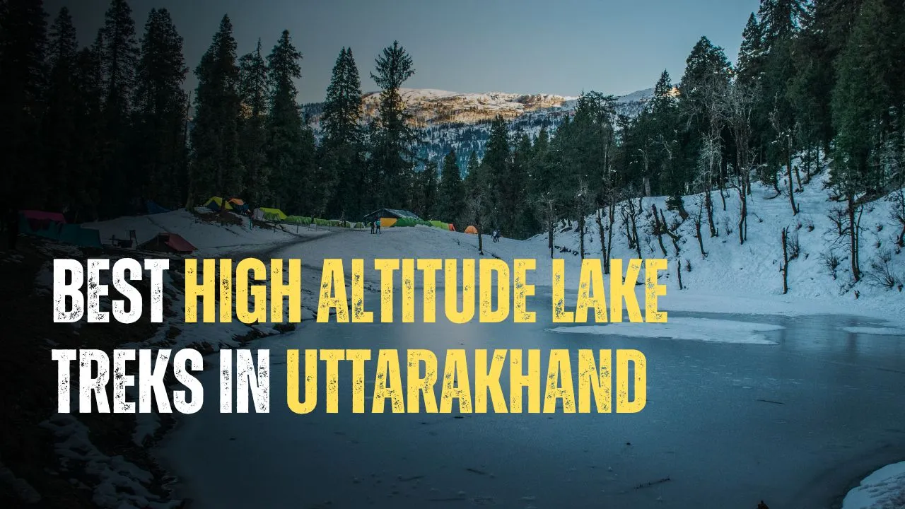
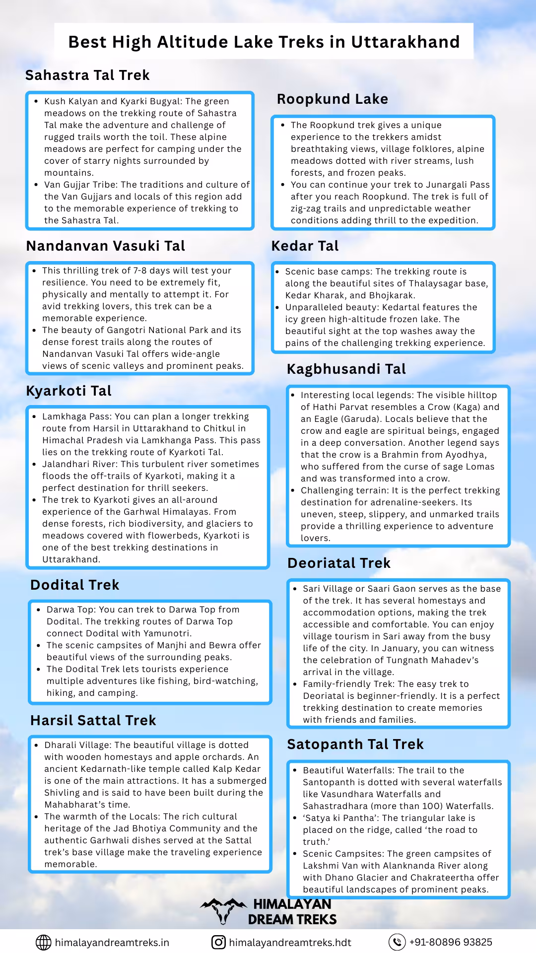
Located in the Central Himalayan belt, Uttarakhand, also known as Devbhoomi, is home to some of the best trekking destinations in India. The state has several high-altitude lakes fed by the glacial activities of the towering mountains around them. Uttarakhand is a trekker’s paradise, and the many treks in Uttarakhand offer beautiful valleys filled with dense forest trails, alpine meadows, and rich biodiversity. Its rustic villages attract adventure and spirituality seekers alike. Whether you are a seasoned trekker or a novice adventurer, Uttarakhand has a trek for everyone. The beauty of its high-altitude lake treks is unique and hard to find anywhere else.
Below, we will explore some of the best high-altitude lake treks in the region, their difficulty levels, and special features.
Table of Contents
1. Sahastra Tal Trek
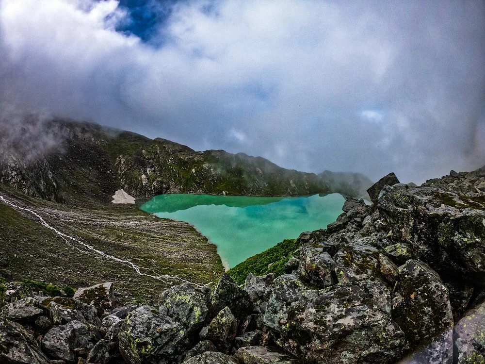
Located in the Tehri Garhwal district, Sahastra Tal is a high-altitude lake at around 4740m. Bhatwari is the base of the trekking route near Silla village, about 65 km from the alpine lake. This trek leads to the beautiful landscape of Sahastra Tal, also known as “the lake of gods” and “Darshan Tal.” Its rugged trails feature other lakes, they are, Arjun Tal, Pari Tal, Bhim Tal, Ling Tal, Dhodhii Tal, Lamb Tal, Mamle Tal, Nar Singh Tal, and Kokuli Tal.1
Sahastra Tal trek is perfect for peace and nature lovers, as it is less crowded. The local myths and legends associated with the Tal make it an ideal destination. The steep trek is moderately challenging and requires trekkers to be physically fit and experienced.
| Attribute | Details |
|---|---|
| Region | Garhwal Himalayas, Uttarakhand |
| Base Camp | Silla Village |
| Difficulty | Difficult |
| Total Distance | 65 km |
| Altitude | 4,740 m/ 15,551ft |
| Minimum Age | 15 years |
| Terrain Type | Forest, Meadows, Ridges, Valleys |
| Ideal For | Adventure, Nature Beauty, Camping, Hiking |
| Best Season | May to June and August to October |
| Nearest Town/City | Uttarkashi |
Why make Sahastra Tal your next trekking destination?
Sahastra tal is also known as Mahatmya Tal, Darshan Tal, and Shastru Tal. It is one of the most beautiful and divine trekking destinations of Uttarakhand, as:
- Spiritual Significance: Several local legends are attached to this high-altitude lake. It is said that a king once performed prayers at the lake by offering one thousand Brahma Kamal to Lord Vishnu.
- Interesting Legends: Another local legend says that a Saint performed Tapasya at the lake, marking the origin of the Balganga River. It is believed that Dharmaraja Yudhishthir went for salvation after killing tribes on this route, marking the origin of the Dharmaganga River. Both these rivers meet at Budha Kedar.
- Kush Kalyan and Kyarki Bugyal: The green meadows on the trekking route of Sahastra Tal make the adventure and challenge of rugged trails worth the toil. These alpine meadows are perfect for camping under the cover of starry nights surrounded by mountains.
- Van Gujjar Tribe: The traditions and culture of the Van Gujjars and locals of this region add to the memorable experience of trekking to the Sahastra Tal.
Special Features
Sahastra Tal is the topmost glacial lake of the several lakes along its trekking trails. The route offers:
- Visible Peaks: Kokuli Dhar, Jaonli, Srikanth, Kalanaag, Draupadi ka Danda, and Bandarpoonch.
- Flora: Brahma Kamal, Guggul, Phen Kamal, Neel Kamal, Himalayan Poppy, Chirayta, Atish, Katuka, Thunder, Bhanjh, Moru, Kharsu, and Jata Mansi
- Fauna: Himalayan Tahr, Musk Deer, Bear, Leopard, Mules and Wild Boar.
- Birds: Himalayan Monal, Ghatu, and Gidh.
Temperature: 15°C in summers to alpine extreme cold weather in winters which falls below the freezing point of -10°C.
2. Roopkund Lake

Popular as one of the most mysterious places in India, Roopkund is a high-altitude glacial lake, in the Chamoli district of Uttarakhand. The lake is located in the Garhwal Himalayas about 5,029 m (16,500ft) above sea level. Roopkund became famous when several skeletal remains, allegedly dating back to the 9th to 18th centuries were found along its edges and shores.
Roopkund trek, apart from being popular due to its mystery offers thrilling views of alpine meadows- Ali and Bedni Bugyal. The dense forest trails open to vast meadows and breathtaking sights of the frozen lake between the peaks of Junargali to the North and Chandania Kot to the East. The rugged trek to Roopkund is moderate which needs prior experience of trekking.
| Attribute | Details |
|---|---|
| Region | Chamoli District, Uttarakhand |
| Base Camp | Wan Village/ Bhagwabasa |
| Difficulty | Difficult |
| Total Distance | 53 km (round trip) |
| Altitude | 5,029 meters/ 16,500ft |
| Minimum Age | 15 years |
| Terrain Type | Zig-zag trails, Rocky, Snow, Meadows, steep ascent and descent |
| Ideal For | Adventure seekers, History buffs, Camping |
| Best Season | May to June, September to October |
| Nearest Town/City | Lohajung |
Why make Roopkund your next trekking destination?
The intriguing glacial lake of Roopkund is an ideal trekking destination if you love the combination of mystery and thrill. The moderately challenging trek offers:
- Several temples are located on the trekking route of Roopkund. Kalu Vinayak is a spectacular high-altitude ancient temple placed on the initial ascent of the trek, before the base Bhagwabasa. It is named after the black-coloured idol of Ganesha placed inside the temple. The temple site gives a stunning view of Kedarnath, Chaukhamba, Neelkantha, Trishul, and Nanda Ghunti.
- Nanda Raj Jat Yatra: The trek to Roopkund overlaps with the sacred Nanda Yatra practiced by the locals. This annual yatra starts near Karnaprayag via Roopkund to Homkund. It is a significant cultural practice performed by the people of the Kumaon and Garhwal regions.2
- The Roopkund trek gives a unique experience to the trekkers amidst breathtaking views, village folklores, alpine meadows dotted with river streams, lush forests, and frozen peaks.
- You can continue your trek to Junargali Pass after you reach Roopkund. The trek is full of zig-zag trails and unpredictable weather conditions adding thrill to the expedition.
Special Features
The unique features of the Roopkund trek are:
- Visible Peaks: Trishul and Bedna Ghunti.
- Flora: Fir, Birch, Primula, Brahma Kamal, Rhododendron, and Juniper.
- Fauna: Himalayan Black Bear, Himalayan Tahr, Serow, and Snow Leopards.3
- Birds: Grosbeaks, Rose Finches, Ruby Throat, Red Fox, Royle’s Pika, Chir Pheasants, and Warblers.
- Temperature: 15°C in summers to alpine extreme cold weather in winters which falls below the freezing point of -10°C to -15°C.
3. Nandanvan Vasuki Tal
The alpine glacial lake of Nadanvan Vasuki Tal is located in Gangotri National Park, Uttarkashi district in Uttarakhand. The trek to Nandanvan via Tapovan starts from Gangotri Dham. The route takes you through Bhojabasa, Gaumukh, Tapovan, Nandanvan, and finally reaching Vasuki Tal. On your way, you will witness the breathtaking beauty of Akash Ganga flowing along the initial trails.
Vasuki Tal is a glacial lake, placed at 16,200 ft is the base of Vasuki Parvat. The glacier feeds the river of Vasuki Ganga, which got its name from Lord Shiva’s snake ‘Vasuki’ that sits curled like the meandering river around his neck. The trek is challenging with riverine boulders on its uneven paths. Only seasoned trekkers should complete this high-altitude lake trek.
| Attribute | Details |
|---|---|
| Region | Uttarkashi, Uttarakhand |
| Base Camp | Gangotri or Bhojabasa |
| Difficulty | Challenging |
| Total Distance | 65 km (round trip) |
| Altitude | 4938 meters/ 16,200ft |
| Minimum Age | 18 years |
| Terrain Type | Rocky, Snow, Meadows, Glaciers, Moraine |
| Ideal For | Adventure, Camping, Spirituality |
| Best Season | May to June, September to October |
| Nearest Town/City | Gangotri |
Why make Nandanvan Vasuki Tal your next trekking destination?
The trekking route of Nandanvan Vasuki Tal is famous among seasoned trekkers for its natural beauty and adventurous trails. Additionally, it attracts tourists for:
- Local legends: It is said that Lord Vishnu took a bath in the holy water of Nandanvan Vasuki Tal, making the lake water pure.
- This thrilling trek of 7-8 days will test your resilience. You need to be extremely fit, physically and mentally to attempt it. For avid trekking lovers, this trek can be a memorable experience.
- The beauty of Gangotri National Park and its dense forest trails along the routes of Nandanvan Vasuki Tal offers wide-angle views of scenic valleys and prominent peaks.
Special Features:
Nandanvan Vasuki Tal offers a one-of-a-kind experience for adventure lovers with its unique features such as:
- Glaciers: Gaumukh Glacier, Chaturangi Glacier, Vasuki Glacier.
- Visible Peaks: Sudarshan, Meru, Bhagirathi, Shivling, Kedar Dome, and Vasuki Parvat.
- Flora: Brahma Kamal, Deodar, Birch, Blue Pine, Juniper, and Rosehip berries.
- Fauna: Himalayan Black Bear, Himalayan Tahr, Weasels, Griffon, and Snow Leopards
- Birds: Wagtails, Alpine Choughs, and Himalayan Monals.
- Temperature: Moderate during the summers (17°C to -10°C) to extreme high-altitude cold weather in winters, falling below freezing point.
4. Kedartal

The adventurous trek to Kedartal, also known as ‘Shiva Lake’ starts from the sacred town of Gangotri. Situated at a height of 4,750m, the trek to this glacial lake offers beautiful views of surrounding peaks and alpine meadows. The glacial lake is formed from the snow of Mt. Thalaysagar. Kedartal is the source of Kedar Ganga, a revered river, said to be born from the blessings of Lord Shiva.
The trek to this high-altitude lake is not for beginners. Its route consists of spider walls, ragged trails, and steep slopes, as you hike from Gangotri to Bhoj Kharak. Only experienced trekkers are advised to complete the Kedar Tal Trek. One must be prepared for extreme conditions at high altitudes by acclimatizing properly.
| Attribute | Details |
|---|---|
| Region | Uttarkashi, Uttarakhand |
| Base Camp | Gangotri |
| Difficulty | Difficult |
| Total Distance | 24 km (round trip) |
| Altitude | 4,750 meters/ 15,584 ft |
| Minimum Age | 18 years |
| Terrain Type | Rapidly increasing altitude, Rocky, Snow, Meadows, Glaciers |
| Ideal For | Adventure, Nature, Camping, Spirituality seekers |
| Best Season | May to June, September to October |
| Nearest Town/City | Gangotri |
Why choose Kedar Tal as your next trekking destination?
Kedar Tal Trek gives more than a thrilling experience. It is a perfect destination to have an immersive experience of trekking in Devbhoomi, because:
- Spiritual getaway: Kedar Tal is a sacred site for the devotees of Lord Shiva. As per local legends, the practice of ‘Samudra Manthan,’ involved the churning of the ocean. This resulted in elixir and poison. It is said that Lord Shiva drank the poison and quenched his thirst from the waters of Kedartal Lake. The lake feeds Kedar Ganga which is said to be the sister stream of the mighty Ganga River.
- Scenic base camps: The trekking route is along the beautiful sites of Thalaysagar base, Kedar Kharak, and Bhojkarak.
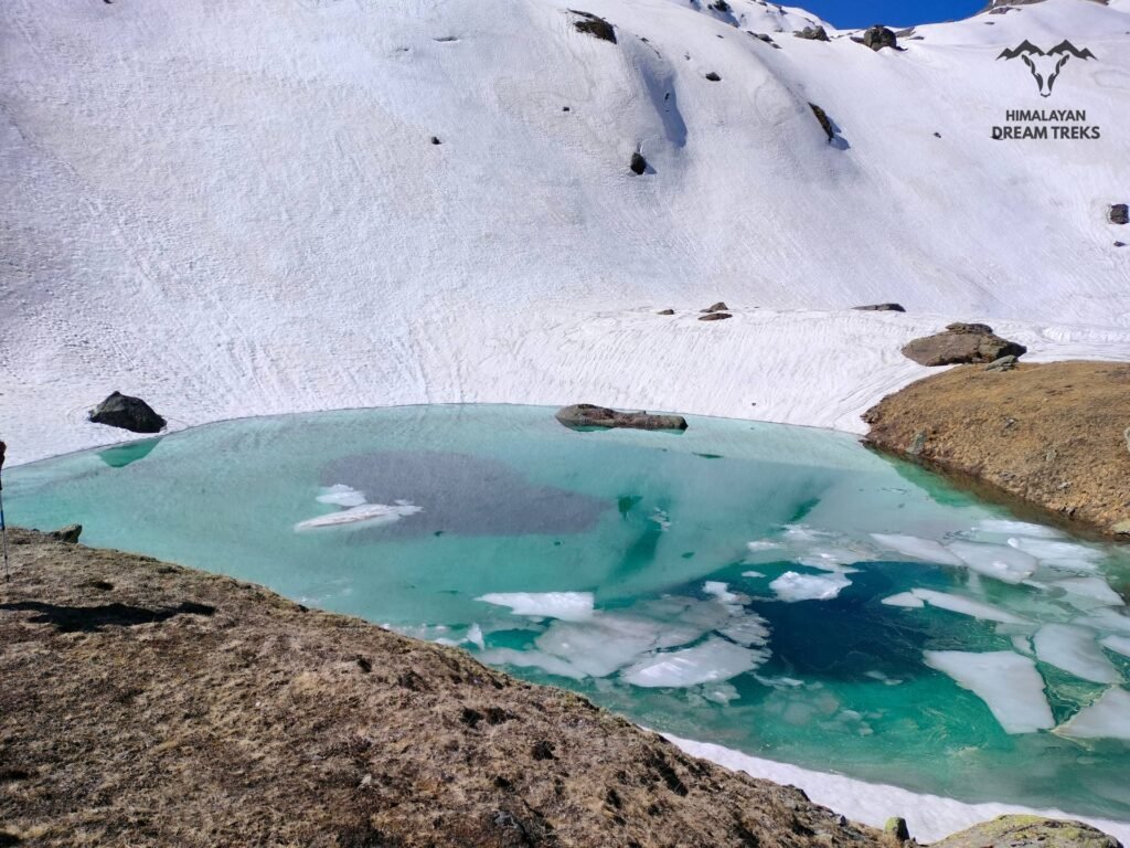
- Unparalleled beauty: Kedartal features the icy green high-altitude frozen lake. The beautiful sight at the top washes away the pains of the challenging trekking experience.
Special Features
Being located inside the Gangotri National Park, Kedar Tal hosts several unique physical features such as:
- Visible Peaks: Thalay Sagar, Jogin I, Jogin II, Manda, and Bhrigupanth.
- Flora: Brahma Kamal, Rhododendron, Oak, and Pine.
- Fauna: Himalayan Black Bear, Himalayan Goral, Snow Leopard, Red Fox, Himalayan Griffon, and Bharal (blue sheep).
- Birds: Himalayan Snowcock, Snow Partridge, Snow Pigeon, Golden Eagle, Black Eagle, Kalij Pheasant, and Himalayan Monals.
Temperature: Moderate during the summer 16°C to 5°C to extreme alpine cold weather in winter, falling below the freezing point of -2°C to -20°C.
5. Kyarkoti Tal
Another high-altitude lake trek in the Garhwal Himalayas is Kyarkoti Tal. This offbeat trekking route starts from the Harsil Village as its base camp in the Uttarkashi district of Uttarakhand. Situated at 3,820 meters/ 12,533 ft, this glacial lake is surrounded by green alpine meadows and lofty peaks. Its rugged forest trails feature rich biodiversity, ‘goat paths,’ and bird-eye view of valleys and bugyals.
The moderate difficulty level makes this trek accessible. The stunning beauty of the lake makes it a rewarding conclusion to an exciting adventure.
| Attribute | Details |
|---|---|
| Region | Uttarkashi, Uttarakhand |
| Base Camp | Harsil valley |
| Difficulty | Moderate |
| Total Distance | 31.4 km (round trip) |
| Altitude | 3,820 meters/ 12,533 ft |
| Minimum Age | 8 years |
| Terrain Type | Gradual ascent, Meadows, Glaciers, defined trails, dense forests |
| Ideal For | Adventure, Nature, Camping, Hiking, Family Trip, Bird-watching |
| Best Season | April to June, September to October |
| Nearest Town/City | Harsil |
Why choose Kyarkoti Tal as your next trekking destination?
This moderate trekking destination is ideal for thrilling experiences, with the added beauty of:
- Lamkhaga Pass: You can plan a longer trekking route from Harsil in Uttarakhand to Chitkul in Himachal Pradesh via Lamkhanga Pass. This pass lies on the trekking route of Kyarkoti Tal.
- Jalandhari River: This turbulent river sometimes floods the off-trails of Kyarkoti, making it a perfect destination for thrill seekers.
- The trek to Kyarkoti gives an all-around experience of the Garhwal Himalayas. From dense forests, rich biodiversity, and glaciers to meadows covered with flowerbeds, Kyarkoti is one of the best trekking destinations in Uttarakhand.
Special Features
The Kyarkoti Tal Trek offers the following distinct features:
- Visible Peaks: Mt. Srikantha, Horns of Harsil and Banderpunch.
- Flora: Rhododendron, Wildflowers, Birch, Oak, Guchchi mushrooms, and Pine.
- Fauna: Himalayan Black Bear, Snow Leopard, Bharal or blue sheep, and Brown Bear.
- Birds: Himalayan Snowcock and Himalayan Monals.
- Temperature: Pleasant during the summer (10°C to 15°C) to extreme cold weather in winter (-15°C to 0°C).
6. Kagbhusandi Tal
Kagbhusandi Tal is a scenic green high-altitude lake at a height of 4,363 meters (14,314 feet). The beautiful lake is located in the Chamoli district of Uttarakhand near Kankul Pass. There are two routes to the Kagbhusandi Tal trek, Vishnu Prayag via Painka village or from Govind Ghat through Bhyundar Village. The path from Govind Ghat leads to the Valley of Flowers National Park, a World Heritage site. At Bhyundar Village, the trail splits, the left path goes to the Valley of Flowers, while the right path heads toward Kagbhusandi Tal. This right path follows the Karnkul Ganga river, fed by a nearby glacier at Raj Khark.4
The forest trails of Kagbhusandi Tal are inside the premises of the Nanda Devi National Park. They lead to numerous alpine meadows and beautiful campsites such as Bhyundar, Kargila, Semartoli, Bankbara, Dang Khark, and Raj Khark. The trek to Kagbhusandi is very challenging with unmarked trails. Experienced trekkers can attempt this trek by acclimatizing properly.
| Attribute | Details |
|---|---|
| Region | Chamoli, Uttarakhand |
| Base Camp | Bhyundar Village |
| Difficulty | Challenging |
| Total Distance | 60-65 km (round trip) |
| Altitude | 4,363 meters (14,314 feet) |
| Minimum Age | 18 years |
| Terrain Type | Rocky, Meadows, glaciers, un-defined trails, dense forests, river boulders |
| Ideal For | Adventure, Nature, Camping, Hiking |
| Best Season | May to June, September to October |
| Nearest Town/City | Joshimath |
Why choose Kagbhusandi Tal as your next trekking destination?
The Kagbhusandi trail is strategically located in Nanda Devi National Park, adding to its natural beauty. It is a perfect trekking destination because of:
- Interesting local legends: The visible hilltop of Hathi Parvat resembles a Crow (Kaga) and an Eagle (Garuda). Locals believe that the crow and eagle are spiritual beings, engaged in a deep conversation. Another legend says that the crow is a Brahmin from Ayodhya, who suffered from the curse of sage Lomas and was transformed into a crow.
- Challenging terrain: It is the perfect trekking destination for adrenaline-seekers. Its uneven, steep, slippery, and unmarked trails provide a thrilling experience to adventure lovers.
- Vishnuprayag Trek: You can continue your trek from Kagbhusandi to Vishnuprayag. It is the sacred site where the rivers Alaknanda and Dhauliganga merge.
Special Features
Kagbhusandi Tal Trek is a biodiversity hotspot, its features are:
- Visible Peaks: Hathi Parvat, Neelkanth, Chaukhamba, and Nar-Narayan
- Flora: Brahma Kamal, Phen Kamal, Nettles, Wildflowers, Rhododendrons, Deodars, and Oak trees.
- Fauna: Himalayan Black Bear, Snow Leopard, and Brown Bear.
- Birds: Himalayan Snowcock and Himalayan Monals.
- Temperature: Pleasant during the summer 12°C to 17°C to extreme cold weather with snow-covered trails in winter going below freezing point.
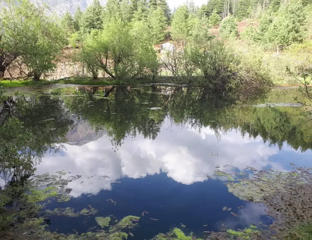
7. Dodital Trek

Famous as the ‘birthplace of Lord Ganesha’, Dhundital or Dodital is a freshwater high-altitude lake. ‘Dodi’ translates to Himalayan Trout, a fish species in this lake. Located at 3,024m/9,921ft above sea level, the trek to this beautiful lake starts from Assi Ganga Valley, Uttarkashi. The trekking route starts from Village Agoda and passes through Bebra and Majhi.
Dodital Lake feeds the water of the Assi Ganga river stream which merges with Bhagirathi at Gangotri.5 This easy trek is ideal for beginners, families, and kids. The pristine waters of the lake and the temples of Lord Ganesha and Goddess Annapurna attract venturesome and spirituality seekers alike.
| Attribute | Details |
|---|---|
| Region | Uttarkashi, Uttarakhand |
| Base Camp | Agoda Village |
| Difficulty | Easy |
| Total Distance | 32.7 km (round trip) |
| Altitude | 3,024m/9,921ft |
| Minimum Age | 7 years |
| Terrain Type | Slightly steep ascend, Rocky, Meadows, defined trails, dense forests |
| Ideal For | Adventure, Nature, Camping, Hiking, Fishing, Bird-watching |
| Best Season | April to November |
| Nearest Town/City | Uttarkashi |
Why choose Dodital as your next trekking destination?
The trek to Dodital attracts tourists with its greenery and river streams. Additionally, it offers:
- Spiritual significance: As per local legends, Dodital is said to be the lake where Lord Shiva and Goddess Parvati used to bathe. It is the birthplace of Lord Ganesha who is worshipped here every year.
- Darwa Top: You can trek to Darwa Top from Dodital. The trekking routes of Darwa Top connect Dodital with Yamunotri.
- The scenic campsites of Manjhi and Bewra offer beautiful views of the surrounding peaks.
- The Dodital Trek lets tourists experience multiple adventures like fishing, bird-watching, hiking, and camping.
Special features
Dodital Trek offers stunning beauty and scenic landscapes along its trail:
- Visible Peaks: Mt Srikantha, Banderpunch, Black Peak, Jaonli
- Flora: Oak, Cedar, Rhododendron, and Deodar
- Fauna: Musk Deer, Snow Leopard, Bharal Blue Sheep, and Brown Bear.
- Birds: Himalayan Monals and others
- Temperature: Pleasant during the summer 11°C to 15°C to extreme cold weather with snow-covered trails during winters falling below -5°C.
8. Deoriatal Trek

Deoriatal is a mesmerising high-altitude lake located in Rudraprayag district, Uttarakhand. Its trekking route comes under the Kedarnath Musk Deer Sanctuary, featuring rich flora and fauna, crystal-clear lake water, and lofty mountain peaks. The trek starts from the Sari Village 13 km from Ukhimath in Rudraprayag.
The trek to Deoriatal is easy, making it an ideal hiking destination for less-experienced trekkers. The beautiful lake of Deoriya reflects a stunning landscape of prominent peaks in its water, which is perfect for photography.
| Attribute | Details |
|---|---|
| Region | Rudraprayag, Uttarakhand |
| Base Camp | Sari Village |
| Difficulty | Easy |
| Total Distance | 6 km (round trip) |
| Altitude | 2,438m/7,998ft |
| Minimum Age | 5 years |
| Terrain Type | Slight ascent, Rocky, Meadows, Stone-paved trails, dense forests |
| Ideal For | Adventure, Nature, Camping, Hiking, |
| Best Season | March to November |
| Nearest Town/City | Rudraprayag |
Why choose Deoriatal as your next trekking destination?
Deoriatal is the perfect high-altitude lake trek to plan your holidays with family and friends:
- Sari Village or Saari Gaon serves as the base of the trek. It has several homestays and accommodation options, making the trek accessible and comfortable. You can enjoy village tourism in Sari away from the busy life of the city. In January, you can witness the celebration of Tungnath Mahadev’s arrival in the village.
- Starting point of other treks: Deoriatal lies along the trekking route of the famous Tungnath and Chandrashila trek.
- Mythological significance: It is believed that Pandavas visited the Deoriatal during their exile. Here, Yaksha, a mystic entity, questioned Yudhishthir to test his wisdom and virtue.
- Family-friendly Trek: The easy trek to Deoriatal is beginner-friendly. It is a perfect trekking destination to create memories with friends and families.
Special Features
Deoriatal Trek is a nature-lovers paradise with:
- Visible Peaks: Chaukhamba, Kedar Dome, Janhukut, Neelkantha, Kalanag, Kedar range, and Bandarpunch.
- Flora: Oak, Cedar, Rhododendron, and Deodar.
- Fauna: Wild Pigs, Musk Deer, Snow Leopard, Bharal Blue Sheep, and Brown Bear.
- Birds: Himalayan Monals, Himalayan Woodpecker, Snow Partridge, and others.
- Temperature: Pleasant during the summer 14°C to 25°C, extremely chilly weather with snowfall in winter, and mercury falling below freezing points.
9. Harsil Sattal Trek
Sattal translates to “seven lakes,” that are present on its trekking route as one ascends to the top. These seven lakes are Sankhghata Tal (3039m), Ghandoliya Tal (3025m), Rikh Tal (3016m), Bamniya Tal (2995m), Dawariya Tal (2972m), Chadgiya Tal (2969m) and Mirdunga Tal (2842m).6
Sattal Trek is a popular hiking destination in the Harsil Valley of the Uttarkashi district. The trails start from the small village of Dharali, which is famous for its rustic houses and apple orchards. The hike to the topmost lake is easy and beginner-friendly. You can hike with your kids in Sattal to introduce them to trekking. The beautiful forest trails of Harsil Sattal take you through wetlands and meadows, where you can camp and enjoy the clear starry nights.
| Attribute | Details |
|---|---|
| Region | Uttarkashi, Uttarakhand |
| Base Camp | Dharali Village |
| Difficulty | Easy |
| Total Distance | 4-5 km (round trip) |
| Altitude | 3,000m/9,843ft |
| Minimum Age | 5 years |
| Terrain Type | Slightly steep ascent, Rocky, Meadows, uneven trails, dense forests |
| Ideal For | Adventure, Nature, Camping, Hiking, Bird-watching, Eco-tourism |
| Best Season | March to November |
| Nearest Town/City | Harsil Valley |
Why choose Sattal as your next trekking destination?
Harsil Sattal Trek is more than its dense forest trails, It attracts adventure lovers and peace seekers with:
- Dharali Village: The beautiful village is dotted with wooden homestays and apple orchards. An ancient Kedarnath-like temple called Kalp Kedar is one of the main attractions. It has a submerged Shivling and is said to have been built during the Mahabharat’s time.
- The warmth of the Locals: The rich cultural heritage of the Jad Bhotiya Community and the authentic Garhwali dishes served at the Sattal trek’s base village make the traveling experience memorable.
- Camping beside the Seven Lakes offers a one-of-a-kind experience amidst green alpine meadows.
- Family-friendly Trek: The Sattal Trek is family and kids-friendly. Its beautiful flora and fauna diversity provides a good learning opportunity for kids. Its marked trails and easy trails make it ideal for family trips.
Special Features
The unique features of the Sattal Trek are:
- Visible Peaks: Dhumdar Kandi Pass, Black Peak, and Swargrohini.
- Flora: Oak, Himalayan Birch, Apple Trees, Wildflowers, Rhododendron, and Deodar
- Fauna: Himalayan Goral, Bharal Blue Sheep, and Brown Bear.
- Birds: Himalayan Monals, Himalayan Bluetail, and Spectacled Finch.
- Temperature: Pleasant during the summer 18°C to 5°C to extremely chilly weather with snowfall in winter between 15°C to -2°C.
10. Satopanth Tal Trek

Satopanth is a triangular high-altitude lake at 4603 m/15,100 ft above sea level. This alpine lake is about 25km from Badrinath in the Chamoli district of Uttarakhand. The trek to Satopanth starts from Mana Village, famous as India’s last village (before the Tibetan border) about 4.4km from Badrinath.
The Santopanth Tal Trek is moderately challenging with uneven and un-marked trails along its rugged route. The high altitude and steep ascent of the trekking route require hikers to be experienced and physically fit.
| Attribute | Details |
|---|---|
| Region | Chamoli, Uttarakhand |
| Base Camp | Mana Village |
| Difficulty | Moderate to Difficult |
| Total Distance | 34 km (round trip) |
| Altitude | 4603m/15,100ftt |
| Minimum Age | 12 years |
| Terrain Type | Steep ascent, Moraine, Meadows, uneven trails, dense forests, glaciers |
| Ideal For | Adventure, Nature, Camping, Hiking |
| Best Months | March, June, September and October |
| Nearest Town/City | Badrinath |
Why choose Santopanth as your next trekking destination?
The journey to Satopanth provides stunning views and an opportunity to connect with ancient tales. Here are some interesting facts:
- Old Legends: This lake holds significant religious importance, being associated with the epic Mahabharata. It is said that Pandavas spent their final days on the route to Swargrohini Peak via Santopanth Tal. It is also believed that the Trimurtis of Hindu Mythology- Lord Brahma, Vishnu, and Shiva bathe in the lake on sacred days.
- Beautiful Waterfalls: The trail to the Santopanth is dotted with several waterfalls like Vasundhara Waterfalls and Sahastradhara (more than 100) Waterfalls.
- ‘Satya ki Pantha’: The triangular lake is placed on the ridge, called ‘the road to truth.’
- Scenic Campsites: The green campsites of Lakshmi Van with Alanknanda River along with Dhano Glacier and Chakrateertha offer beautiful landscapes of prominent peaks.
Special Features
Trekkers are rewarded with an unparalleled experience of solitude and natural beauty upon reaching the lake:
- Visible Peaks: Bhagirathi, Chaukhamba, Neelkantha, Swargarohini and Balakun.
- Flora: Oak, Brahma Kamal, Blue Poppy, Orchids, Wildflowers, Rhododendron, Birch, and Deodar
- Fauna: Snow Leopards, Indian Leopards, Jackals, Himalayan Black Bear, Pika, Marmot, and Red Fox
- Birds: Himalayan Monals, Snow Partridge, Koklass Pheasant, and Little-pied Flycatcher
- Temperature: Around 12°C during the summer to extremely chilly weather with heavy snowfall in winter between -2°C to -20°C
Final Thoughts
Uttarakhand’s high-altitude lake treks offer diverse experiences, catering to trekkers of all skill levels. From easy to challenging treks, Uttarakhand is a treasure trove of breathtaking landscapes and spiritual experiences. Before attempting any trek, it is important to physically prepare, acclimatize, and respect the local environment and culture.
References
- https://www.himalayanclub.org/hj/42/21/expeditions-and-notes-42/#point7 ↩︎
- https://books.google.co.in/books?hl=en&lr=&id=eQ0XEQAAQBAJ&oi=fnd&pg=PA75&dq=roopkund+lake&ots=OKNJjkvdc8&sig=FK8p7ZWs75105tmAahVG_3FCKJQ&redir_esc=y#v=onepage&q=roopkund%20lake&f=false ↩︎
- https://www.researchgate.net/profile/Bilal-Habib-3/publication/292988847_Status_of_Wildlife_in_Trans-Himalayan_Region_of_Uttarakhand/links/56b6e8d608ae44bb3307ae00/Status-of-Wildlife-in-Trans-Himalayan-Region-of-Uttarakhand.pdf ↩︎
- https://www.outlooktraveller.com/experiences/adventure/uttarakhand-visit-kagbhusandi-tal ↩︎
- https://www.researchgate.net/profile/Sushma-Singh-8/publication/324983075_ECO-TOURISM_IN_DODI_TAL_LAKE_ENVIRON_A_SUSTAINABLE_REVENUE_SOURCE_FOR_MOUNTAIN_COMMUNITIES_OF_GARHWAL_HIMALAYAS/links/5aeff3f50f7e9b01d3e2d6aa/ECO-TOURISM-IN-DODI-TAL-LAKE-ENVIRON-A-SUSTAINABLE-REVENUE-SOURCE-FOR-MOUNTAIN-COMMUNITIES-OF-GARHWAL-HIMALAYAS.pdf ↩︎
- https://www.gbpihed.gov.in/PDF/Publication/Bulletin/Envis_Bulletin_Himalayan_Ecology_Vol_29_2021.pdf#page=47 ↩︎
Leave a Comment