Overview
Looking for an adventurous escape into the Himalayas that combines thrill with spirituality? The Kedartal trek offers you an incredible opportunity to travel into the untouched trails of the Garhwal Himalayas. Located at a high altitude of15,531 ft in the Kedar Ganga Valley, Kedartal Lake is one of the most beautiful alpine lakes in Uttarakhand.
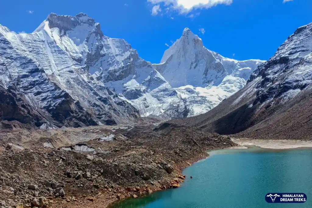
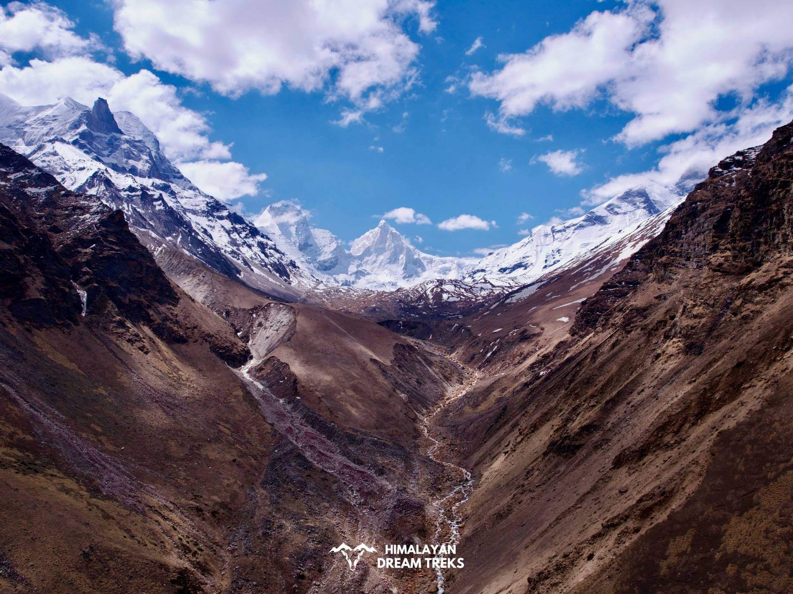
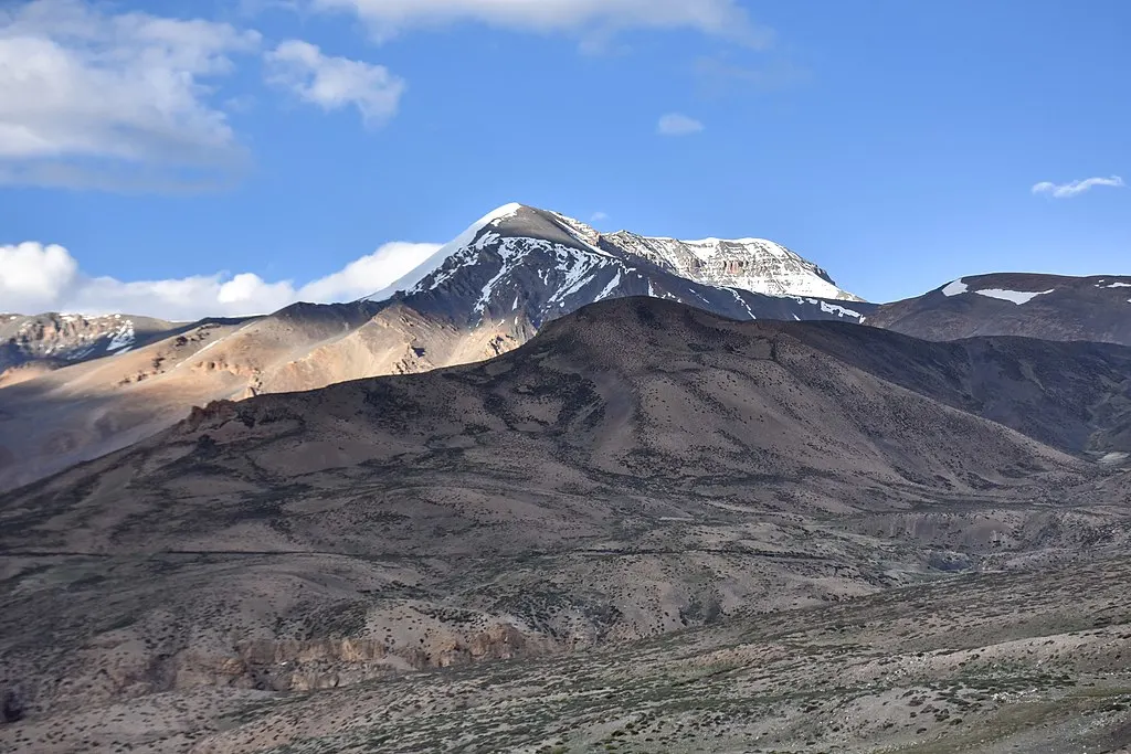
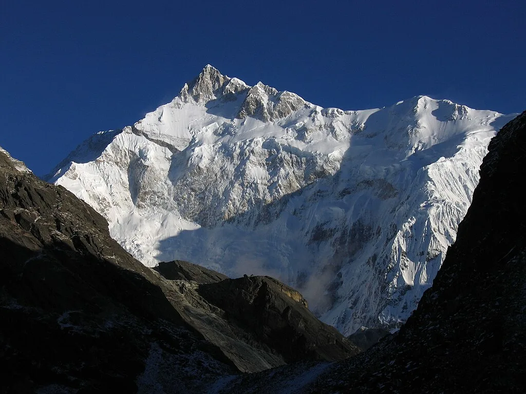
Surrounded by mountains such as Bhrigupanth, Gangotri, Manda Massif, Mt. Meru, and Thalayasagar, this emerald-colored glacial lake measures about 1,200m by 300 m.
Kedartal is famously known as Lord Shiva’s Lake, it is where the Kedar Ganga River originates. Its eastern bank serves as the base camp for the expedition of Thalay Sagar, Bhirgupanth, and Jogin peaks. The trails to Kedartal take you through several water streams, near-vertical sections, moraine-laiden terrain, and spectacular campsites at Bhoj Kharak and Kedar Kharak. This trek is suitable for trekkers with high-altitude trekking experience due to its steep gradient, which includes spider walls, unmarked trails, and unpredictable weather.
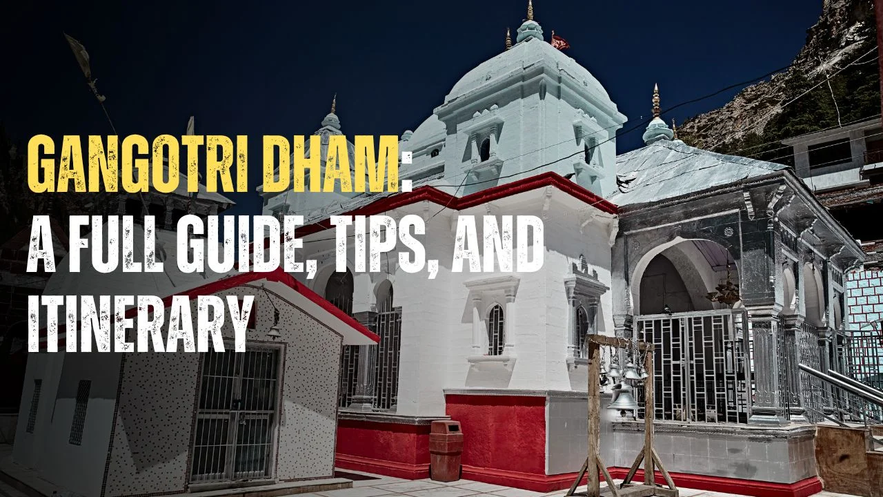
The Kedartal trek begins at the holy abode of Maa Ganga, Gangotri Dham, after crossing the banks of the Bhagirathi River. From the outset, the gradient of the trails becomes steep as they ascend the western flanks of the Kedar Ganga Valley gorge.
You will pass through the lush vegetation of birch forests and several streams of water to reach Bhoj Kharak after 8 km of uphill trekking. The next campsite, Kedar Kharak, presents new challenges along its trails, filled with lateral moraines of the Kedar Bamak Glacier. These two campsites offer a unique experience of spending the night under a star-studded sky amidst mighty peaks.
Read on to explore the Kedartal Trek itinerary, the best time to visit, and the difficulty factors, and discover why it is one of the most rewarding treks in Uttarakhand. This guide will also tell you the spiritual significance of this sacred lake of Mahadev and the rare species of flora and fauna you can spot on its trails.
Kedartal Trek Itinerary
Day 1: Dehradun to Gangotri (Base Camp)
Drive Distance: 245 km
Drive Time: 8-9 hrs
Altitude: 10,300 ft at Gangotri [640 m (2100 ft) at Dehradun to 3,100 m (10,200 ft) at Gangotri]
Highlights: Scenic drive through Moriana Top, Uttarkashi and Harsil
Your trek to Kedartal starts in the holy town of Gangotri. You can share a taxi or catch a bus from Dehradun, drive your own car, or hire a private vehicle for your group.
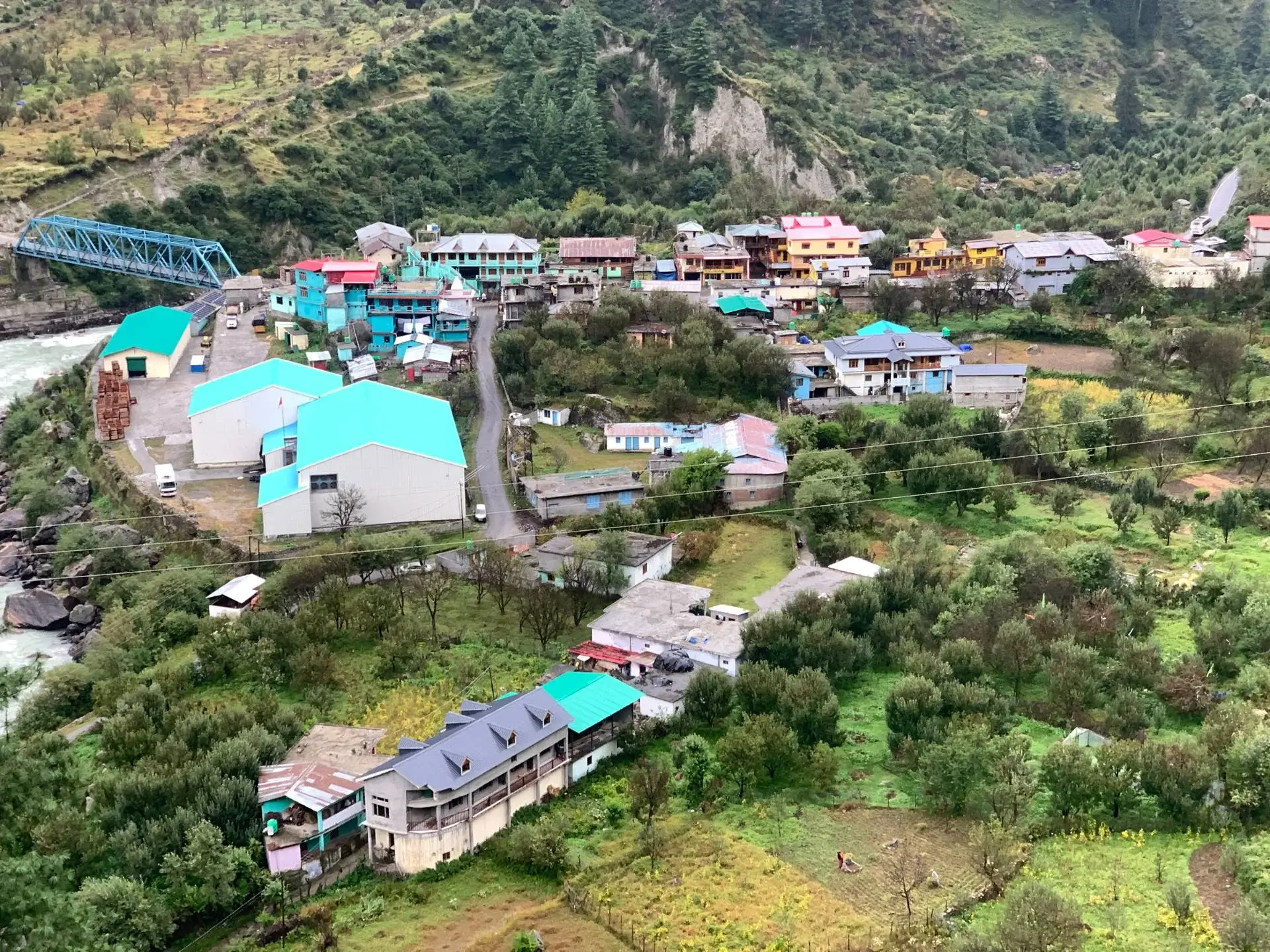
Leave Dehradun early so you reach Gangotri by evening. The drive is beautiful, winding through Uttarkashi’s valleys and villages like Gangnani, Sukki, Jhala, Purali, Harsil, Mukhba, and Dharali. After Bhaironghati, turn onto NH 34 to arrive in Gangotri.
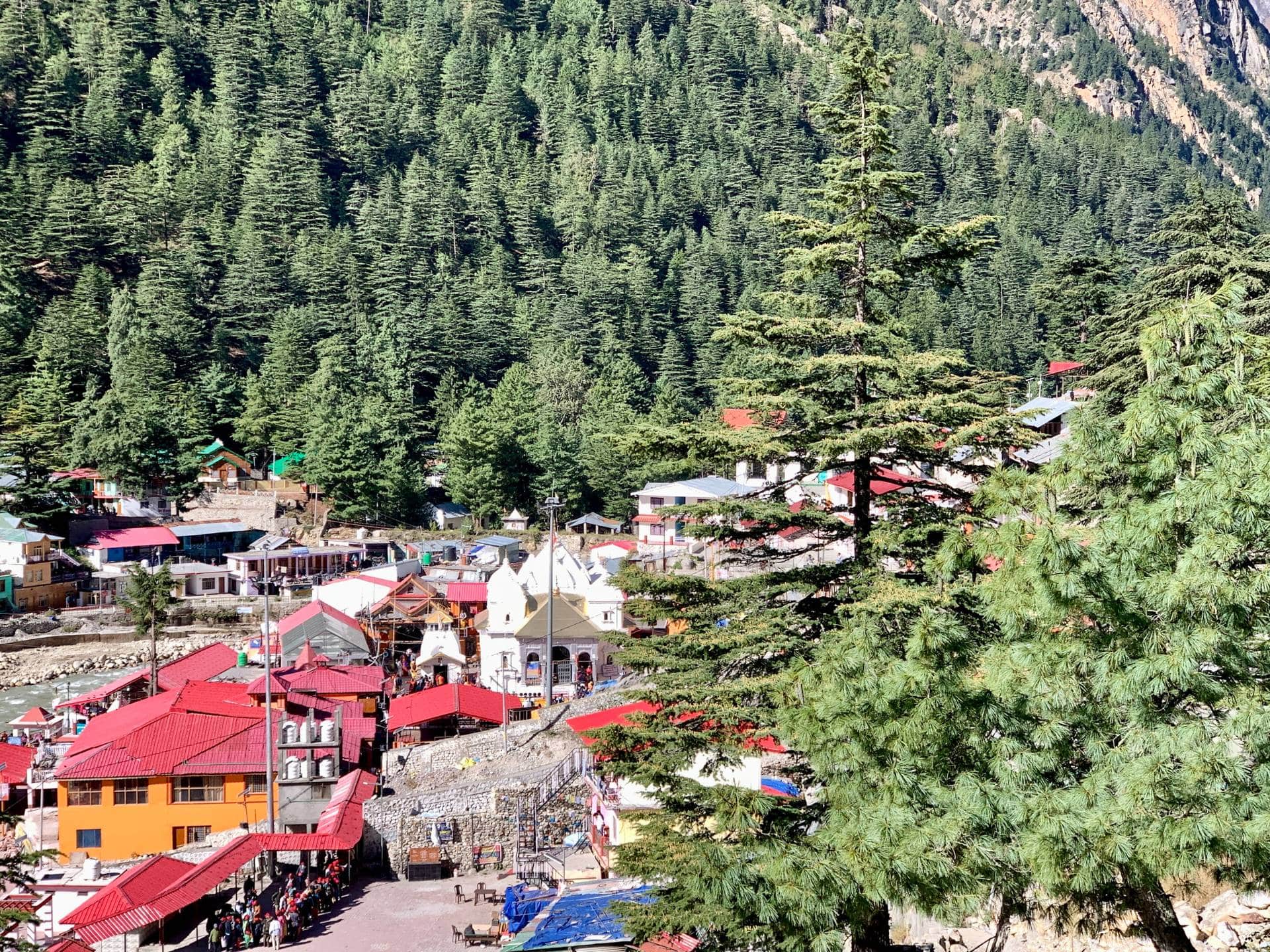
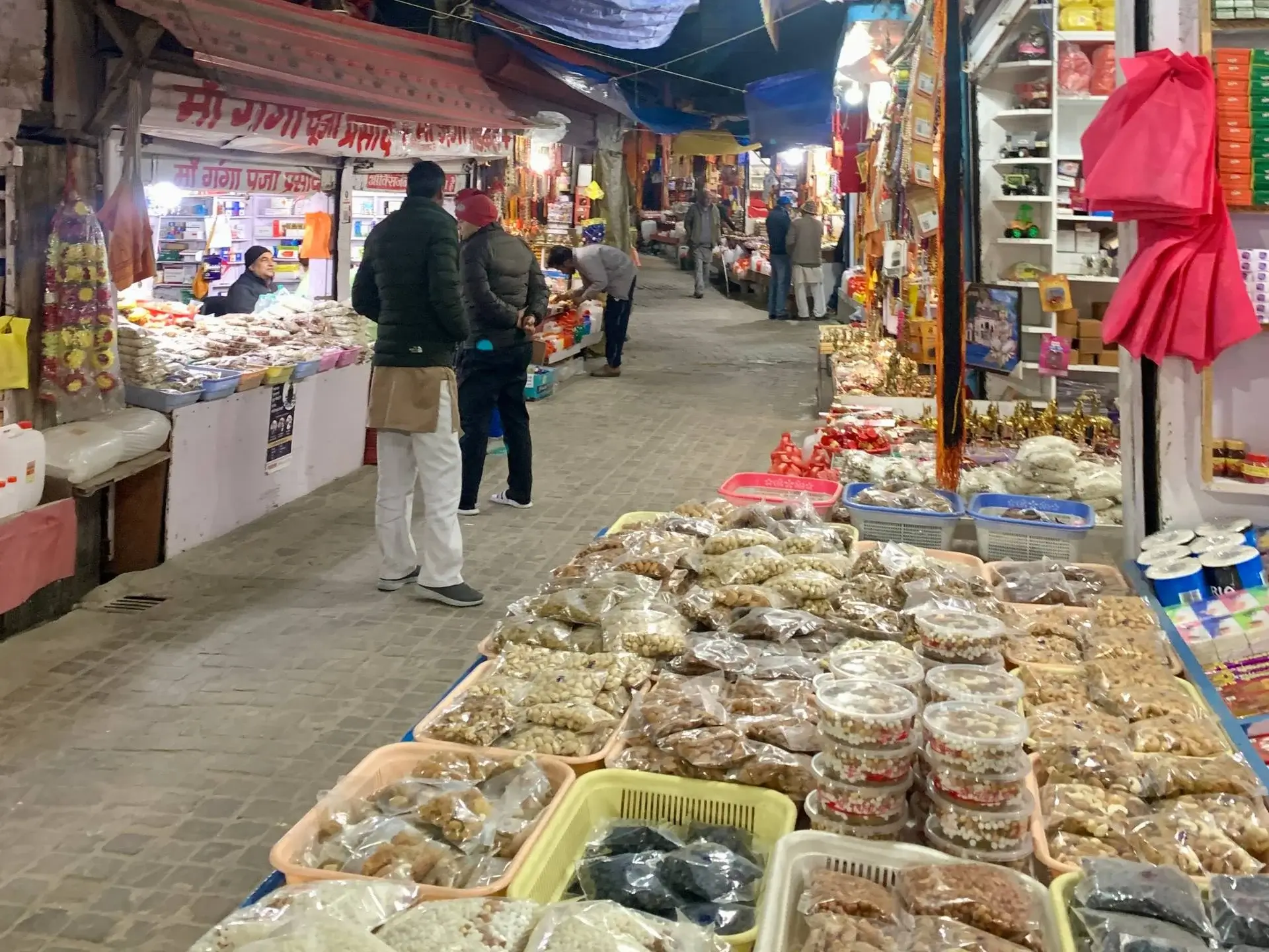
Known as the home of Maa Ganga, Gangotri is full of small shops and roadside eateries. If you have time, visit the Gangotri Temple and offer your prayers. Then relax by the riverbank, enjoy dinner at your hotel, and get a good night’s rest before starting the trek. We advise you to add another day to your itinerary to spend one day here for acclimatization.
Trek Distance & Time: 8 km, 7-8 hours
Altitude: 3,780 m/ 12,401 ft
Altitude Gain: 9975 ft or 3040 m (Gangotri) to 12,402 ft or 3,780 m (Bhoj Kharak)
Highlights of the day: Climb the exciting ‘spider wall’ on the trails to Bhoj Kahrak
Wake up early in the morning and visit the Gangotri Temple to seek Maa Ganga’s blessing before starting your Kedar Tal trek. After a hearty meal, pack your food items and purchase the necessities from the local market, as the trail sections are remote with no shops.
Begin your trek by crossing the bridge behind the Gangotri Temple, which overlooks the fast-flowing Bhagirathi River. Take the trail to your right and start with a gradual pace as the trail becomes steep from here. The Kedar Tal check post is about 100 m from Surya Kund. Proceed after getting your permits checked.
After an ascent of 300 to 400 meters, you will see views of the Gangotri Temple from the top. This trail section goes through a dense forest of Bhojpatra, blue pine, and fir trees. After traversing about 4 kilometers, the forest section opens up to a beautiful valley filled with colorful wild plants. Further along, you encounter a large terraced waterfall, and its cool mist gives you a refreshing sensation.
Take regular breaks and maintain a rhythmic pace to reduce physical fatigue while climbing. Soon, you will reach the ‘Spider Wall,’ named after the near-vertical rock face that you must cross to continue your journey. This is one of the riskiest sections of the trek, and you may face water flowing over it, so cross it by leaning from the side carefully and patiently.
After a short hike of 300-400 m further, you will arrive at Bhoj Kharak, a small campsite with plain grounds. Here, you will catch the first glimpse of Mt. Thalaysagar and Bhrigupanth. Set up your tents here to relax and unwind for the night.

Trek Distance: 6 km, 4-5 hours
Altitude: 4,375 m/ 14,140 ft
Altitude Gain: 12,402 ft or 3,780 m (Bhoj Kharak) to 14,353 ft or 4,375 m (Kedar Kharak)
Highlights of the day: Traverse through the lateral moraine section of Kedar Ganga Valley, witness the natural habitat of the Himalayan Blue Sheep (Bharals), and cross the landslide zones.
Today, we will start our day early to reach another campsite of this trek, Kedar Kharak. The first 200 m stretch from the campsite involves a steady hike downhill, which is easy. You will enter a vast field with colorful and bright grasses. Hiking further, cross the stream of water that appears on the trail.
As you continue, you will find yourself on the rough terrain of a rocky mountain, filled with scree and loose stones. Place your foot carefully and firmly to ensure you do not trip over any stones along the way. This 300-400 m is comparatively risky and requires mindful navigation. Follow the trail that runs along the banks of Kedarganga.
After trekking for 100-200 m, cross the landslide zone with a nearly vertical wall with patience. Further ahead, you will reach a waterfall, where you can relax and enjoy some refreshments. Continuing your trek, the trail will gradually become flat, and you will cross another water stream. Catch the views of the mighty Manda I peak as the slope steepens again.
Eventually, you will arrive at a beautiful valley where you may find Bharals and Gorals grazing in the fields. The small forest clearing, Kedar Kharak, is where you will set up your camps with the towering Bhrigupanth in the backdrop. Do not miss the beautiful sunset that paints the sky pink and orange, making the views magical.

Total Trek distance & Time: 5 km, 6-7 hrs (both sides)
Altitude: 4,734 m/ 15,531 ft
Altitude Gain: 14,353 ft or 4,375 m (Kedar Kharak) to 15,531 ft or 4,734 m (Kedar Tal)
Highlights: Reach the Kedartal and experience the towering Himalayan peaks of Thalaysagar, Bhrigupanth, and Manda III
Day 4 is the most exciting day of your itinerary as you will finally witness the Kedartal after 5 km of tough trekking. Enjoy the beautiful sunrise at your campsite and start your trek after having breakfast. Pack your snacks and fill your bottles, as you may not find many water streams on the trail.
Moving further from the campsite, you will get to see the majestic Jogin peak towards your right. The trail section in the 1st km goes through the Kedar Kharak Valley, which is filled with colourful leaves and wildflowers. As you move up towards the high altitudes, the significant drop in oxygen levels may leave you short of breath. Keep a gradual pace and take proper pit stops to relax and catch your breath.
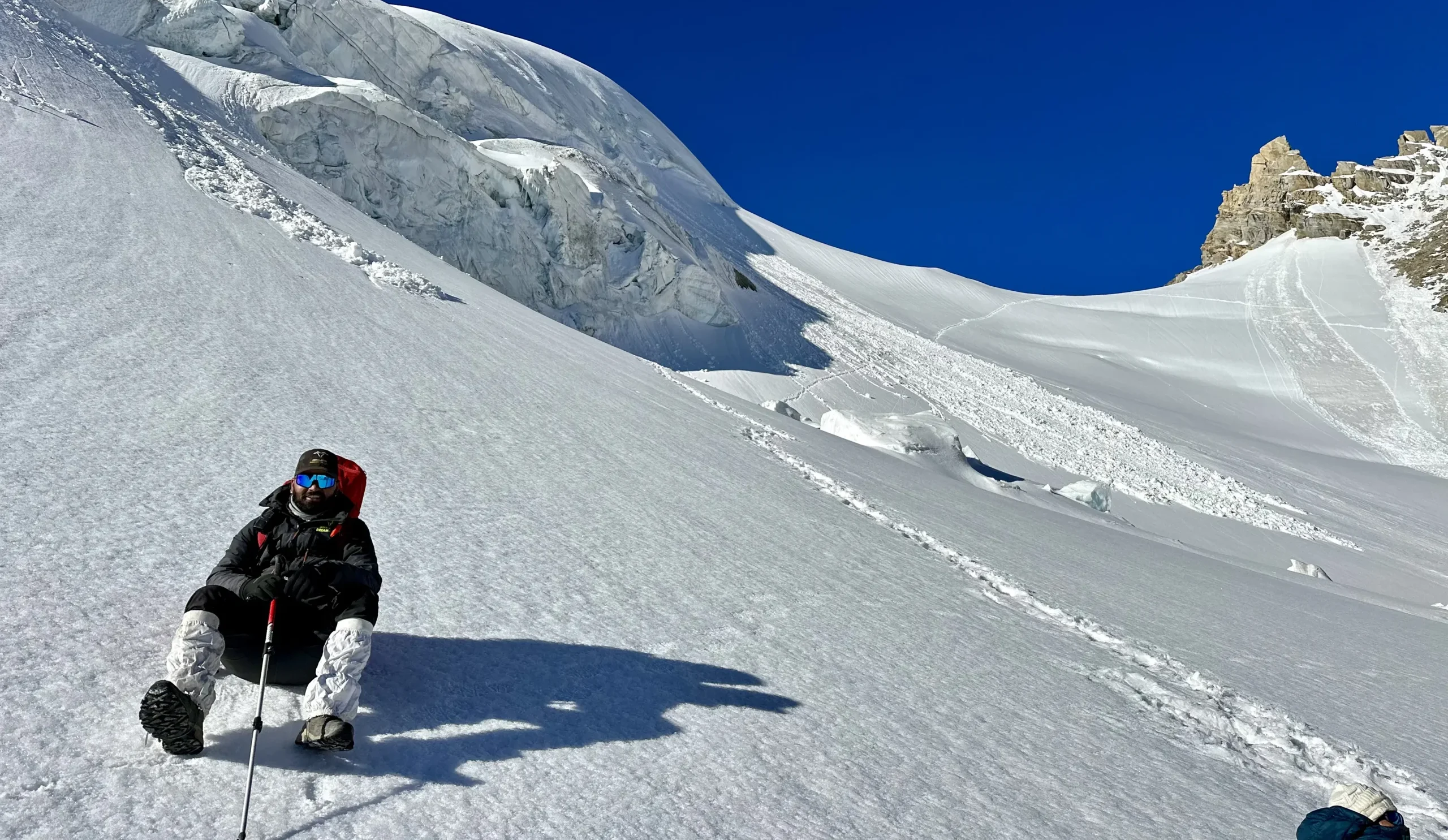
You will now cross a water stream with big boulders to reach the other side of the valley. Here, a 1 km uphill and well-marked trail section will present you with some mild challenges. The terrain is rugged and rocky, with some ice visible at a distance. After crossing this section, you will enter the glacier area.
Do not forget to look back and admire the beautiful views of Kedar Kharak Valley as you climb up. You may find fresh snow or black ice after a 2 km trek in the glacier area, which can be challenging to cross. There can be a risk of slipping and falling, or even leg injuries, if the snow is covering pits or sharp rocks.
After crossing this tough section, you will now ridge from where the entire snowy trail that leads to Kedar Tal is visible. This section is even more challenging, so take careful steps with firm footing while trekking. The trails are not marked, but you may find many cairns of rocks to indicate the correct path.
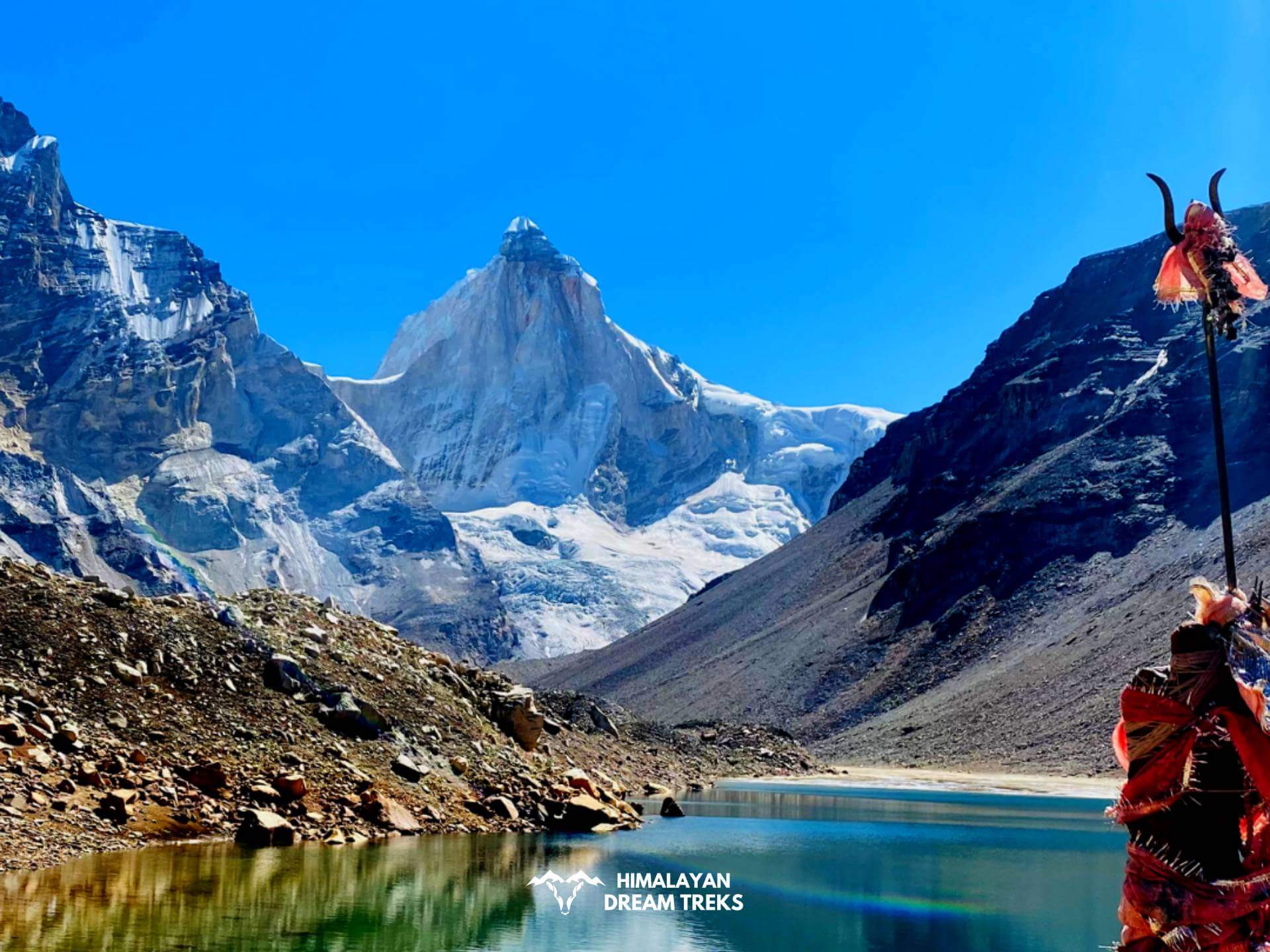
The last lap requires you to descend from the ridge towards the Kedartal. You will finally arrive at this heavenly emerald lake, which is surrounded by towering peaks and glaciers. The Thalaysagar mountain is visible up close from here, with a full view from base to top. Towards its left is Bhrigupanth, and next to it is Manda III peak.
Enjoy the stunning views and soak in this spiritual paradise of Lord Shiva. Try to trek back to the campsite as soon as possible, as the weather becomes very unpredictable at the top.

Total Trek distance & Time: 9 km, 7-8 hrs
Altitude: 10,300 ft
Wake up early in the morning at Kedar Kharak to witness the beautiful sunrise in the morning. If the sky is clear, you may catch a view of the distant Bhairava Jhamp cliff.
After having your breakfast, pack your belongings and retrace your steps to descend back to Gangotri Dham. The trails go downhill, making it easy for you to return on time. Take small breaks to relax at the scenic viewpoints.
Distance & Time: 245 km, 7-8 hrs
The sixth day marks the end of your Kedartal Trek. You can hire a taxi or catch a bus to return to Dehradun. Enjoy the scenic drive and reminisce about the adventurous journey you completed.
Kedartal Trek Package
Price Inclusion
Stay: 2 Nights stay in Gangotri
Camping: 3 Nights stay in camping
Meals: Meals from Day 1 dinner to Day 6 breakfast
Trek Equipment: All essential trek equipment is included, such as sleeping bags, kitchen and dining tents, utensils, mattresses, personal tents, toilet tents, and crampons (if needed).
Forest Entry and Permits: All required fuel charges, tolls, forest entry fees, and permits are covered.
Trek Staff: A qualified, professional team, including a mountaineering-certified trek leader, guide, cook, and support staff, will accompany you.
Emergency Kit: First aid medical kits, oxygen cylinders, and stretchers are provided for safety.
Trek Completion Certificate
Price Exclusion
Travel Insurance
Meals during the transportation
For backpack offloading additional fee will be charged
5% GST is not included
Any expenses or items not mentioned in the inclusion section are not covered
Any expenses arising from emergencies during the trek
Transportation from Dehradun to the base camp and back to Dehradun
Check the booking procedure here, including details on booking deposits, payment terms, refund and the cancellation policy.
Best Time for Kedartal Trek
The best time to do the Kedartal trek is between May to June and mid-September to mid-October. Even in summer, in the month of May, you may experience snowfall due to the lake’s high altitude. The cold winds blow during both summer and autumn, but the biggest advantage of visiting in summer is the exceptional view of frozen Kedar Tal lake.
While the Summer offers you better trekking conditions and stable weather, Autumn brings out the beauty of Kedartal in full glory. The monsoon months of July and August are not recommended for the Kedartal trek. The risk of mudslides, avalanches, and landslides, along with flooding of the Kedar Ganga River and other water streams, increases due to extreme and unpredictable rainfall.
Let us discuss the ideal months for trekking in Kedartal in detail:
Summer (Mid-May to June)
| Attribute | Details |
| Temperature Range | 12° C to 15°C during the day |
| -1°C to 3°C at night | |
| Weather | Cold and crisp air with comfortable trekking conditions during the day and chillier nights |
| Clothing layer required | Thermal inners with fleece outer and a padded jacket |
| Ideal for | Trekkers with prior high-altitude trekking experience |
| Special features | Frozen Kedartal, pleasant weather during the day, snow-covered trails |
Given the high altitude of Kedartal, you may find snow if you plan your trek during May. During this month, residual snow patches cover the shadow regions of the hilly terrain, making the Kedartal trek even more thrilling for adventure-seekers. The best part about trekking in summer is the beautiful scenery, with a frozen lake surrounded by Thalaysagar and Bhrigupanth peaks.
With the arrival of June, most of the residual snow disappears, giving you mesmerising views of the valley. Some of the trail sections become lush with tall and colourful grasses, making the journey more exciting. During both these months, the weather remains comfortable during the day. However, you must carry a padded jacket to protect yourself from cold winds at high altitudes. At night, the temperature may fall below sub-zero, so make sure you pack accordingly.
Autumn (Mid-September to Mid-October)
| Attribute | Details |
| Temperature Range | 7°C to 12°C during the day |
| -1°C to 4°C at night | |
| Weather | Cold winds during the day and night, clearer skies, and stable weather |
| Clothing layer required | heavy thermals with fleece outer, and a windproof and padded jacket |
| Ideal for | Astrophotography, scenic views, and visible mountains |
| Special features | Golden landscape, raw and untouched scenery, the thrill of winter trekking |
The months of July, August, and early September bring heavy rainfall during the monsoon, making the region prone to landslides, mudslides, and flash floods. However, by mid-September, the monsoon retreat results in stable weather conditions for trekking to Kedartal. During this time, you will find lush greenery along the trails at lower altitudes, bubbling streams, and Kedartal brimming with water.
Autumn arrives and stays till mid-October, transforming the valleys along the trek into a picture-perfect landscape. The weather becomes colder during the day, with freezing temperatures at night. However, minimal rainfall and clear skies with higher visibility of Thalaysagar, Bhrigupanth, and Manda make it an ideal time for the Kedartal trek.
Late October marks the onset of winter, which is extremely harsh, and trekking is not possible till May. The area experiences heavy snowfall and has a high risk of avalanches, making the trails to Kedartal life-threatening.
Difficulty Level of Kedartal Trek
The Kedartal trek is considered one of the most challenging treks that takes you to the high altitudes of the great Himalayas. This trek is suitable for seasoned trekkers, and we do not recommend it for beginners. The trek’s difficulty involves a steep uphill climb, rocky terrain, long walking distances, and snow-covered patches on the trail.
Given the unpredictability of the weather at the top and the presence of landslide and avalanche zones, the trails to Kedartal can be very risky. On top of that, you will traverse the ‘spider wall’, which is exciting yet challenging at the same time.
Let us evaluate the difficulty level of the Kedartal trek with respect to terrain analysis, walking distance, altitude gain, and weather factors:
Terrain Analysis
The trails of the Kedartal trek start from dense forests of the Gangotri region. From there, you follow the Kedarganga Riverbank along steep, rocky slopes littered with scree and large boulders. This makes its terrain one of the major difficulty factors.
Many consider the famous ‘spider wall’ as the most difficult part of the journey. However, as you proceed towards Kedartal, you will encounter several sections that are extremely risky to cross. This is due to loose rocks and landslide zones along the sloping ledges of the Himalayas.
In addition to this, the trails are usually covered in snow or black ice near the top. These act as blind spots for many pits and pointed rocks, where you may tip, slip, or injure your ankle. Some of the sections of the Kedartal Trek are unmarked, and you may need a guide to navigate them.
Walking Distance and Altitude Gain
The total trekking distance of the Kedartal trek is around 24 km, which you will be covering under 5-6 days. Even though the walking distance may seem less for each day, the steep and near-vertical trail sections make them difficult to cover. We advise you to carefully cross such sections and take proper breaks to catch your breath between the treks.
Altitude gain is a key factor that makes the Kedartal trek challenging. On the first day itself, you leave the Gangotri Dham to reach Bhoj Kharak, gaining an altitude of about 740 m. Hereafter, you trek to a height that is more than 14,000 ft, facing low oxygen levels in a very demanding terrain. You must add an extra acclimatization day to your itinerary as the risk of AMS may arise at any point of the trek.
Weather as a Difficulty Factor
As discussed above, the ideal time for attempting the Kedartal trek is between May to June and mid-September to mid-October. For most treks in Uttarakhand, summer offers stable weather, but for Kedar Tal, it is a different story. Due to its high altitude of more than 15,000 ft, the weather is very unpredictable, and even during May, you may experience chilly temperatures. At Kedar Kharak campsite, the weather can turn from sunny to foggy within a few hours. You may encounter unpredictable rainfall or snowfall at night, making the temperature even more freezing.
In addition to closely watching the weather forecasts, we advise you to carry an extra layer of clothing to combat the extreme cold at high altitudes. Pack a raincoat, waterproof gloves, and water-resistant hiking boots to help you cross water streams and snow-covered sections.
Trek Essentials [What to Pack]
- 45-60 Ltr Bag Pack With Rain Cover & Comfortable Straps
- Hot and Cold Water Bottle Like Borosil and Milton
- Energy Bar, Dry Fruits, and ORS
- Personal Medical Kit
- 1 Pair of Sunglasses (UV Protected)
- 1 Neck Gaiters (Buff)
- Tiffin Box
- 2/3 Full Sleeves (Non-Cotton)
- 1 Full Fleece T-Shirt
- 1 Fleece Jacket (Woolen or Sweater)
- 1 Down Feather/ Hollofil Jacket
- 1 Waterproof Jacket/ Poncho
- 1 Pair of Thermal Inners (Upper and Lower)
- 2 Trek Pants (Avoid Shorts and Denim Pants)
- 1 Pair of Waterproof Gloves
- 1 Pair of Woolen Gloves
- Sun Cap
- Woolen Cap
- 4 Pairs of Cotton Socks
- 1 Pair of Woollen Socks
- 1 Waterproof and High Ankle Trekking Shoes
- 1 Pair of Floaters
- Hand Sanitizer and Sunscreen Lotion
- Toothbrush and Toothpaste
- Toilet Paper
- Quick Dry Towel
- Lip Balm and Antibacterial Powder
- Moisturizer
- Aadhaar Card, Pan, or Passport for Applying Permit
- Trek Insurance
- Medical Certificate
- Self-Declaration Form
- Sleeping Bag
- Common Tent
- Mattress
- Dining Tent
- Camping Stool
- Walkie Talkie (For Team)
- Utensils
How To Reach Gangotri
If you choose to reach Dehradun by flight, it is the easiest and quickest medium. However, the air flight does not take you directly to Dehradun, but to Jolly Grant Airport, the nearest airport from the city. It is located approximately 25 kilometers from the city center, where several domestic airlines operate regular flights to and from Dehradun. Upon landing at the airport, you can hire a taxi, vikram, or take bus to Dehradun.
It is recommended to book your tickets a month or two before your departure date. Last minute flight booking is usually higher than regular price.
If direct flights to Dehradun seem to be pricey, then it will be wise to take flights to Delhi as they are more affordable. From Delhi, you can reach Dehradun via state bus like UTC, or HRTC or use apps like Abhibus or Redbus. Railways and shared taxis are also good options.
Traveling by train is another great option to reach Dehradun. You can reach there within a short period as it is well-connected to major cities by train. The Dehradun Railway Station serves as the primary railway station while you can also always choose Haridwar Railway Station. You can book tickets on various trains connecting Dehradun to places like Delhi, Mumbai, Kolkata, and more.
You can also travel via road to Dehradun from your hometown. Dehradun is connected by National Highways from/to the major cities like Delhi, Kolkata, and Chadigarh. So it will not be a problem in getting a transportation to Dehradun; however, it might not be as quick as air flight.
Nevertheless, you can still enjoy the beautiful views of the Himalayan foothills during your ride.
Gangotri, the starting point for Gaumukh Tapovan, is approximately 242 kilometers from Dehradun. To reach there, you can hire a private taxi or take a bus from Dehradun, which takes around 8-10 hours.
Buses to Uttarkashi leave early in the morning from Dehradun Hill Station and Prade Ground. The bus ticket usually costs 350 – 400 rs. And shared taxi charges from 400-500 which can be booked in Rispana pul and Prade ground. To reach Uttarkashi by 12 PM, you must board the bus early in the morning around 5 am. Taxis from Uttarkashi bus stand to Gangotri leave till 2 Pm during the summer season and 12 pm in the autumn season.
Once you reach Uttarkashi, you can get a shared taxi to Gangotri, which charges 300- 400 RS and can be found at the Uttarkashi taxi stand.
We also arrange transportation services for our trekkers, with the pick up point being Prince Chowk, Dehradun and pick up time between 6 am and 7 am. An add on of INR 2500 will be charged from trekkers.
Kedartal Trek Route Map
Peaks Visible From Kedartal
More Info of Kedartal Trek
Kedartal is located in the upper reaches of the Kedar Ganga Valley, which has been a place of reverence for Hindu devotees since ancient times. The lake receives its water from the mighty Kedar Bamak Glacier. Its history is deeply rooted in the origin of the Ganga River, which was the result of King Bhagirath’s penance and Lord Shiva’s blessings.
Legend says that Kedartal or ‘the lake of Shiva’ was created by Mahadev as his contribution to the Bhagirathi River. This glacial lake was born when Lord Shiva shook water from his matted locks (जटा), creating the Kedar Ganga that originates from it. The river later flows down the Kedar Ganga Valley and joins the Bhagirathi River.
Trekkers and pilgrims have always seen this clear and blue river as sacred. You will also find a small temple dedicated to Lord Shiva built on the big rock near the shore of the Lake. Towering peaks like Thalay Sagar and Bhrigupanth stand guard around the lake, their snowy tops reflected perfectly on the Kedartal’s surface. This natural amphitheater feels like heaven within heaven, radiating the divine energy of Mahadev.
The Kedartal Trek takes you through the rich biodiversity of the Gangotri region and the Garhwal Himalayas. Its trails wind through the Kedar Ganga Valley, giving you ample opportunities to spot some of the rare Himalayan species. Let us have a detailed look at them:
Flora at Kedartal Lake
The Kedartal Trek starts from the lower reaches of the Gangotri town, taking you through the dense forests of Himalayan Birch (Bhojpatra), Silver Birch, and Rhododendrons. The tall trees like Pine, Oak, and Deodar give you respite during the tedious uphill climb. After the forest sections, the trail mostly involves forest clearings or lateral moraine, which do not have much vegetation. However, at Bhoj Kharak, you may find some rare species of medicinal plants, colourful grasses, and wildflowers.
Fauna at Kedartal Lake
Due to its remote location, Kedartal acts like a hidden high-altitude refuge for several wildlife species. Its isolated slopes are home to large herds of bharal (blue sheep) grazing between Bhoj and Kedar Kharak and high up toward the lake. You may also spot species like the Himalayan Buck, the Musk deer, Snow leopards, and Himalayan black bears. In the lower reaches, birdwatchers may find Himalayan monals and snow cocks.
- Gaumukh Tapovan: Just a few kilometers from Gangotri, Gaumukh is the source of the sacred river Ganges. It’s a mesmerizing sight where the river emerges from the Gangotri Glacier. Nearby, Tapovan offers breathtaking views and is a popular meditation site.
- Auden’s Col: For seasoned trekkers, Auden’s Col is a challenging high-altitude pass that connects the Gangotri and Kedarnath valleys. This trek offers a unique perspective of the region.
- Patangini Dhar: A trek to Patangini Dhar offers pristine landscapes and the chance to witness the region’s rich flora and fauna. It’s a relatively unexplored trail with serene beauty.
- Thalay Sagar Expedition: If you’re an experienced mountaineer, the Thalay Sagar peak presents a formidable challenge. It’s one of the technical climbs in the Garhwal Himalayas.
- Jaonli Peak Expedition
- Gangotri Temple: Don’t miss the Gangotri Temple in the town of Gangotri itself. It’s an important pilgrimage site for Hindus and holds historical and religious significance.
- Harshil Valley: This picturesque valley, located not far from Gangotri, is known for its apple orchards and tranquil ambiance. It’s a great place to unwind and soak in the natural beauty.
- Nelong Valley
SCL, Foreign Permit & Vehicle
HDT is registered with the IMF, and we can cater to the needs of SCL for Government Employees. According to the rule, the government of India provides its employees with a prospect where they’re allowed to apply for a 30-day special casual leave in a calendar year to do trekking, hiking, or whatever adventure pleases them.
Mail us at info@himalayandreamtreks.in or call us at +91 80896 93825, if you want to avail SCL.
For foreign nationals, permit charges are different, and hence the overall package price is different for foreign trekkers. Connect with us before booking your trek.
- For 4-6 people Ertiga/Bolero or equivalent vehicle.
- For 7 or more people, Force Traveller.
FAQs
No, it’s not advisable for kids as Kedartal Trek is challenging and can be dangerous due to steep terrain and altitude.
From Kedartal, you can witness the majestic peaks of Mount Thalaysagar, Mount Bhrigupanth, Manda Parvat, Mt Jogin, and Mt Gangotri
Yes, trekking in late October can be done, but check the weather forecast before leaving for the trek.
Yes, Kedartal is a glacier lake, one of the highest in India.
Absolutely, since the trek is within Gangotri National Park, a permit is required for entry. Don’t worry we handle all the permit arrangements to ensure your hassle-free experience.
Mobile networks are limited, once you start your trek from Gangotri, you will get disconnected from the network. While rooms at the base camp have plug points for charging electronic devices, there are no charging facilities once you leave Gangotri.
It’s recommended to carry spare batteries for cameras and a power bank with a capacity of more than 10,000 mAh to ensure you have enough power for the entire trek. Cold temperatures can drain batteries faster, so keep them warm in a pouch inside your sleeping bag.
Uttarkashi has ATMs where you can withdraw cash. However, cash availability can be limited, so it’s wise to make last-minute cash withdrawals in Dehradun before starting the trek.
The Kedartal trek covers a total distance of 24 km, starting and ending at Gangotri over 5 trekking days.
The Kedartal trek is graded Difficult and is suitable only for seasoned trekkers. The trail involves the near-vertical Spider Wall, rocky lateral moraine sections, and snow-covered patches near the summit at 15,531 ft.
The ideal window is May to June and mid-September to mid-October. Summer brings frozen lake views and stable daytime conditions. Autumn offers clear skies with stunning close-up views of Thalaysagar and Bhrigupanth.


Leave a Comment