
Overview
Kush Kalyan Bugyal, a great alpine meadow in the Garhwal region of the Himalayas is an ideal spot to trek, camp and experience some of the best high-altitude moments.
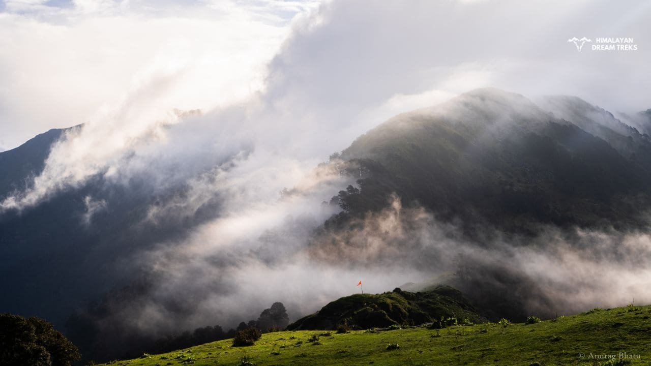
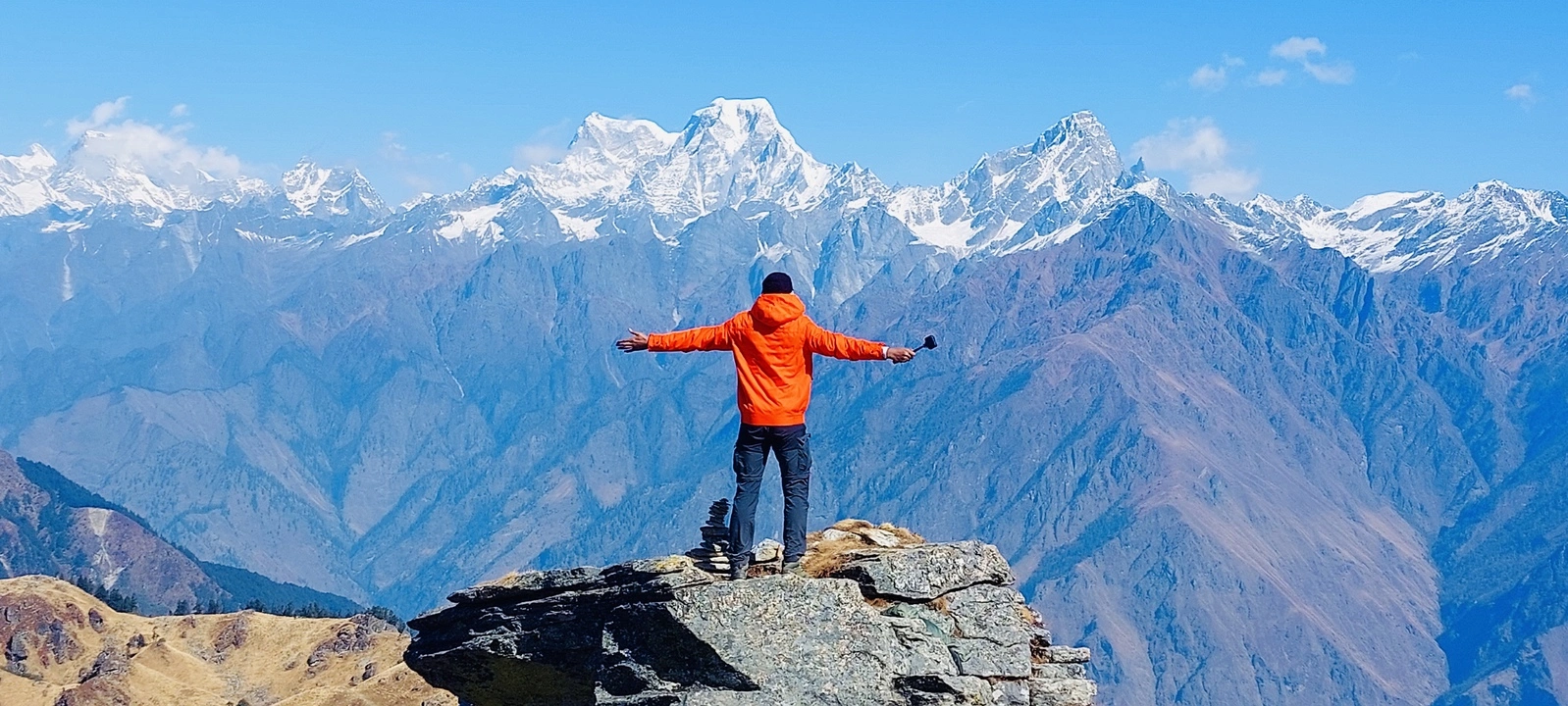
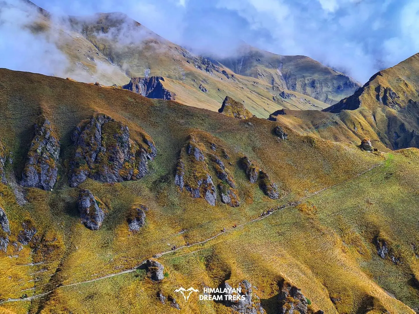
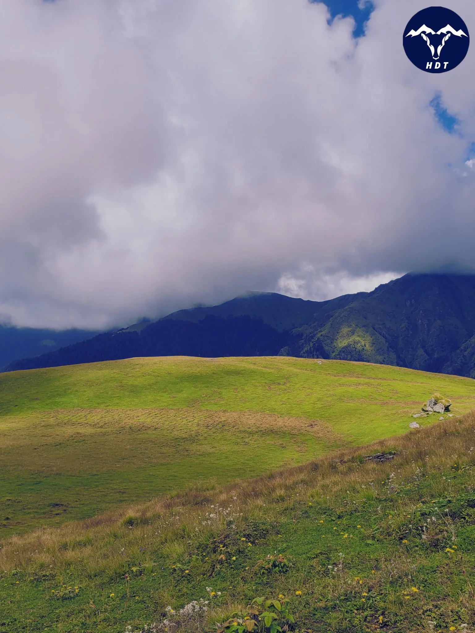
This Bugyal at 3838 m. altitude on the border of Uttarkashi and Tehri Garhwal districts and comprises a variety of wildflowers, berries plants, medicinal herbs, rhododendrons and orchids. Besides this, a river stream Devan Gad also flows near the Bugyal and it is a good source of water for nearby villages. After reaching the top of Kush Kalyan, you will get serene views of the Swargarohini, Kala Naag and Bandarpoonch ranges.
Overall the reason behind the beauty of the Kush Kalyan trek lies in these colourful knee-length plants, pin-drop silence, the chirping of Himalayan birds, and of course the views of other snow-covered ranges. The length of this trek is 35 Km, so usually trekkers take 3 days to reach the final trek destination. This was the brief about Kush Kalyan trek, but to know its Itinerary and other information, you have to read the blog till the end.
Join Himalayan Dream Treks to make your journey memorable.
Itinerary
Day 1: Dehradun to Uttarkashi Drive
Drive Distance: 151 km
Drive Time: 6-7 hrs
Altitude: 4,050 ft
On the very first day of the Kush Kalyan trek, our target would be reaching Uttarkashi. Therefore in the first half of the morning, we shall leave Dehradun and drive to Uttarkashi. Uttarkashi is 140 km away from Dehradun so we shall reach there in about 5 hours.
We go via Landour, Suwakholi, and Chinylisaur routes. It offers a scenic journey and if we get lucky we will get to see the whole Garhwal Himalayas from Moriana Top.
We will reach Uttarkashi by afternoon and check in to our hotel.
Trek Distance & Time: 8 km, 5-6 hours
Altitude Gain: 4,697 ft
Altitude: 6,500 ft
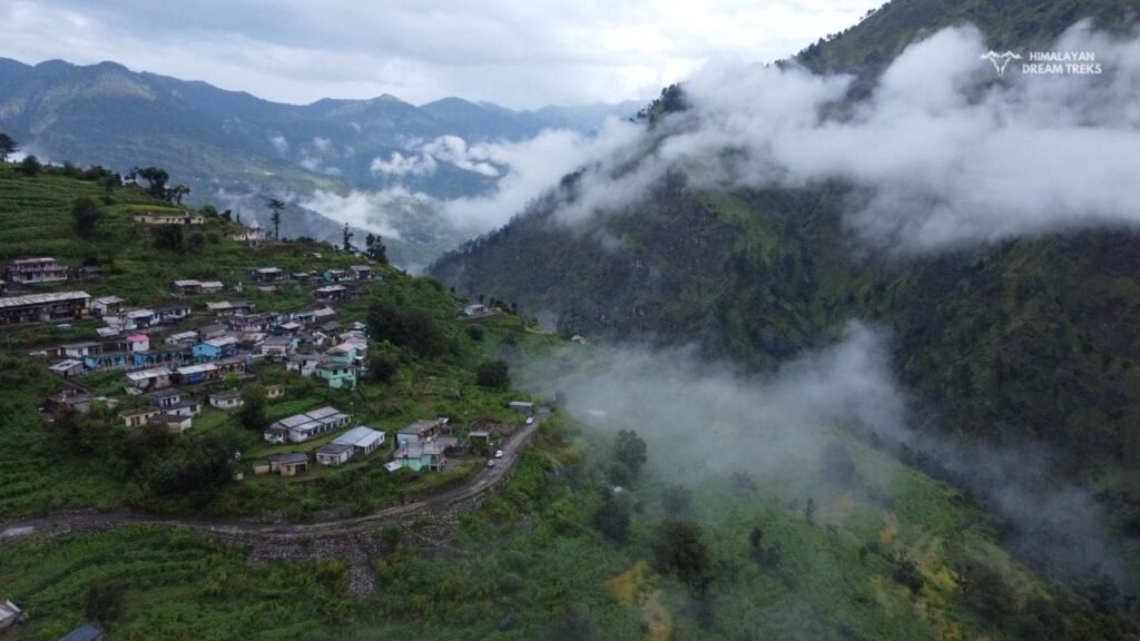
From Uttarkashi, we shall drive to Malla, which is 27 Km distant. On this route, there will be small places like Maneri, Jamak and Kumalti and we shall reach Malla in 1 hour. From Malla, Silla village is about 7 Km away. Because Silla Village is located a bit off-road, we have to take a narrow path from Malla towards the right side. After driving for some time, we shall arrive at Silla
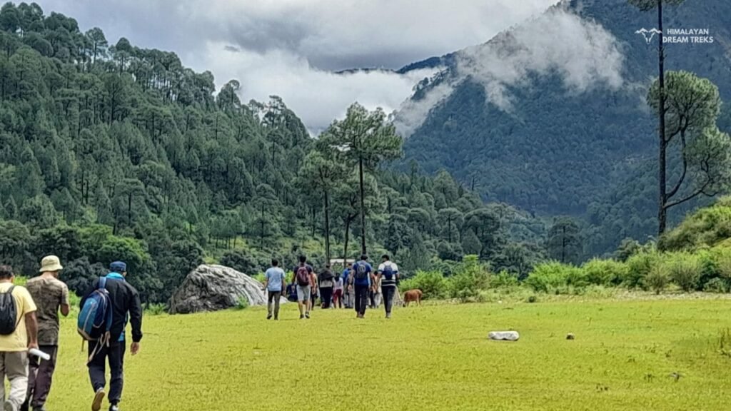
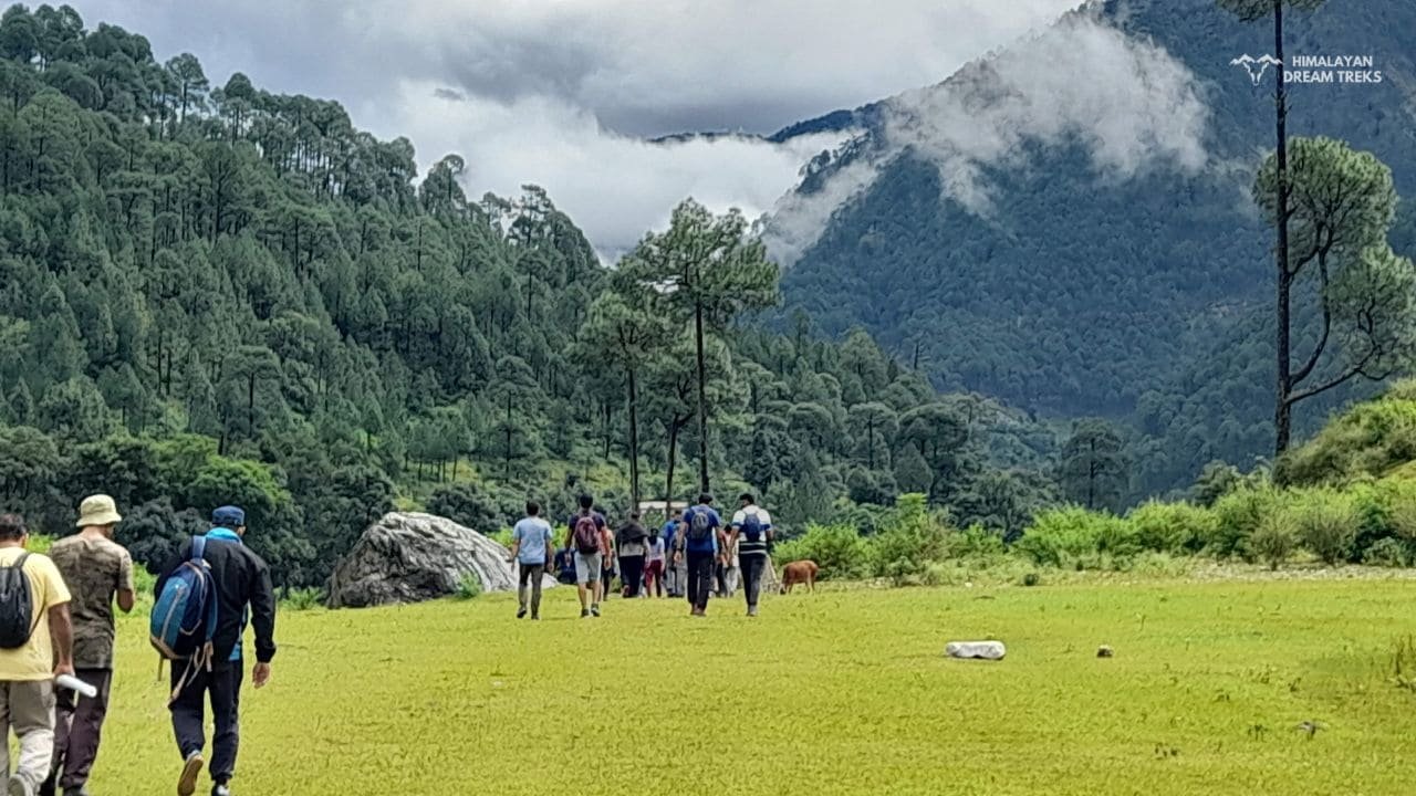
To reach our night stop site timely, we shall start hiking early. But before leaving the Silla village. The trek will start from a scenic trail of Silla. After walking for a few minutes, we shall reach the Forest Department Checkpoint. There is also a small temple also, where the local deity is in the Sanctum Sanctorum.
Then we shall pass through the peaceful forest. On this trail, there are several water streams coming from an anonymous point. Usually, the water in these streams is fresh and chilled. The trekkers often consume this water and fill their bottles also.
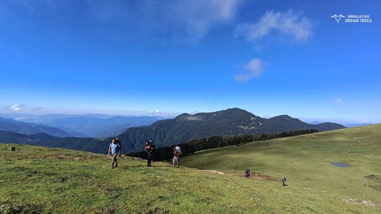
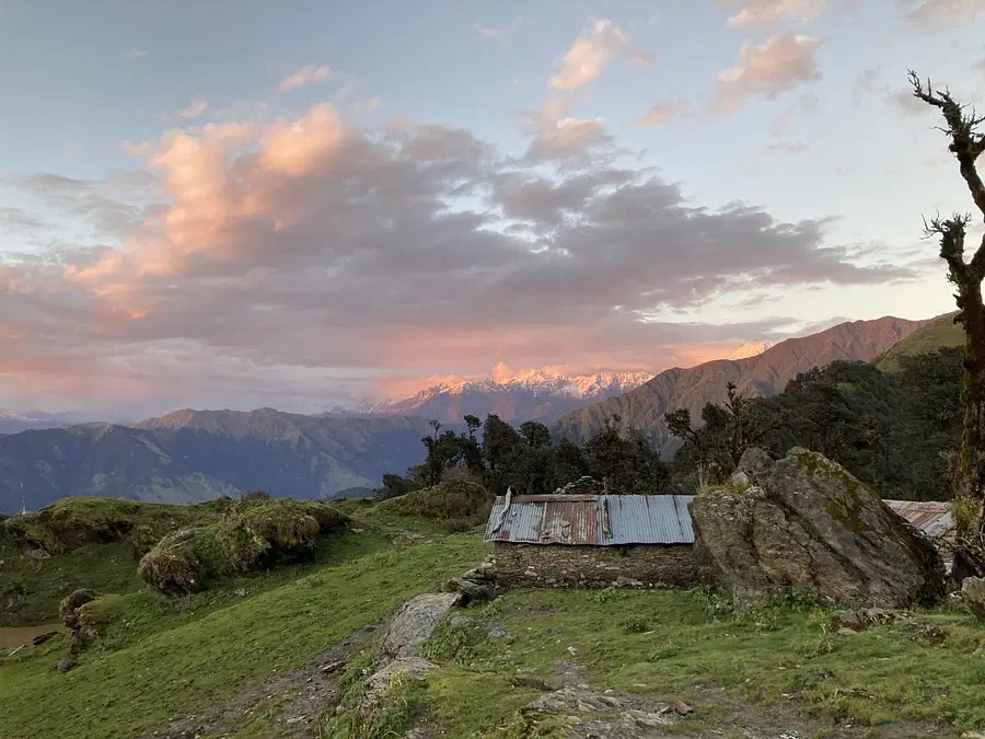
Gradually as we move forward, the elevation of the trek will rise. To be energised, keep drinking water and trek with full enthusiasm. After 5 hours of challenging yet exciting trek, we shall reach the Gairi, where our camp will be tonight. In Gairi, there are a few huts of Silla Village residents.
Trek Distance: 7 km, 6-7 hours
Altitude: 12,600 ft
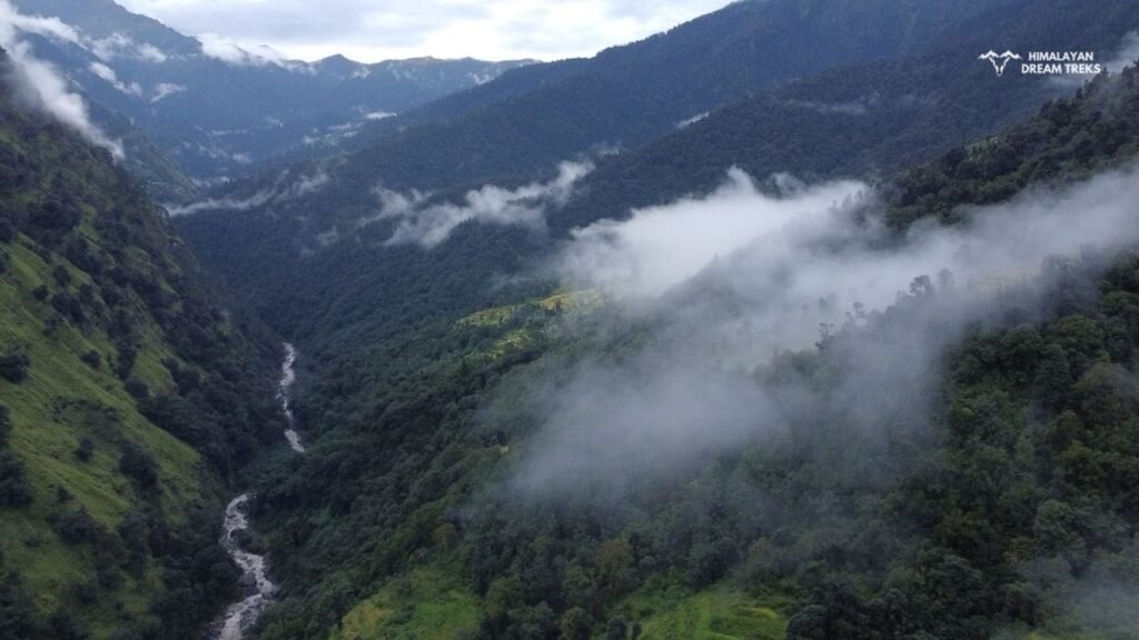
The Day 3 of the Kush Kalyan trek, is about covering the 7 km distance. So it would be better as soon as we start trekking in the morning. We shall get to see the heart-enriching views throughout the trek. The closer we shall reach the Kush Kalyan, the more slanted the slopes will be. On this route, we shall catch the view of Bakariya Top and Dayara Bugyal other side of the Valley. In the first half of today’s trek, we shall not get enough water streams, so store water for the way.
Besides this, there will be several kinds of wildflowers beside the narrow trail. The most common flowers are Kukhdi and Moor. These flowers have an intense fragrance that may cause a headache. But these flowers are not grown on the entire route, so when we move forward, it will be alright.
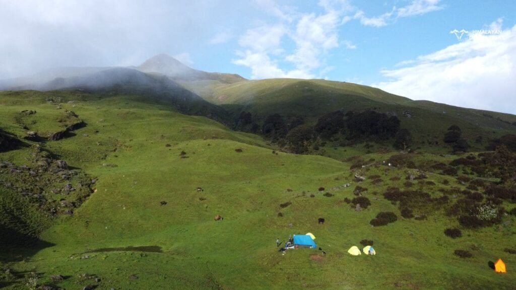
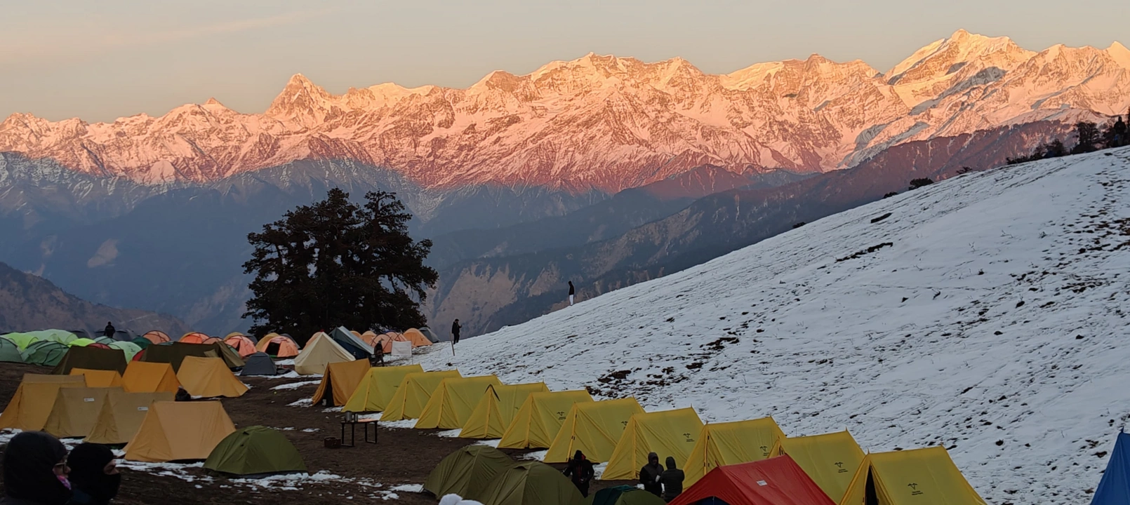
Beyond this location, there is a downslope. So we all must be very careful before a few kilometres from Kush Kalyan Bugyal. By taking short breaks in the middle and enjoying the adventure, we shall reach the Kush Kalyan Bugyal finally. From Kush Kalyan, we shall get to see the Bandarpoonch peak and so on. At night we shall stay there in a camp.

Total Trek distance & Time: 10 km, 7-8 hrs
Altitude Loss: 2,902 ft
Altitude: 9,700 ft
This will be the first day of returning from this memorable Kush Kalyan trek. Today’s night stop would be in Belak. So our goal will be to trek down via Jorai Bugyal and reach there by evening. But as we proceed from the Kush Kalyan, there will be an upward slope to the Jorai Bugyal. So first, we shall ascend to reach Jorai Bugyal and then there’s a downslope for our stop Belak. At night we shall stay in the camp at Belak.
Fortunately, there are many small water reservoirs and streams on the Belak trail. These random water bodies on the challenging trails appear more breathtaking and calming. From Kush Kalyan to Jorai, there are only meadows, but once we start to descend down to Belak, treeline will appear again.
Belak is a popular stay point for various nearby treks including the Sahastra Tal. Belak is also called Belak Khaal. Here are some Chhani that are huts of local people, who live there along with their cattle in monsoon season. These locals are very cooperative and help the trekkers by offering cooked meals, common stay and the Porters at genuine cost. So we shall also stay near Chhani by setting our camps.
In ancient times, Belak used to be the midway point of the Gangotri Kedarnath route. It is resided in the common route of Bhilangana Valley, Kamad Valley, and Ganga Valley. For your kind information, all these valleys are significant from a trekking perspective.
Total Trek distance & Time: 10 km, 6-7 hrs
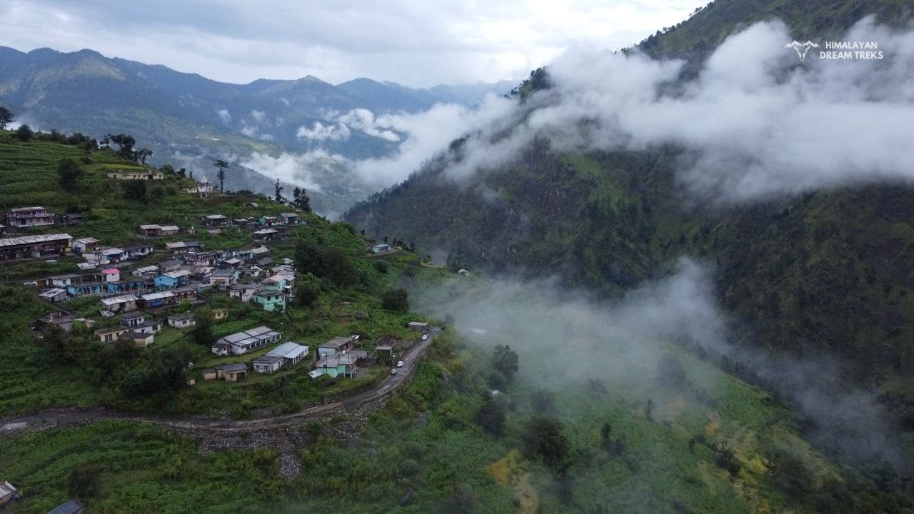
Today we have to reach Uttarkashi by trekking for 7 hours. Starting from Belak, the elevation reduces continuously and we get to walk in comparatively less steep treks. Also, now the meadows had elapsed and we would see only tree lines on both sides of the trail. Passing through the forests of Oak, Maple, Thuner, and Walnut, we shall step down to the Saura Village.
Belak to Saura Village trail is almost downward. Before reaching Saura Village, we shall witness Maneri Dam. From there Saura is only a few kilometres left. Ahead of Saura village, there will be a wide road, where we shall get a taxi to go back to Uttarkashi. Tonight we shall stay in a lodge of Uttarkashi.
Drive Distance & Time: 151 km, 6-7 hrs
The last day of the Kush Kalyan trek will take us to Dehradun, where it all started. This distance will be covered with the assistance of vehicles. The Uttarkashi to Dehradun distance is about 140 Km, so it will take 5 hours to reach our last site.
Trek Package
Price Inclusion
Stay: 2 Nights stay in Uttarkashi and 3 Nights camping in tents.
Meals: Meals from Day 1 dinner to Day 6 breakfast
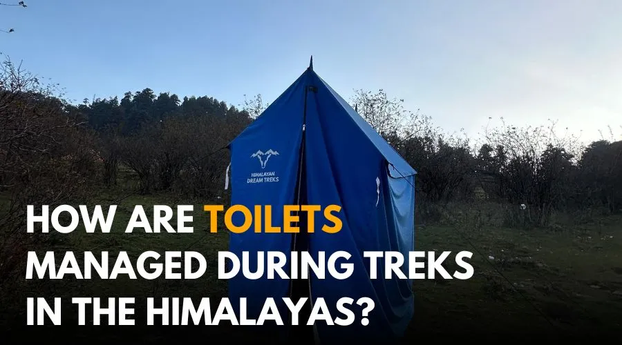
Trek Equipment: All essential trek equipment is included, such as sleeping bags, kitchen and dining tents, utensils, mattresses, personal tents, toilet tents, and crampons (if needed).
Forest Entry and Permits: All required fuel charges, tolls, forest entry fees, and permits are covered.
Trek Staff: A qualified, professional team, including a mountaineering-certified trek leader, guide, cook, and support staff, will accompany you.
Emergency Kit: First aid medical kits, oxygen cylinders, and stretchers are provided for safety.
Trek Certificate: Trek completion certificates will be given at the end of the trek.
Price Exclusion
Travel Insurance (not mandatory but highly recommended)
Meals during the transportation
5% GST is not included
Offloading charges for backpack or personal luggage
Any expenses arising due to emergencies, delays, or unforeseen situations
Items or services not mentioned in the Price Inclusions section
Transportation from Dehradun to the base camp and back to Dehradun
Any personal expenses
Check the booking procedure here, including details on booking deposits, payment terms, refund and the cancellation policy.
Best Time to Visit Kush Kalyan
The best time to do the Kush Kalyan trek is the summer and autumn season. In the summer, the weather usually remains stable so trekkers find ease while trekking. Whereas in the autumn season, you will feel comparatively lower temperatures but almost negligible precipitation.
Summer Temperature Range: On a sunny day, it goes up to 18°C, but at night the temperature falls rapidly up to 2°C.
Autumn Temperature Range: Whereas in autumn, the day temperature goes only up to 18°C but falls to (-8°C) in the nighttime.
To be more specific, the summer season brings freshness to the atmosphere and so the meadows again gain a bright green color. The sun’s rays get intense and so the snow of nearby glaciers starts melting. Because of the adequate amount of sun heat, the vegetation of the region flourishes and so the wildflowers also bloom. The fragrance of flowers gets mixed in the air and makes trekkers realise that yes It’s Summer in High Altitude. Along with this, the water level in the waterfalls and reservoirs such as lakes increases. The small streams of water widen due to melting snow.
As we mentioned, meadows look like a bright green layer. So the residents of nearby hamlets found it favorable to bring their cattle here. Usually, those are Van Gujjar tribes whom you will find roaming in these green meadows. The cattle also find that almost flat Bugyal comfortable to sit and graze the wild grass.
In a nutshell, the summer months are the golden time to come on the trek of Kush Kalyan. All the wildflowers, high altitude birds, Himalayan Tahr, and the bright sun rays will welcome you in summer with a few random rain showers.
The Autumn season at this altitude comes with several contrary changes in the weather and environment. Though the sky is usually clear, the temperature decreases gradually. Due to the effect of the equinox phenomenon, the sun’s rays lose their heat intensity and so the warmth in the atmosphere also declines. As a consequence, the bright green color of grasses turns into a bright hue color.
The cattle don’t like eating this grass as much as in summer. So the Van Gujjar tribes prefer emigrating to the low-altitude villages. Besides this, the water streams and lakes also shrink their size. The good thing is that you can see the Saraswati and Bandarpoonch ranges clearly from the Kush Kalyan Bugyal in the autumn months. If you are the one who likes Autumn hues, and don’t mind cold temperatures, then you must plan the trek in the autumn season only.
You should refrain from going on a trek in the monsoon season. Because the weather in high altitudes remains unstable and sometimes we witness incidents like cloud bursting and extreme lightning. Besides these, the trail also becomes slippery, and so reduces friction. Then it appears tough to maintain balance on narrow paths. Hence, first, check the weather forecast for the upcoming week and then plan the Kush Kalyan Trek along with your friends.
Difficulty Level of Kush Kalyan
This Kush Kalyan trek is Moderately challenging compared to a low-altitude trek.
When we compare it with high-altitude treks, then it is not that much tough. However, it depends on your stamina also. The physically fit individuals don’t feel it tough but others might feel contrary. In this trek, you have to ascend on the slopes, and that will be a little tiring. Somewhere the slopes are steep, so it takes more energy to climb that.
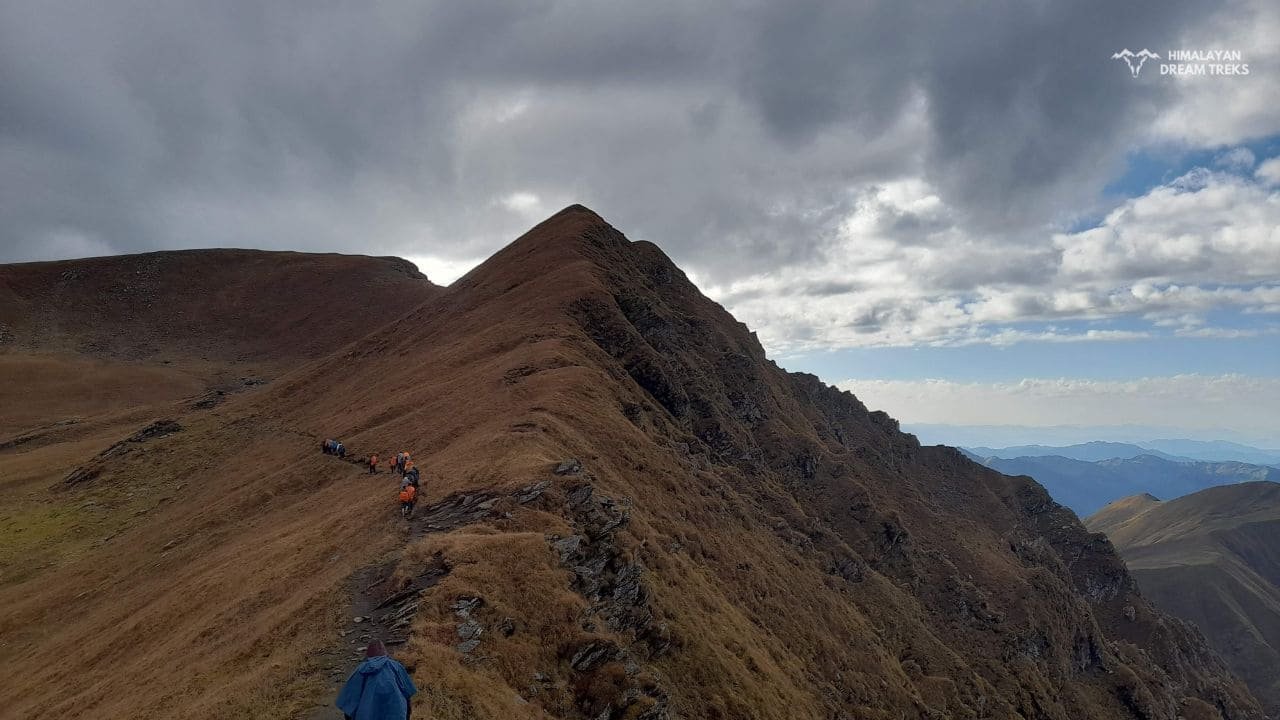
In the initial days of the trek, when we shall be going towards Kush Kalyan Bugyal, there are mostly upward trails. In uphill trails, one needs more strength. So keep taking small amounts of snacks and water on the way. You have to step up through several ridges like Chuli La Pass, which will often be covered with wild grass. The ridges are narrow, so you should be utmost careful while walking in these adventurous yet tough trails. Thereafter, when you hike in the meadows, there will be a lack of trees. Hence, if the weather turns on a lightning and raining phase then you can not hide yourself at all in the meadows.
That is why, our genuine advice is that, do the necessary preparation before going on these offbeat treks. Here, we are signaling towards trekking essentials, weather prediction techniques, and survival skills.
Trek Essentials [What to Pack]
- 45-60 Ltr Bag Pack With Rain Cover & Comfortable Straps
- Hot and Cold Water Bottle Like Borosil and Milton
- Energy Bar, Dry Fruits, and ORS
- Personal Medical Kit
- 1 Pair of Sunglasses (UV Protected)
- 1 Neck Gaiters (Buff)
- Tiffin Box
- 2/3 Full Sleeves (Non-Cotton)
- 1 Full Fleece T-Shirt
- 1 Fleece Jacket (Woolen or Sweater)
- 1 Down Feather/ Hollofil Jacket
- 1 Waterproof Jacket/ Poncho
- 1 Pair of Thermal Inners (Upper and Lower)
- 2 Trek Pants (Avoid Shorts and Denim Pants)
- 1 Pair of Waterproof Gloves
- 1 Pair of Woolen Gloves
- Sun Cap
- Woolen Cap
- 4 Pairs of Cotton Socks
- 1 Pair of Woollen Socks
- 1 Waterproof and High Ankle Trekking Shoes
- 1 Pair of Floaters
- Hand Sanitizer and Sunscreen Lotion
- Toothbrush and Toothpaste
- Toilet Paper
- Quick Dry Towel
- Lip Balm and Antibacterial Powder
- Moisturizer
- Aadhaar Card, Pan, or Passport for Applying Permit
- Trek Insurance
- Medical Certificate
- Self-Declaration Form
- Sleeping Bag
- Common Tent
- Mattress
- Dining Tent
- Camping Stool
- Walkie Talkie (For Team)
- Utensils
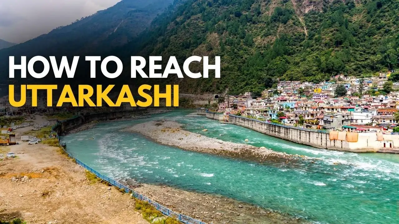
How To Reach
If you choose to reach Dehradun by flight, it is the easiest and quickest medium. However, the air flight does not take you directly to Dehradun, but to Jolly Grant Airport, the nearest airport to the city. It is located approximately 25 kilometers from the city center, where several domestic airlines operate regular flights to and from Dehradun. Upon landing at the airport, you can hire a taxi, Vikram, or take a bus to Dehradun.
It is recommended to book your tickets a month or two before your departure date. Last minute flight booking is usually higher than the regular price.
If direct flights to Dehradun seem to be pricey, then it will be wise to take flights to Delhi as they are more affordable. From Delhi, you can reach Dehradun via state bus like UTC, or HRTC or use apps like Abhibus or Redbus. Railways and shared taxis are also good options.
Traveling by train is another great option to reach Dehradun. You can reach there within a short period as it is well-connected to major cities by train. The Dehradun Railway Station serves as the primary railway station while you can also always choose Haridwar Railway Station. You can book tickets on various trains connecting Dehradun to places like Delhi, Mumbai, Kolkata, and more.
You can also travel via road to Dehradun from your hometown. Dehradun is connected by National Highways from/to the major cities like Delhi, Kolkata, and Chadigarh. So it will not be a problem in getting a transportation to Dehradun; however, it might not be as quick as air flight.
Nevertheless, you can still enjoy the beautiful views of the Himalayan foothills during your ride.
To reach our Basecamp Silla, firstly we shall reach the Malla. After landing in Dehradun, we shall drive to Malla by taxi. The distance between Dehradun airport and Malla is 194 km, so it will be covered in 5 to 6 hours. On the right side of this route, the Bhagirathi River flows down. Our Basecamp Silla village is located east of the Bhagirathi River.
Kush Kalyan Trek Route Map
Other Facts to Know about the Kush Kalyan
Kush Kalyan Bugyal and nearby villages celebrate a distinctive Culture, tradition and custom in itself. Lesser on the numbers, the villagers here endure their lives on minimum resources that are being provided to them by nature. To earn their living, they’re primarily engaged in Livestock farming.
Alongside, agriculture is the second main occupation adopted by the locals. The Van Gujjar tribe who are semi-nomadic migrate here every year from the foothills of the Himalayas. They domesticate Gujjar buffalo whose milk is so rich in nutrition and is consumed by almost half of the population.
Moving on to the women of the Gujjar tribe, these tribal women wear outfits and jewelry in a vintage manner. You will see them wearing bulky solid jewelry on their neck and wrists. As they are not mixed with modernization, their real customs are still unpolluted and pure.
It is believed by the locals that the land here is pure and their local deities live here. Deities like Kela Veer, Naag Devta, Achri Matri, and Hari Maharaj are worshipped here by the locals. You will find various small temples, trees, and rocks dedicated to them. The local people living here, refrain from consuming alcohol or any other intoxicants. Alcohol is completely banned here even for tourists travelling in this region.
The bugyal also served as a way in the former route of Kedarnath Dham. That used to start from somewhere near Belak Village. As of now, there is another active route to Kedarnath Dham, so it has become a primitive one. The people living around Kush Bugyal say that their ancestors used to earn by offering services to Char Dham Pilgrims.
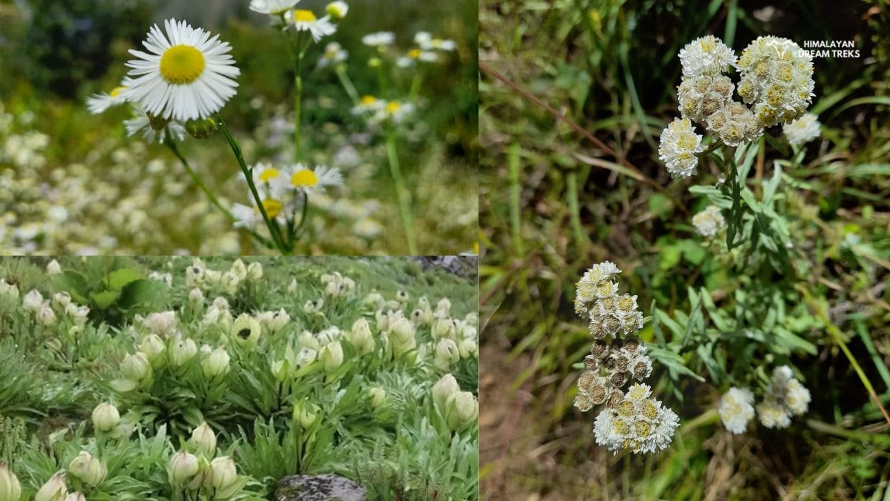
The forests and meadows we see on the trek of Kush Kalyan have a diversity of plants and wildflowers. Many of the plants present in this region are considered medically significant, especially for the Ayurveda. The most common feature of the flowers blooming here is the high fragrance, that you can not ignore. Let us dive deep and know about the flora and fauna around Kush Kalyan Bugyal.
Flora Found In Kush Kalyan Trek
Himalayan Daisy, Blue Poppy, Cobra lily, Chirayita, Moor, Burans, Kukhdi, Atish, Jata Mansi, Kutaki, Jayan, Pahari Strawberry and Thuner are the most found plants on this high altitude Kush Kalyan Trek. The bright appealing flowers in the meadow look like embroidery in the Green Carpet.
The inflorescence of all the flowers is so attractive that you can not resist appreciating nature’s beauty.
Most of these plants have medicinal uses and some are used in the manufacturing of perfumes and odoured soaps.
Fauna Found in Kush Kalyan Trek
Animals found in this altitude of the Himalayas usually have thick skin and heavy body hair. It is to save them from cold temperatures in the winter. There are both types of animals, pet and wild.
Almost all the tribal families living in that region have pets at home. Usually, people domesticate either milch animals or Horses. Talking about wild animals, these animals walk freely in the rhododendron forests and the valleys. Generally, they don’t come near humans, because it uncomfort them. But you can see them near water streams or lakes often. In the daytime, you’ll mostly hear the voices of birds like Monal. But at night, birds speak less, whereas the wild animals make hoots and growls.
Let us know the vernacular names of animals found there.
- Jular
- Ghorad
- Kakad
- Therag
- Thar
- Kasturi Mrig
- Kala Bhalu
- Tahr
- Bharal
- Red Fox
- Kashi Vishwanath Temple
- Sahastra Tal Trek
- Khatling Glacier Trek
- Dayara Bugyal Trek
- Chaurangi Khal and Harunta Bugyal Trek
- Kheda Tal
- Masar Tal
SCI, Foreign Permit & Vehicle
HDT is registered with the IMF, and we can cater to the needs of SCL for Government Employees. According to the rule, the government of India provides its employees with a prospect where they’re allowed to apply for a 30-day special casual leave in a calendar year to do trekking, hiking, or whatever adventure pleases them.
Mail us at info@himalayandreamtreks.in or call us at +91 80896 93825, if you want to avail SCL.
For foreign nationals, permit charges are different, and hence the overall package price is different for foreign trekkers. Connect with us before booking your trek.
- For 4-6 people Ertiga/Bolero or equivalent vehicle.
- For 7 or more people, Force Traveller.
FAQs
Kush Kalyani trek is located in the Uttarkashi and Tehri Garhwal districts in the Himalayas. That area is specifically the Garhwal region and one needs to reach Malla to start this majestic trek.
Sahastra Tal is located beyond Kush Kalyan Bugyal. Sahastra Tal is about 14 kilometres ahead of Kush Kalyan Bugyal. As the trail in High Altitude is not straightforward, you need to go through a circular steep and challenging path to reach Sahastra Tal. There are multiple routes between these locations. One of those is the route from Kush Kalyan to Sahastra Tal via Mamle Taal, Pari Taal and Kukli Top.
Mainly there are two options to stay on this trek. First is by setting the camps on your own along with the team. The other one is staying in the Chhani of the people. Both options are safe from a trek perspective.
The great green meadow is the main attraction of Kush Kalyan. It’s known for its beautiful Bugyal. The views trekkers get from the top of Kush Kalyan Bugyal is something that keeps every adventurer pushing to come on this trek and enjoy nature.
Uttarkashi has ATMs where you can withdraw cash. However, cash availability can be limited, so it’s wise to make last-minute cash withdrawals in Dehradun before starting the trek.
Charging your gadgets might be always challenging during the trek. During the trek, the last charging point you will get is at Silla Village. So it is recommended to carry spare batteries for cameras and a power bank with a capacity of more than 20,000 mAh to ensure you have enough power for the entire trek.
Pure vegetarian food will be served with dishes like Rice, Dal, Roti, Vegetables, Parantha etc. If you are a Jain or have any special food requests then do let us know. Note: Only vegetarian food will be served.
Aadhaar card, Declaration form, and Travel Insurance. If you are a teen then a parent’s declaration will be needed. If you are 60+ then a medical certificate will be required. And if you are a foreign national then your Passport will be needed for issuing permits.
Click on book now, enter the details like full name, city etc, and pay the amount. In between if you face any problem, reach out to us at +91 80896 93825.


Leave a Comment