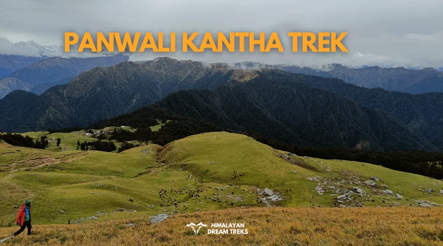
While most trekkers travel to the Garhwal Himalayas for Kedarnath or Tungnath, the Panwali Kantha is slowly gaining popularity as an offbeat trek. This bugyal is located at an elevation of around 3,445 m in the Tehri Garhwal district. Its trail follows an old pilgrimage route that connected Gangotri to Kedarnath long before motorable roads existed.
The Panwali Kantha meadow opens onto an unobstructed view of all four Char Dham mountain ranges: Yamunotri, Gangotri, Kedarnath, and Badrinath, along with Thalay Sagar, Chaukhamba, Kedar Dome, Meru, and Nilkanth. Very few treks in Uttarakhand offer this range from a single vantage point.
The fact that most people have not heard of it is what makes it worth an attempt. This guide will walk you through the Panwali Kantha trek itinerary, best time to visit, difficulty, and how to reach here.
Table of Contents
Why the Panwali Kantha Trek is a Must-Visit
The Panwali Kantha is a high-altitude meadow, and its trails take you through some of the most stunning landscapes of the Himalayas. The trek features accessible trails, several small meadows dotted with shepherd huts, and natural diversity. Here is why you must add it to your travel bucket list:
- The Char Dham Panorama: From the top of the Panwali ridge, you can see the mountain ranges of all four Char Dhams in one sweep. The sunset from this meadow, when every snowfield on those peaks catches orange light, is truly incredible.
- Less Crowded: Above Gaurmanda, you are more likely to cross paths with shepherds and their herds than with other trekking groups.
- An All-Season Trek: The trails of Panwali Kantha remain accessible throughout the year. The experience on this trail changes completely depending on when you go, from vibrant green during the monsoon to snow-covered during winter.
- The Old Pilgrimage Route: The trail from Triyuginarayan through Maggu Chatti to Panwali follows a path that pilgrims once used to travel between the Gangotri and Kedarnath shrines.
- Suitable for First-Time Trekkers: The ascent throughout the trek is gradual and manageable. If you have completed a shorter Himalayan day trek before and want to step up to a multi-day expedition, Panwali Kantha is a reasonable first choice.
Panwali Kantha Trek Itinerary
There are three ways to do the Panwali Kantha trek:
- Out-and-back from Ghuttu (northern region of Tehri Garhwal), where you climb to Panwali Kantha and return the same way you came.
- From Triyuginarayan village in Rudraprayag, which climbs through Maggu Chatti to the meadow, and reverses the same path.
- A full traverse which starts at Ghuttu, crosses the Panwali ridge, descends through Maggu Chatti, and exits at Triyuginarayan before driving back.
The third trail works better as you do not repeat any section of the complete trail.
Day 1: Drive From Dehradun to Ghuttu
- Drive Distance and Time: 182 km; 6 to 7 hours
- Altitude Gain: 640 m/2,100 ft at Dehradun to 1,539 m/ 5,048 ft at Ghuttu
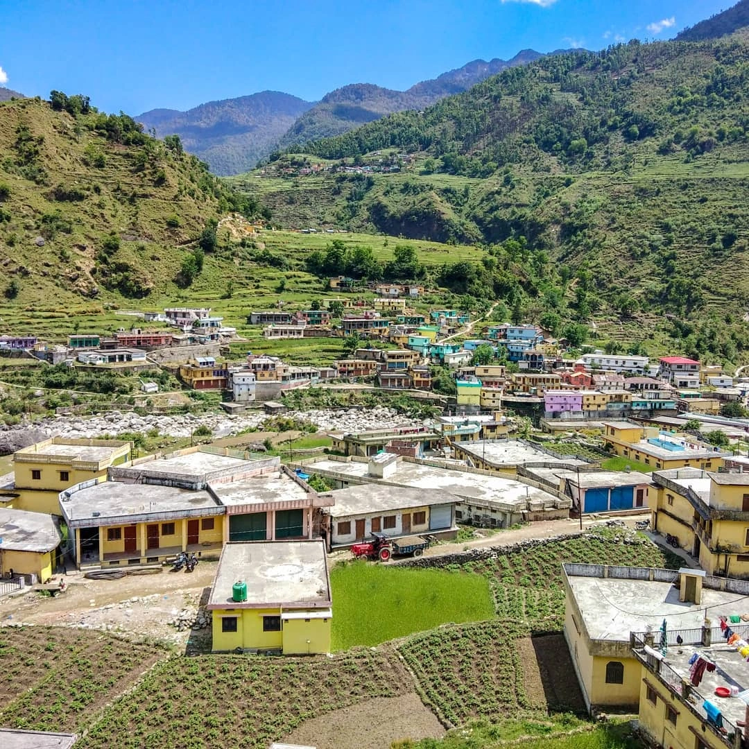
Leave Dehradun early in the morning. The road goes via Tehri and Ghansali before reaching Ghuttu, which sits in the Bhilangana Valley, Tehri District. After Tehri, the road narrows and follows the river for a long stretch.
Arrive at Ghuttu by afternoon, check into a guesthouse, and keep the evening for rest. Ghuttu has a few small lodges and tea stalls. There is no gear shop here, so sort all your supplies before leaving Dehradun.
Day 2: Trek From Ghuttu to Gaurmanda
- Trek Distance and Time: 7 to 8 km; 6 to 7 hours
- Altitude Gain: 1,539 m/ 5,048 ft at Ghuttu to 2,525 m/ 8,284 ft at Gaurmanda
The trek begins from Ghuttu village. The trail climbs steadily from the start through dense oak and rhododendron forest. You will pass a series of seasonal shelters that locals build near the upper grazing grounds for use in summer.
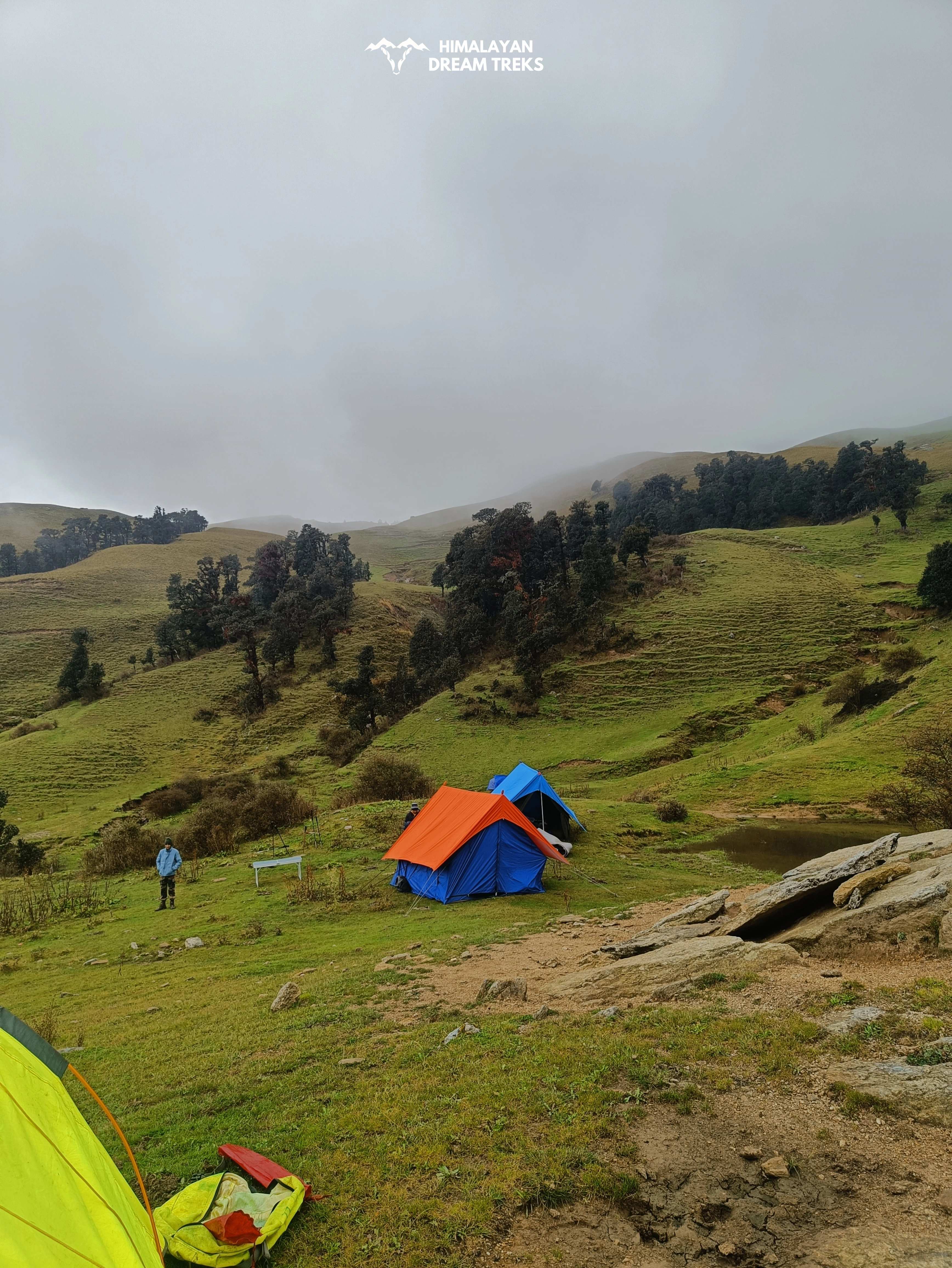
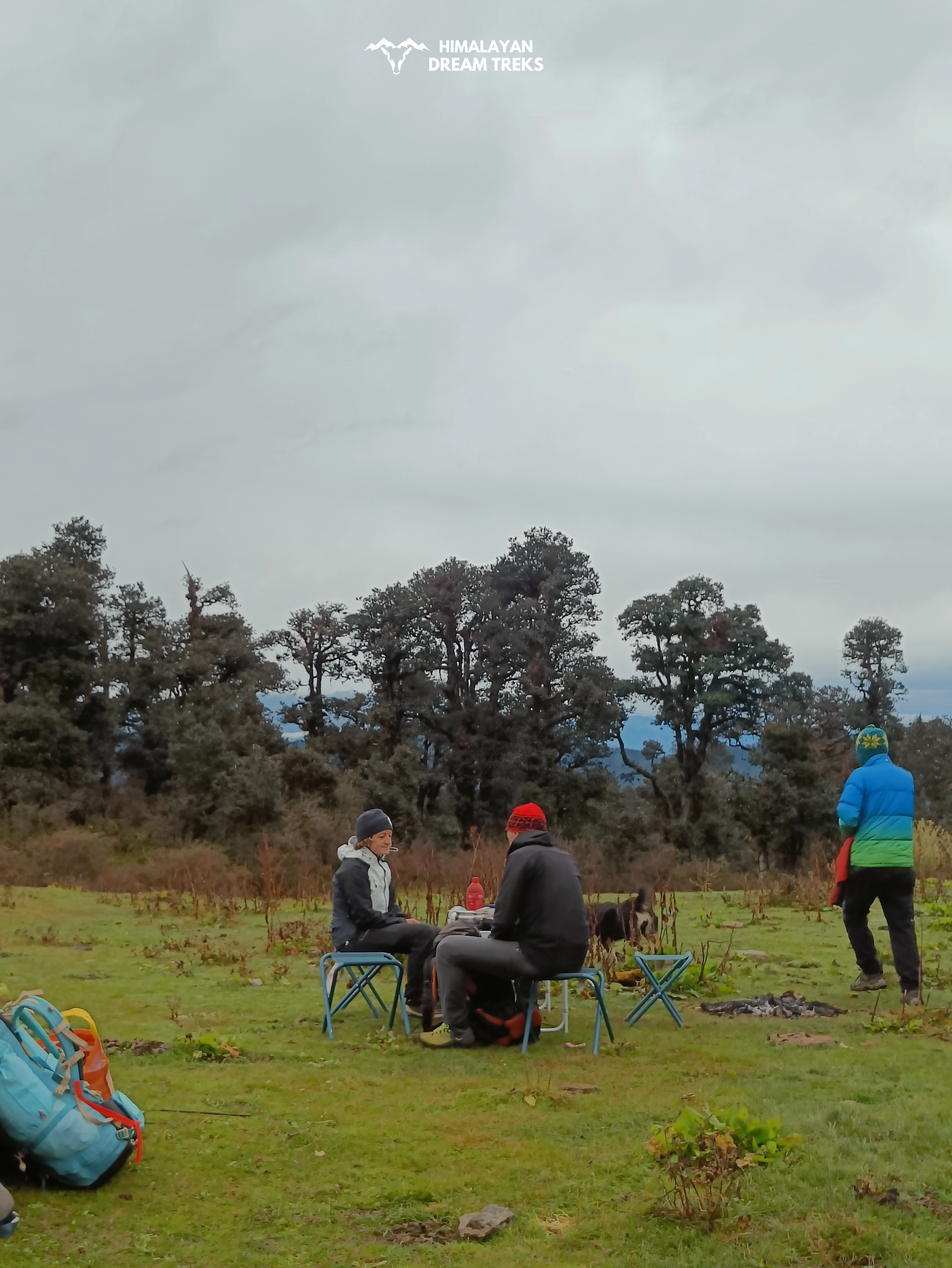
The climb is steep for the first few kilometres. Keep a steady pace and take short breaks on the few flat stretches you find. Further, the trail opens into the flat clearing at Gaurmanda (2,525 m). It sits at the edge of the forest, wide enough for comfortable camping, with banj oak on three sides.
Day 3: Trek From Gaurmanda to Panwali Kantha via Pobhari
- Trek Distance and Time: 7 to 8 km; 7 hours
- Altitude Gain: 2,525 m/ 8,284 ft at Gaurmanda to 3,445 m /11,302 ft at Panwali Kantha
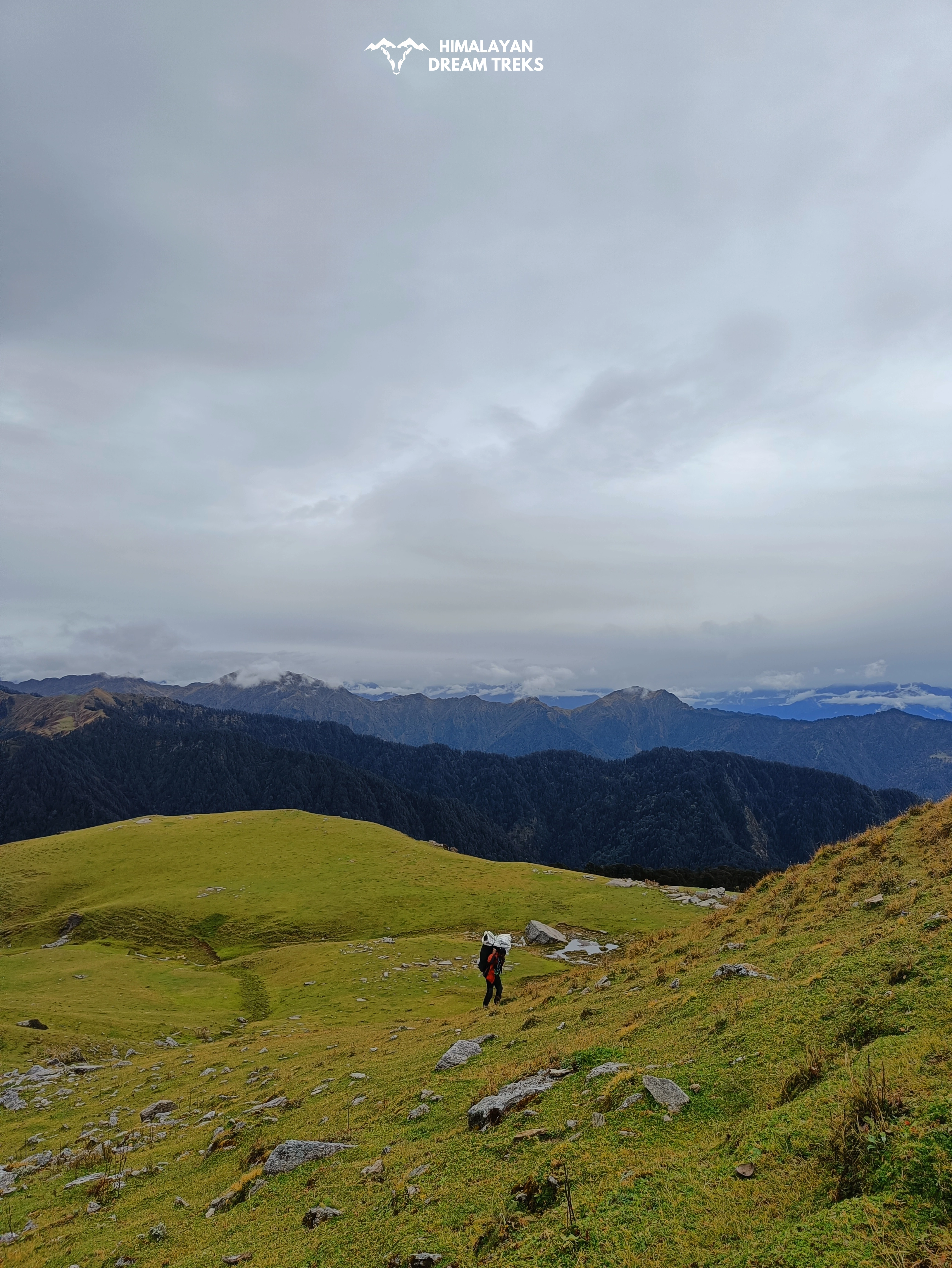
Leave camp by 7:00 am. This is the most rewarding day of the trek. The trail climbs gradually through the forest to Pobhari (2,945 m), about 4 to 5 km from Gaurmanda. The path levels briefly here before picking up again toward Dophand.
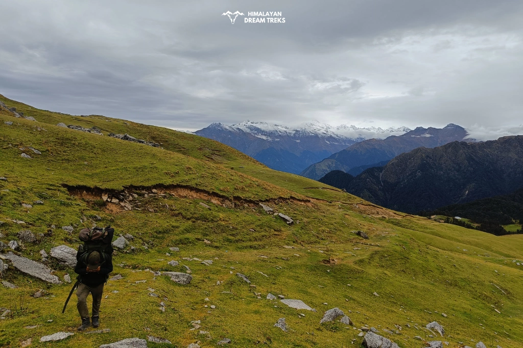
By Dophand, the trees have thinned, and views across the Bhilangana Valley start opening to the south. Shepherd huts appear on both sides of the trail. At the top, the meadow opens wide. You will see the Char Dham panorama towards the northern horizon: Chaukhamba (7,138 m), Thalay Sagar (6,904 m), Kedar Dome (6,940 m), Nilkanth (6,596 m), and Meru (6,660 m) are all visible from this ridgeline.
Day 4: Trek From Panwali Kantha to Maggu Chatti
- Trek Distance and Time: 12-13 km; 7-8 hours
- Altitude Loss: 3,445 m /11,302 ft at Panwali Kantha to 3,235 m/10,615 ft at Maggu Chatti
Wake up before sunrise and watch the first light hit the peaks before breaking camp. Today, you cross to the northern side of the ridge and begin the descent toward Maggu Chatti.
It is a shepherd settlement used seasonally, and on your way, you will pass through Raj Kharak, another small shepherd settlement. The distance of 12 to 13 km makes it the longest walking day of the trek. Set up your camps here and retire for the night.
Day 5: Trek From Maggu Chatti to Triyuginarayan and Drive to Rishikesh
- Trek Distance and Time: 7 km; 3-4 hours
- Drive Distance and Time: 213 km; 5-6 hours
- Altitude Loss: 3,235 m/10,615 ft at Maggu Chatti to 2,167 m/ 7,110 ft at Triyuginarayan
The final trekking section descends from Maggu Chatti to Triyuginarayan Village. The descent is gradual, and the trail is well-defined. As you approach the village, the ancient Triyuginarayan Temple comes into view. Even if you are not a pilgrim, it is worth spending 20 to 30 minutes here before the drive.
From Triyuginarayan, you can drive or hire a cab to Rishikesh via Sonprayag and Rudraprayag. The drive takes 5 to 6 hours. You will reach Rishikesh by evening.

Best Time to Visit Panwali Kantha Trek
The best time to visit the Panwali Kantha trek is between May and June, and late September to November. Its trails are easily accessible from April to November, with the monsoon months being the only period most trekkers avoid. Let us see what each season brings to the Panwali Kantha trek:
Spring and Summer
Months: April to June
The trail from Ghuttu is lined with red and pink rhododendrons through April and May. Temperatures are comfortable for climbing during the day, between 10°C and 18°C, though nights at the top drop to 2°C or below. The onset of May welcomes slightly warmer conditions but remains pleasant for the ascent.
Monsoon
Months: July to mid-September
The region receives heavy and unpredictable rainfall during the monsoon season. This makes the trail slippery and increases landslide risk. Avoid the core monsoon months of July and August. However, if you crave adventure, you can choose to visit during mid-September, the recovery window with clearer days.
Note: Check with your tour operator and consult a weather forecast before travelling to Panwali Kantha during the monsoon.
Autumn
Months: September to October
This is the most recommended window. The monsoon clears out by mid-September, and the skies stay clear through October. The meadows become green after the rains, lined with wildflowers, and the mountain views are the best during this period for photography. During October, evenings get colder at higher elevations, with temperatures falling to around 0°C near the top.
Winter
Months: November to March
The trails of the Panwali Kantha trek remain open during the winter. However, the difficulty level increases as the snow-covered upper reaches from Probhari and the ridge walk near Panwali become risky. Covering these narrow and icy paths requires prior high-altitude trekking experience. Hence, beginners must avoid visiting during this season. That said, the views of the prominent peaks become exceptional after the snowfall in December or January.
Note: Carry ice axes, crampons, gaiters, and microspikes if attempting it in deep winter.
How to Reach Panwali Kantha Trek Basecamp
There are three entry points to the Panwali Kantha trek. The first one starts from Ghuttu, the second from the Gangotri side (Uttarkashi), and the third from the Kedarnath side (Triyuginarayan village). As Ghuttu and Triyuginarayan are the most preferred starting points, here is how you can choose to travel for the Panwali Kantha Trek:
By Air:
The nearest airport is Jolly Grant Airport in Dehradun, approximately 159 km from Ghuttu and 229 km from Triyuginarayan by road. From there, you can hire a private taxi from the airport directly to Ghuttu or Triyuginarayan.
By Train:
Dehradun Railway Station and Rishikesh Railway Station connect to Delhi, Haridwar, and other major cities in India. From Dehradun or Rishikesh, you can hire a direct taxi or a shared cab to Ghuttu or Triyuginarayan Village.
By Road
From Dehradun, take the road via Tehri and Ghansali to reach Ghuttu. The road to Ghuttu passes through NH 34, taking approximately 6 hours to cover the distance of 184 km. You get various options ranging from private cabs, shared taxis or jeeps to reach here.
Via Triyuginarayan (Alternate Start): From Rishikesh, drive to Rudraprayag, then Sonprayag. Triyuginarayan is 11.3 km from Sonprayag on a rough road.
How Difficult is Panwali Kantha Trek?
The Panwali Kantha trek is rated easy to moderate. The maximum altitude of 3,445 m is high enough to have some high-altitude trekking experience, but physically fit beginners can also attempt this trek. By keeping a steady pace during the ascent, you can avoid altitude sickness.
The difficulty comes from two factors. First, the climb out of Ghuttu is steep and tiring for the first few kilometres. There are no flat sections for resting on. Second, on Day 2 and Day 3, you gain around 1,000 m of elevation each day. Both these factors are manageable for trekkers with basic fitness and trail experience.
The trail surface is mostly dirt and stone, with grass in the upper meadow sections. In winter and early spring, sections above Pobhari can carry snow. You may need crampons or microspikes from January to March. Above Dophand, some ridge sections are narrow and exposed, so they must be navigated carefully.
Note: There are no shops or water points between Ghuttu and Gaurmanda. Carry at least 2 litres of water from Ghuttu on Day 1.
Things to Carry for Panwali Kantha Trek
- Clothing: Woollen jacket or heavy fleece for evenings above 3,000 m. Waterproof outer layer, thermal base layer, warm gloves, and a hat.
- Footwear: Sturdy ankle-support trekking shoes with good grip. In winter, carry microspikes or crampons for sections above Pobhari.
- Gear: Ergonomic backpack of 30 to 40 litres, trekking poles, and a sleeping bag.
- Water: Carry 2 to 2.5 litres of water on the first day. From Day 2 onward, you can refill the bottles from streams near camp.
- Food: Pack energy bars, dry fruits, and chocolates for the trail.
- Essentials: Sunscreen and UV-protected sunglasses are necessary throughout the trek. Carry personal medications and a basic first aid kit.
Plan Your Panwali Kantha Trek!
The Panwali Kantha trek takes you on a four- to five-day journey that requires decent endurance and patience to tackle the rugged yet accessible terrain. It offers you a quiet adventure in the midst of the Himalayan wilderness, with an experience of a lifetime. Adding to this, it takes you to the temple town of Triyuginarayan, serving as a grounding reminder of how spirituality and nature are woven together.
Contact us at Himalayan Dream Treks: +91 80896 93825, info@himalayandreamtreks.in
Leave a Comment