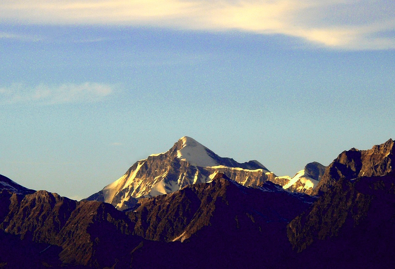
In the quiet Gangotri region, the morning light brushes the snow-draped summits of Jogin I, II, and III, three peaks rising like watchful sentinels above the high Garhwal Himalaya.
Located roughly around 30°52′N and 79°03′E, these peaks sit tucked between the Kedar Ganga valley and Gangotri, forming a cluster for those who enjoy remote alpine climbing. Although the terrain demands caution, crevasses, avalanche-prone bowls, and technical stretches near the summits, the approach remains surprisingly inviting for climbers familiar with basic mountaineering techniques.
But this is only a glimpse of what awaits. If you want to explore their climbing history, ideal budgets, route maps, and package options, keep reading. Your full guide begins now.
Table of Contents
Climbing History of Jogin I, II & III
When you look into the origins of mountaineering in the Gangotri region, you quickly realize that Jogin I, II, and III occupy a unique niche – neither excessively documented nor entirely obscure. Although these peaks do not share the fame of nearby giants like Shivling or Thalay Sagar, they have attracted explorers since the early mid-20th century. Early expeditions often approached through the Kedar Tal region or directly from Gangotri, using the high meadows and glacier basins as natural staging points.
Jogin I was first climbed on 22 June 1970 by students of the 19th Advanced Mountaineering Course at NIM, led by Colonel J. C. Joshi, the institute’s principal and a successful Indian Everest climber. Jogin III was first climbed in June 1967, a team led by Dr. G. R. Patwardhan.
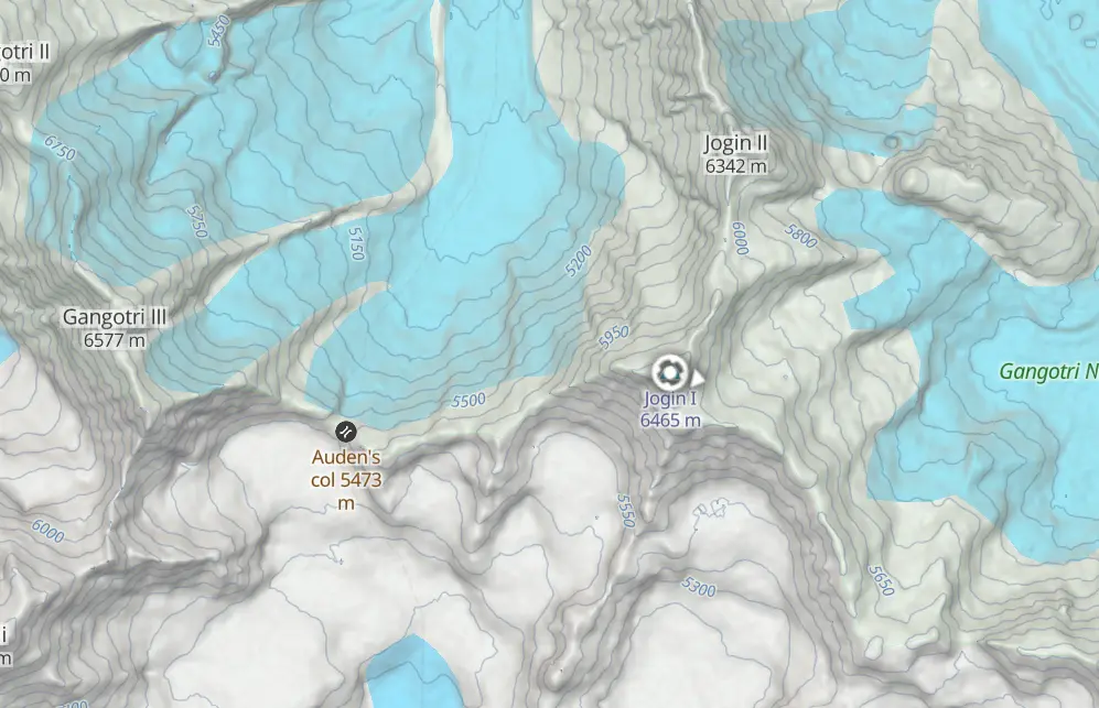
As you trace the chronological pattern, you find that many initial teams consisted of small, self-sufficient groups – often university climbers, members of the Himalayan Club, or independent expeditions looking for quieter summits. Jogin I [6,465 metres (21,211 ft)], the tallest of the trio, typically garnered the most attention. Jogin II [6,342 metres (20,807 ft)] and Jogin III [6,116 m (20,066 ft)], slightly lower and closer to the primary ridge, became frequent add-on ascents for teams acclimatizing or testing climbing conditions.
Over the decades, the route preferences have remained relatively consistent. Most climbers still follow the classic line through Kedar Kharak, aiming for the Kedar Ganga glacier before working toward the snow basins that link the three peaks. In fact, the charm of Jogin lies partly in this continuity – routes that remain timeless, with only minor variations based on weather and snow quality.
Even today, when commercial expeditions have become commonplace in the Himalaya, the Jogin trio stays somewhat shielded from mass tourism. As a result, when you step onto these slopes, you feel not just the thrill of a climb, but also the quiet echo of the region’s early mountaineering history.
Budget and Cost Breakdown
When planning your Jogin expedition, you’ll notice that your overall budget depends heavily on group size, itinerary style, and service preferences. Because the region requires porters, guides, permits, and glacier equipment, the costs can vary.
Below is a general estimate to help you structure your plans:
1. Expedition Cost Range
- Economy Trek + Climb Package: ₹75,000 – ₹1,15,000 per person
- Standard Expedition Package: ₹1,25,000 – ₹1,85,000 per person
- Premium/Custom Expedition: ₹1,95,000 – ₹2,60,000+ per person
These typically include tents, meals, guide fees, permits, and transport from Uttarkashi or Gangotri, though inclusions vary by operator.
2. Additional Expenses to Expect
- Personal climbing gear (boots, harness, down jacket, etc.)
- High-altitude insurance
- Tips for guides and porters
- Travel to Dehradun or Uttarkashi
- Buffer days due to weather delays
3. Best Value Approach
If you want to keep the trip cost-efficient, travel in a group of 4–8 climbers, allowing you to split major logistical expenses without compromising safety.
Best Time to Climb
Although the Himalaya experiences dramatic seasonal shifts, the Jogin region offers two reliable climbing windows:
Pre-monsoon (May to June)
During this period, you will encounter firm snow conditions, clearer skies, and relatively predictable weather. This season is ideal for those who prefer colder but stable climbing routes.
Post-monsoon (September to October)
If you visit in autumn, you’ll find sharper visibility, beautiful post-monsoon landscapes, and colder nights. Snow can be softer in the afternoons, but the conditions remain manageable for experienced climbers.
Both windows provide stable enough weather for a 10–14 day expedition, including acclimatization, glacier movement, and summit attempts.
Route Map & Geographic Orientation
While you won’t find a single universally standardized map for the Jogin peaks, you can orient yourself through the common trekking and climbing progression:
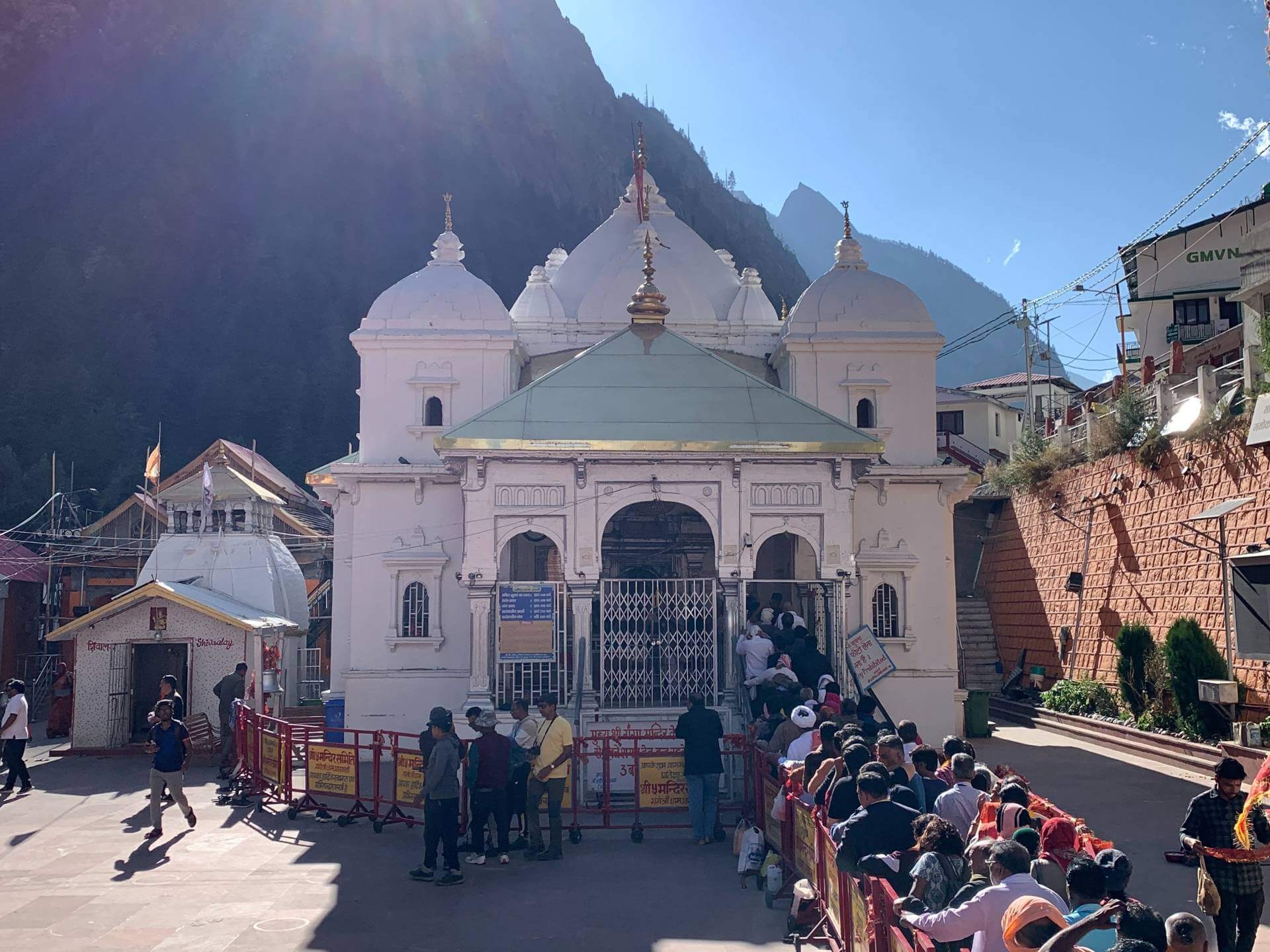
1. Starting Point: Gangotri (3,000 m)
Your journey begins at the well-known pilgrimage and trekking hub. The trail initially follows the Kedar Ganga river, moving steadily through forested slopes and alpine meadows.
2. Kedar Kharak (4,300 m)
As you continue upward, the trail opens into a broad meadow with panoramic views. This is where you begin to feel the remoteness of the region.
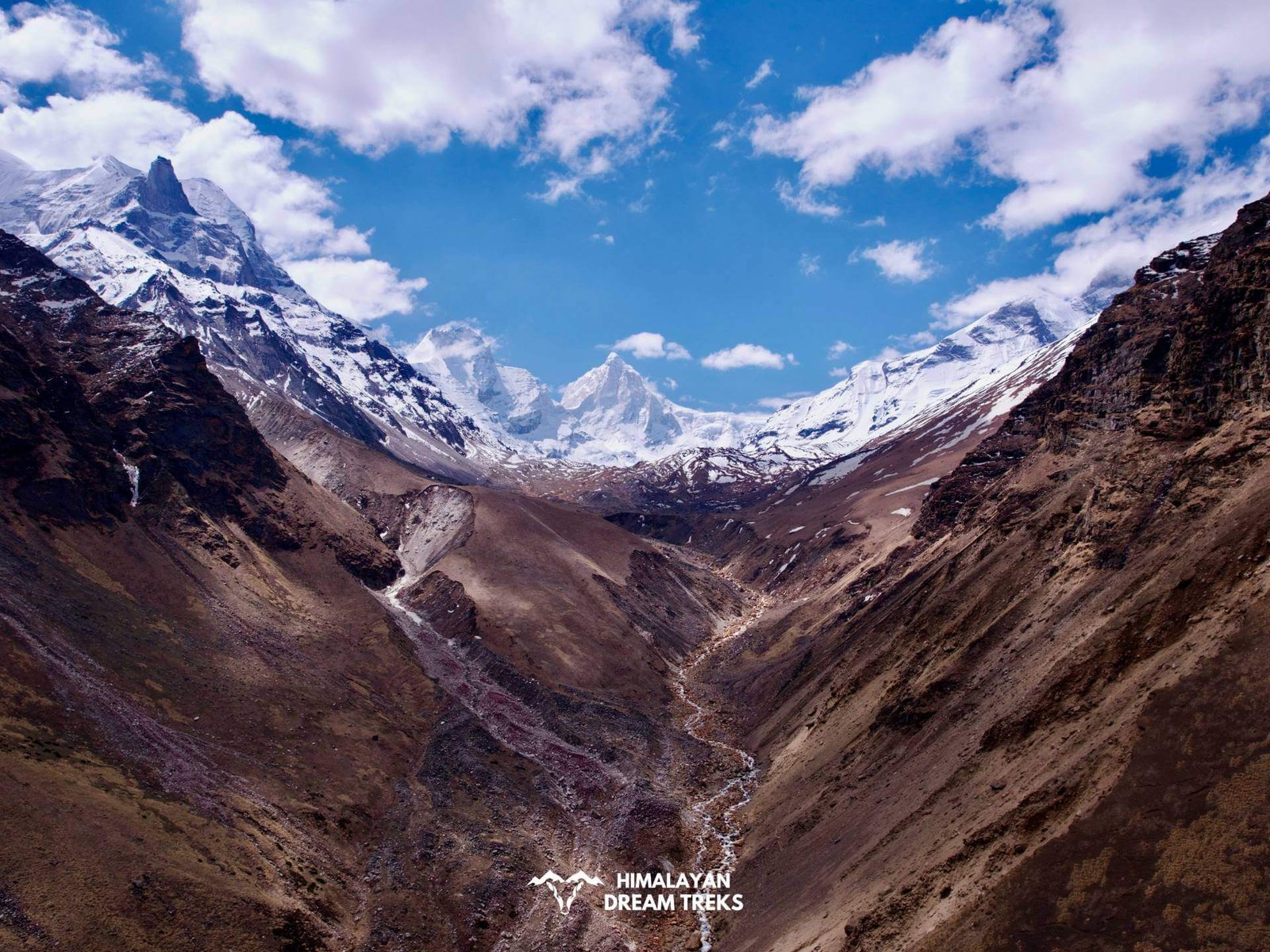
3. Kedar Tal Base Region (4,750 m)
From here, you step onto glacial terrain. The atmosphere shifts dramatically – moraine ridges, crevasses, and steep ice slopes start to dominate the approach.
4. High Camp (5,200–5,400 m)
Most expeditions establish a single high camp for all three peaks. Depending on current conditions, teams may adjust the camp location slightly.
5. Summit Routes
- Jogin I: Involves moderate to steep snow, with sections requiring fixed rope support.
- Jogin II: Often treated as a follow-up climb after Jogin I, with easier access from the same high camp.
- Jogin III: Usually the least technical, though weather and snow stability determine difficulty.
Map Availability
You can obtain topographic maps from:
- Mountaineering agencies in Uttarkashi
- Mountaineering libraries
- Online Himalayan mapping resources
- Local guide services who carry field-tested route sketches
Although no single map replaces on-ground navigation, combining two or three sources gives you a reliable route visualization.
Suggested Itinerary (10–12 Days)
To ensure smooth acclimatization and comfortable pacing, you can follow this typical schedule:
Day 1: Dehradun → Gangotri
Day 2: Acclimatisation Day at Gangotri (3,000 m)
Day 3: Gangotri → Bhoj Kharak
Day 4: Bhoj Kharak → Kedar Kharak
Day 5: Kedar Kharak → Kedar Tal Base
Day 6: Rest + Acclimatization
Day 7: Base → High Camp
Day 8: Summit Attempt (Jogin I or II)
Day 9: Optional Second Summit (Jogin II or III)
Day 10: High Camp → Base Camp
Day 11: Base → Gangotri
Day 12: Return to Uttarkashi → Dehradun
Wrapping Up
As you reach the end of this journey through the Jogin peaks, you can feel how each detail brings you closer to the heart of the Garhwal Himalaya.
Moreover, you now understand not just the routes and seasons, but the spirit of exploration that shapes these mountains. As you plan your own ascent, you carry a sense of history, challenge, and wonder. Ultimately, whether you chase a summit or simply the serenity of high alpine terrain, the Jogin trio invites you to step forward with confidence and curiosity!
Leave a Comment