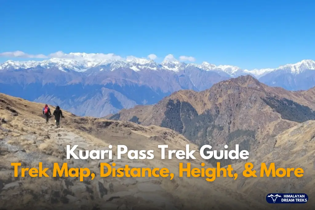
Overview
Pangarchulla Peak is located in the Chamoli District of Uttarakhand at an altitude of 15,009 ft/4,572 m. The trail for this trek goes through the “Kuari Pass” or Lord Curzon Trail, giving you the double treat in one trek with Kuari Pass and Pangarchulla Peak Trek.
George Curzon, then viceroy of India (1899-1905), visited this place and, hence the name. This trail is also part of “Chimney Peak” (14,700 ft). The name “Kuari” has other cultural significance, as it is known as the Abode of Goddess Nanda Devi.
The trek perfectly blends rugged terrain, high altitude, summit climb, and snow-covered trail, yet it is beginner-friendly with some prior trekking experience.
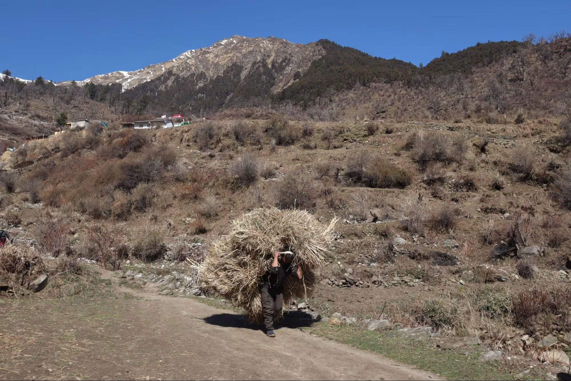
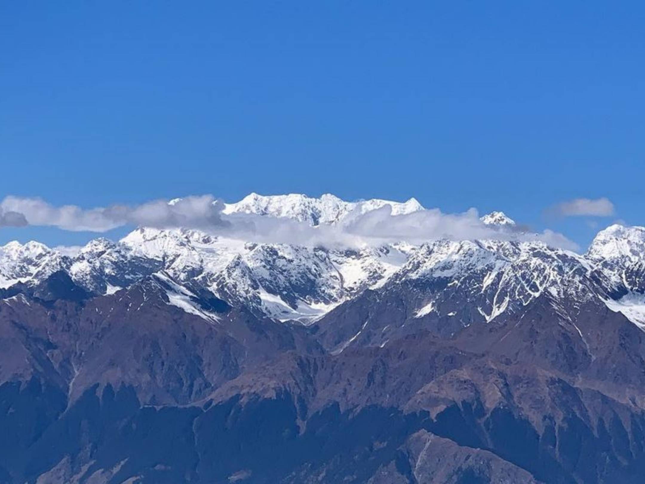
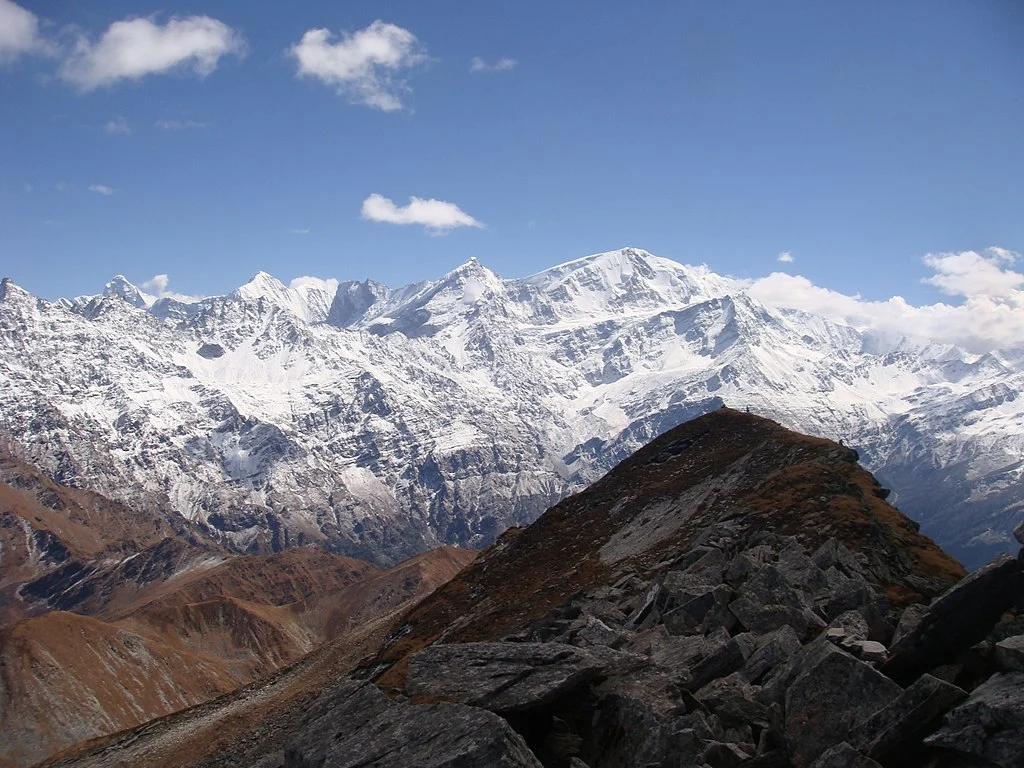
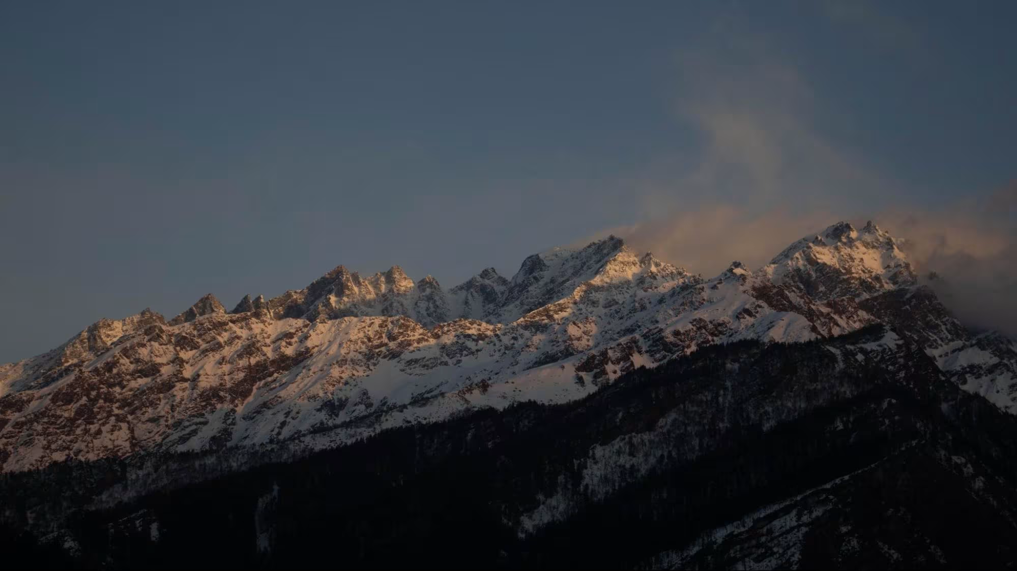
From Pangarchulla trek, you get panoramic views of various peaks like Mt.Nanda Devi, Dronagiri, and Mt. Trishul. Like many scenic treks in Uttarakhand, the trail is filled with dense forests of Walnuts, Birch and other trees.
The final summit trek is filled with snow, boulders and steep ascent, quenching your thirst for an adventure without a difficult or technical climb.
Trek Itinerary
Drive Distance and Time: 250 km; 9-10 hours
Altitude Gain: 6,150 feet
Today’s Difficulty: Easy
Highlights: A scenic drive via Rudraprayag, Devprayag, Karanprayag and Pipalkoti
The distance from Rishikesh to Joshimath is 250 km, which takes 9-10 hours to complete via NH7. We will leave Rishikesh early in the morning, enjoying the beautiful road journey.
On our way, we will come across 4 out of 5 Panch Prayags (Prayag is a holy confluence of two rivers). First, we will come across Devprayag (the last Prayag), where Alaknanda meets Bhagirathi to form the river Ganga finally. Then, we will encounter Rudraprayag (4th), where Alaknanda meets the Mandakini River. At Karnaprayag (3rd), Alaknanda meets the Pindar river. Lastly, at Nandprayag(2nd), Alaknanda meets the Nandakini river.
These rivers will follow you along till Joshimath, adding more beauty to your road trip.
We will spend the night in Joshimath to get refreshed for another drive and hike the next day.
Tip – It is advised that trekkers reach Rishikesh on Day 0, which is a day prior, to avoid delays. By reaching on Day 0, you can take a short tour of Rishikesh.
Trek Distance and Time: 5 km; 3-4 hrs
Altitude: 9,600 ft
Today’s Difficulty: Easy
Highlights: Dhak Village, water streams, and forest trail
Dhak village is 11.1 drive away from Joshimath, which takes approx 45 mins to cover.
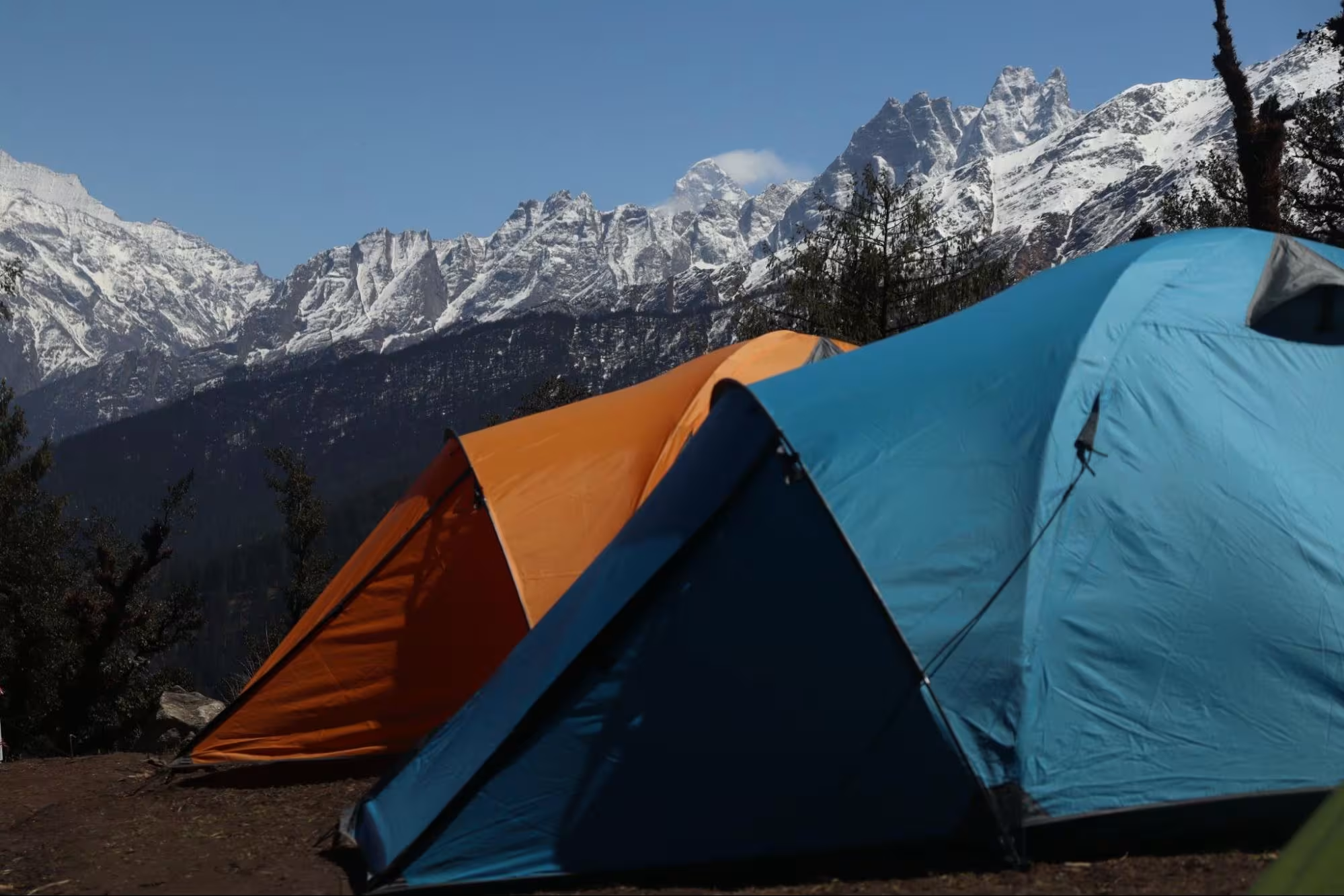
After this short drive to Dhak village, our trek starts towards Gulling Top via Tugasi village, our first campsite.
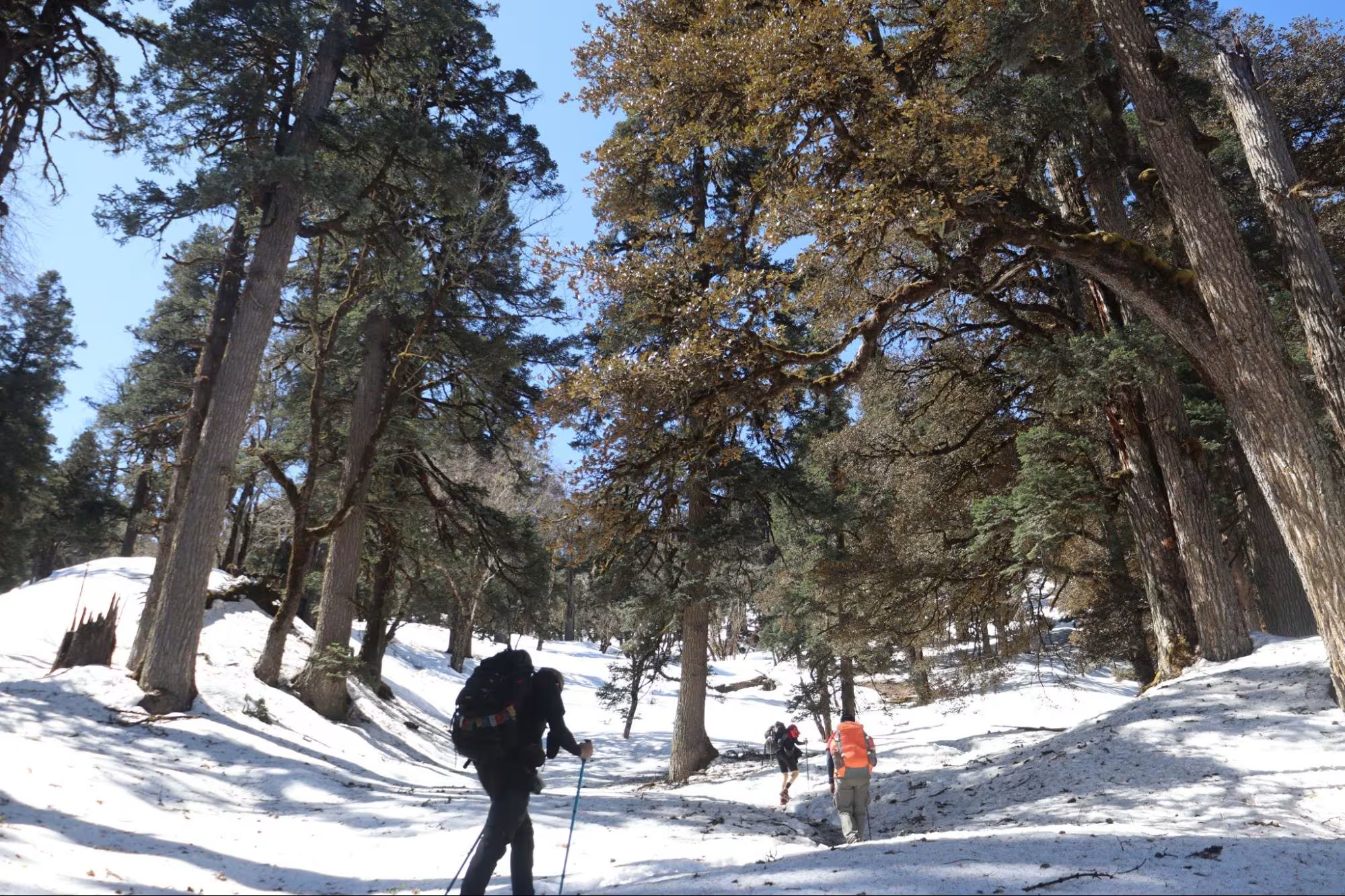
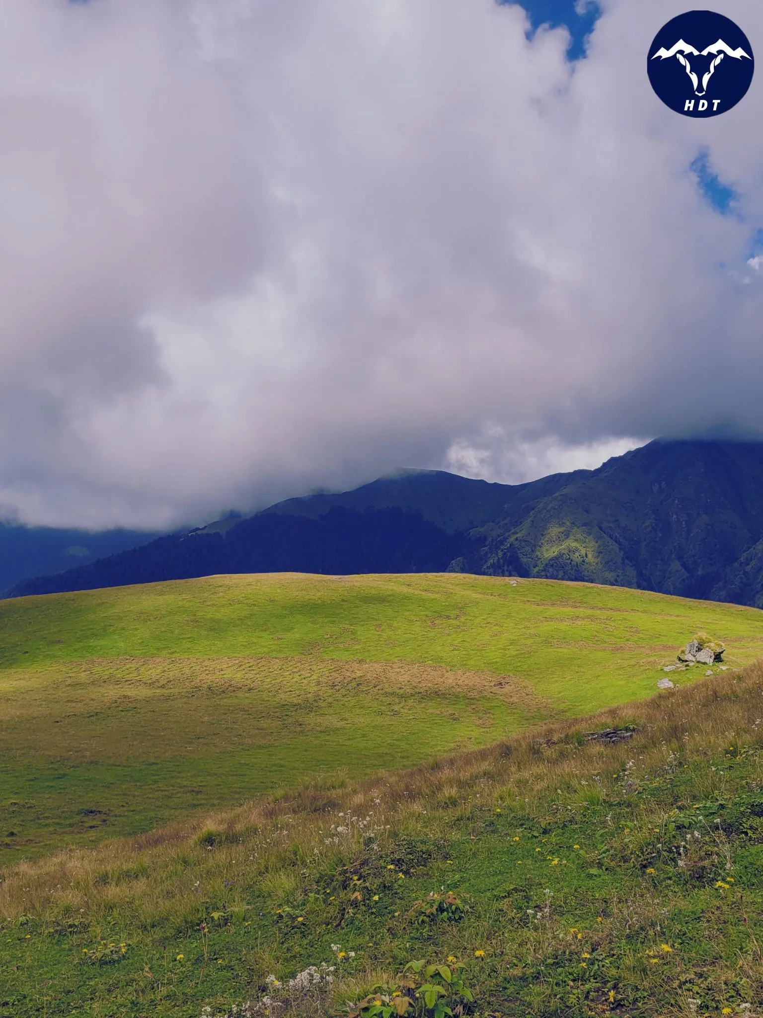
The trail towards Gulling is filled with trees of oaks, maple, pine, and walnuts, giving you a chance to enjoy fresh nuts right off the tree. The gulling top is a vast open field providing beautiful views of various snow-covered mountain peaks like Mt. Dronagiri.
After our hike for the day, we will stretch and enjoy a delicious hot dinner.
Trek Distance and Time: 7 km; 5-6 hrs
Altitude: 11,000 ft
Highlights: Dense forest trail, water streams, Hathi Ghora Peak, Dronagiri Peak and Khullara Clearing
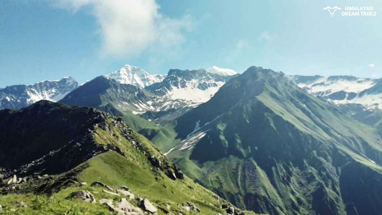
After a delicious breakfast, we will head for Khullara Top. The ascent climb is a little bit steep but not tiring. The whole trail will go through the deep forest of Oak, Thunder, and Cedars. Throughout the hike, Mt. Dronagiri will follow you along other peaks. You will find small clear water streams here for drinking water.
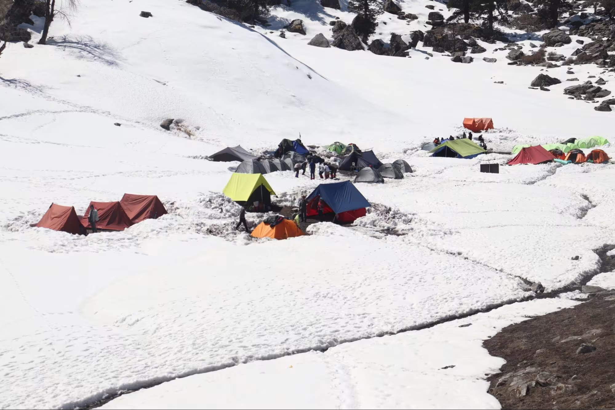
Khulara Top provides a grand space for camping, like a small bugyal, with the Himalayan Peaks like a big tapestry hanging in the background.
Trek Distance and Time: 14 km; 7-8 hrs
Altitude: 12,500 ft
Highlights: Kuari Top, View of Chaukhambha, Dronagiri, Hathi Ghoda Peak,
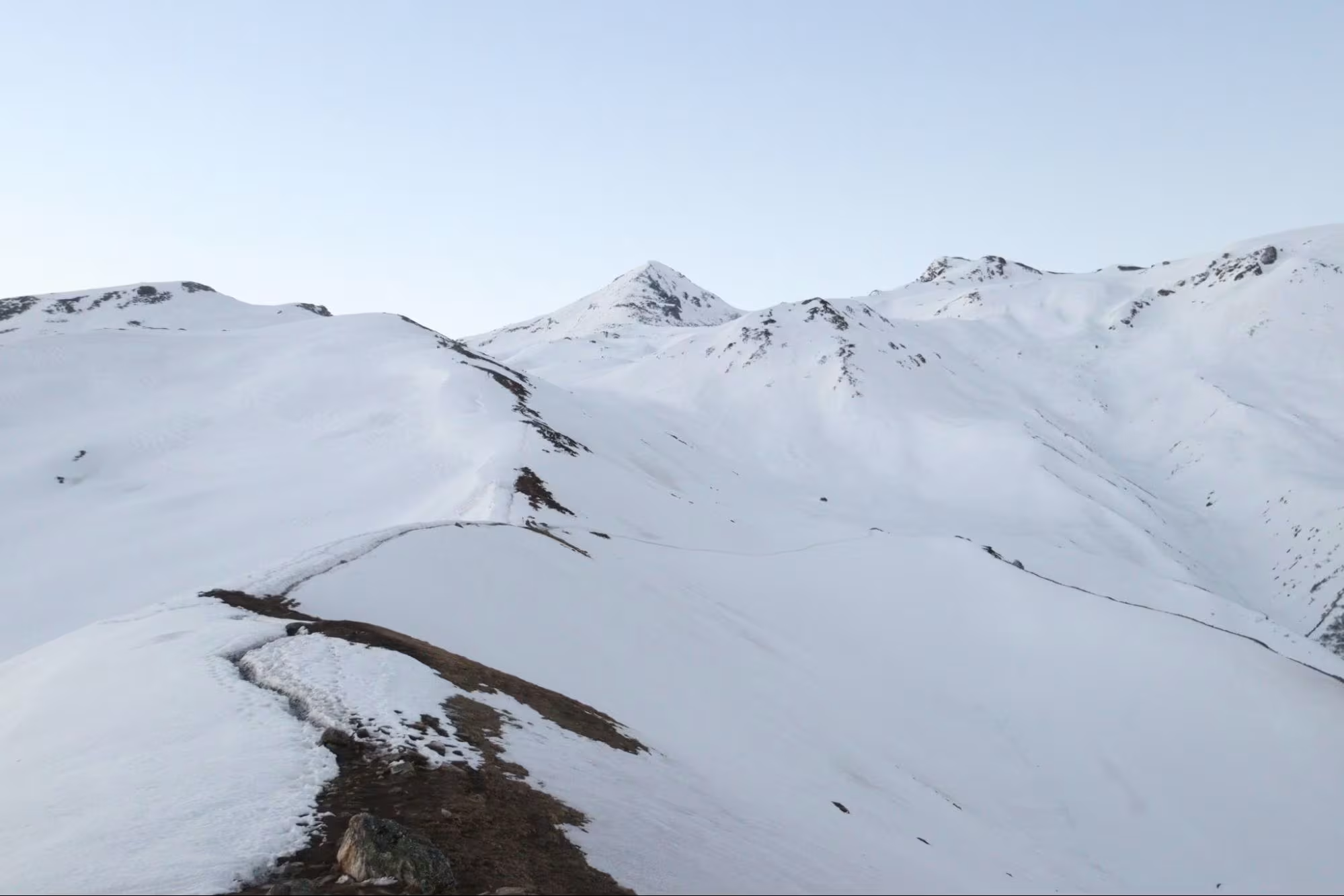
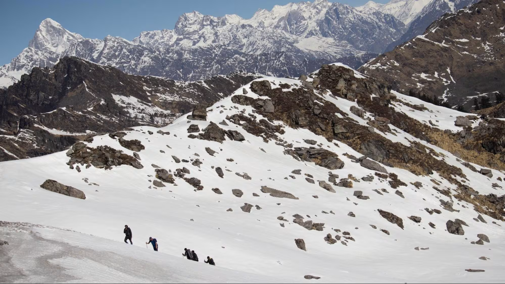
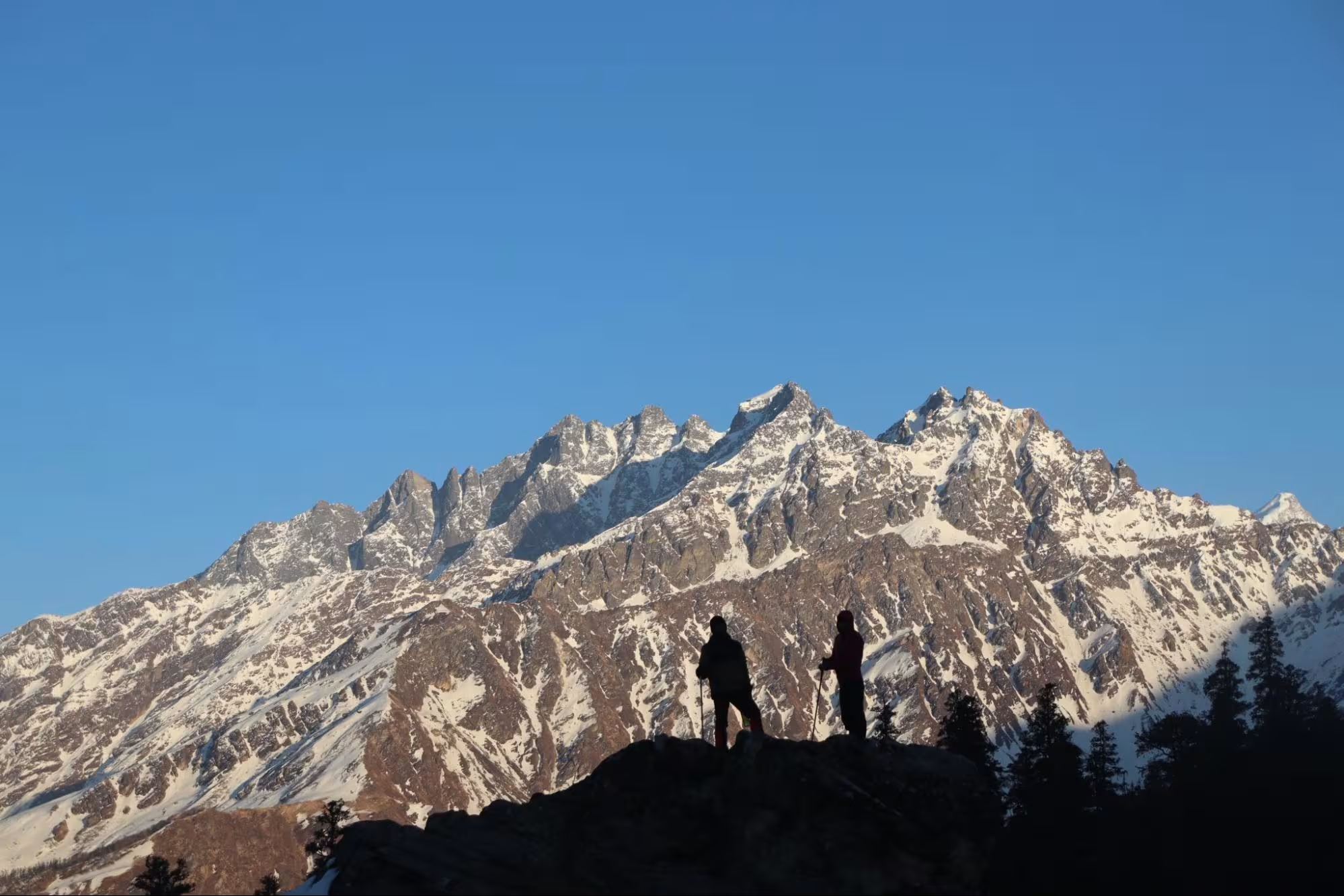
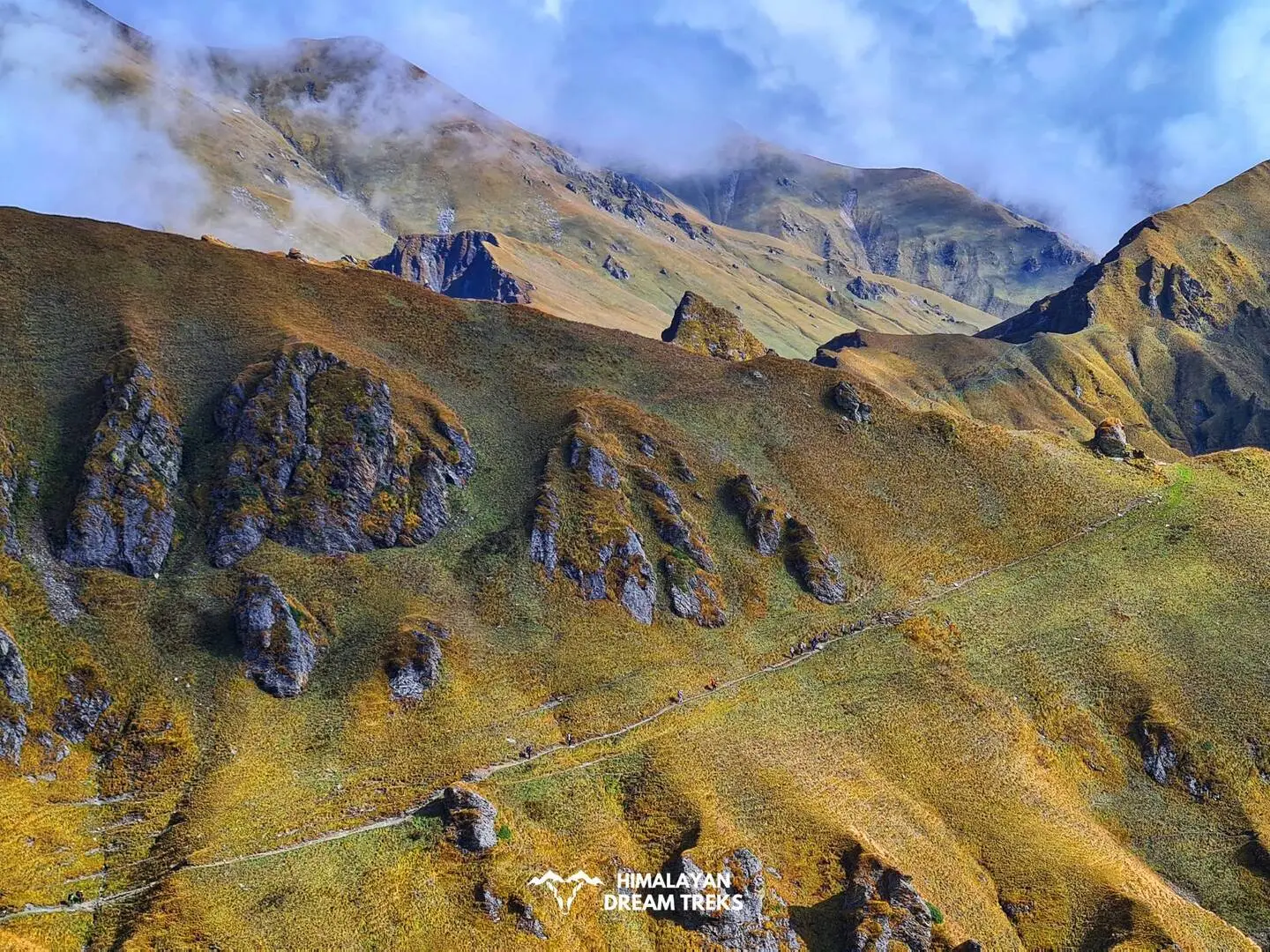
The trek today will be long but worth every step. After a steep climb of 1.5 km, you’ll walk on a ridge famously known as “Lord Curzon Trail”. Our trek will continue on this ridge and inclines, finally leading to Kuari Top. From here, you can clearly see many peaks like Dronagiri, Hathi Parvat, Chaukhamba, Neelkanth, and so on.
After a short descent from the top and a few kms, you’ll reach Kuari Pass. The trail remains the same for both Kuari Top and Kuari Pass, as both are at the same altitude.
We will retrace back to our campsite – khulara, and rest well for the next day’s summit climb.
Trek Distance and Time: 14 km; 10-12 hours
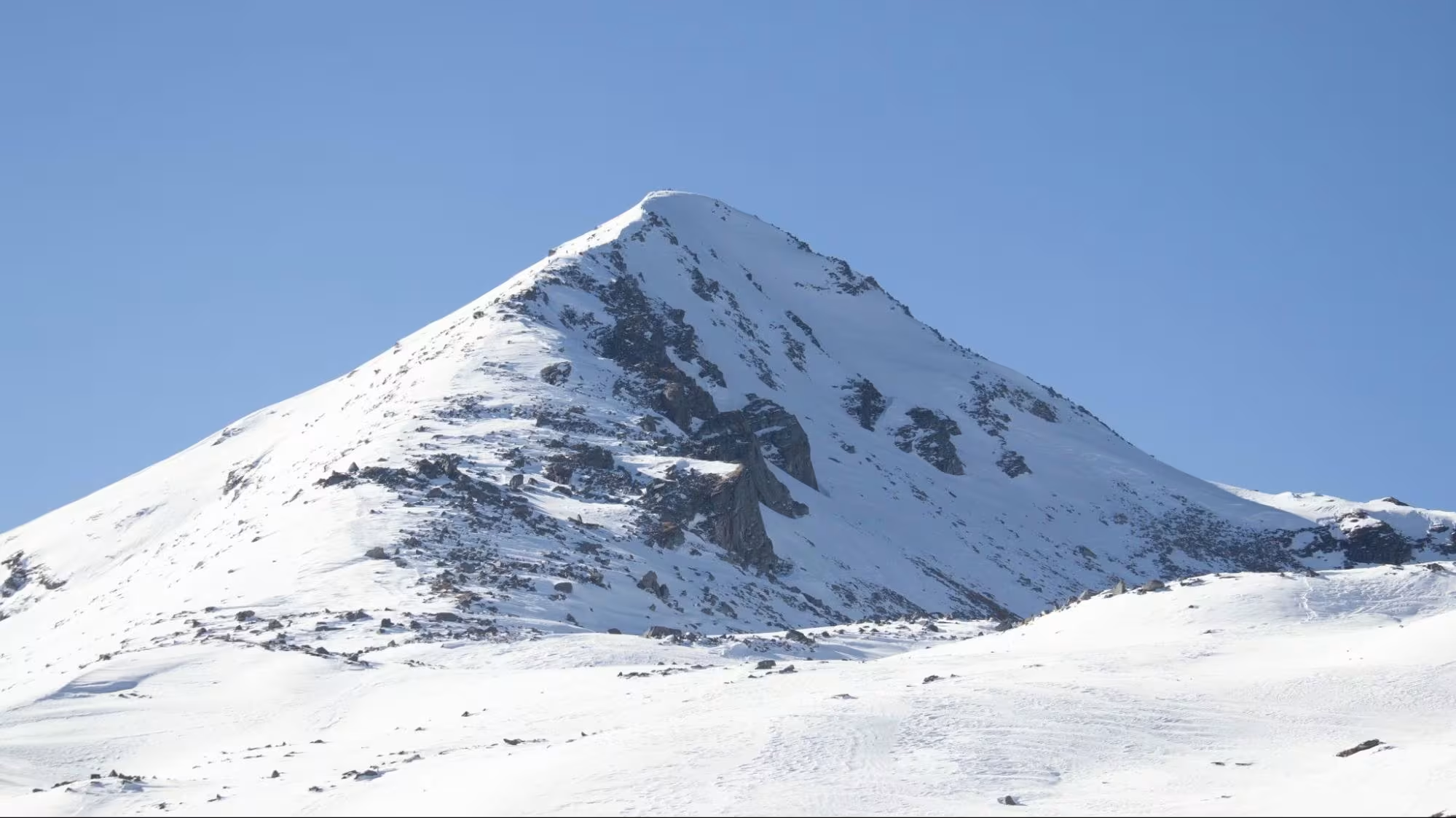
Altitude: 15,000 ft
Highlights: Ascend of Pangarchula, 360 view of the Himalayas.
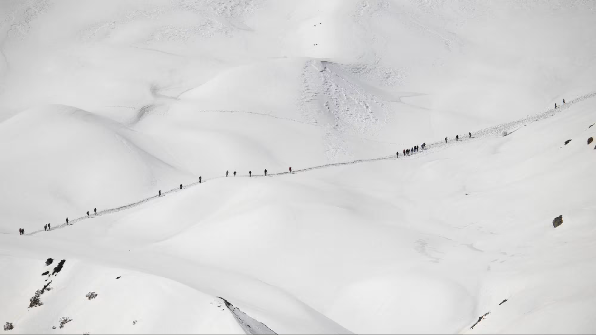
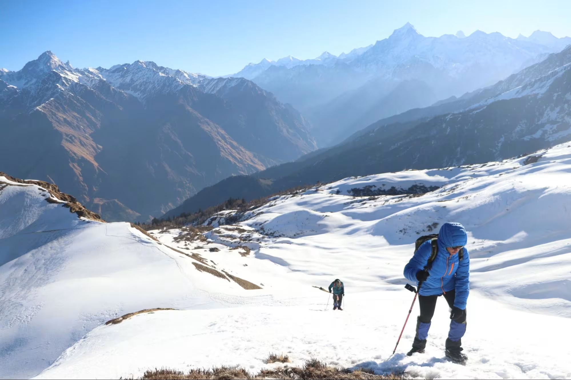
The most awaited part of the trek begins today – the summit climb to Pangarchulla Peak.
We will begin our trek at midnight, 1:00 am, yes, to catch the first rays of the sun sparkling on the snow-covered mountain peaks.
After packing our food, we will start our trek carefully, as it will be dark and difficult to walk on a snowy path. The path is a mixture of knee-to-waist-high snow, boulders, and ridge walking, making it adventurous and difficult to trek. Today, we will gain more altitude and walk for a longer period of 10-12 hours on difficult terrain.
It is advised to be prepared with the right gear and follow the trek leader’s expert advice to avoid mishaps.
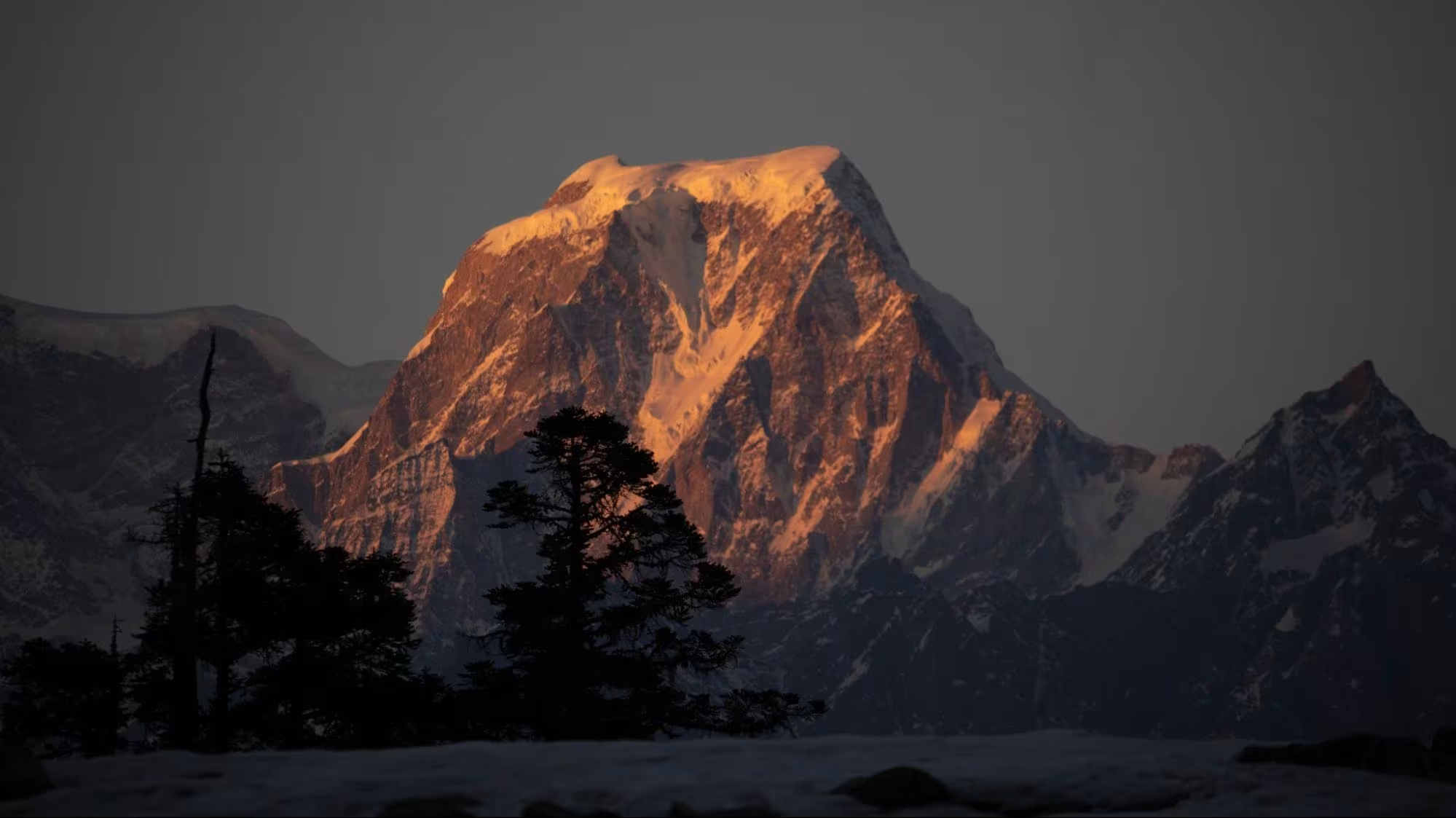
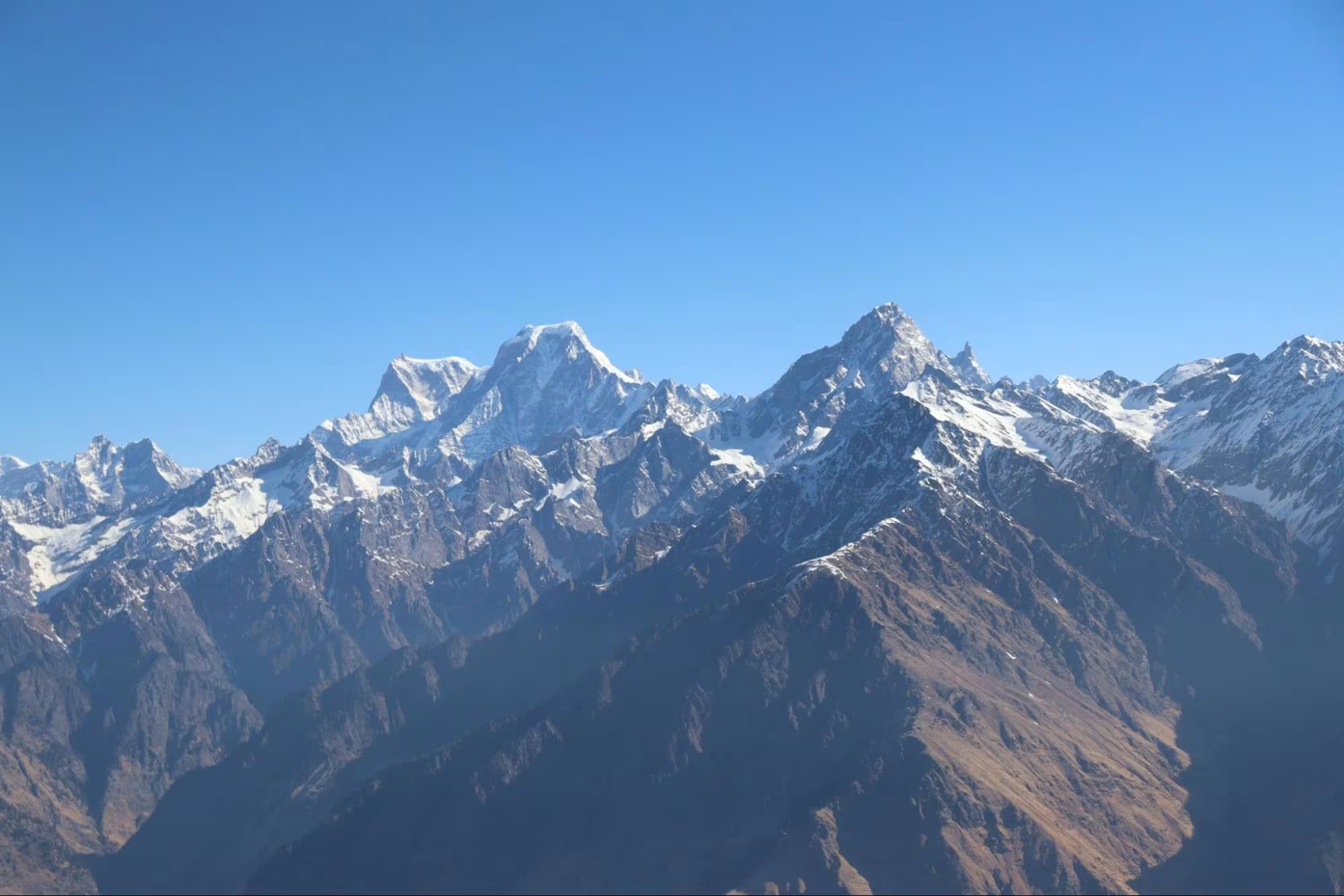
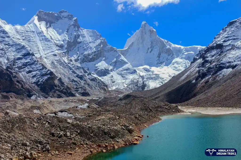
After reaching the Pangarchulla Peak, you can locate many peaks like Nanda Devi (7816 m), Kamet (7756 m), Hathi Parbat (6727 m), Gauri or Ghori Parbat (6708 m), Neelkantha (6500 m), Mana (7274 m), Deoban (6855 m), Trishul (7120 m), Trishul II (6690 m), Trishul III (6007 m) and Dronagiri (7066 m).
Trek Distance and Time: 12 km; 5-6 hours
After taking a well-deserved rest, we will start our descent back to Joshimath via the same route, enjoying everything all over again. It will take us around 5-6 hours to reach back. From Dhak or Tugasi we will take a taxi back to Joshimath. It will be 1 hour drive only.
Upon reaching back, you are free to take a stroll through the town or rest and relax your muscles
Drive Distance and Time: 250 km; 9-10 hours
After taking a well-deserved rest, we will start our descent back to Joshimath via the same route, enjoying everything all over again. It will take us around 5-6 hours to reach back. From Dhak or Tugasi we will take a taxi back to Joshimath. It will be 1 hour drive only.
Upon reaching back, you are free to take a stroll through the town or rest and relax your muscles
Package Details
Price Inclusion
Accommodation: 2 Nights stay in Joshimath and 4 Nights camping
Transportation: Transportation from Rishikesh to Rishikesh
Meals: Meals from Day 1 dinner to Day 7 breakfast
Trek Equipment: All essential trek equipment is included, such as sleeping bags, kitchen and dining tents, utensils, mattresses, personal tents, toilet tents, and crampons (if needed).
Forest Entry and Permits: All required fuel charges, tolls, forest entry fees, and permits are covered.
Experienced and Certified Guides: A qualified, professional team, including a mountaineering-certified trek leader, guide, cook, and support staff, will accompany you.
Emergency Kit: First aid medical kits, oxygen cylinders, and stretchers are provided to ensure the safety, comfort and well-being of all participants.
Trek Certificate & HDT Badges: Receive a trek certificate and HDT badges to celebrate your adventure.
Price Exclusion
Meals during Transfer: Meals are not included while traveling to and from the trek starting points.
Emergency Evacuations: Any charges related to emergency evacuation are not included.
Meals During Transfer
Personal Expenses: Any meals or accommodations outside of the provided itinerary or additional services not listed in the inclusions.
Personal Luggage Carrying: Charges for mules or porters to carry personal luggage are NOT included in fees.
5% GST is not included
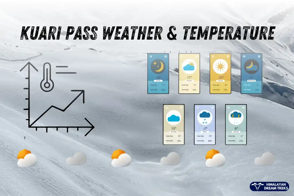
Best Time to do Pangarchulla Peak Trek
Pangarchulla is famous as a winter trek but it can be done during other seasons and making each experience unique.
Months – November to February
Temperature – Day: 5℃ to 10℃ | Night: -5℃ or below
The best time to experience a snow-covered adventure. During these months, you’ll find thick snow sheets with chilly winds and freezing temperatures waiting for you. Though you’ll find snow on summit climbs throughout the year during winters, the feel is different.
For adventure enthusiasts, winter is the perfect season as the snow becomes hard, making the challenging and heavy snowfalls closing down paths and forcing you to trek in deep snow adds more challenges.
Tip – Rent proper gear like crampons, headlamps, water-repellent shoes, gaiters and appropriate clothing.
Months – April to June
Temperature – Day: 10℃ to 12℃ | Night: -2℃ to 5℃
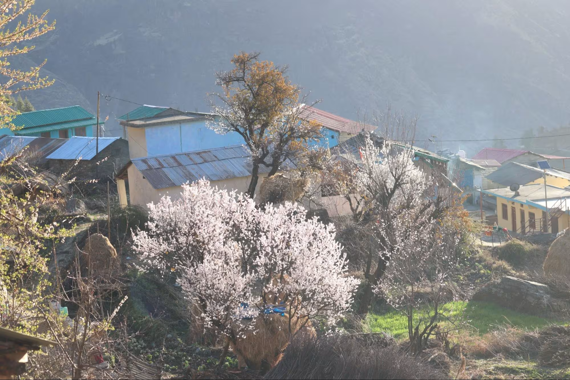
In spring, the snow starts to melt as the increasing temperature makes snow soft and easy to walk on. Trekking during this time still remains challenging enough for adventure seekers without the freezing temperatures.
After harsh winters, springs bring back the colour in the region. With melting snow, life returns with the excitement of a new beginning. Beaming colourful flowers, meadows, and forest greenery with a white backdrop of the Himalayas create a beautiful live image.
Difficulty Grade of Pangarchulla
The Pangarchulla Trek is rated as moderate to difficult level. A trek’s difficulty is decided on the basis of the number of days required, terrain & gradient type, and altitude gain.
- Altitude Gain – The Pangarchulla peak is at an altitude of 15,069 ft above sea level. As a high-altitude trek, the threat of health issues like AMS (Acute Mountain Sickness) increases, leading to worse problems like HAPE/HACE.
- Long Trek – There are many long treks, but here you have to walk more on a single day, and changing weather, such as increasing altitude, takes a toll on the body if not acclimatised well.
- Changing Terrain – The starting is easy, but the mixture of terrain and different gradients to the summit top makes being physically and mentally fit essential. Factors like rough winds, big boulders, steep summit climbs, sharp ridges and walking ina knee to waist-deep snow add more challenges and thrill to the trek.
Hence, it is advised to follow a proper workout routine that includes both strength training and cardio. Try to achieve running 5 kms in 45 mins. This will make your trekking experience more pleasant without any problems.
Prior experience with treks and snow treks like Kedarkantha, Dayara Bugyal, Sandakhphu, or Rupin Pass will help you better prepare for this trek.
Preparation for the Trek [Physical Fitness, AMS]
The trek difficulty dictates your level of fitness and preparation for it. As mentioned above, it is moderate level trek, so prepare accordingly.
We take acclimatisation seriously and make sure that our trekkers get proper time to acclimatise and rest in between. This is neither a very long trek nor at a higher altitude, so we will only trek for a short number of kilometers every day, giving your body the time it needs.
- An easy level and weekend treks require a basic fitness level, where you should focus on building your stamina and strength. Start with walking/running and include a 45-minute to 1-hour workout (cardio + strength training).
- A level-up in a fitness routine is required for an easy to moderate level trek like start aiming to run 5 km in under 40 mins, and strength training is a must.
Mental preparation includes thorough research of the trek you want to do or decide to. Understand the terrain, difficulty level, and the ways to get fit for it, look up for sudden situations that may happen, and how to tackle them. Being prepared gives you an edge to keep calm & handle a difficult situation.
1. Exercises to achieve the goal
- Cardiovascular Training: Running, cycling, and swimming to boost stamina.
- Strength Training: Focus on leg exercises like squats, lunges, and step-ups for endurance.
- Core Strength: Planks, mountain climbers, and Russian twists to maintain balance on uneven trails.
- Flexibility Exercises: Stretching, yoga, and dynamic warm-ups to prevent injuries.
- Mental Conditioning: Visualisation techniques, breathing exercises, and meditation to strengthen focus and manage stress on difficult days.
Tip: For moderate to difficult-level treks, practise exercises with weights. Seek professional advice accordingly.
2. Extra Tips related to the diet, muscle recovery, and healthy lifestyle routine
Diet: Incorporate proteins like lentils, chicken, eggs, tofu, etc for fast recovery after a strenuous trek. Whole grains like wheat, quinoa, barley, etc for sustained energy, and leafy greens like spinach, bitter guard, and any seasonal veggie for those extra nutrients and building the immunity system.
Muscle Recovery: Plan rest days and add stretching, relaxing yoga poses or foam rolling after every workout.
3. Lifestyle Routine:
Stay hydrated – drink 2 to 3 liters of water. To incorporate more nutrients, including coconut water, fruit, and vegetable juices.
Limit alcohol and caffeine consumption.
Start sleeping up to 8 hours.
Altitude Sickness happens when your body cannot adjust to lower oxygen levels at higher altitudes. This happens mainly because your body didn’t have enough time to acclimatise to a higher altitude or not enough time to get used to lower oxygen levels.
How to Prevent
- Gradual Ascent: Climb slowly to give your body time to adjust.
- Hydration: Drink plenty of water to prevent dehydration.
- Rest and Sleep: Ensure ample rest, especially as you reach higher camps.
- Avoid Alcohol: Limit alcohol and caffeine, which can lead to dehydration.
What to do
- Most Important – Inform your trek leader as well-trained leaders and experience they can assess the situation better and find solutions faster.
What trek leader may suggest. Trekkers without agency should also know these instructions
Seek Medical Help: After descending our team will take you to the nearest hospitals if needed. If solo, then descend and seek the closest medical help.
Stop and Rest: Pause your trek to recover.
Descend if Necessary: Descend immediately to Raithal Basecamp, our team with the vehicle and necessary help will be there for further action.
Stay Hydrated: Drink water and avoid strenuous activity.
Trek Essentials
- 45-60 Ltr Bag Pack With Rain Cover & Comfortable Straps
- Hot and Cold Water Bottle Like Borosil and Milton
- Energy Bar, Dry Fruits, and ORS
- Personal Medical Kit
- 1 Pair of Sunglasses (UV Protected)
- 1 Neck Gaiters (Buff)
- Tiffin Box
- 2/3 Full Sleeves (Non-Cotton)
- 1 Full Fleece T-Shirt
- 1 Fleece Jacket (Woolen or Sweater)
- 1 Down Feather/ Hollofil Jacket
- 1 Waterproof Jacket/ Poncho
- 1 Pair of Thermal Inners (Upper and Lower)
- 2 Trek Pants (Avoid Shorts and Denim Pants)
- 1 Pair of Waterproof Gloves
- 1 Pair of Woolen Gloves
- Sun Cap
- Woolen Cap
- 4 Pairs of Cotton Socks
- 1 Pair of Woollen Socks
- 1 Waterproof and High Ankle Trekking Shoes
- 1 Pair of Floaters
- Hand Sanitizer and Sunscreen Lotion
- Toothbrush and Toothpaste
- Toilet Paper
- Quick Dry Towel
- Lip Balm and Antibacterial Powder
- Moisturizer
- Aadhaar Card, Pan, or Passport for Applying Permit
- Trek Insurance
- Medical Certificate
- Self-Declaration Form
- Sleeping Bag
- Common Tent
- Mattress
- Dining Tent
- Camping Stool
- Walkie Talkie (For Team)
- Utensils
How To Reach Base Camp
The nearest airport is Dehradun’s Jolly Grant Airport, which is just 15.8 km away from Rishikesh.
From here, you have two options.
- Hire a private taxi or shared one if it is convenient for you to visit Rishikesh itself.
- From the airport, the main highway is 1.5 km away; walk till there or hail a shared auto/taxi.
You can book a direct train to Rishikesh railway station, which is named Yog Nagri Rishikesh Station, Rishikesh being the Yoga Capital of the world.
Option 2 is to book train tickets to Dehradun, which is 38.4 km away with 1-hour drive time.
Similarly, you can book tickets for Haridwar, which is 44 km away and has a 1-1.5 hour drive time.
Tip – Book for a train that reaches Rishikesh early in the morning on Day 0. It will give you time to acclimatise to the weather, and a short tour of the city can also be done.
Joshimath is well connected to motorable roads, so you can directly drive here in your private vehicle.
Another option is to reach Delhi, the capital of the country. The city is well-connected with all parts of the country. From Delhi, you can book a bus ticket directly to Rishikesh from the Kashmiri Gate bus stop or use online booking platforms like Redbus.
Local buses from various operators like UTC, Vishwanath Seva, and Himgiri are available from Rishikesh or Dehradun to Joshimath. These buses leave early in the morning from Rishikesh Domestic Bus Stand and Parade Ground, Dehradun.
Map of Trail and Peaks Visible
Peaks Visible From Pangarchulla
Weather & Temperature
Culture, Flora, Fauna and Adventures
Culture, Heritage, and Historical Significance
Mythology of Dronagiri Parvat
According to Ramayana, when Lord Ram’s younger brother was severely injured during the battle with Demon King Ravan’s son Meghnad, a rare herb “Sanjeevni” was the only cure.
Hanumanji was tasked with fetching Sanjeevni, which can only be found in the Himalayas.
It was believed that Sanjeeevni was found on Mt. Dronagiri/Dunagiri or Gandhamardhan. But Hanuman could not identify the herb, so he took the whole mountain to the battlefield.
After this incident, the locals stopped worshipping Lord Hanuman. This ritual is still followed in present times. Even during the Ram-Leela performance in the festival of Dussehra, the Hanumanji part is skipped entirely.
Nanda Devi Raj Jaat Yatra Festival
Nanda Devi is believed to be Goddess Parvati, so when she married Lord Shiva, she moved to Kailash Parvat, leaving behind her maternal place.
This three-week-long festival is organized once every 12 years, which signifies that Maa Nanda Devi visits her hometown every 12 years. Other than 12 years Raaj Jaat, there is Lok Jaat which is celebrated every year. The festival is celebrated with enthusiasm in nearby villages of Joshimath and Chamoli.
Flora and Fauna
Uttarakhand is blessed with diverse flora and fauna. You can spot animals like Himalayan Brown bears, Langurs, Himalayan Musk Deers and, during winters, even a Snow leopard.
During the trek, you will come across a diverse range of trees and flowers, such as Silver Birch, Oak, and Pine. Pink and White flower Rhododendrons, also known as “Buransh ke Phool”, welcome you when in bloom.
The magical properties of Thuner’s tea will vanish your cough & cold in minutes.
If luck is in your favour, you may spot birds like the Himalayan Monal (State bird of Uttarakhand) and the Himalayan Griffon Vulture.
Nearby Attractions and Adventures
Badrinath Temple– One of the pilgrims in Char-Dham Yatra, the Badrinath Temple is just 40.5 km away from Joshimath. Situated at an elevation of 10,171 ft, the trek to the temple is filled with devotion, joy and beautiful views of the Himalayas.
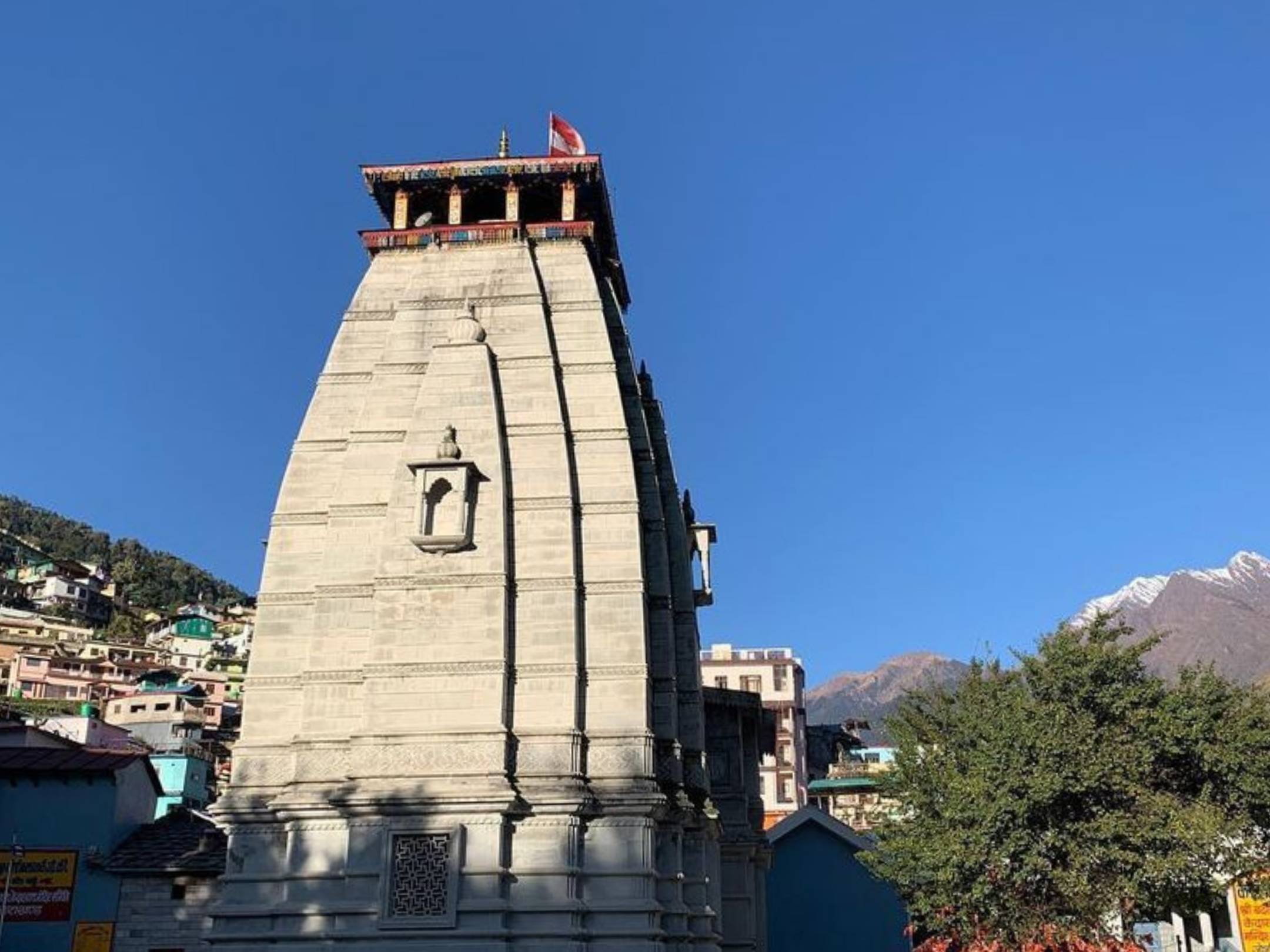
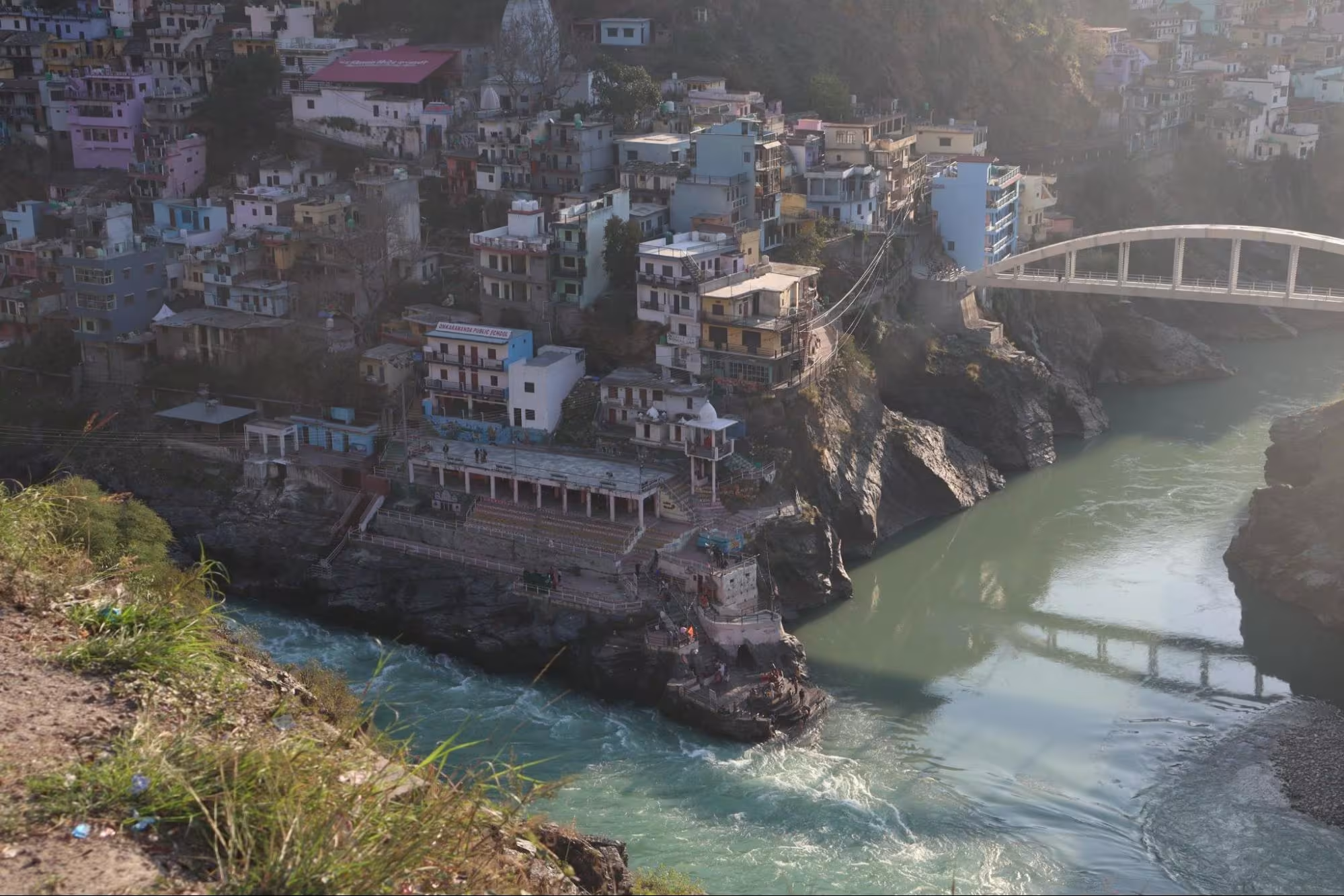
Joshimath – Our base village of Trek provides many sites and temples, like Narsingh Devta temple, Adi Shankaracharya Math, Auli Ropeway, Jogidhara Waterfalls etc, for you to explore.
Valley of Flowers – Recognised as a prestigious UNESCO World Heritage Site in 2002, this valley is home to more than 600 species of flowers. One of India’s oldest treks, accidentally found in 1931, is a must-visit.
Bagini Glacier Trek – Enjoy a trek to the glacier without crowd and hassle, just an hour’s drive away from Joshimath to Jumma base village. Peaks like Changa Banga and Kalanka add to the beauty of this glacier.
SCL, Foreign Permit & Vehicle
HDT is registered with the IMF, and we can cater to the needs of SCL for Government Employees. According to the rule, the government of India provides its employees with a prospect where they’re allowed to apply for a 30-day special casual leave in a calendar year to do trekking, hiking, or whatever adventure pleases them.
Mail us at info@himalayandreamtreks.in or call us at +91 80896 93825, if you want to avail SCL.
For foreign nationals, permit charges are different, and hence the overall package price is different for foreign trekkers. Connect with us before booking your trek.
- For 4-6 people Bolero or equivalent vehicle.
- For 7 or more people, Force Traveller.
FAQs
The total trek on foot distance is 52 km.
Yes, a permit is required as Pangarchulla lies in a protected area. If you hire a trekking company like ours, then it is covered in the package itself.
Yes, gears like spikes, gaiters, trekking poles, etc, are a must. You can buy or opt to rent gear.
Yes, as it is a moderate-level trek, prior experience helps you understand and adjust better to higher altitudes, snow and ever-changing weather conditions.
Charging your gadgets might be always challenging during the trek. During this trek, the last charging point you will get is at Joshimath. So it is recommended to carry spare batteries for cameras and a power bank with a capacity of more than 20,000 mAh to ensure you have enough power for the entire trek.
In Joshimath, network is available via networks like Jio, Airtel and BSNL.
Aadhaar card, Declaration form, and Trek Insurance. If you are a teen then a parent’s declaration will be needed. If you are 60+ then a medical certificate will be required. And if you are a foreign national then your Passport will be needed for issuing permits.


Leave a Comment