
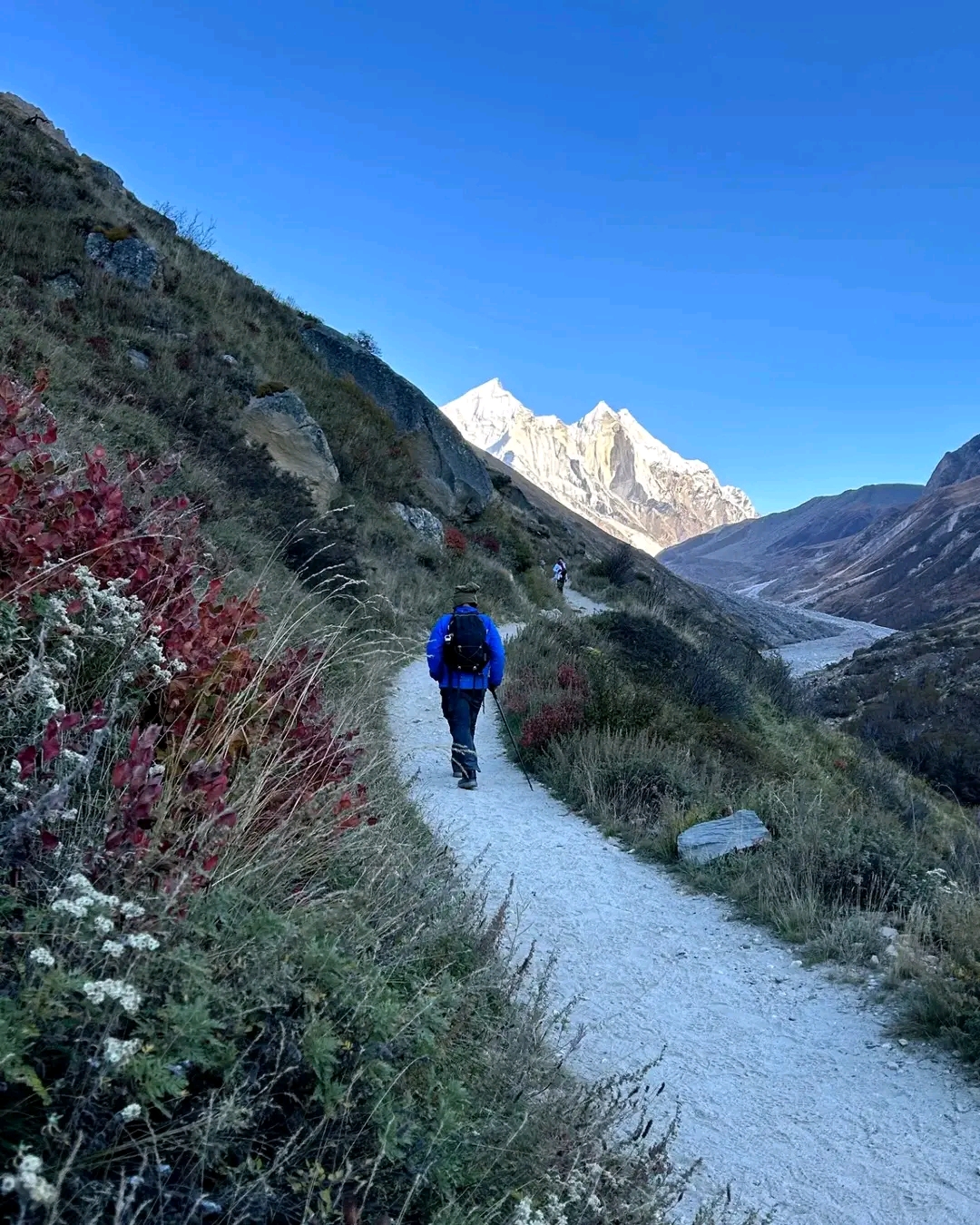
You step outside your home, and see yourself drenched in sweat due to the scorching summer heat. The routine seems boring and the traffic doesn’t help much. We have got the perfect escape for you – slowing down in the Himalayas. Just you and your backpack, in the mountains. As the snow begins to melt and the wildflowers bloom, the mountains turn into a perfect backdrop and offer favourable conditions for trekking. Imagine trekking through forests, with clear views of the sky and the peaks, serene lakes and the blooming flowers giving a touch of colour.
India’s diverse landscape offers many summer treks giving you the adrenaline rush and also a sense of calm. So, tie your shoelaces, pack your bags, and get ready to explore India’s best Summer Treks.
Table of Contents
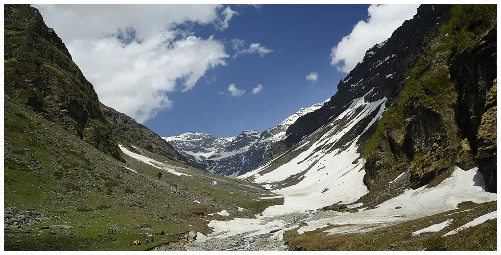
1. Rupin Pass Trek
This trek has sealed its spot in the popular treks for all the right reasons, given its unparalleled beauty. With every climb, the landscape changes faster than your breath. Treating you to snow-capped peaks, alpine meadows, lakes and waterfalls, this is a trek you cannot miss this Summer.
| Attributes | Details |
| Region | Uttarkashi District, Uttarakhand |
| Duration | 7 Days |
| Difficulty Level | Moderate |
| Maximum Altitude | 15,280 Ft |
| Trekking Distance | 40 km |
| Terrain Type | Alpine Meadows, Rocky Paths, Glacial terrian |
| Starting from | Jiskun |
| Peaks Visible | Kinner Kailash range |
| Suitable For | Experienced trekkers |
After a drive from Rohru to Jiskun, the first day of the trek takes you to Jakha, called the hanging village on this trek. Alternatively you can take the traditional route from Dehradun to Dhaula, but the Jiskun route will leave you spellbound.
The next stretch is through Saruwas Thatch, where you will reach the Rupin river, crossing beautiful rhododendrons. The following couple of days take you to Dhanderas Thatch through flower beds and meadows that put up a wonderful show in the Summer with their vibrant colours.
The last two days of the trek are the most adventurous, putting your fitness skills to test! The ascent starts from the Waterfall camp to Rupin Pass on rocky paths, further progresses to Ronti Gad. The trek ends at Sangla Kanda from where you will drive back to Shimla.
As you climb up the meadows, you will spot ‘Chupa’, an animal that is a cross between a yak and a cow, and some Brown-fronted Woodpeckers.
Trekking requires strength, and this trek has just the right thing to boost that packing in those multivitamins and omega 3 – the Fiddlehead Ferns. Give the sabzi made of these ferns a try. Be informed that some may be carcinogenic, but the locals know what’s best.
What to keep in mind:
- Photo ID is mandatory for entry at forest check posts on the trek. Make sure to carry a copy with you.
- Do not carry or eat meat at the Jakha village as it follows the rules of Satsang.
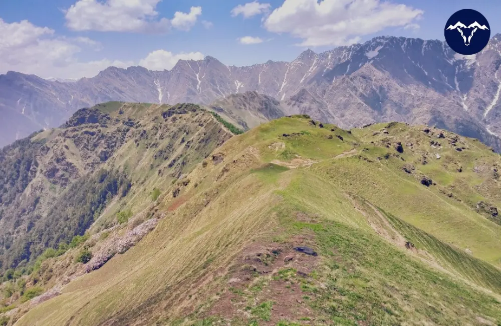
2. Ali Bedni Bugyal Trek
Ali and Bedni meadows are one of the largest high altitude meadows of India. The meadows go as far as your eyes can see, and offer breathtaking panoramic views of mountain peaks like Mt Trishul. This definitely is India’s grandest twin alpine meadows.
| Attributes | Details |
| Region | Chamoli district, Uttarakhand |
| Duration | 6 Days |
| Difficulty Level | Moderate |
| Maximum Altitude | 12,550 Ft |
| Trekking Distance | 28 km |
| Terrain Type | Alpine Meadows, Forested Paths |
| Starting from | Lohajung |
| Peaks Visible | Mt Trishul, Mt Nanda Ghunti |
| Suitable For | Experienced trekkers, Family |
The trek begins after the drive from Rishikesh to Lohajung. The locals believe this is where Goddess Parvathi had a war with Lohasur, hence the name.
Trekking a distance of 6km takes you from Wan to Gehroli Patal. Right off the trek, you will find ancient and huge Cyprus trees. It will take at least 8 pairs of hands to hug the tree fully! There is also the Latu Devta temple which the villagers believe protects the area.
The next day of the trek leads you to Bedni Bugyal top, through oak and rhododendron forests. From here you will see Mt Trishul, Mt Nanda Ghunti rise in front of you, in all its glory. It feels like you can almost touch them. From there, trek to the Ali Bugyal, right on the opposite side. Post that pitch a tent at the Abin Kharak campsite for the night. Be sure to carry sufficient water with you, as there are no water sources for this 10 km distance.
The path will then lead you to Didna to Kulling and drive back to Lohajung.
After the trek you can cool your muscles off by relaxing by the Ganga river in Rishikesh or the Bhimtal Lake.
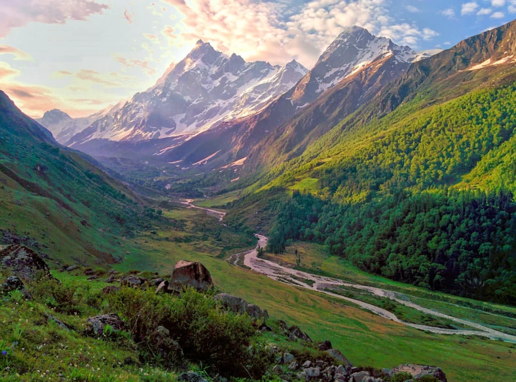
3. Har Ki Dun Trek
Known as the way to heaven this valley is a true gem and can be trekked almost round the year. Tucked away in the Garhwal Himalayas and revealing Swargarohini peaks as you walk on the trail, the trek will take you by ancient temples and quaint villages. The locals believe that the Pandavas from the Mahabharatha took this path on their journey to heaven.
| Attributes | Details |
| Region | Garhwal Himalayas, Uttarakhand |
| Duration | 7 Days |
| Difficulty Level | Easy to Moderate |
| Maximum Altitude | 11,604 Ft |
| Trekking Distance | 34 km |
| Terrain Type | Forested Paths, Alpine Meadows and Grasslands |
| Starting from | Sankri |
| Peaks Visible | Mt. Bandarpoonch, Swargarohini Peaks, Kalanag, Hata Peak |
| Suitable For | Beginners with required fitness level, Experienced trekkers |
Driving from Dehradun through the Queen of Hills, Mussoorie, you will reach Sankri and then to Dharkot, where the trek starts from.
On the first day you will trek from Dharkot to Seema, with the blue waters of Supin River accompanying you. Did you know the villagers of Osla prayed to Duryodhan and built a temple for him! The following day offer your prayers at this Someshwar Temple. You will also be mind blown seeing the views of Hata peak as you climb up.
The trek then continues to Kalkatiyadhar, where you might also see millet crops and amaranth. The views of Kalanag and Swargarohini will blow your mind away. You will then reach Boslo, and be welcomed by a beautiful view of the Har ki Dun valley.
The final stretch will get to the stunning Valley of Gods, Har ki Dun. Ruinsara range, Hata Peak views become more clear here. At the summit you will find the Mahadev Temple, leave a prayer of gratitude, and start your descent. You will trace the trail back from Boslo to Seema via Osla and drive back to Sankri.
You can also witness the cultural traditions of the Bhotiya and Jaunsari tribes.
Keep an eye out for Musk Deer, Himalayan Griffon and the Himalayan Monal.
Being a part of the Govind Wildlife Sanctuary, this trek requires permits that need to be taken at the forest office in Sankri.
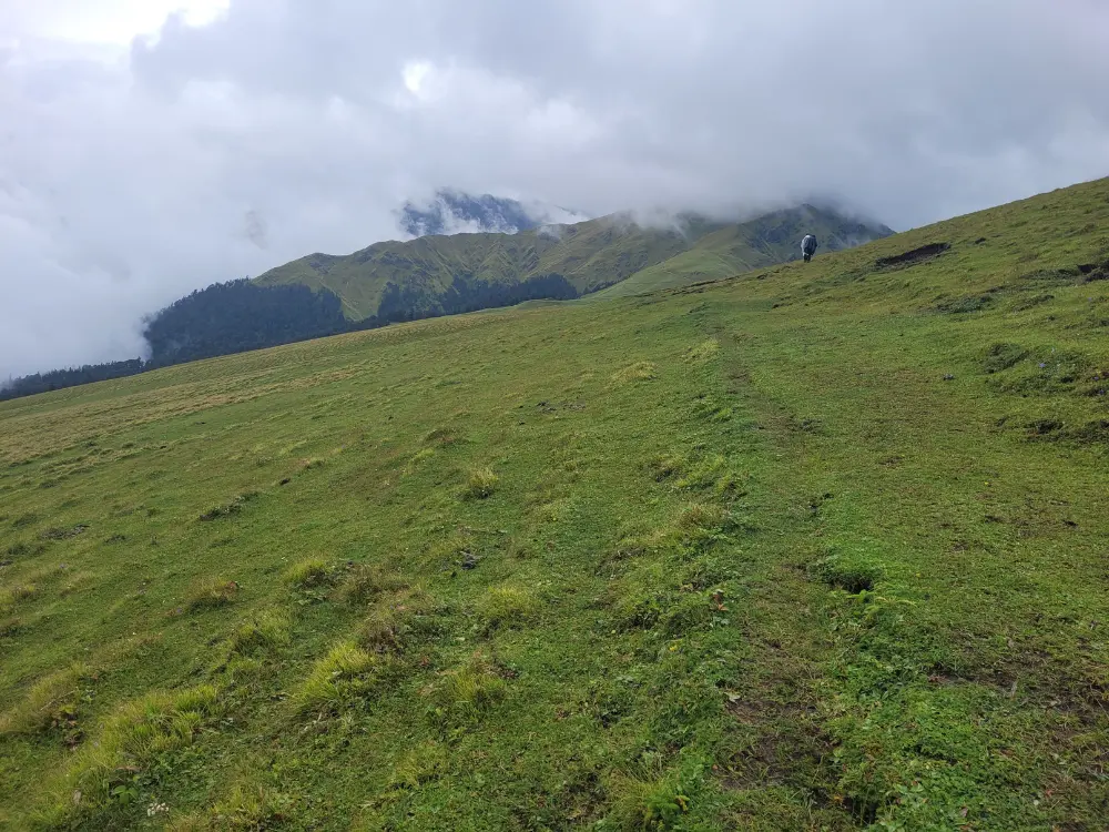
4. Phulara Ridge Trek
If you want to immerse yourself in the mountain views for more than just a few minutes at the summit, Phulara Ridge is the perfect choice. Ridge is where two mountain sides meet, and walking on the ridge will feel like the majestic mountains are walking with you!
| Attributes | Details |
| Region | Uttarkashi district, Uttarakhand |
| Duration | 6 Days |
| Difficulty Level | Easy to Moderate |
| Maximum Altitude | 12,172 Ft |
| Trekking Distance | 26 Km |
| Terrain Type | Forested Paths, Alpine Meadows |
| Starting from | Sankri |
| Peaks Visible | Swargarohini, Kalanag (Black Peak) |
| Suitable For | Beginners with required fitness level, Experienced trekkers, Kids and Family |
After driving to Sankri, the trek begins from there to Juda ka Talab through the Himalayan Cedar trees covering you in its scent. A legend has it that when Shiva was unravelling locks of his hair a few drops fell from it and created this lake.
You will then have to trek from Sikolta to Bhoj Gadi. As you enter Karsu Thatch you will see the famous Kedarkantha peak. The trail will then take you to Pushtara through the Phulara Ridge. As you walk on the ridge, which is a standout feature among offbeat treks in Uttarakhand, you will have the company of these peaks – Sarutal Top, Bandarpoonch, Kalanag, Swargarohini, Hata Peak, Ranglana, Kedarkantha.
The last day of the trek is to descend to Taluka village and drive back to Sankri.
The ridge is home to marsh marigolds, purple poppies, and dwarf rhododendrons. The trek afterall was named after the blooming wildflowers! Another common sight is that of Amaranth, which is used in the local dishes.
You could also spot langurs, pheasants and Monal.
5. Kedartal Trek
This trek will give you that adventure adrenaline as it takes you to the heart of the Himalayas at 15,000 feet. With the backdrop of Mt. Thalaysagar lies the mystical Kedartal Lake, known as Shiva’s Lake.

| Attributes | Details |
| Region | Uttarakhand |
| Duration | 7 Days |
| Difficulty Level | Moderate to Difficult |
| Maximum Altitude | 15,470 Ft |
| Trekking Distance | 24 Km |
| Terrain Type | Forested Paths, Rocky Paths, Glacial Moraine |
| Starting from | Gangotri |
| Peaks Visible | Mt. Thalaysagar, Mt. Brigupanth |
| Suitable For | Experienced trekkers, Adventure seekers |
The trek starts at the pilgrim town of Gangotri. From there you trek to Bhojkarak, through forests and rocky terrain. After a few hours of trekking, you will find yourself with the famous Spider Wall, which is a narrow and a cave to pass through.
The next section of the trek will take you to Kedarkharak, you will be mesmerised as the sun goes down behind Mt Brigupanth. The next day the path will lead you to the most exciting part, the Lake. Piles of stones are placed en route to the lake to point in the right direction. Watch your step as there are plenty of loose rocks.
After you cross a rocky ridge, you will descend to Kedartal. You will see the reflection of mighty Thalaysagar peak on the Tal(lake). Descend back the same route to Gangotri, where the trek ends.
At Kedarkharak you might have a chance to spot Bharal (blue sheep), Goral, Himalayan black bear.
The Bhojpatra tree is commonly found on this trail. Due to the texture of this bark, ancient Indian texts were written on it.
6. Gaumukh Tapovan Trek
This trek is a journey to the source to the Gangotri Glacier, source of the sacred Bhagirathi River, and Mt. Shivling.
| Attributes | Details |
| Region | Uttarkashi district, Uttarakhand |
| Duration | 7 Days |
| Difficulty Level | Moderate to Difficult |
| Maximum Altitude | 14,150 Ft |
| Trekking Distance | 46 Km |
| Terrain Type | Forested Paths, Rocky Paths, Stream Crossings, Glacial terrain |
| Starting from | Gangotri |
| Peaks Visible | Mt. Shivling, Kedar Dome, Gangotri Glacier, Chaturangi Glacier |
| Suitable For | Experienced trekkers |
This trek also begins at Gangotri Town. The trek begins from there to Chirbasa, surrounded by Chir trees, hence the name. You can hear the Bhagirathi river flow by the campsite here. Then you have to trek to Bhojbasa, the name comes from the Bhojpatra trees. As you reach here, it offers breathtaking views of Mt. Shivling and the Gaumukh glacier.
The next stretch will take you to Tapovan and will encounter Akash Ganga flowing by. The view of Mt Shivling and Meru Peak is better from here, and the beauty is unparalleled. Tapovan is famous for stargazing, as you can enjoy clear views of the galaxy. The descent then begins to Bhojbasa and then Gangotri.
There are some landslide prone areas on the trek, where you need to exercise great caution.
Gangotri Temple, Bhagirathi Rock, Pandav Gufa (cave), Mukhba Village are some prominent cultural sites here.
The trail has Himalayan Birch, Deodar, Blue Pine. And you can also spot Blue Sheep, Himalayan Griffons.
7. Pindari Glacier Trek
If you are looking for a glacier trek without worrying about the difficult terrain, Pindari Glacier Trek is the right choice! It is one of the easiest and most accessible glacier treks.
| Attributes | Details |
| Region | Kumaon Himalayas, Uttarakhand |
| Duration | 6 Days |
| Difficulty Level | Moderate |
| Maximum Altitude | 12,300 Ft |
| Trekking Distance | 60 Km |
| Terrain Type | Forested Paths, Glacial terrain, Ridges, Meadows |
| Starting from | Khati |
| Peaks Visible | Mt Nanda Devi |
| Suitable For | Experienced Trekkers |
The trek begins from the Khati village and takes you to Dwali through moraine sections along the Pindari River. Though the steep climbs and sometimes unpredictable weather make this trek challenging, the valley views are spectacular.
You will then trek to Phurkiya watching majestic peaks Nanda Devi East unfold in front of you. You will also encounter spider wall and two streams to cross. Then you will trek to the Zero Point, climbing up glacial streams and snow fields. Mt Nanda Khat is clearly visible from here. As some of the trail sections are prone to landslides, watch out for falling rocks.
You will then start your descent back to Khati through the same trail.
The temple at the top is dedicated to Durga Devi, and was built by the famous Pindari Baba, Dharmanand Swami.
Himalayan Birch is a common sight on most of these trails. You will also find Chir Pine, Deodar, Rhododendrons, Jatamansi among many others. Red Flying Squirrel, Himalayan bears, Tahr, Red Fox can be spotted.
8. Geochala Trek
This trek is not for the weak hearted, and it rewards you well. You can see not just one mountain summit, but 14 other summits, given its proximity to Nepal. How exciting is that? This trek is the closest you can get to Kanchenjunga, the highest peak in India.
| Attributes | Details |
| Region | Yuksom, Sikkim |
| Duration | 10 Days |
| Difficulty Level | Difficult |
| Maximum Altitude | 15,100 Ft |
| Trekking Distance | 73 Km |
| Terrain Type | Dense Forests, Rocky Slippery Paths |
| Starting from | Yuksom |
| Peaks Visible | Mt Kanchenjunga, Mt Pandim, Mt Rathong, Mt Koktang |
| Suitable For | Experienced trekkers, Adventure seekers |
The first day of the trek begins from Yuksom to Sachen through a thick rainforest and a suspension bridge with Pha Khola stream flowing by. The trail then takes a sharp turn to Tshoka through oak forest. Mt. Pandim strikingly stands out making you feel like it’s rising above the skyline. You can choose to stay the night at Tshoka or Bakhim, which offers better views of the valley.
You then trek to Dzongri via Phedang with red rhododendrons springing up. After acclimatising at Dzongri top for a day, trek to Kokchurang and, then to Thansing. The paths will lead you to the beautiful Samiti Lake. The next morning watch the sun rays hit the Kanchenjunga peak.
From there you would have to descend to Thansing and back to Tshoka.
This trek takes you to 15000+ feet, it is long and requires great endurance. If you find yourself not being able to continue the entire trail, returning from Dzongri is a good idea.
If luck is on your side, you might be able to spot red panda, and snow leopard. Himalayan black bear, tahr, tibetan wild ass are others that can be spotted.
An entry has to be made at the police station in Yuksom and a permit taken at the forest check post.
What to Keep in Mind for Summer Treks.
- Hydrate, Hydrate, Hydrate: Everything at high altitudes needs extra caution. Given it is summer, ensure to hydrate well to avoid fatigue.
- Appropriate Layering: Because it is summer, don’t think it won’t be cold! Early mornings and night have lower temperatures while the rest of day is warm. Pack appropriate layers to protect yourself.
- Sunscreen: The sun is brutal at high altitudes. Carry a sunscreen of atleast 50+ SPF, wear glasses, and keep your face covered.
- Unpredictable Weather: Though it’s summer, the weather could still be unpredictable; it could rain or snow. Be prepared for such weather.
- Pack Light: As you have to trek through steep ascents and challenging terrains, pack right, pack light. Prioritise essentials and you can fancy wearing the rest when you are back in the city.
- Acclimatisation: Gain altitude gradually, take rest days, and listen to your body. AMS (Acute Mountain Sickness) can hit anyone, anytime. Watch for sickness symptoms and know when to return. Take medicines to help you hold your boat until you can take further action.
- Fitness and Endurance: Be sure to train your body and mind well for the trek and its trails.
- Permits: Many treks require permits and documents to be taken prior. Be sure to check and take the necessary documents.
Leave a Comment