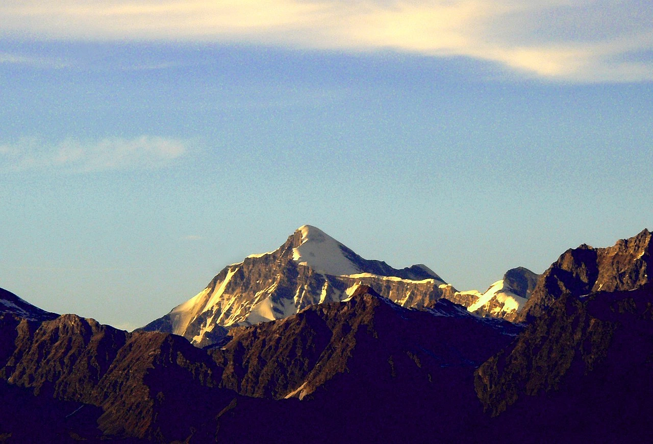
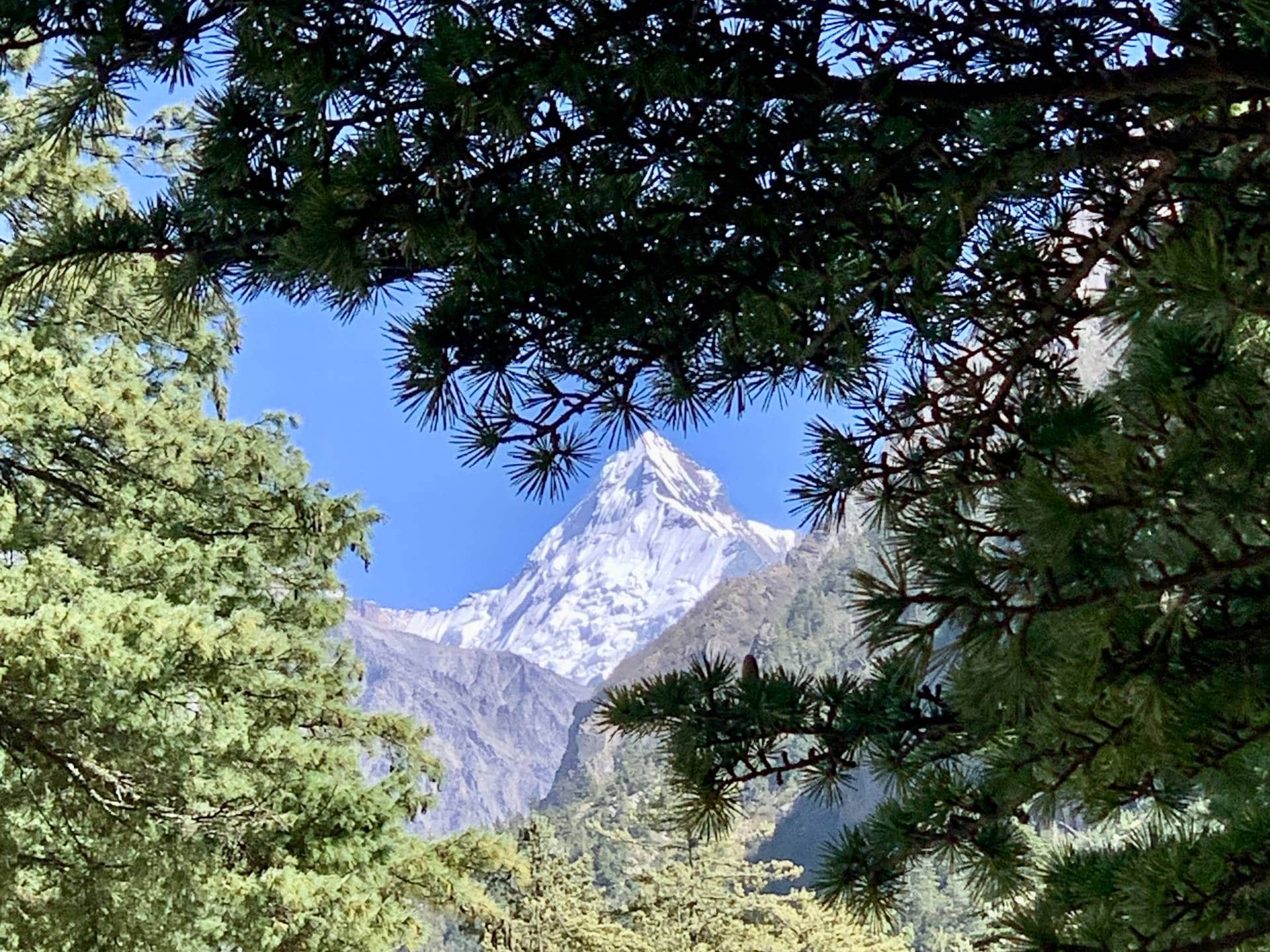
Mountain regions across the Himalayas present a wide range of challenges shaped by terrain, altitude, and weather. These landscapes are not defined by scenery alone but by the demands they place on those who travel through them.
Some peaks are suitable for those beginning their mountaineering journey under proper guidance, while others require advanced skills, experience, and careful decision-making. Each ascent reflects a balance between preparation, conditions, and respect for the environment.
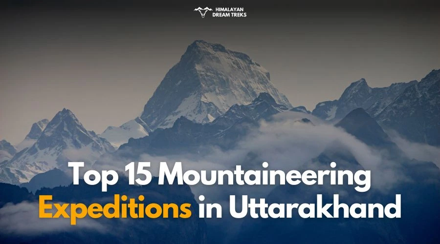
As you explore this list of expeditions in Uttarakhand, you will see how varying levels of difficulty, highest peaks of Uttarakhand, and geography influence the character of every expedition.
Table of Contents
1. Satopanth (7,075 m)

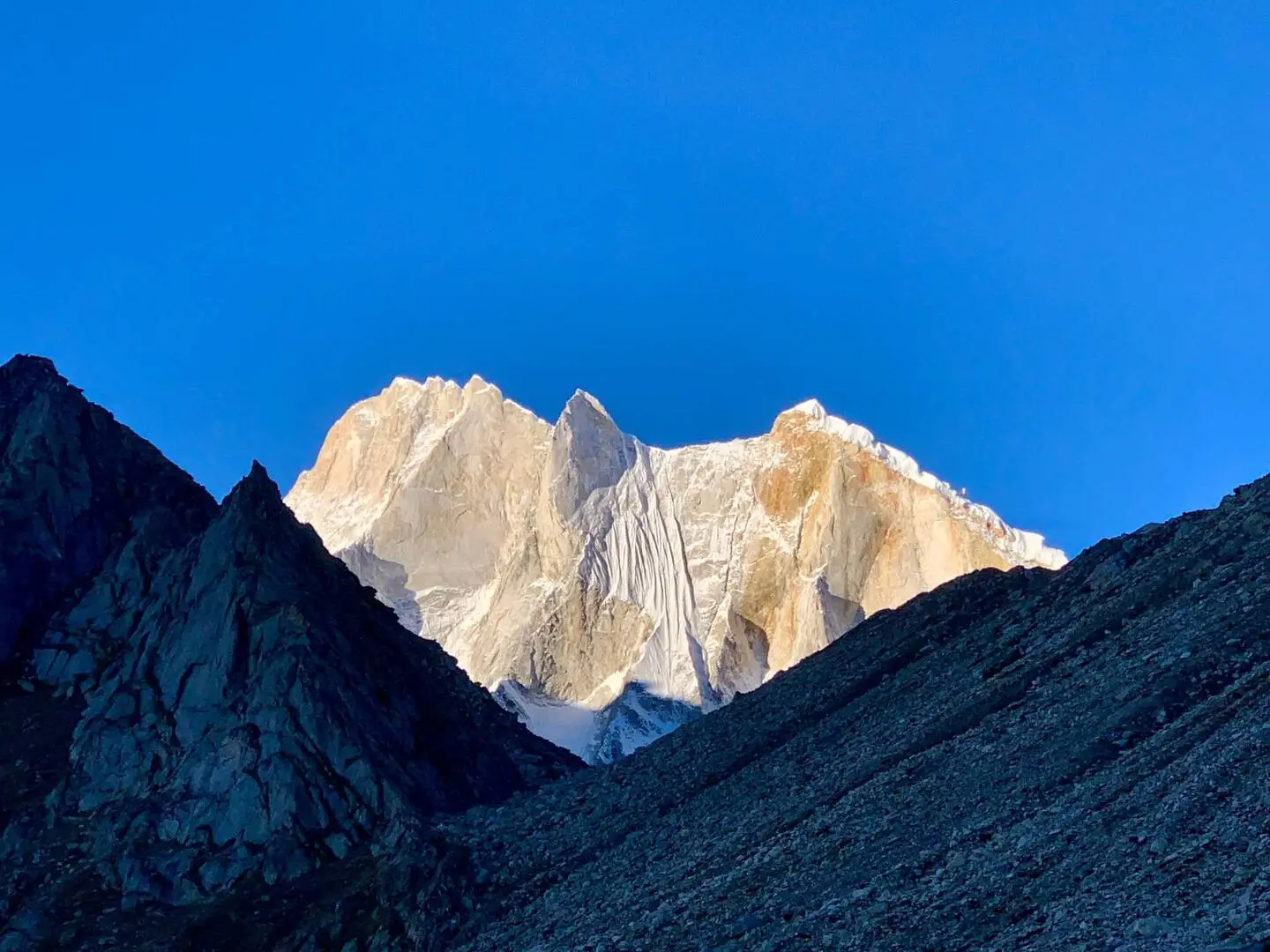
Located above the upper reaches of the Gangotri Glacier, Satopanth Peak is one of the most impressive mountains in the Garhwal Himalaya. With a height of over 7,000 meters, it holds both spiritual meaning and mountaineering appeal. Named after an ancient Hindu belief, the peak demands modern climbing skills, strong endurance, and careful preparation.
The route includes long glacier approaches, steady snow climbing, and high-altitude camps. Satopanth expedition is not meant for beginners, yet it is not highly technical either. For climbers ready to step beyond 6,000-meter peaks, it offers a challenging but achievable Himalayan expedition in a remote and dramatic setting.
Climbing History: Satopanth was first successfully climbed in 1947 by a Swiss expedition, marking an early milestone in post-independence Himalayan mountaineering. Since then, it has attracted climbers seeking a serious yet achievable 7,000-meter objective. While not overly technical, its altitude, weather, and glacier travel command respect and preparation.
Key Facts & Expedition Details
An understanding of Satopanth’s altitude, terrain, and logistical demands sets the foundation for the expedition, shaping how climbers acclimatize, move, and plan their summit attempt.
| Height | Satopanth rises to an elevation of 7,075 meters, placing it firmly among India’s major Himalayan peaks. The altitude presents serious acclimatization challenges, requiring carefully staged camps and disciplined ascent strategies to manage fatigue, cold exposure, and altitude-related risks. |
| Coordinates | Located at approximately 30.79°N latitude and 79.32°E longitude, Satopanth lies in Uttarakhand’s Garhwal Himalaya. Its position near the Gangotri Glacier places it in a remote, glaciated environment influenced by rapidly changing high-altitude weather systems. |
| Best Season | The ideal climbing windows are May to June and September, when weather conditions are relatively stable. |
| Days Required | A full expedition typically requires 25 to 28 days, including approach, acclimatization rotations, summit push, and descent. |
| Technical Skills | Climbers should be proficient in snowcraft and basic ice climbing techniques. The route involves rope work, crampon use, self-arrest skills, and safe movement on snow slopes, making prior technical training essential for a successful ascent. |
| Previous Experience | Prior experience on a 6,000-meter peak is strongly recommended. Climbers should be familiar with high-altitude living, glacier travel, and multi-day expeditions, ensuring they can handle physical strain and decision-making in thin air. |
| Snow & Ice Sections | The climb features sustained snow slopes with occasional short ice walls that require careful footwork and protection. While not extremely technical, these sections demand concentration, efficient movement, and comfort on exposed snow and ice terrain. |
| Crevasse Risk | Crevasse danger on the Satopanth Glacier is moderate but significant. Proper rope techniques, glacier awareness, and experienced guides are essential, especially during warmer periods when snow bridges weaken and hidden crevasses become more hazardous. |
| Budget & Cost Range | The overall expedition cost generally ranges between ₹5,00,000 and ₹6,50,000, depending on logistics, team size, and services included. This covers the complexity of permits, high-altitude support, and extended expedition duration. |
| Package Includes | Most organized expeditions include climbing permits, local logistics, experienced guides, porters, base camp setup, meals, and safety support. These services allow climbers to focus on acclimatization and climbing rather than operational challenges. |
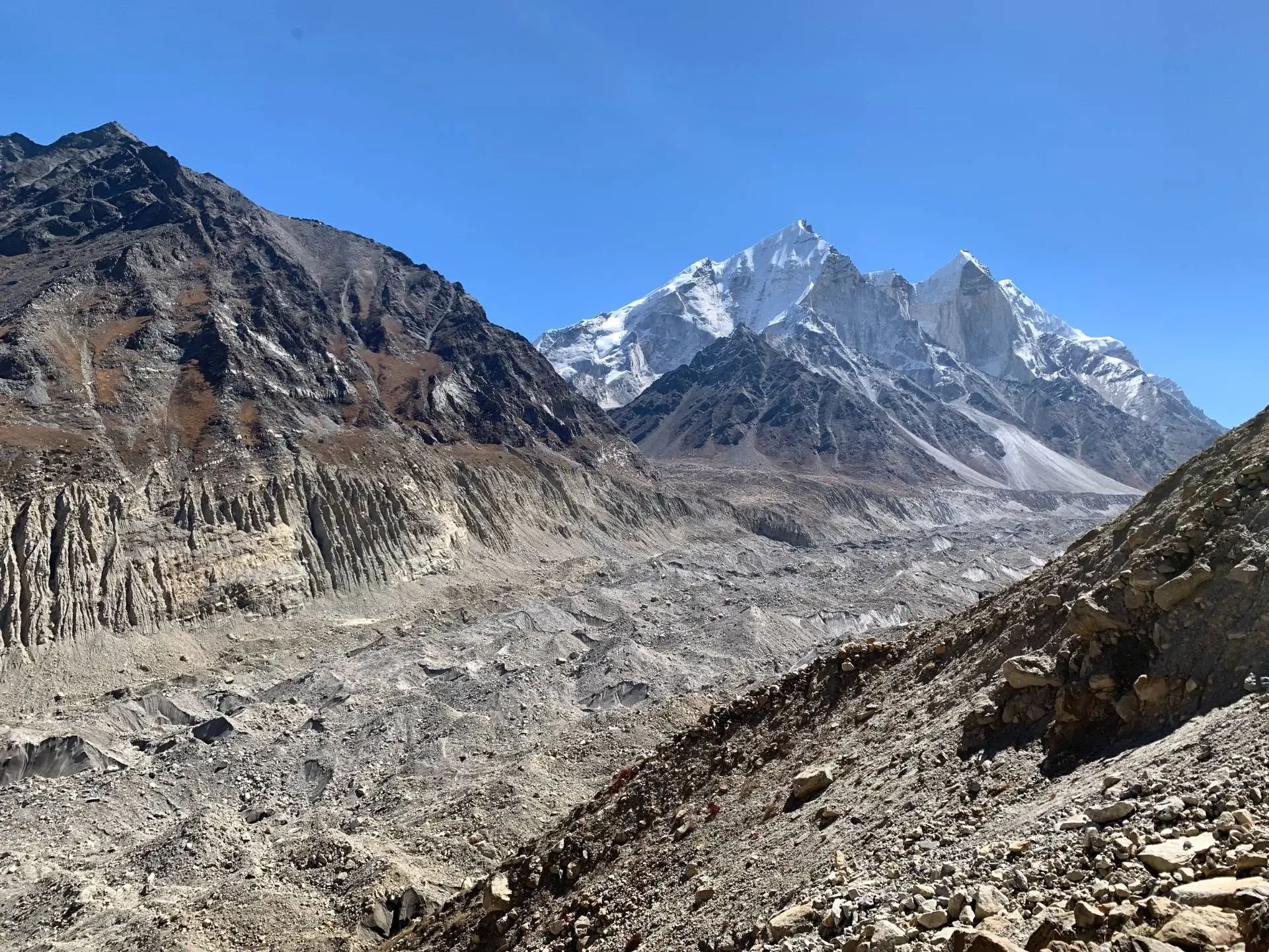
Map / Approach Route
Access to Satopanth typically follows the route via Gangotri, continuing toward the Gangotri Glacier. The approach involves trekking through alpine terrain, moraines, and glacial valleys before establishing base camp near the glacier.
| Aspect | Details | Notes |
| Difficulty | Moderate–High | Long summit day |
| Route Type | Snow & glacier | Weather sensitive |
| Ideal For | Aspiring 7,000ers | Endurance focus |
2. Kamet (7,756 m)
Towering at 7,756 meters, Kamet commands the Garhwal Himalayas. Its immense walls of ice, endless snowfields, and lonely ridgelines create a landscape that feels untouched by time.
Short History: Once believed to be unclimbable due to its height and remoteness, Kamet symbolized early Himalayan ambition. In the early twentieth century, it represented the limits of human endurance and logistics. Explorers viewed Kamet not merely as a summit, but as a gateway to understanding extreme altitude mountaineering.
Climbing History: Kamet was first successfully climbed in 1931 by an expedition led by Frank Smythe. At the time, it became the highest mountain ever climbed, marking a historic breakthrough in high-altitude climbing. The ascent established Kamet as a benchmark peak for serious Himalayan expeditions.
Key Facts & Expedition Details
Kamet’s scale and isolation mean that every logistical detail matters, making its expedition profile as demanding as the climb itself.
| Height | Standing at 7,756 meters, Kamet is one of India’s tallest mountains. The altitude significantly impacts oxygen availability, making acclimatization critical and increasing both physical strain and exposure-related risks throughout the expedition. |
| Coordinates | Kamet is located at approximately 30.92°N latitude and 79.59°E longitude in Uttarakhand. Its position places it deep within the Zanskar range, surrounded by extensive glaciers and remote alpine terrain. |
| Best Season | The prime climbing season is May to June, when weather patterns are comparatively stable. |
| Days Required | A typical Kamet expedition requires 28 to 32 days, including approach marches, acclimatization rotations, summit attempt, and descent. |
| Technical Skills | Climbers must be skilled in high-altitude glacier travel and ice climbing. Rope management, crevasse rescue, fixed-line movement, and efficient crampon technique are essential due to steep and exposed sections. |
| Previous Experience | Prior experience on multiple 6,500-meter peaks is strongly recommended. Climbers should be comfortable with long expeditions, extended high camps, and decision-making under extreme altitude stress. |
| Snow & Ice Sections | The route features extensive snowfields culminating in a steep summit pyramid. These sections require sustained effort, careful pacing, and precise movement on hard snow and ice near the summit. |
| Crevasse Risk | Crevasse risk is high, particularly on the East Kamet Glacier. Teams must maintain strict rope discipline, route-finding awareness, and constant vigilance, especially during warmer daytime conditions. |
| Budget & Cost Range | The overall expedition cost typically ranges between ₹5,80,000 and ₹8,30,000, depending on logistics, team size, and support services. The higher cost reflects altitude, duration, and technical complexity. |
| Package Includes | Most expeditions include permits, full logistics, experienced guides, porters, base camp services, high-altitude support, meals, and safety infrastructure, allowing climbers to focus solely on performance and acclimatization. |
Map/Approach Route:
The standard approach to Kamet follows the route via Joshimath, leading toward the East Kamet Glacier. This involves long glacier travel and progressive camp establishment deep within remote terrain.
| Aspect | Details | Notes |
| Difficulty | High | Extreme altitude |
| Route Type | Glacier & ice | Long carries |
| Ideal For | Experienced climbers | 7,000 m goal |
3. Mukut Parvat (7,242 m)
At 7,242 meters, Mukut Parvat stands as a regal presence within the Nanda Devi Sanctuary. Cloaked in sweeping glaciers and formidable ridges, it feels like a hidden crown of the Himalayas. Its remoteness preserves an untouched beauty.
Short History: Known as the “Crown Peak” due to its distinctive summit shape, Mukut Parvat remained largely obscure for decades. Overshadowed by Kamet, it attracted little early attention despite its stature. This relative isolation preserved its reputation as a quiet, serious Himalayan objective.
Climbing History: Mukut Parvat was first climbed in 1951 by a French expedition. The ascent highlighted the mountain’s mixed terrain and high-altitude demands, establishing it as a respected but lesser-known peak for experienced climbers seeking technical variety beyond popular routes.
Key Facts & Expedition Details
| Height | Mukut Parvat rises to 7,242 meters, placing it among India’s significant high-altitude peaks. The elevation requires careful acclimatization and disciplined pacing, especially during summit pushes involving sustained exposure and mixed climbing sections. |
| Coordinates | Located at approximately 30.93°N latitude and 79.57°E longitude, Mukut Parvat lies close to Kamet in Uttarakhand. Its position places it within a remote glaciated basin shaped by severe weather and alpine conditions. |
| Best Season | The optimal climbing window is May to June, when snow conditions are more stable, and access routes are clearer. This period offers safer mixed climbing conditions before monsoon activity increases avalanche and crevasse risk. |
| Days Required | A typical expedition lasts between 26 and 30 days, accounting for approach, acclimatization, summit attempt, and descent. |
| Technical Skills | Climbers must be proficient in mixed climbing, combining snow, ice, and rock techniques. Rope handling, crampon precision, ice-tool efficiency, and movement on exposed ridges are essential for safe progress. |
| Previous Experience | Prior experience on 6,000 to 6,500-meter expeditions is strongly recommended. Climbers should be comfortable with high camps, mixed terrain, and prolonged exposure to cold and altitude. |
| Snow & Ice Sections | The route features mixed snow-and-ice ridges that require steady movement and careful protection. These sections demand concentration, especially where conditions vary between hard ice, soft snow, and exposed rock. |
| Crevasse Risk | Crevasse risk is moderate on the approach glaciers. While less severe than Kamet, teams must maintain rope discipline, route awareness, and cautious timing during warmer parts of the day. |
| Budget & Cost Range | The overall expedition cost typically ranges between ₹5,40,000 and ₹7,50,000, depending on logistics, guide services, and team size. Costs reflect the mountain’s altitude, duration, and technical requirements. |
| Package Includes | Guided expedition packages generally include permits, logistics, experienced guides, porters, base camp services, meals, and safety support, ensuring climbers can focus fully on acclimatization and climbing performance. |
Map / Approach Route:
Mukut Parvat follows the same approach as Kamet, starting from Joshimath and moving toward the East Kamet Glacier, before branching toward Mukut Parvat’s distinct climbing line.
| Aspect | Details | Notes |
| Difficulty | High | Less crowded |
| Route Type | Mixed | Route finding |
| Ideal For | Advanced climbers | Technical growth |
4. Trishul (7,120 m)
Soaring to 7,120 meters, Trishul dominates the skyline of the Kumaon Himalayas with striking elegance. Named after Lord Shiva’s trident, its three sharp peaks pierce the sky in dramatic symmetry.
Short History: Trishul holds deep significance in Hindu mythology, named after the trident of Lord Shiva. For centuries, it has been revered as a sacred mountain in the Kumaon region. This spiritual legacy continues to shape the mountain’s identity alongside its mountaineering appeal.
Climbing History: Trishul was first climbed in 1907, making it one of the earliest 7,000-meter peaks ever ascended. This historic ascent marked a turning point in Himalayan exploration and established Trishul as a benchmark peak in the early era of high-altitude mountaineering.
Key Facts & Expedition Details
| Height | Rising to 7,120 meters, Trishul presents significant altitude challenges despite its relatively direct routes. Climbers must manage thin air, cold exposure, and sustained physical effort throughout long summit days and acclimatization rotations. |
| Coordinates | Located at approximately 30.31°N latitude and 79.77°E longitude, Trishul stands prominently in Uttarakhand’s Kumaon Himalaya. Its position offers sweeping views while exposing the mountain to strong winds and variable weather systems. |
| Best Season | The best climbing periods are May to June and September. |
| Days Required | A full expedition generally requires 25 to 28 days, including approach, acclimatization climbs, summit attempt, and descent. |
| Technical Skills | Climbers should be proficient with ice axe and crampon use. While the climb is not highly technical, secure footwork, self-arrest ability, and confident movement on steep snow are essential. |
| Previous Experience | Prior alpine climbing experience is strongly recommended. Familiarity with snow routes, exposed ridges, and multi-day expeditions at altitude helps climbers manage both physical demands and decision-making on the mountain. |
| Snow & Ice Sections | The route involves steep snow faces that require steady pacing and careful technique. These sections can become demanding in hard snow or icy conditions, especially during early morning summit pushes. |
| Crevasse Risk | Crevasse risk is moderate, particularly on glacier approaches. Proper rope techniques, route awareness, and experienced supervision are necessary to navigate hidden crevasses safely during changing seasonal conditions. |
| Cost Range | The overall expedition cost typically ranges between ₹5,00,000 and ₹7,10,000, depending on logistics, support level, and team size. Costs reflect the mountain’s altitude, duration, and historical significance. |
Map / Approach Route:
| Aspect | Details | Notes |
| Difficulty | Moderate–High | Classic routes |
| Route Type | Snow | Weather dependent |
| Ideal For | Strong intermediates | Historic peak |
5. Shivling (6,543 m)

At 6,543 meters, Shivling stands as one of the most sacred and striking peaks of the Garhwal Himalayas. Its near-perfect pyramid shape rises above icy glaciers like a divine monument.
Short History: Shivling is revered as a sacred peak near Gangotri, one of Hinduism’s most important pilgrimage sites. For centuries, it was admired rather than attempted, viewed as a divine formation rather than a climbing objective. Its spiritual importance still defines the atmosphere surrounding the mountain.
Climbing History: The peak was first successfully climbed in 1974, opening the door to serious technical climbing in the region. Since then, it has become a prized objective for advanced alpinists, known for its steep routes and demanding mixed climbing conditions.
Key Facts & Expedition Details
| Height | Shivling rises to 6,543 meters, where altitude combines with steep terrain to create a demanding climb. While lower than many Himalayan giants, the technical difficulty significantly increases physical and mental fatigue at elevation. |
| Coordinates | Located at approximately 30.86°N latitude and 79.08°E longitude, Shivling stands near the Gangotri Glacier in Uttarakhand. Its position exposes it to rapid weather shifts and strong winds funneling through glacial valleys. |
| Best Season | The best climbing windows are May to June and September, offering firmer snow, clearer weather, and safer access routes. |
| Days Required | A complete expedition typically takes 18 to 22 days, including approach, acclimatization, route preparation, summit attempt, and descent. The shorter duration reflects the peak’s height but not its technical seriousness. |
| Technical Skills | Climbers must be proficient in rock, ice, and mixed climbing. Efficient use of ice tools, precise crampon technique, and confident movement on steep rock are essential for safe and successful ascents. |
| Previous Experience | Prior experience on technical alpine routes is essential. Climbers should be comfortable leading on exposed terrain, placing protection, and managing complex rope systems at altitude. |
| Snow & Ice Sections | The climb includes steep ice couloirs that demand sustained front-pointing and strong ice-tool placement. These sections are often the crux, requiring focus, endurance, and efficient movement. |
| Crevasse Risk | Crevasse risk is low to moderate on the approach glaciers. While less extensive than larger peaks, proper rope travel and glacier awareness remain important, especially during warmer daytime conditions. |
| Cost Range | The overall expedition cost generally ranges between ₹4,10,000 and ₹5,80,000, depending on guide services, logistics, and team size. Costs reflect the technical nature of the climb rather than expedition length. |
Map / Approach Route:
| Aspect | Details | Notes |
| Difficulty | Technical | Steep faces |
| Route Type | Mixed | Precision required |
| Ideal For | Expert climbers | Iconic ascent |
6. Meru (6,660 m)
As you trek deeper into the Garhwal Himalaya, Meru rises abruptly like a blade of stone and ice. You immediately sense that this mountain is not about altitude alone, but about precision, commitment, and patience. Its sheer granite faces, combined with hanging glaciers, demand respect and methodical planning.
Short History: For decades, Meru remained largely unclimbed due to its intimidating walls and extreme technical difficulty. Early explorers documented it as one of the most dramatic peaks in the Gangotri region, admired more for its beauty and complexity than approached as a realistic climbing objective.
Climbing History: The first ascent of Meru Central was attempted in 1986, opening the door to future exploration. Meru later gained global recognition through elite alpine-style ascents, particularly on the iconic Shark’s Fin route, now considered one of the world’s most demanding climbs. In 2008, the first successful ascent was made to Shark’s Fin by Conrad Anker, Jimmy Chin, and Renan Ozturk. In 2015, the feature film Meru was released, documenting their journey.
Key Facts & Expedition Details
| Height | Meru rises to 6,660 meters, where altitude compounds the technical difficulty of the climb. Though lower than many Himalayan peaks, sustained exposure, steep terrain, and limited retreat options make altitude management critical. |
| Coordinates | Located at approximately 30.86°N latitude and 79.11°E longitude, Meru stands near the Gangotri Glacier. Its position exposes it to rapid weather changes and intense cold funneling through narrow alpine corridors. |
| Best Season | The best climbing periods are May to June and September, offering more stable weather and safer conditions on ice and rock. Outside these windows, storms and unstable snow significantly increase objective hazards. |
| Days Required | A typical expedition lasts 20 to 25 days, including approach, acclimatization, route preparation, summit attempt, and descent. The duration reflects technical complexity rather than altitude alone. |
| Technical Skills | Climbers must be highly proficient in advanced rock, ice, and mixed climbing. Efficient aid techniques, precise ice-tool placements, and strong rope management are essential throughout the ascent. |
| Previous Experience | Prior experience on multiple technical 6,000-meter peaks is essential. Climbers should be comfortable leading sustained hard pitches, managing exposure, and operating efficiently at altitude for extended periods. |
| Snow & Ice Sections | The route involves vertical ice sections and hanging snowfields that demand endurance and absolute focus. These features are often unstable, requiring careful timing and disciplined movement. |
| Crevasse Risk | Crevasse risk is moderate on the Meru Glacier. Rope travel, route awareness, and glacier safety techniques remain critical, especially during approach and descent phases. |
| Budget & Cost Range | The expedition cost generally ranges between ₹4,60,000 and ₹6,70,000, depending on logistics, guide expertise, and technical support. Costs reflect the advanced nature of the climb rather than expedition length. |
| Package Includes | High-altitude technical expedition packages usually include permits, specialized guides, logistics, base camp services, safety equipment, and support staff tailored to complex alpine objectives. |
Map / Approach Route:
The standard approach follows the Gangotri route, continuing toward the Meru Glacier. This access leads into steep, technical terrain requiring careful load management and acclimatization planning.
| Aspect | Details | Notes |
| Difficulty | Very High | Technical focus |
| Route Type | Mixed | Sustained exposure |
| Ideal For | Expert alpinists | Elite objective |
7. Nanda Devi East (7,434 m)
Standing opposite the main Nanda Devi summit, Nanda Devi East (Sunanda Devi) offers a serious yet achievable gateway into the inner sanctum of the massif.
Short History: Revered as a goddess in Hindu tradition, the Nanda Devi peaks have long held deep spiritual significance. For many years, the region remained restricted due to ecological and cultural concerns, preserving its pristine environment and reinforcing its reputation as a protected Himalayan sanctuary.
Climbing History: Nanda Devi East was first climbed in 1939 and later became known as the more accessible counterpart to the main summit. While technically less severe, it still represents a serious high-altitude challenge and remains a respected objective for experienced Himalayan climbers.
Key Facts & Expedition Details
| Height | Nanda Devi East rises to 7,434 meters, making it one of India’s highest peaks. The altitude demands disciplined acclimatization, strong physical conditioning, and careful pacing, especially during the long summit push from high camp. |
| Coordinates | Located at approximately 30.41°N latitude and 79.97°E longitude, the peak lies deep within the Nanda Devi massif. Its isolated position contributes to extreme weather exposure and logistical complexity throughout the expedition. |
| Best Season | The optimal climbing windows are May to June and September, when access routes are clearer and weather patterns are relatively stable. These periods avoid monsoon snowfall and provide safer glacier and ridge conditions. |
| Days Required: | A full expedition typically requires 28 to 32 days, including approach, acclimatization rotations, summit attempt, and descent. Extra time is essential due to remoteness, permit logistics, and potential weather delays. |
| Technical Skills | Climbers must be proficient in glacier travel and ice climbing. Rope management, crevasse rescue, and efficient movement on snow slopes are essential skills for navigating the mountain safely. |
| Previous Experience | Prior experience on a 7,000-meter expedition is strongly preferred. |
| Snow & Ice Sections | The route features extended snow ridges that require sustained effort and endurance. |
| Crevasse Risk | Crevasse risk is high, especially during glacier approaches and warmer periods. Strict rope discipline, experienced route-finding, and constant vigilance are critical to managing this objective hazard. |
| Cost Range | The overall expedition cost generally ranges between ₹6,20,000 and ₹8,70,000, depending on logistics, team size, and support level. The cost reflects the mountain’s altitude, remoteness, and extended duration. |
Map / Approach Route:
| Aspect | Details | Notes |
| Difficulty | High | Remote logistics |
| Route Type | Snow & ice | Long carries |
| Ideal For | Advanced climbers | 7,000 m goal |
8. Bandarpunch (6,316 m)
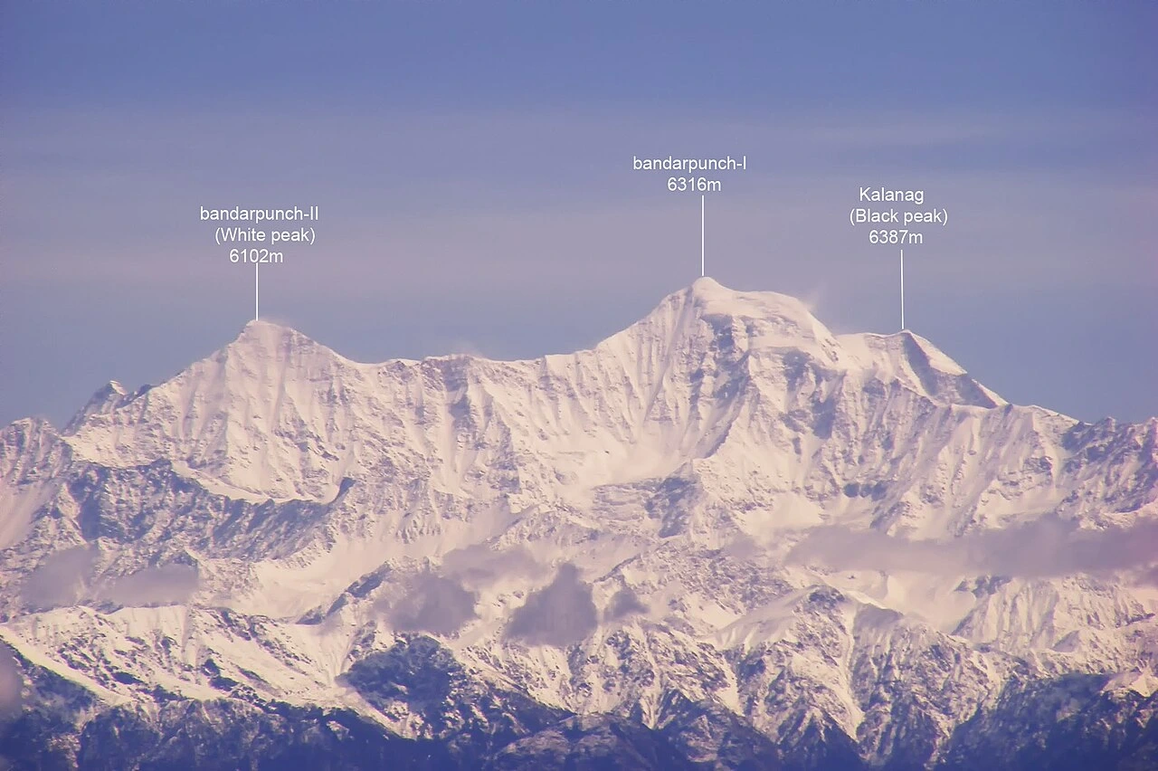
Bandarpunch, standing 6,316 meters high, captivates with its wide snowfields and dramatic ridgelines. The mountain’s smooth slopes and strong shape form a stunning natural view. Surrounded by glaciers and local legends, it feels powerful yet welcoming, showcasing the raw beauty of Uttarakhand’s Himalayan landscape.
Short History: Bandarpunch is named after the mythological tail (punch) of Lord Hanuman, giving the mountain deep cultural significance. The peak has long been referenced in local legends, blending mythology with mountaineering history and adding symbolic depth to the climbing experience.
Climbing History: First climbed in 1950, Bandarpunch quickly gained recognition as a classic Himalayan objective. Over time, it has become popular among strong intermediate climbers, valued for its clear routes, manageable technical difficulty, and impressive alpine scenery.
Key Facts & Expedition Details
| Height | Bandarpunch rises to 6,316 meters, where altitude becomes a serious factor without overwhelming technical difficulty. |
| Coordinates | Located at approximately 30.96°N latitude and 78.44°E longitude, Bandarpunch lies in the Garhwal Himalaya. |
| Best Season | The ideal climbing periods are May to June and September, when snow conditions are stable and weather windows more predictable. These seasons provide safer ridge travel and clearer summit days. |
| Days Required | A complete expedition typically takes 18 to 22 days, including approach, acclimatization, summit attempt, and descent. The duration makes Bandarpunch suitable for climbers with limited expedition time. |
| Technical Skills | Climbers should be comfortable with snow climbing and ridge travel. Confident crampon use, ice axe technique, and movement on exposed snow ridges are essential for safety and efficiency. |
| Previous Experience | Prior experience on 5,500 to 6,000-meter peaks is recommended. Familiarity with high-altitude camping and snow routes helps climbers adapt smoothly to Bandarpunch’s terrain and elevation. |
| Snow & Ice Sections: | The route primarily involves snow ridges that require endurance and careful foot placement. |
| Crevasse Risk | Crevasse risk is low to moderate on the approach glaciers. While less complex than larger peaks, rope travel and glacier awareness remain important, especially during warmer hours. |
| Cost Range | The expedition cost generally ranges between ₹3,70,000 and ₹5,40,000, depending on logistics, guide support, and group size. |
Map / Approach Route:
| Aspect | Details | Notes |
| Difficulty | Moderate | Scenic routes |
| Route Type | Snow | Stable conditions |
| Ideal For | Intermediate climbers | Skill building |
9. Nanda Ghunti (6,309 m)
Nanda Ghunti, standing at 6,309 meters, welcomes the eye with a calm and graceful presence. As one draws closer, its elegant slopes and icy ridges reveal a rewarding alpine journey.
Short History: Often overshadowed by the towering presence of Nanda Devi and Trishul, Nanda Ghunti has long remained understated. Despite this, it holds a distinct charm, valued by climbers who appreciate quieter routes and less commercialized Himalayan peaks.
Climbing History: Nanda Ghunti was first successfully climbed in 1959 by an Indian expedition. The ascent highlighted the mountain’s sustained snow slopes and alpine seriousness, establishing it as a respected objective for experienced snow climbers.
Key Facts & Expedition Details
These expedition specifics shed light on a climb that quietly tests endurance, where long snow slopes and weather awareness are central to success.
| Height | Nanda Ghunti rises to 6,309 meters, where altitude significantly affects endurance and recovery. |
| Coordinates | Situated at approximately 30.42°N latitude and 79.83°E longitude, the peak lies in Uttarakhand’s Kumaon region. |
| Best Season | The ideal climbing season is May to June, when snow conditions are relatively stable and access routes are safer. |
| Days Required | A typical expedition requires 20 to 24 days, including approach, acclimatization climbs, summit attempt, and descent. |
| Technical Skills | Climbers should be proficient in snow and basic ice techniques. Confident crampon use, ice axe handling, and movement on steep snow slopes are essential for safe progress. |
| Previous Experience | Prior experience on alpine snow climbs is recommended. Familiarity with exposed snow terrain and multi-day high-altitude expeditions helps climbers manage both physical and technical demands. |
| Snow & Ice Sections | The route involves steep snow slopes that require sustained effort and careful footwork. These sections can become demanding in firm or icy conditions, especially near the summit. |
| Crevasse Risk | Crevasse risk is moderate on the glacier approaches. Rope travel, route awareness, and cautious movement remain important, particularly during warmer parts of the day. |
| Cost Range | The expedition cost generally ranges between ₹3,90,000 and ₹5,60,000, depending on logistics, guide services, and team size. Costs reflect the mountain’s moderate altitude and expedition duration. |
Map / Approach Route:
| Aspect | Details | Notes |
| Difficulty | Moderate–High | Variable weather |
| Route Type | Snow | Long approach |
| Ideal For | Serious learners | Altitude gain |
10. Jogin (6,466 m)
The Jogin peaks rise high above Gangotri, forming a dramatic wall of sharp ridges and steep snow faces. Their striking shape and commanding presence dominate the landscape, drawing the eye upward.
Short History: Historically, the Jogin peaks were used as training and preparation climbs for Indian Himalayan expeditions. Their proximity to Gangotri and varied terrain made them ideal for skill development, acclimatization, and testing expedition readiness before attempting larger objectives.
Climbing History: Jogin has seen multiple ascents since the 1950s, gradually establishing its reputation as a serious yet accessible technical peak. Over the decades, it has remained popular among climbers looking to gain experience on snow, ice, and exposed ridges.
Key Facts & Expedition Details
| Height | Jogin rises to 6,466 meters, where altitude combines with technical terrain to create a demanding climb. While not extreme in height, sustained effort and exposure significantly increase physical and mental fatigue. |
| Coordinates | Located at approximately 30.88°N latitude and 79.05°E longitude, Jogin stands near the Gangotri region. |
| Best Season | The optimal climbing window is May to June, when snow conditions are more stable and access routes safer. |
| Days Required | A full expedition typically takes 18 to 22 days, including approach, acclimatization, summit attempt, and descent. |
| Technical Skills | Climbers must be proficient in snow, ice, and ridge climbing. Confident crampon use, ice axe technique, rope management, and movement on exposed terrain are essential for success. |
| Previous Experience | Prior technical climbing experience is recommended. Climbers should be comfortable on steep snow and ice, with experience handling exposure and decision-making in alpine environments. |
| Snow & Ice Sections | The route features snow couloirs that require sustained climbing and careful technique. These sections can be demanding in firm snow or icy conditions, particularly during early summit pushes. |
| Crevasse Risk | Crevasse risk is low to moderate on the approach glaciers. While less complex than larger peaks, rope travel and glacier awareness remain important safety considerations. |
| Cost Range | The expedition cost generally ranges between ₹3,70,000 and ₹4,90,000, depending on logistics, guide support, and team size. Costs reflect the technical nature and moderate expedition length. |
Map / Approach Route:
| Aspect | Details | Notes |
| Difficulty | Moderate | Technical exposure |
| Route Type | Snow & mixed | Training value |
| Ideal For | Skill enhancement | Gangotri region |
11. Bhagirathi (6,856 m)
The Bhagirathi peaks soar sharply above the surrounding valleys, marked by steep faces and demanding alpine terrain. Their bold rock walls, icy slopes, and dramatic form create an intense and inspiring mountain presence.
Short History: Bhagirathi is named after the river goddess Bhagirathi, the sacred source stream of the Ganga. The mountain holds deep spiritual significance due to its proximity to Gangotri, blending mythology, reverence, and rugged Himalayan terrain.
Climbing History: The peak was first successfully climbed in 1937, during the early era of Himalayan exploration. Since then, it has been recognized as a demanding technical peak, respected for its steep routes and challenging alpine conditions.
Key Facts & Expedition Details
| Height | Bhagirathi rises to 6,856 meters, where altitude intensifies fatigue and slows recovery. Combined with steep terrain, the elevation requires excellent acclimatization and efficient movement throughout the climb. |
| Coordinates | Located at approximately 30.90°N latitude and 79.07°E longitude, Bhagirathi stands near the Gangotri Glacier. |
| Best Season | The prime climbing season is May to June, when snow and ice conditions are more stable. |
| Days Required | A complete expedition generally takes 22 to 26 days, including approach, acclimatization, route preparation, summit attempt, and descent. The timeline reflects the peak’s technical nature rather than altitude alone. |
| Technical Skills | Climbers must be highly skilled in advanced ice climbing. Strong front-pointing technique, ice-tool precision, and efficient rope management are essential for navigating steep ice walls safely. |
| Previous Experience | A strong alpine background is required. Climbers should have prior experience leading technical routes, managing exposure, and operating efficiently on sustained ice at high altitude. |
| Snow & Ice Sections | The route includes steep ice walls that form the primary technical challenge. These sections demand endurance, confidence, and controlled movement, especially in cold and windy conditions. |
| Crevasse Risk | Crevasse risk is moderate on the glacier approaches. Proper rope travel, route awareness, and cautious timing remain critical, particularly during approach and descent phases. |
| Cost Range | The expedition cost typically ranges between ₹4,60,000 and ₹6,30,000, depending on logistics, guide expertise, and technical support. Costs reflect the mountain’s advanced difficulty and expedition duration. |
Map / Approach Route:
| Aspect | Details | Notes |
| Difficulty | High | Technical routes |
| Route Type | Ice & rock | Precision required |
| Ideal For | Advanced climbers | Technical mastery |
12. Black Peak (Kalanag) (6,387 m)
Black Peak, also known as Kalanag, commands attention with its dark rocky walls and steep summit pyramid. Its powerful shape rises boldly above the surrounding glaciers, creating a striking contrast against snow and sky.
Short History: The peak derives its name Kalanag, meaning “Black Serpent,” inspired by its long, sinuous ridgeline and dark rock formations. For generations, it stood as a striking landmark in the Bandarpunch-Swargarohini region, admired more than attempted due to its steep and serious character.
Climbing History: Black Peak was first climbed in 1939, during the early period of Himalayan exploration. Since then, it has earned a reputation as a solid technical objective for climbers transitioning from easier snow peaks to more demanding alpine routes.
Key Facts & Expedition Details
| Height | Rising to 6,387 meters, Black Peak combines significant altitude with sustained technical terrain, making acclimatization and fitness equally important. |
| Coordinates | Situated at approximately 30.98°N and 78.45°E, the peak lies in a remote section of the Garhwal Himalaya, exposed to fast-changing mountain weather. |
| Best Season | The optimal climbing window is May to June, when snow and ice conditions on the summit pyramid are relatively stable and access routes are clearer. |
| Days Required | A full expedition typically takes 20 to 24 days, allowing for approach marches, acclimatization rotations, summit push, and safe descent. |
| Technical Skills | Climbers must be proficient in snow and ice climbing. Confident crampon work, ice-axe technique, and rope management are essential, particularly on steeper summit sections. |
| Previous Experience | Experience on prior 6,000-meter peaks is strongly recommended. Familiarity with high-altitude movement and technical snow climbing significantly improves safety and success. |
| Snow & Ice Sections | The summit is guarded by sustained ice slopes that require careful footwork and efficient movement, especially in early morning conditions. |
| Crevasse Risk | Crevasse danger is moderate on the glacier approaches. Proper rope travel and route selection remain critical throughout the climb. |
| Cost Range | The expedition generally costs between ₹4,00,000 and ₹5,70,000, depending on logistics, team size, and level of technical support. |
Map / Approach Route:
| Aspect | Details | Notes |
| Difficulty | Moderate–High | Classic climb |
| Route Type | Snow & ice | Weather sensitive |
| Ideal For | Intermediate climbers | Exposure training |
13. Swargrohini (6,252 m)

Swargarohini welcomes you with a gentler presence than many of its Garhwal neighbors, defined by long snow ridges, rounded domes, and an atmosphere steeped in mythology. The mountain feels expansive rather than intimidating, inviting steady progress and quiet reflection as you move upward.
Short History: Swargarohini is deeply rooted in the Mahabharata, believed to be the path taken by the Pandavas on their ascent to heaven. This mythological significance has long made the peak spiritually important, even before it became a mountaineering objective.
Climbing History: The mountain was first climbed in 1949, during a period when Himalayan expeditions were expanding beyond exploration into more structured alpine ascents. Since then, Swargarohini has been regarded as an excellent introductory 6,000-meter peak.
Key Facts & Expedition Details
| Height | At 6,252 meters, Swargarohini offers high-altitude exposure without extreme technical difficulty, making it suitable for developing Himalayan experience. |
| Coordinates | Located near 31.01°N, 78.37°E, the peak lies in the western Garhwal Himalaya, close to the Bandarpunch – Kalanag region. |
| Best Season | The most favorable climbing period is May to June, when snow conditions are stable and access routes remain reliable. |
| Days Required | A typical expedition lasts 18 to 22 days, including approach, acclimatization, summit attempt, and descent. |
| Technical Skills | The climb primarily requires solid snow travel skills, including crampon use, ice-axe self-arrest, and roped movement on snow. |
| Previous Experience | Basic alpine experience is recommended. This peak is well suited for climbers transitioning from trekking peaks to expedition-style climbs. |
| Snow & Ice Sections | The route features broad snow domes and rolling ridgelines rather than steep faces, emphasizing endurance over technical difficulty. |
| Crevasse Risk | Crevasse danger is generally low, though standard glacier travel precautions remain necessary. |
| Cost Range | Expedition costs usually fall between ₹3,50,000 and ₹5,00,000, depending on logistics and level of support. |
Map / Approach Route:
| Aspect | Details | Notes |
| Difficulty | Moderate | Mythological route |
| Route Type | Snow | Stable slopes |
| Ideal For | Beginners | 6,000 m entry |
14. Kedar Dome (6,831 m)
Kedar Dome has long been regarded as an ideal high-altitude training and acclimatization peak for larger Himalayan objectives. Its location near major Gangotri peaks made it a natural choice for early expeditions preparing for more technical summits.
Climbing History: The first successful ascent of Kedar Dome was achieved in 1947. Since then, it has remained a respected objective for climbers seeking experience above 6,800 meters, particularly in managing long glacier routes and altitude exposure.
Key Facts & Expedition Details
| Height | Rising to 6,831 meters, Kedar Dome offers sustained high-altitude exposure, demanding strong physical conditioning and efficient acclimatization rather than advanced technical climbing ability. |
| Coordinates | Situated at approximately 30.85°N, 79.07°E, the peak lies within the Gangotri region of the Garhwal Himalaya, surrounded by major alpine objectives. |
| Best Season | The optimal climbing window is May to June, when snow conditions are relatively stable and glacier travel remains manageable before monsoon influence. |
| Days Required | A standard expedition spans 22 to 26 days, allowing time for glacier approaches, acclimatization rotations, summit push, and safe descent. |
| Technical Skills | Climbers must be proficient in glacier navigation, rope travel, crevasse rescue techniques, and efficient movement on snow-covered terrain. |
| Previous Experience | High-altitude trekking or prior non-technical 6,000-meter peaks are strongly recommended to prepare for prolonged exposure above 6,500 meters. |
| Snow & Ice Sections | The route is characterized by long, broad snow slopes rather than steep faces, emphasizing stamina, pacing, and weather awareness. |
| Crevasse Risk | Crevasse danger is high on the Gangotri Glacier, requiring disciplined rope travel, route-finding skills, and constant vigilance. |
| Cost Range | Typical expedition costs range between ₹4,00,000 and ₹5,50,000, depending on logistics, permits, and level of on-ground support. |
Map / Approach Route:
| Aspect | Details | Notes |
| Difficulty | Moderate–High | Long approach |
| Route Type | Glacier | Crevasse awareness |
| Ideal For | Aspiring climbers | Acclimatization |
15. Sudarshan Parvat (6,507 m)
Sudarshan Parvat rises quietly above the Gangotri region, often overlooked in favor of its more famous neighbors. Yet as you move closer, the mountain reveals a refined balance of elegance and challenge. Its clean snow ridges, expansive glacier views, and calm setting create a climb that feels purposeful rather than overwhelming, rewarding patience, rhythm, and steady mountaineering judgment.
Short History: Sudarshan Parvat has been thoughtfully documented in early Himalayan surveys and exploration records. Its quiet setting and relative isolation have allowed it to retain a pristine, unspoiled character, making it an appealing choice for climbers who value authenticity, solitude, and classic alpine exploration.
Climbing History: The first successful ascent of Sudarshan Parvat was completed in 1935, during the formative years of Himalayan exploration. Since then, it has remained an infrequently climbed peak, appealing mainly to experienced mountaineers seeking solitude.
Key Facts & Expedition Details
| Height | At 6,507 meters, Sudarshan Parvat sits comfortably in the high-altitude category, offering significant elevation gain without the extreme exposure of higher technical giants. |
| Coordinates | Positioned at approximately 30.85°N, 79.12°E, the peak lies close to the Gangotri Glacier system in the Garhwal Himalaya. |
| Best Season | The ideal climbing window is May to June, when snow conditions are stable and access routes remain relatively safe before monsoon onset. |
| Days Required | A complete expedition generally takes 20 to 24 days, allowing sufficient time for acclimatization, summit attempt, and weather buffers. |
| Technical Skills | Climbers should be proficient in snow and ice techniques, including crampon use, ice-axe handling, and roped glacier movement. |
| Previous Experience | Prior experience on 6,000-meter peaks is recommended to ensure comfort with altitude, cold conditions, and multi-day alpine routines. |
| Snow & Ice Sections | The route mainly follows snow ridges and upper snowfields, requiring balance, endurance, and careful footwork rather than steep technical climbing. |
| Crevasse Risk | Crevasse danger is moderate, particularly on approach glaciers, making rope discipline and route assessment essential throughout the climb. |
| Cost Range | Typical expedition costs range between ₹4,00,000 and ₹5,50,000, depending on logistics, support staff, and permit arrangements. |
Map / Approach Route:
| Aspect | Details | Notes |
| Difficulty | Moderate–High | Quiet routes |
| Route Type | Snow & ice | Good progression |
| Ideal For | Skill refinement | Lesser-known peak |
Closing Note
As you move through these expeditions, you begin to see Uttarakhand not as a single destination, but as a progression of challenges that shape you step by step. Each peak asks something different of you: sometimes strength, sometimes patience, and often humility.
While some mountains invite you to learn and grow, others demand mastery, discipline, and unwavering focus. Yet, together, they form a natural pathway for your mountaineering journey.
Moreover, beyond altitude and technique, these climbs teach respect for weather, terrain, and tradition.
In the end, you realize that every expedition is not just about reaching a summit, but about understanding yourself in the vastness of the Himalayas!
Leave a Comment