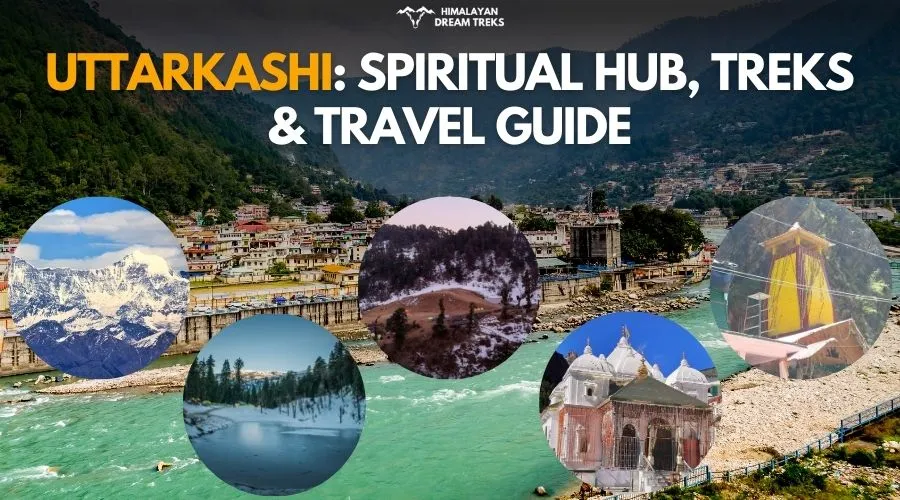
Uttarkashi is not just another hill district; it is the northern Kashi, a rare place where a jyotirlinga tradition, two Char Dham shrines and serious Himalayan mountaineering culture sit inside one administrative district of Uttarakhand. Most of the district lies along the central Garhwal Himalayas. It is one of the 13 districts of Uttarakhand and also its second largest by area, spread over roughly 7,950 to 8,016 sq km in the north‑west corner of the state, touching the Tibet border, Kinnaur and Shimla on one side and opening towards Tehri, Rudraprayag, Chamoli and Dehradun.
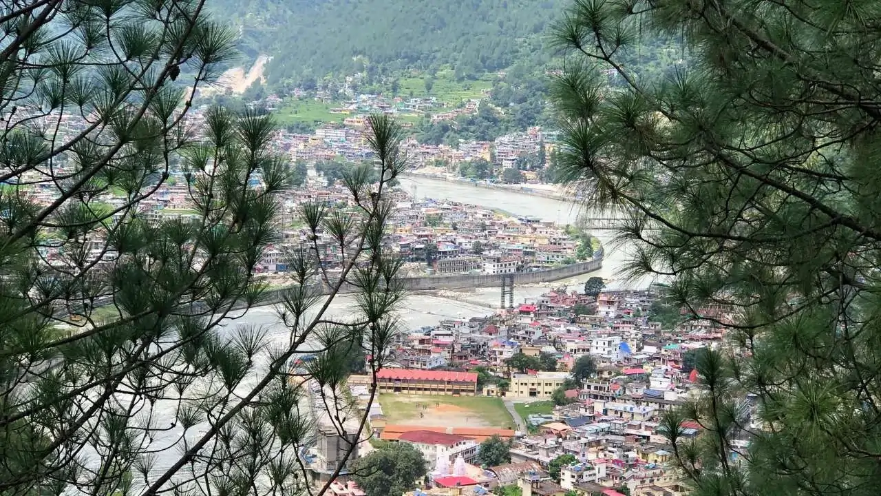
Table of Contents
Why is Uttarkashi Special?
Spend a few mornings in Uttarkashi town and the place starts to reveal its layers. The first is obvious, the ghats on the Bhagirathi, the aartis, the long line of pilgrims passing through for Gangotri and Yamunotri. But look closer and another Uttarkashi appears: homestays full of trekkers drying their shoes, small gear shops, porters discussing routes to Dayara Bugyal or Gaumukh Tapovan over chai, and local drivers casually talking about Auden’s Col as if it’s the neighbourhood pass.
What makes Uttarkashi special is the mix of three things that rarely come together in one valley:
- A continuous pilgrimage corridor (Kashi Vishwanath – Gangotri – Gaumukh – Tapovan – Yamunotri) that locals treat as one living kshetra, not separate “sights”.
- A densecluster of 6,000-7,000 m peaks, technical glacier passes and historic expedition routes that gave many Indian climbers their first serious Himalayan experience.
- Everyday village life that still runs on devta oracles, bugyal grazing cycles and river‑based festivals, so a visitor can move in one day from temple bells to rope‑coiling sessions for a glacier crossing and end the evening at a small ghat aarti on the Bhagirathi.
Historical Significance
Uttarkashi’s historical significance as a travel and pilgrimage centre grows out of its position on the ancient routes to Gangotri and Yamunotri, where streams of pilgrims, traders and wandering ascetics have passed for centuries along the Bhagirathi valley. Old references to settlements in this Himalayan belt, traditional markets, and temple inscriptions point to a living landscape where religious journeys, seasonal migration of shepherds and small-scale trade all layered over each other, turning the valley into a natural stopping point rather than an isolated outpost. Over time, village temples, local devta traditions and fairs created a cultural web that drew people from neighbouring regions for darshan, barter and festivals, giving Uttarkashi a reputation as a spiritually charged yet accessible mountain space.
Uttarkashi’s historic role grew from its position on the old trans‑Himalayan routes that linked the plains to the Bhagirathi valley, the passes above Harsil and further towards Tibet. Markets like Uttarkashi town and Harsil functioned as seasonal halts for pilgrims, traders carrying salt and wool, and shepherds migrating with their flocks, which is why the district feels like a long corridor rather than an isolated valley.
Locally, old texts and oral traditions refer to this broader belt as Somyakashi or Somya Kashi, the “gentle” or “calm” Kashi in the north, mirroring the spiritual magnet of Varanasi in the plains. When India’s frontier hardened after Independence and eventually during the 1962 India-China war, these same valleys, especially the upper Bhagirathi, Nelong Valley and Jadh Ganga side towards the border, shifted from soft trade and pilgrimage routes to strategic zones, leaving behind small army posts, restricted areas and a different awareness among locals about the line that now separates Uttarkashi from Tibet.
Religious Significance
Uttarkashi is understood locally as a kshetra, a sacred field, where multiple deities share the same landscape rather than compete for attention. The idea of “Devbhoomi Uttarakhand” becomes very concrete here because shrines, stones, village temples and glacier sources all feed into a single imagination: Shiva as Kashi Vishwanath, the Ganga as Bhagirathi, the Yamuna at Yamunotri, and dozens of village devtas carried in palanquins from one fair to another.
Kashi Vishwnath
Kashi Vishwanath Temple in Uttarkashi is seen as the uttar (northern) counterpart of the famous Vishwanath jyotirlinga at Varanasi, which is why many locals simply call the town “Uttarkashi” – the northern Kashi. Varanasi is the classic southern/central seat of Shiva on the Ganga; Uttarkashi balances that axis in the Himalaya, at about 1,150-1,200 m on the Bhagirathi, where travellers link their Char Dham journey with the idea of bowing first (or last) at Shiva’s northern Kashi.
Significance: Uttarkashi, literally meaning “Kashi of the North” (Uttara-Kashi), derives its name from the Vishwanath Temple dedicated to Lord Shiva, positioned as the Himalayan counterpart to Varanasi’s iconic Kashi Vishwanath Jyotirlinga. Located at 1,150-1,200 meters on the Bhagirathi’s banks adjacent to Varun Parvat and featuring a Manikarnika Ghat, the town mirrors Varanasi’s sacred geography, complete with Asi and Varuna river confluences. Historical records, including 5th-century CE temple inscriptions and Xuanzang’s 7th-century reference to it as Brahmapura (a queens-ruled capital), affirm its ancient spiritual stature as Saumya Kashi or northern Shiva seat, where Parashurama performed penance.
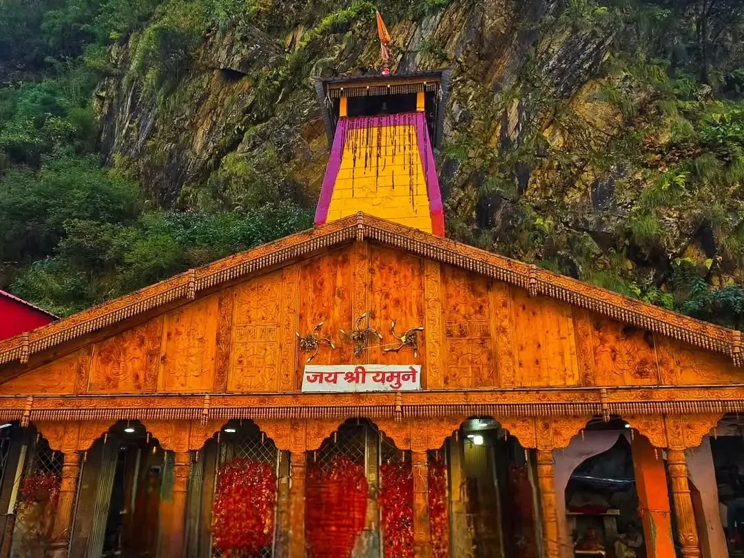
Yamunotri
Yamunotri Dham sits in the upper valley at roughly 3,200-3,300 m, approached by a road from Uttarkashi-Barkot side to Janki Chatti and then a steep, paved 5-6 km climb on foot, pony or palki. The glacier that actually feeds the Yamuna lies higher in the Bandarpunch massif, but for most devotees the hot springs, small temple courtyard and the last steep zigzags of the trail are where the river is born in their lived experience.
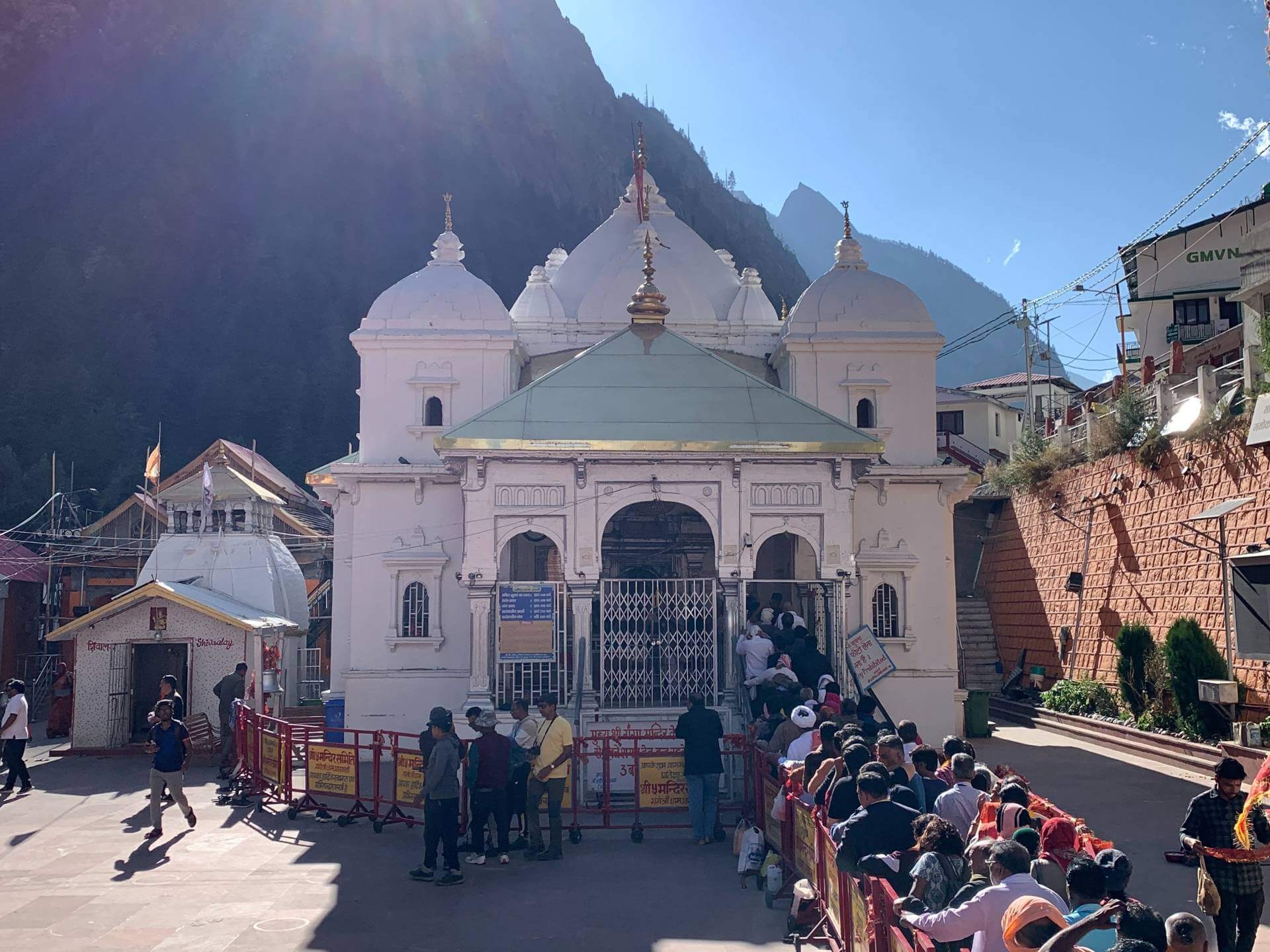
Gangotri
Gangotri Dham stands at about 3,400 m in a narrow valley, with Bhagirathi water thundering past the temple steps and snow peaks closing the horizon on three sides. From here the foot trail runs roughly 18-19 km to Gaumukh and then another 4-5 km up to Tapovan around 4,300-4,400 m, turning a simple temple visit into a layered journey that touches both the mythic origin of the Ganga and the physical snout of the Gangotri glacier.
Local Dieties
Beyond the main dhams and jyotirlinga, Uttarkashi breathes through its local devta traditions. These are not “minor” deities; in village life they are often more immediate than any distant shrine.
- Kandar Devta: Often associated with protection and justice, Kandar Devta’s temples and dolis (palanquins) come alive during fairs and village rituals, where the deity is believed to give oracles through chosen mediums.
- Someshwar Devta: Linked with Shiva but rooted in local lore, Someshwar’s worship blends the wider Shaivite tradition with village customs, animal bells, folk drums and seasonal offerings.
- Raj Rajeshwari: Seen as a powerful form of the Goddess, Raj Rajeshwari is invoked for household wellbeing and protection; her shrines may be modest but they are emotionally central for many local families.
- Nagini Mata: Serpent-associated goddesses like Nagini Mata hold an important place in these hills, tied to water sources, fields and protection from disease, and their hilltop shrines quietly watch over terraced fields.
- Kuteti Devi: Perched on a hill near Uttarkashi, the Kuteti Devi Temple is both a devotional and a scenic spot, giving wide views of the Bhagirathi valley and an intimate connection to a fiercely protective goddess.
Geographical Advantage of Uttarkashi
The district stretches from about 1,150 m in Uttarkashi town to over 7,000 m on its high ridges, giving it a dramatic vertical spread inside a single administrative unit. To the north and north‑east it leans against the Indo‑Tibet border; to the south and south‑west it is framed by Tehri Garhwal and Dehradun, and to the south‑east by Chamoli and Rudraprayag, which means major river systems and mountain chains all pass through or originate here before flowing out to the rest of Uttarakhand and India.
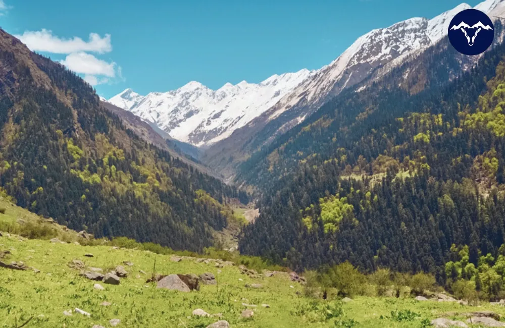
For trekkers and mountaineers this geography translates into an unusual density of terrain types: oak and pine forests around 1,500 to 2,400 m, big open bugyals usually between 3,000 to 4,000 m, and glacier basins and high passes above 4,500 m, many of them reachable using Uttarkashi town as the main staging point.
Mountain Ranges
The main ranges that matter to a traveller in Uttarkashi are not just names on a map; they decide where the rivers rise, where the meadows sit and how hard a trek will feel on your legs. Below is a tightened, trek‑oriented way of reading them:

- Bandarpunch Range: West of the Bhagirathi, throwing long spurs towards Yamunotri, Har Ki Dun, Kedarkantha and Dayara Bugyal; key peaks includeBandarpunch (about 6,316 m) and Kalanag/Black Peak (about 6,387 m), both snow domes that feed the Yamuna system.
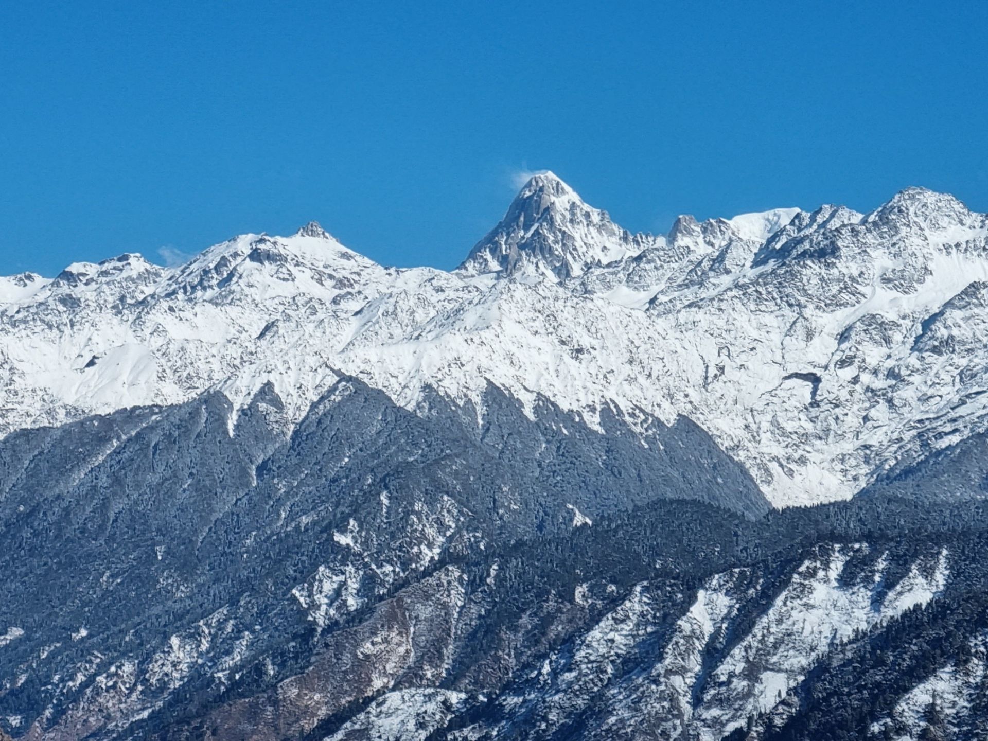
- Gangotri Range: East and north‑east of Uttarkashi town and Gangotri Dham, crowned by Chaukhamba I (about 7,138 m) and a ring of 6,000+ m peaks such as Shivling, Thalay Sagar, Meru and Bhagirathi I-III, whose glaciers pour into the Bhagirathi.
- Inner High Himalaya Belt: The more remote string of summits like Janhukut and Satopanth that rise around 7,000 m and tie Uttarkashi visually and hydrologically to the Alaknanda basin, even if access often uses approaches from Chamoli side.
High Mountain Peaks in Uttarkashi
Here is a list of some of the marquee 6,000-7,000 m peaks that dominate the Uttarkashi skyline; the “challenge level” is from a trekker’s perspective, not a professional climber’s grading.
| Peak | Approx. height & character | Base village/area | Challenge level (trekker view) |
| Satopanth | ~7,075 m, big ice pyramid, classic high Garhwal | Often approached from Gangotri side | Expedition‑only, technical high‑altitude climbing |
| Meru | 6,600+ m, famous for near‑vertical faces | Gangotri – Bhojbasa – Tapovan belt | For armchair mountaineers; purely technical objective |
| Chaukhamba I | 7,138 m, four‑pillared massif dominating Garhwal | High valleys around Gangotri-Kedarnath divide | Major expedition peak, not a trekking summit |
| Thalay Sagar | 6,904 m, steep rock and ice tower | Above Gangotri/Kedar Ganga valley | Technical climbs only, iconic skyline peak |
| Shivling | 6,543 m, striking double‑summit pyramid above Tapovan | Tapovan from Gangotri | Visual highlight of Gaumukh-Tapovan trek, technical to climb |
| Sri Kailash | 6,900+ m class peak linked in name to Kailash lore | In the wider Gangotri catchment | Remote, expedition‑level objective |
| Janhukut | ~6,800-6,900 m class high peak | Inner upper Ganga basin | Serious expedition peak, rarely seen except on long traverses |
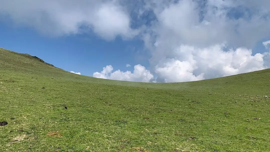
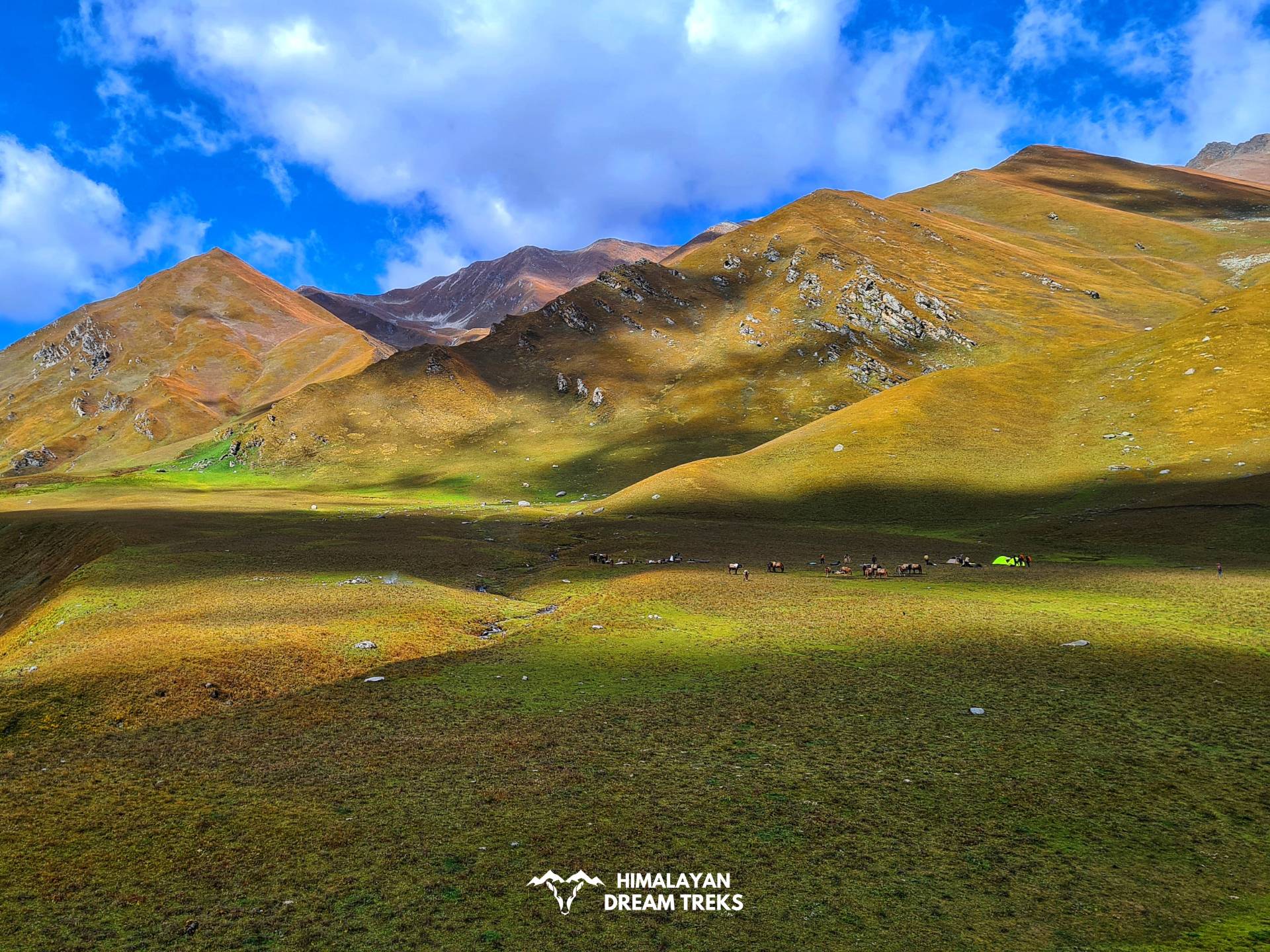
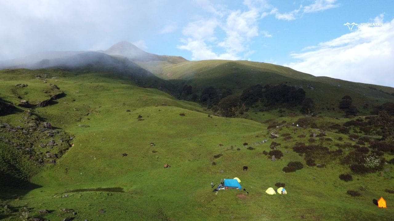
Bugyals
In Uttarkashi, “bugyal” is not just a tourism brochure word; it’s how shepherds talk about their summer grazing slopes and how locals remember journeys behind flocks of sheep and goats. These high-altitude meadows, usually between 3,000 to 4,000 m, turn into snowfields in winter and carpets of wildflowers and soft grass in late spring and monsoon, making them perfect for easy Himalayan treks and family treks in Uttarakhand.
Most bugyals here sit roughly between 3,000 to 4,000 m, which is high enough for snow in winter but still reachable on 2 to 5 day walks from the nearest roadhead, making them perfect for someone’s first real Himalayan trek.
- Dayara Bugyal:
- Height: meadow around 3,400 to 3,700 m; Dayara Top about 3,700 m/12,000 ft.
- Approx trek distance: 14 to 22 km round trip depending on route (Raithal/Natin/Barsu to Dayara Top and back).
- Gidara Bugyal:
- Height: roughly 3,700 to 4,000 m on long, high ridges above the Bhagirathi and Yamuna valleys.
- Approx trek distance: usually 30+ km over 5 to 7 days because of its remoteness and multi‑day ridge walks.
- Chainsheel Bugyal:
- Height: about 3,500 to 3,800 m near the border regions of Uttarkashi.
- Approx trek distance: 25 to 35 km over 4 to 6 days, depending on the exact start and exit points.
- Gulabi Kantha Bugyal:
- Height: roughly 3,700 to 3,800 m.
- Approx trek distance: usually 12 to 18 km over 3 to 4 days from the nearest roadhead.
- Kush Kalyan Bugyal:
- Height: around 3,500 to 3,800 m on the old routes between Bhagirathi valley and Kedarnath side.
- Approx trek distance: 30+ km over 5 to 6 days if you do a proper traverse.
Passes

| Pass | Detail |
| Bali Pass | High pass linking Har Ki Dun side to Yamunotri region; total distance roughly 60-70 km, pass height around 4,900-5,000 m. |
| Kalindi Khal Pass | High-altitude glacial pass (5,947 m/19,511 ft) connecting Gangotri (3,100 m) to Badrinath via Vasuki Tal (4,800 m), 99-122 km total over 12-15 days with Nandanvan (4,400 m), Kalindi Base (5,590 m), and Arwatal (3,980 m) camps. Features 40-degree ice walls, 12+ crevasses requiring rope teams, and Vasuki Parbat (5,917 m) views. |
| Rupin Pass Trek | Dramatic east-west crossing (4,650 m/15,250 ft) from Dhaula (1,580 m) to Sangla via Rupin waterfalls and hanging valley, 52 km over 7-8 days through Dhanderas Thatch (4,657 m). Includes 5 river crossings, 3 hanging valleys with 300 m drops, and Kinnaur Kailash views; shepherd lore identifies 7 unmarked alpine meadows supporting 150 sheep flocks annually. |
| Darwa Pass | Steep alpine pass (4,100 m/13,450 ft) extension from Dodital Lake (3,029 m) via Manjhi (2,400 m), 40 km round trip over 5-6 days with 1,500 m ascent. |
| Borasu Pass | Ancient trade pass (5,450 m/17,880 ft) linking Sankri (1,920 m) in Tons Valley to Chitkul (3,450 m) in Baspa Valley, 64 km over 7-8 days through alpine meadows and moraines. Divides Uttarakhand-Himachal border with 8 hanging glaciers. |
| Muling La Pass | Border proximity pass (5,669 m/18,600 ft) from Harsil (2,745 m) via Neelapani (59 km drive), 44 km round trip over 7 days through Nallah-1/2 camps near Indo-China frontier. |
| Auden’s Col Pass | Long, high and committing; overall foot distance can easily cross 70-80 km including approaches and exits, with the pass itself near 5,490-5,500 m, making it a full expedition‑style project rather than a trek. |
Rivers
One way to understand Uttarkashi is to follow the water. Rivers here are not just geographical features; they are axes along which towns, villages, pilgrimages and treks all line up, making this district central to the Ganga river system and Himalayan watershed.
Bhagirathi
The Bhagirathi rises at Gaumukh, the snout of the Gangotri glacier, at about 4,000 m in Gangotri National Park and runs 200‑odd km before meeting the Alaknanda at Devprayag to form the Ganga. Uttarkashi town, many of its villages and most of its ghats sit on or above this river, which is why evening light on the Bhagirathi, with bells from several small temples carrying across, tends to be the strongest memory many visitors take back.
Yamuna
The Yamuna’s temple at Yamunotri marks the sacred start of the river at around 3,200 to 3,300 m, but the actual snow and ice that feed it lie in the Bandarpunch massif above 6,000 m. Only the earliest part of the river’s journey – hot springs, steep gorge, first shrines; falls inside Uttarkashi; after that the Yamuna quickly leaves the district on her long run to the plains and finally to Prayagraj.
Main Tributaries in and around Uttarkashi/Tehri belt
- Rudra Ganga/Rudraganga: A mountain stream system in the upper Gangotri region that joins the Bhagirathi after flowing through steep, rocky valleys known to local shepherds and select trekkers; often identified with the Rudragaira side valley used on approaches towards high passes like Auden’s Col.
- Jahnvi Ganga (Jadh Ganga): Associated with side valleys in the upper Bhagirathi belt (Nelong Valley) and remembered in local lore as one of the fierce, narrow mountain streams that swell rapidly in monsoon, feeding into the main river system before Tehri.
- Assi Ganga: Originates directly from Dodital Lake (3,029 m elevation, 11 km northeast of Uttarkashi) as its primary outflow, flowing 45 km westward through dense deodar forests and narrow gorges before merging with Bhagirathi near Uttarkashi town at 1,150 m. Known locally as Ganesha’s stream carrying Dodital’s sacred waters to main Ganga system; features 7 seasonal waterfalls visible only post-monsoon, with 3 bridges linking Maneri side villages used by 200+ shepherd families annually.
- Kedar Ganga: Emerges from Kedar Tal glacial lake (4,750 m) draining Kedargaira Glacier meltwaters, cascading 15 km north through dramatic 1,200 m deep gorge flanked by Thalay Sagar (6,904 m) and Jogin peaks before joining Bhagirathi at Gangotri village (3,100 m). Forms Gangotri’s southern boundary with Rudragaira Valley; locals identify 5 unnamed hot springs along banks used for ritual dips during Shivratri, with gorge walls hosting rare blue poppy blooms seen only in June.
- Bhilangna River: Longest Bhagirathi tributary (80-90 km) rising from Khatling Glacier (3,717 m) in Tehri Garhwal, flowing north through Phata and Ghansali (976 m) with Bal Ganga joining at Ghansali before confluence at Old Tehri Dam site (742 m). Forms Tehri reservoir’s eastern arm submerging 42 villages; features 18 hanging valleys with 6 seasonal bridges used by 500+ transhumant families, carrying 25% of Tehri Dam’s inflow volume during monsoon.
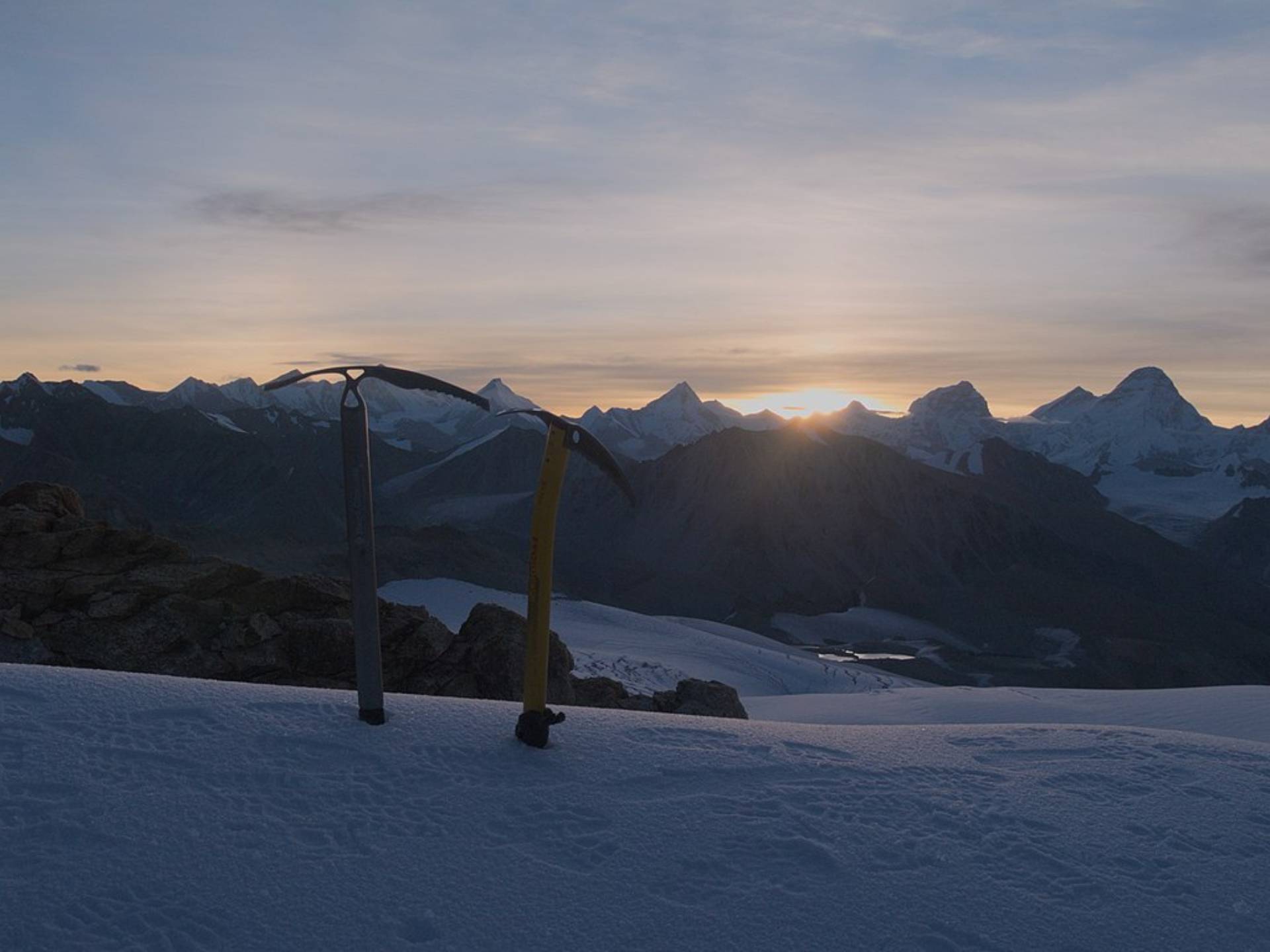
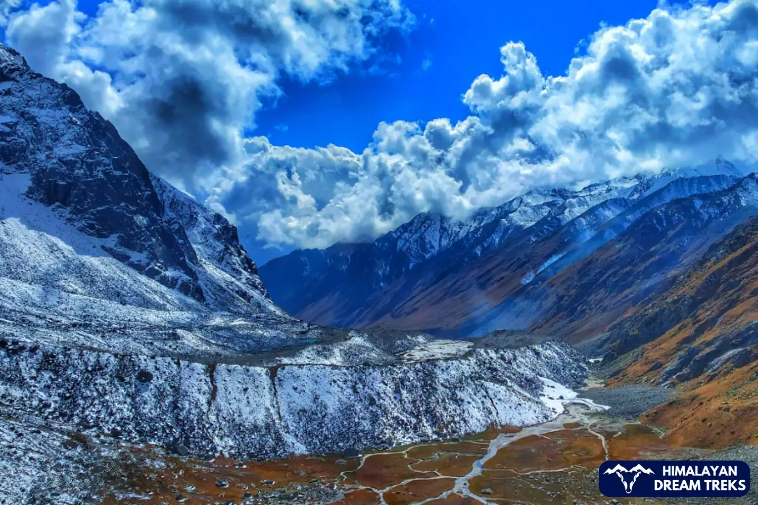
Glaciers
When people say “source of the Ganga”, what they are really talking about is the complex glacial system around Gangotri. Uttarkashi holds a large part of this icy architecture within its high valleys, making it a crucial region for glacier treks in Uttarakhand and for India’s water security.
The Gangotri Glacier, about 30 km long and several kilometres wide, flows down from a cirque below Chaukhamba and is surrounded by peaks like Shivling, Thalay Sagar, Meru and Bhagirathi III. Its snout at Gaumukh, resembling a cow’s mouth, is the classic pilgrimage-cum-trekking destination where many visitors get their first close look at a real Himalayan glacier.
Feeding into this main glacier are several tributary glaciers within what is now protected as Gangotri National Park. Major contributing systems include Chaturangi, Raktavarna and Kirti glaciers, along with many smaller “bamak” glaciers, all adding ice and meltwater to the Bhagirathi. This network makes Uttarkashi a natural classroom for understanding climate change in the Himalayas and the fragility of Himalayan ecosystems.
Uttarkashi holds a big piece of the Ganga’s “ice architecture”, especially inside Gangotri National Park, which sprawls over roughly 1,550 to 2,390 sq km depending on which boundary definition you use. Elevations inside the park range from about 1,800 m to over 7,000 m, and most of that height is taken up by glacier basins, icefalls, snowfields and the peaks that guard them.
| Approx. length/size | Main streams formed/fed | Main streams formed / fed | Key surrounding peaks and notes |
| Gangotri Glacier | ~30 km long, several km wide at places | Bhagirathi at Gaumukh (about 4,000 m) | Chaukhamba massif, Shivling, Thalay Sagar, Meru, Bhagirathi I-III |
| Chaturangi Glacier | Multi‑branched tributary system feeding into Gangotri | Joins Gangotri from the south‑east, adding volume to Bhagirathi headwaters | High 6,000-7,000 m peaks on the inner Gangotri ring, including parts of Satopanth-Chaukhamba complex |
| Raktavarna Glacier | Medium‑sized tributary glacier with reddish rock bands visible in places | Feeds the Gangotri system and, through it, the Bhagirathi | In the Gangotri basin under unnamed but sharp 6,000 m peaks that frame the side valleys |
| Kirti Bamak | Tributary glacier flowing from flanks of peaks associated with Sri Kailash and neighbouring summits | Adds ice and meltwater into the upper Bhagirathi catchment | Ringed by remote 6,000 m‑plus peaks that see more expeditions than casual trekkers |
| Nearby glacier clusters | Several smaller “bamak” glaciers hanging off the main walls. Maiandi Bamak, Swachhand Bamak, Nila Pani Bamak, Surli Bamak, Tara Bamak, Arwa Glacier, Bhagirath Kharak Glacier, Siyan Bamak, Dhumdar Bamak, Ratiya Bamak | Seasonal streams that either plunge directly into Gangotri or join its side streams | Provide the broken moraine and ice formations |
Most of these glaciers lie fully or largely inside Gangotri National Park; trekking to Gaumukh Tapovan is effectively walking along the lower tongue of one of India’s most important glacier systems.
Treks
Uttarkashi’s treks naturally fall into three bands: bugyal treks (2,000-4,000 m), lake and valley treks (up to ~4,200 m), and glacier/high‑pass treks that push 4,500-5,900 m.
| Easy | Moderate | Difficult |
| Dharali-Lamb Tal/Harsil valley trails | Gaumukh Tapovan | Kedar Tal |
| Dayara Bugyal | Har Ki Dun – Ruinsara Tal | Shastra Tal |
| Gulabi Kantha | Kush Kalyan | |
| Dodital | Surya Top | |
| Kedarkantha |
Tourism in Uttarkashi
Tourism in Uttarkashi stands on two strong legs: trekking and mountaineering and pilgrimage and spiritual tourism. Over time, a third leg, quiet, long-stay hill breaks and homestays, has also begun to grow, attracting travellers looking for a slow travel experience in the Himalayas. Uttarkashi district has several important base points for trekking, with many popular places like treks starting from places like Gangotri and Sankri.
Famous Treks
Famous Expeditions
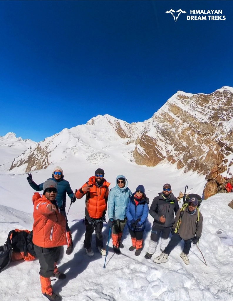
For climbers and high-pass enthusiasts, Uttarkashi is almost a rite of passage. Some of the better-known expedition routes and objectives connected to the district are:
| Expedition | Highlights |
| Auden’s Col | A high, glaciated pass considered one of the tougher crossings in Garhwal, suitable only for experienced teams. |
| Kalindi Khal | A long, committing high-altitude traverse connecting Gangotri to the Alaknanda side through glaciers and high passes. |
| Bhagirathi Peaks (I, II, III) | A dramatic trio rising above the Gangotri glacier, they remain technical snow and rock peaks where route‑finding, mixed climbing and weather all demand serious experience. |
| Meru (“Shark’s Fin”) | Known globally for its near‑impossible central buttress, attempts and eventual success on Meru’s steep faces are part of modern Himalayan climbing folklore. |
| Satopanth Peak | High 7,000 m‑class pyramid in the broader Gangotri-Alaknanda complex, long considered a stepping stone for teams looking at 8,000ers because of its altitude, length of approach and exposure to Himalayan weather. |
| Black Peak (Kalanag) | One of the prominent summits of the Bandarpunch group, approached from Sankri side; used by Indian climbers as an early big summit target before tackling higher expeditions. |
| Bandarpunch | Prominent snow dome (main peak 6,316 m, Bandarpunch II 6,102 m) in the Bandarpunch massif feeding Yamuna system. Located in Govind Pashu Vihar National Park with 17-20 day expeditions from Sankri involving crevasse-heavy glacier approaches, crampons, ice axe, and fixed ropes; ideal pre-7,000m training. |
| Swargrohini | Dramatic massif (Swargrohini I 6,252 m) in Bandarpunch range with 2,000 m north face drop. |
| Gangotri Peaks | Technical trio (Gangotri I 6,684 m, II 6,590 m, III 6,680 m) above Gangotri Glacier in Gangotri National Park, classic pre-Everest training objectives with multi-camp (ABC 5,050 m, C1 5,500 m, Summit Camp 5,900 m) 15-23 day expeditions involving 70-degree ice slopes, crevasses, and fixed ropes from Gangotri base. Summit views encompass Shivling, Meru, and Chaukhamba; requires prior high-altitude experience. |
| Sudarshan Parvat | Sharp 6,507-6,529 m summit (456 m prominence) in Gangotri area, 87th highest in Uttarakhand. Technical Garhwal expedition peak with steep ice/rock routes, long approaches via Gangotri Glacier, and exposure to monsoon crevasses; offers panoramic 6,000+ m ring views including Satopanth. |
National Parks
Two major protected areas shape the ecological map around Uttarkashi and influence its trekking and travel circuits, making the district important for wildlife tourism in Uttarakhand as well.
Gangotri National Park

Gangotri National Park is the largest protected area among the national parks in Uttarakhand, spread over roughly 1,553-2,390 sq km in the upper Bhagirathi catchment, with elevations from about 1,800 m to over 7,000 m. To the north and north‑east its ridges lean against the Indo‑Tibet border; to other sides it connects with belts that touch Chamoli (Kedarnath Wildlife Sanctuary side) and the Govind National Park landscape, turning it into a big, continuous block of high‑altitude habitat rather than an isolated “island”.
Key peaks inside or on the park’s rim include Satopanth (7,075 m), Kedarnath Dome (6,831 m), Bhrigupanth (6,772 m), Kharchakund (6,623 m), Shivling (6,543 m), Jogin I (6,465 m) and several Bhagirathi peaks, all of which feed glaciers like Gangotri, Chaturangi, Raktavarna and Kirti. Treks such as Gaumukh-Tapovan and the Gangotri approaches for passes like Kalindi Khal all either pass through or brush this park, which is why permits and minimum‑impact practices are taken seriously here.
Govind Pashu Vihar
Govind Pashu Vihar sits to the north‑west of Uttarkashi district, physically connected through the Sankri-Netwar gateway used by walkers heading to Har Ki Dun, Ruinsara Tal and Bali Pass. The protected area itself extends into Uttarkashi’s neighbouring region but, in practical terms, Sankri and nearby villages function as the common base for both Uttarkashi treks and Govind Pashu Vihar trails, binding them into one mountain travel circuit.
Within this sanctuary-park complex live high‑altitude species such as Himalayan tahr, musk deer and higher up and more secretly the snow leopard, while ridges and side valleys hold meadows and passes that local shepherds have used long before they became trekking routes.
Festivals
- Butter Holi (Makhan Holi): Typically in August, when shepherds and villagers gather on meadows like Dayara Bugyal to celebrate with buttermilk and butter instead of gulal.
- Selku Mela: Held in specific villages of the Rawain-Uttarkashi belt (Selku area), usually once a year around the agricultural cycle, with dates fixed by local devta committees rather than a pan‑Indian calendar.
- Ganga Dushehra: When: Usually in May-June (Jyeshtha Shukla Dashami), marking the mythic descent of the Ganga; in 2026 it will be celebrated on May 25.
- Mahashu Devta Fair: Mahasu/Mahashu Devta traditions are strongest in parts of western Garhwal and spill into pockets of Uttarkashi, with fairs in villages linked to this devta; Masu/Mahasu Devta temples often sit slightly above the main village, reached by a short, steep walk.
- Magh Mela: Held annually on the Bhagirathi River ghats in Uttarkashi town, primarily at the main bathing ghat near Kashi Vishwanath Temple and extending to Vishwanath Ghat and Nehru Ghat.
How to Reach Uttarkashi?
By Road
Most travellers approach Uttarkashi via Dehradun or Rishikesh, which are well connected from Delhi and other major cities by bus, train and air. From Dehradun, regular Uttarakhand Transport Corporation buses start early in the morning for Uttarkashi.
If you are starting from Rishikesh or Haridwar, you can either get a direct bus in the yatra season or break your journey at places like Chamba/Tehri and continue in local transport.
By Air
The nearest airport is Jolly Grant Airport, Dehradun. From your home city, you can:
- Fly directly to Dehradun (if flights are available from your city) and then take a bus, taxi or shared jeep to Uttarkashi.
- Or fly to Delhi and then take an overnight or early morning bus/train to Dehradun, followed by the road journey to Uttarkashi.
By Train
The closest major railway station is Dehradun Railway Station, well connected with cities like Delhi, Kolkata and others by regular trains. Once you arrive at Dehradun, you can move to the bus stand or shared taxi points and continue up to Uttarkashi by road.
Helicopter, Fastest Way
For those short on time or wanting to experience the hills from the air, a helicopter service to Uttarkashi operates seasonally under regional connectivity schemes. Typically, flights run between the Sahastradhara helipad in Dehradun and a helipad near Joshiyara close to Uttarkashi, covering the distance in roughly half an hour.
Self‑drive and Rentals
If you enjoy driving in the hills, you can bring your own car or bike or hire one at Dehradun. The common route runs Dehradun, Mussoorie, Suwakholi, Chinyalisaur, Uttarkashi, with good stretches of road interspersed with typical hill bends.
Best Time to Visit
- For Char Dham Yatra and pilgrimage: The main season runs roughly from late April/May to October, depending on temple opening and closing dates, with peak rush in May-June and again around September-October holidays.
- For meadows and moderate treks: Late April to June and September to early November are ideal, when trails are mostly open and views are clearer, though the monsoon brings lush greenery in July-August along with increased rain and landslide risk.
- For snow treks in Uttarkashi (Dayara, Kedarkantha, etc.), December to February offer snow conditions on higher trails, though actual snowfall and temperatures vary each year and demand proper winter gear and planning.
- For expeditions: May, June, September and October.
Uttarkashi Weather
UTTARKASHI WEATHERUttarkashi, Uttarakhand: A Wrap Up
Uttarkashi is not a place to be “done” in two days; it is a landscape that rewards slowness and repeat visits. Whether you come here for Gangotri and Yamunotri, for Dayara Bugyal or Gaumukh Tapovan, for ambitious Himalayan expeditions or just a quiet week in the hills with a notebook and a view, Uttarkashi has a way of stitching all these motives together into one continuous journey. Many visitors leave with the feeling that they will be back, not because they missed “sights”, but because Uttarkashi itself feels like an unfinished conversation with the Himalayas.
Leave a Comment