
Snowfall in the Himalayas is not just a seasonal attraction; it is a natural system that supports glaciers, rivers, farming, tourism and life far beyond the mountains. But for yet another winter, the Himalayas are witnessing something unusual.
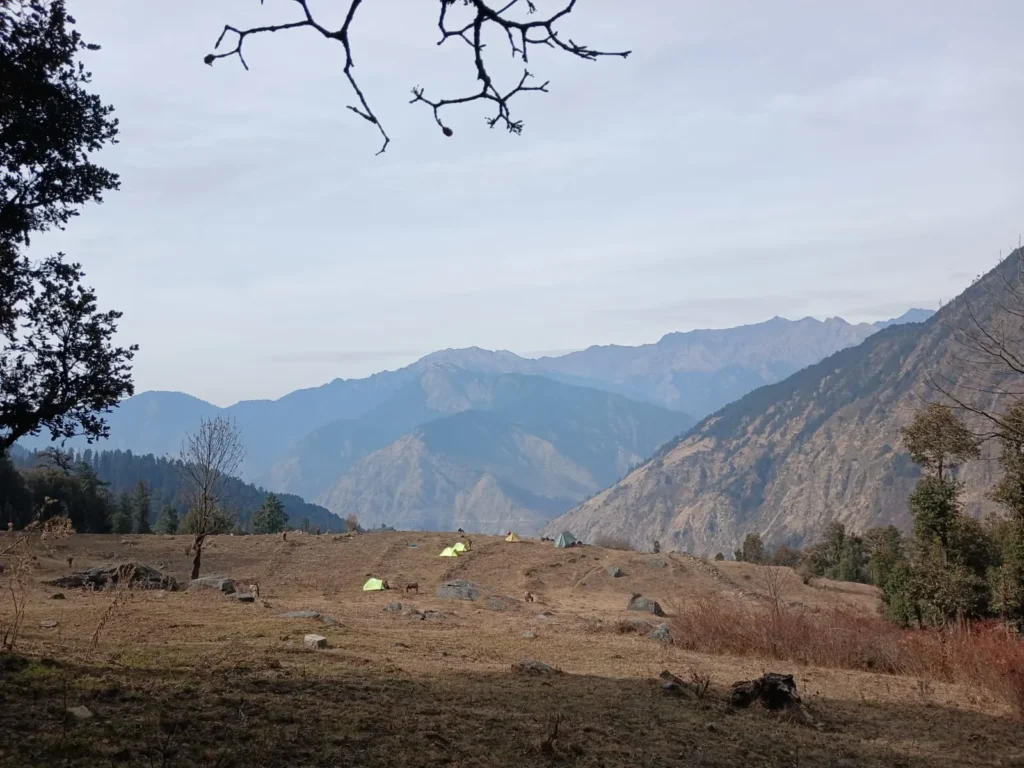
As of mid to late December 2025, large parts of the Himalayan region, including Ladakh, Jammu & Kashmir, Himachal Pradesh, and Uttarakhand, have received below-normal or delayed snowfall. Even regions that usually turn white by December are still experiencing dry slopes, patchy snow or rain instead of snowfall.
Last year, snowfall arrived late, mostly after Christmas. This year, the delay has extended even further, raising concerns among locals, farmers, trekkers, scientists and policymakers alike.
Why is snowfall late in the Himalayas this year, once again?
To understand the answer, we must first understand how snowfall happens in the Himalayas and what has changed in recent years.
The Himalayan mountain range acts as a massive climatic wall between Central Asia and the Indian subcontinent. In India, the Western Himalayas covering Jammu & Kashmir, Himachal Pradesh, and Uttarakhand, receive most of their winter snowfall.
Unlike the monsoon, which brings rain from the Indian Ocean, winter snowfall in the Himalayas depends on a completely different weather system known as Western Disturbance.
This system is the backbone of winter precipitation in North India.
The Role of Western Disturbance

Snowfall in the Western Himalayas mainly occurs due to Western Disturbances (WDs) weather systems that originate over the Mediterranean Sea, Black Sea, and Caspian Sea.
During winter:
- These regions develop high atmospheric pressure
- India experiences lower pressure
- Cold, moisture-laden winds move eastward toward the Indian subcontinent
As these winds travel across West Asia, Iran, Afghanistan and Pakistan, they gather moisture. When they finally reach the Himalayas, the mountains block their path, forcing the air to rise and cool resulting in rain in the plains and snowfall in higher altitudes.
Because of this mechanism:
Kashmir usually receives snowfall first, followed by Himachal Pradesh and Uttarakhand. Occasionally, Nepal and parts of Northeast India are also affected
Let’s understand why snowfall is late in the Himalayas in 2025
This winter, snowfall was significantly delayed over large parts of the Western Himalayas:
In places like Himachal Pradesh and Uttarakhand, snowfall was much below normal until late December. In fact, weather departments expected no snow in Himachal until at least December 27, meaning no “White Christmas” for many tourists.
Even in Uttarakhand’s Auli, a major skiing destination, snow was scant by late December. Temperatures weren’t low enough for snowmaking machines to work, hurting tourism bookings
Weak and Infrequent Western Disturbances
The primary reason for late snowfall in 2025 is the lack of strong Western Disturbances. Normally, between December and March, India experiences:
- Around 4 to 6 major Western Disturbances
- Almost one strong system every month
However, this winter:
- Most disturbances have been weak
- Several systems diverted northwards
- Many lost moisture before reaching the Himalayas
As a result:
- Snowfall events were short-lived
- Accumulation remained low
- Many regions received rain instead of snow
Even Kashmir, which typically records early snowfall, has seen below-average snow cover, indicating that the issue is widespread and not limited to a single state.
Climate Change and Warmer Winters
Rising global temperatures are increasing winter temperatures in mountain regions are raising the snowline altitude, causing precipitation to fall as rain instead of snow
Recent climate studies show that snow persistence, the number of days snow remains on the ground, has reached a multi-decade low across the Himalayan region. This means that even when snowfall occurs, it melts faster than before.
Warmer winters are also affecting:
- The formation of Western Disturbances
- Their moisture-carrying capacity
- Their timing and intensity
Shifting Jet Stream Patterns
Another major factor is the Subtropical Westerly Jet Stream, which guides Western Disturbances toward India.
In recent years, the jet stream has weakened or shifted, weather systems are being pushed away from the Indian subcontinent and disturbances are losing strength before landfall.
This invisible but powerful atmospheric change plays a crucial role in delayed and reduced snowfall across the Himalayas.
Current Weather & Snowfall Situation (Dec 2025)
Northern India is experiencing continued cold with dense fog, especially in Punjab, Haryana, and Himachal Pradesh, limiting visibility and travel conditions. Meanwhile, snowfall is expected in the Himalayan regions as Western Disturbances approach later this week. Reports note snow in parts of the Himalayas and widespread dense fog in the plains affecting holiday travel.
The India Meteorological Department (IMD) forecasts Western Disturbances, dense fog, and cold waves through late December, with travel advisories in effect.
Recent Snowfall Patterns (2025)
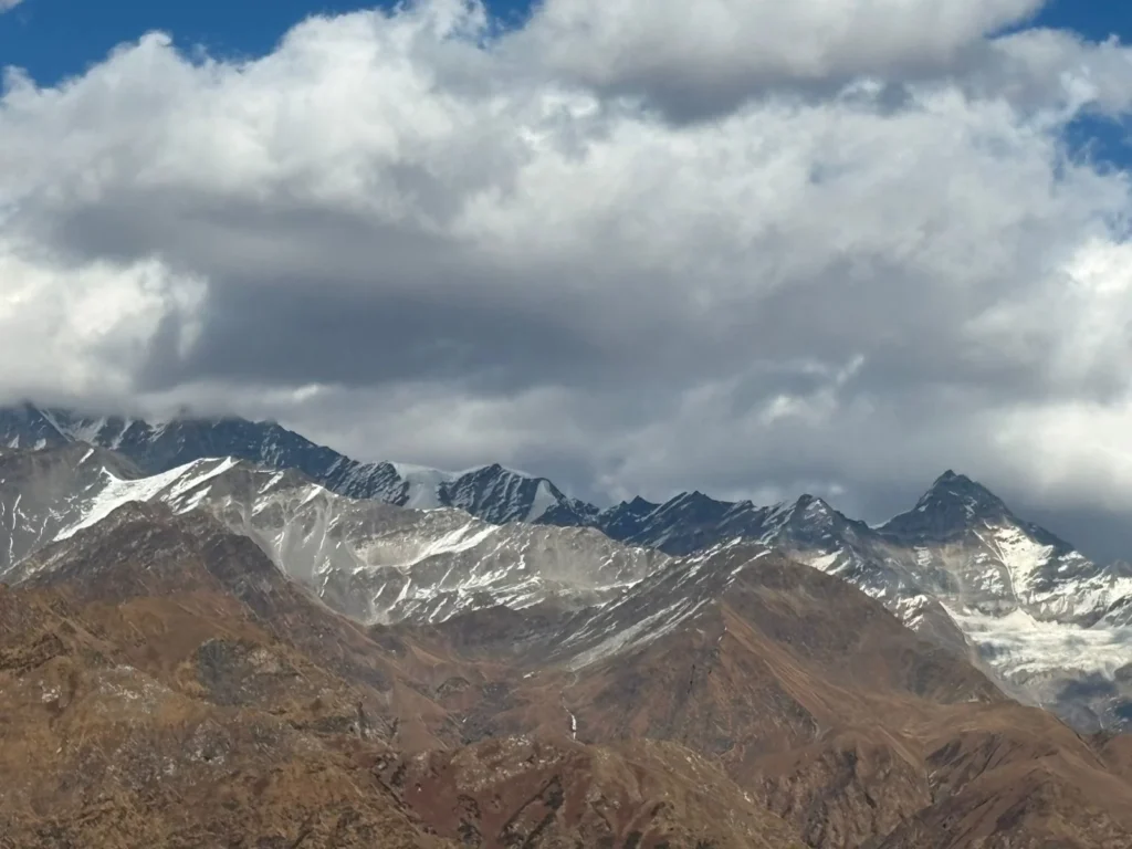
Heavy snowfall did occur earlier this year in some high-altitude regions such as Uttarakhand in January 2025. This indicates that snowfall is still possible but has been spatially uneven, with higher peaks receiving snow while lower elevations remain dry longer than usual.
Reddit-based observations from late 2025 suggest that snow cover is limited in many popular trekking zones (e.g., Manali, Kedarkantha, Kuari Pass) until late December, with fresh snowfall likely only around late December to January.
Scientific & Climate Insights
A new 2025 snow report from ICIMOD confirms that snow persists the period snow remains on the ground hit a 23-year record low across the greater Hindu Kush Himalaya region, including the Indian Himalayas. Snow persistence is a better indicator of overall winter snow health than single snowfall events.
This long-term decline in snow cover is linked with weak atmospheric circulation patterns and climate change, including changes in Western Disturbances and jet stream behavior
Scientists are also reporting rapid snowmelt in sacred and symbolically important sites like Badrinath, where snow layers are reducing earlier each spring, exposing glaciers to direct solar heating and accelerating melt, underscoring the broader trend of reduced winter snow cover impacting glaciers.
How Late Snowfall Is Affecting the Region
Late snowfall is not just a weather anomaly. It has serious long-term consequences
Impact on Tourism
Winter tourism is vital for Himalayan economies.
Destinations like Gulmarg, Auli, Manali, Nainital and Sonamarg depend heavily on snowfall for skiing, snow treks, and winter travel.
Delayed snowfall has resulted in:
- Postponed trekking schedules
- Reduced tourist footfall
- Financial losses for hotels, guides, transport operators, and local businesses
December and January are peak travel months in India. Missing snowfall during this window affects the entire tourism chain.
Impact on Rabi Crops
Western Disturbances provide essential winter precipitation for Rabi crops, such as: wheat, barley, mustard, gram and peas
Delayed winter rainfall can reduce soil moisture, impacting crop yield.
At the same time, if disturbances arrive too late, during harvesting season (March–April), they can cause:
- Crop damage
- Fungal infections
- Post-harvest losses
Thus, both delay and untimely rainfall are harmful.
Impact on Himalayan Glaciers
Snowfall is the primary source of accumulation for Himalayan glaciers
Reduced snowfall leads to, poor glacier replenishment, faster summer melting and long-term decline in glacier mass
This directly threatens the flow of major rivers like the Ganga, Yamuna, and Indus, which depend on snow and glacier melt for sustained water supply.
Is This Becoming the New Normal?
With delayed snowfall occurring for consecutive years, an important question arises:
Are Himalayan winters changing permanently?
Scientists increasingly believe that climate change, combined with shifting atmospheric patterns, is redefining traditional seasonal cycles. What was once considered rare is becoming more frequent.
This makes climate-sensitive planning, sustainable tourism, and ecosystem protection more important than ever.
Real-Time Ground Reports: What Snow Is Actually Happening
Local reports and observations from enthusiasts and weather trackers show:
Kashmir received significant fresh snowfall around 21–22 December 2025, especially in higher altitudes like Gulmarg and North Kashmir, perfect for snow views but mostly in elevated zones.
Manali’s snow cover is limited until late December, with the best chances for full snow coverage only between mid-January and February.
Trekkers report very little snow on Kedarkantha trails in early to mid-December, indicating that early season snow is less reliable this year.
These patterns suggest that snowfall is not absent but delayed and shifted, with higher areas seeing snow first and lower or tourist-popular spots waiting for deeper winter.
Conclusion
Traditionally, Western Disturbances strike Kashmir first, bringing early snowfall to the region. However, even Kashmir has experienced delayed snowfall in the winter of 2025, a clear sign that the issue is regional, not local.
Late snowfall affects:
- Tourism
- Agriculture
- Glaciers
- Water security
- Future weather extremes
Despite these delays, fresh snowfall is arriving in late December and early 2026, especially at higher altitudes, offering windows for tourism and winter activities.
But the broader trend of later snow, reduced persistence, and increased unpredictability highlights a changing Himalayan climate with far-reaching consequences.
While there is still hope for strong Western Disturbances later in the season, the larger lesson is clear:
Changing climate patterns are reshaping Himalayan winters.
Understanding these changes today is essential for preparing for the future.
Leave a Comment