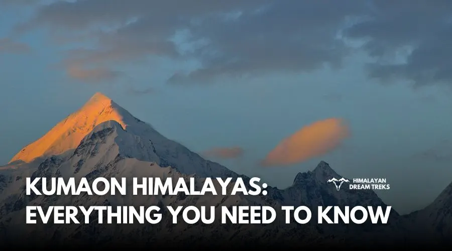
Overview
If you want to experience a thrilling adventure in the remote Johar Valley of the Kumaon Himalayas, the Milam Glacier Trek is a must-visit. Its highest point is situated at an elevation of around 13,943 feet (4,250 m), and it is about 16 km in length. Milam Glacier Trek is a 90-95 km trek, which takes about 9-10 days to complete. Throughout its trails, it offers breathtaking views of the eastern Himalayan peaks, with the Nanda Devi massif standing tallest among them.
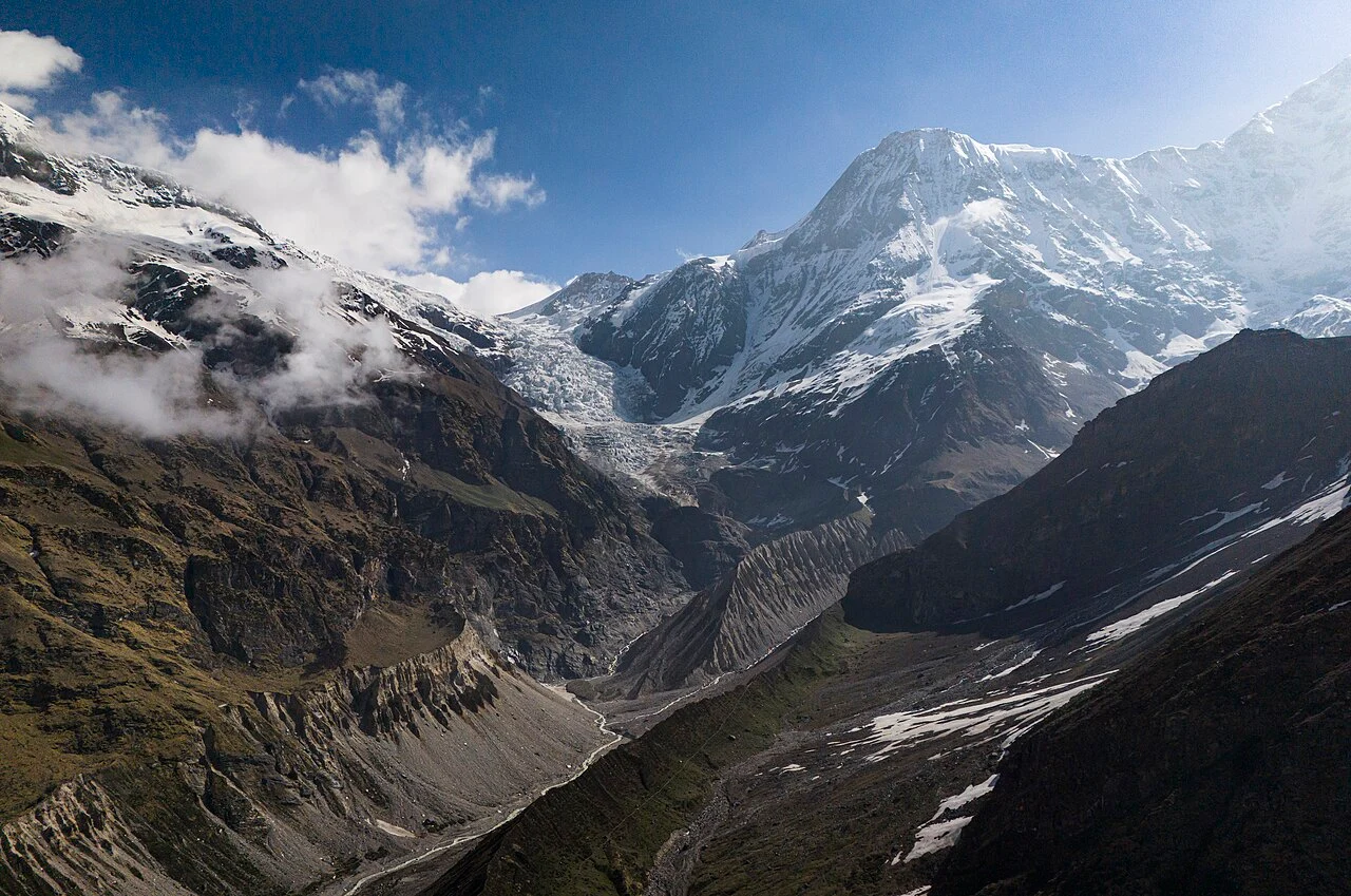
The Milam Glacier trek starts from the town of Munsiyari, which is well-connected via motorable roads and accessible from Kathgodam. You climb through river gorges along the Goriganga River, following an ancient trade route between India and Tibet. Another striking feature of this trek is the ghost villages like Martoli and Milam. These offer you a peek into the ancient Indo-Tibetan trade and the ancient lifestyle of the locals. The final leg of the trek takes you to the glacial snout, the point from which the Goriganga River originates. Here, the panoramic views of Hardeol, Trishuli, Nanda Kot, and Nanda Devi East peaks make your adventure even more exciting.
The overall difficulty of the Milam Glacier trek is moderate to challenging, as you cover long distances every day on the high-altitude terrain. You will encounter rocky moraines, narrow ledge trails, and steep ascents that require physical stamina and endurance. The best time to visit the Milam Glacier trek is during the summer and autumn seasons.
To help you plan for the Milam Glacier trek, let us discuss the detailed itinerary, how to reach Munsiyari, the best time to visit, the difficulty level, and more:
Trek Itinerary
Drive Distance and Time: 278 km; 10-11 hours
Altitude Gain: 1,752 ft/534 m (at Kathgodam) to 2,272 m/ 7,454 ft (at Munsiyari)
Highlights: The scenic drive past Bhimtal and Almora, the first glimpse of the Panchachuli peaks at sunset, and the Birthi Falls.
Your Milam Glacier Trek begins from Kathgodam, which is the nearest railhead to the Kumaon region. The scenic 10-11-hour drive to Munsiyari winds through the foothills of Kumaon, making it an exciting journey.
While driving, you will pass through the hill station of Almora, a town known for its apple orchards and panoramic views. From Almora, the route goes towards Bageshwar and further to the remote town of Pithoragarh. On your way, you will see cultivated terraced fields and further, the dense forests of pine and Oak trees. The drive through the stunning valleys will keep you mesmerised, and on clear days, you can catch glimpses of the Panchachuli peaks of theJohar Valley.
Before reaching Munsiyari, try to visit the Birthi Falls, which offer a break from the long drive. Further, you will descend fromKalamuni Top to reach the base camp in the evening. As you approach Munsiyari, you will notice a change in altitude and weather conditions. Situated at about 7,454 ft, this village serves as the base camp for the Milam Glacier trek and is the last settlement before entering the Johar Valley. Check in to your homestay, have a warm meal, and spend the night here.
Drive Distance and Time: 18.7 km; 1 hour
Trek Distance and Time: 12 km; 6-7 hours
Altitude Gain: 2,272 m/ 7,454 ft (at Munsiyari) to 2,419 m/7,936 ft (at Bugdiar)
Highlights: The Gori Ganga river, the climb through the rugged trail, and the lush subtropical forests.
Wake up early and after having your breakfast, drive to Seolikote (also known as Lilam parking area). This serves as the road head for the Milam Glacier trek. This drive may take about 1 to 2 hours, depending on the road conditions. The entire route is on rough terrain and passes through landslide zones and small waterfalls. Drive carefully on the narrow roads if you are visiting during the winter or spring season, as the roads become slippery due to black ice.
After you reach Seolikote, your actual trek begins. The trail initially descends for about 3 km, taking you down to the banks of the Gori Ganga River. This river originates from the Milam Glacier and will accompany you throughout this trek. You will pass through patches of vegetation and rocky terrain, which must be crossed carefully.
From the riverside, you will take the 3-hour trail that ascends towards Lilam. If the roads are accessible and in good condition, you may also drive till here and trek the remaining distance. The trek from Lilam to Bugdiar is moderately challenging. Along the way, you will cross several waterfalls fed by mountain streams. Moreover, in spring and early summer, you might encounter snow bridges created by melting snow.
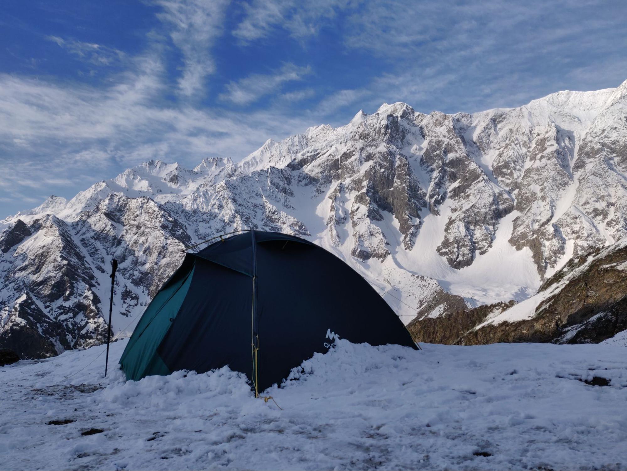
The trail becomes steeper in the final section as you approach Bugdiar. This is an alpine meadow where shepherds graze their flocks of sheep and goats. You will find an ITBP check post here. Set up your tents at this campsite, enjoy a warm meal, and spend the evening watching the sun paint the distant peaks in shades of orange.
Trek Distance and Time: 14-16 km; 7-8 hours
Altitude Gain: 2,419 m/7,936 ft (at Bugdiar) to 3,135 m/ 10,285 ft (at Rilkot)
Highlights: Visit the Nahar Devi shrine cut into the cliff and the old settlements of Mapang and Laspa.
The trek from Rilkot is moderately challenging, so fuel up with a healthy breakfast before you start. Initially, the trail descends for about 1 km, taking you towards the banks of the Gori Ganga River once again. From here, the trail follows the right bank of the river, passing through a narrow gorge.
You will cross this section from the narrow trails carved from the rocks, which seem dangerous as well as adventurous. These ancient trails were once used to trade goods between India and Tibet. Watch out for stone-and-wooden bridges near the river at various points. The roaring river will keep you motivated while crossing the difficult trails that are full of scree and moraine.
On your way, you will pass the Nahar Devi Shrine, which is hidden under a rock overhang. At the gorge section, the trail becomes challenging with granite rock formations and a steep gradient. After about 6-7 kilometers of trekking, the valley opens up into a U-shape of the upper Johar Valley. You will notice sections of alpine grasslands.
The final sections of the trek to Rilkot involve a steep ascent, with the trail gaining more elevation. On your way, you will pass through Mapang and Laspa. These are small settlements where you can rest and relax. Rilkot is a beautiful camping site on the edge of the Lwan Gad Valley.
It offers spectacular views of the surrounding mountains. On clear nights, the starry sky is absolutely breathtaking.
Note: The trail section between Mapang and Laspa may be under construction. So, check with your operator when planning or follow the guidelines of the BRO officials.
Trek Distance and Time: 16-18 km; 6 to 9 hours
Altitude Gain: 3,135 m/ 10,285 ft (at Rilkot) to 3,433 m/ 11,263 ft (at Milam Village)
Highlights: The historic village of Burfu, crossing the Lwan Gad bridge, and entering the trans-Himalayan zone.
The fourth day of the itinerary is the longest day of the itinerary, where you will cover about 16 km. Start early and follow the trail that goes along the Gori Ganga. The route passes through sections of narrow gorges where the river canyon walls are present on both sides.
As you gain altitude, you will notice that the terrain now shows the characteristics of a trans-Himalayan high desert. You will see fewer patches of forests and more sections of low alpine shrubs. The Gori Ganga, which was overflowing in the lower sections, becomes smaller and more manageable. Around the halfway point of this trek, you will cross the river on wooden bridges.
On your way, if you have time, try to visit Martoli, which is about 5 to 7 km from Rilkot. It is an alpine meadow that has turned into a ghost village with old ruins that were once thriving pre-Sino-Indian War. You may find a few homestays here, where you can relax or have refreshments. Martoli is a must-visit spot as you get the views of Nanda Devi East, Hardeol, and other peaks of the Nanda Devi Sanctuary.
From Martoli, the trail descends through open meadows and then ascends toward Milam. The distance is roughly 11 km, and the terrain is easier. Initially, you will cross the meadows of the Johar Valley with Juniper plants and birch trees. The narrow stream of Gori Ganga will accompany you throughout the route.
Once you have covered about 5 km, you will arrive at the Burfu Village. This is a small hamlet where shepherds often stay during the summer months. From Burfu, cross a wooden bridge over the Lwan Gad stream and continue towards Milam.
Continuing on the trek, you will arrive at an expansive meadow and a valley. The Gori Ganga, now an alpine stream, meanders through the valley. Trekking further, you will arrive at the Milam Village. This is another “ghost village,” with the ruins of post-war settlements. However, in recent times, many homestays and residences have been set up here, along with an ITBP outpost. You may also meet some of the local families here that cultivate crops like Buckwheat, Jambhu (a local grass used for flavoring food), and Keeda Jadi.
Milam village is situated above Gori Ganga, and hence, you can get stunning views of the peaks like Mount Trishuli standing to the north. Set up your camp here, and spend your time exploring the ruins and looking at the old architecture. End your day with a warm dinner and have a restful sleep to recover from today’s long journey.
Trek Distance and Time: 8 km (Round Trip); 4-5 hours
Altitude Gain: 3,433 m/ 11,263 ft (at Milam Village) to 13,000 ft/ 3,960 m (Zero Point)
Highlights: The Milam Glacier snout, views of Trishuli and Hardeol, and the source of the Gori Ganga.
Day 5 is the D-day, and you will finally get to explore the Milam Glacier. After a warm breakfast in Milam, you will set out on an early morning trek. The trail from Milam to the glacier snout is short, and the terrain is rough and requires careful climbing.
At first, you will pass through the ruins and the remaining settlement of Milam. As you leave the village, the landscape becomes barren, with sparse alpine vegetation giving way to exposed rock. The trail follows the Gori Ganga upstream as the river becomes smaller.
You will find yourself on a moraine terrain with rocky debris and scree left behind by the retreating glacier. Step carefully on loose boulders, gravel, and fine glacial sediment. Concentrate on each step you take, as loose rocks may topple on your fellow trekkers.
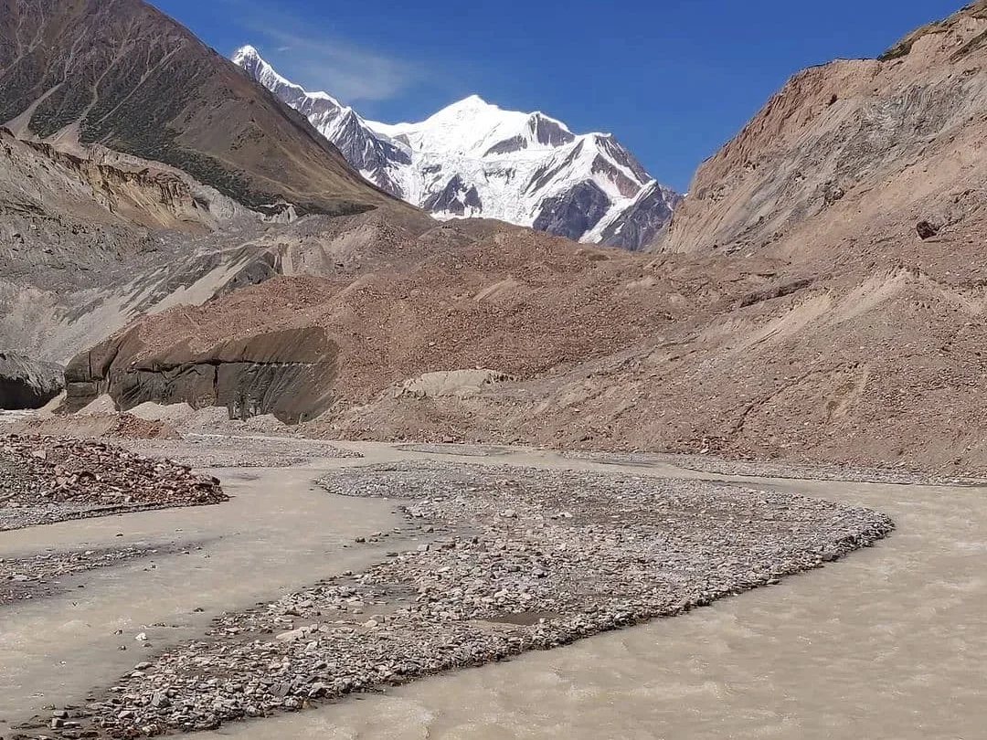
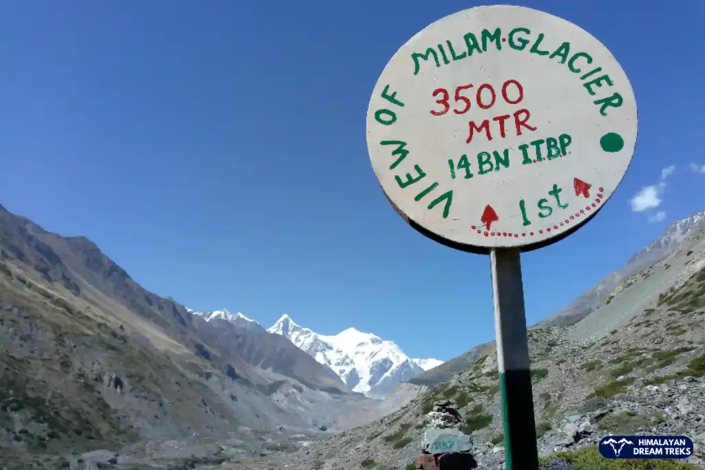
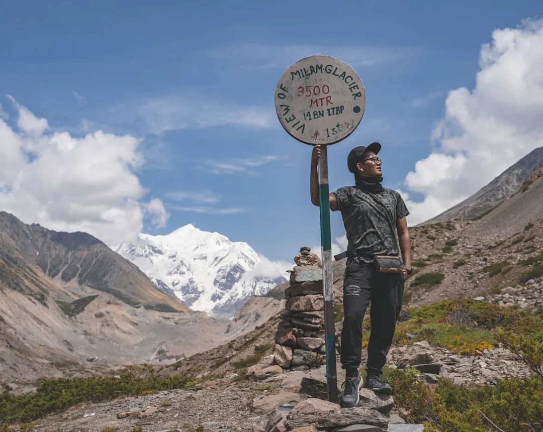
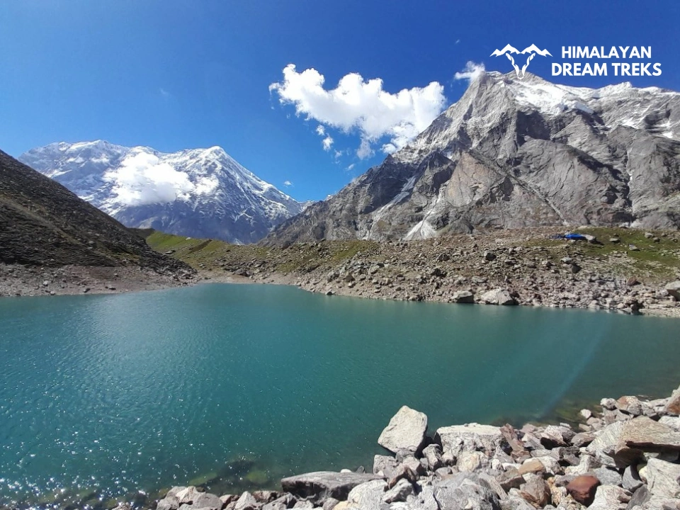
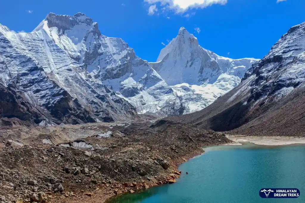
Further on the trail, you will pass by small glacial pools of turquoise-colored water, fed by the glacier above. Take a short break to relax and admire the landscape’s beauty. After about 1.5 to 2 hours of trekking, the Milam Glacier will come into view. This is one of the largest glaciers that covers an area of about 37 km2, stretching far away into the scenery.
You will see the glacier snout in the moraine, covered with ice. This milky white glacial feature adds another layer of beauty to the Milam Glacier trek. This is where the Gori Ganga river flows from, roaring in the lower reaches of the Johar Valley. To the north, you will see Mt Trishuli, and to the east, Hardeol soars in the skyline. Between these two peaks, you can see Rishi Parvat. To the south and west, the twin peaks of Nanda Devi are visible only on clear days.
Spend some hours near the snout, take photographs, explore the region, and soak in its beauty. After thoroughly exploring the glacier and having refreshments, retrace your steps back to Milam village. The descent is easier, and you should reach your camp by late afternoon.
Trek Distance and Time: 17 km; 6-7 hours
Altitude Loss: 3,433 m/ 11,263 ft (at Milam Village) to 3,135 m/ 10,285 ft (at Rilkot)
Highlights: Panoramic valley views and the changing colors of the landscape.
Today, we will head back to Rilkot and retrace the trails of Day 4. The descent will be easier, and the transition in landscape will be more striking. You will climb down through the ruins of Burfu and Mapang village once again. Notice the details you might have missed on your ascent.
You will bypass Martoli today because you have already covered it. The terrain includes patches of meadow and forest with an undulating gradient. The 16-17 km journey to Rilkot will be tiring and hard on your knees, so take appropriate breaks.
As you go downhill, the Gori Ganga river will become larger and more brimming. Soak in the beauty of distant peaks visible from various viewpoints. The final section of the trail will involve an ascent to reach the Rilkot campsite. Set up your tents and eat a warm meal. Spend the evening resting your legs and retire for the night.
Trek Distance and Time: 12 km; 5-6 hours
Altitude Loss: 3,135 m/ 10,285 ft (at Rilkot) to 2,419 m/7,936 ft (at Bugdiar)
Highlights: Re-entering the tree line and the gorge walk.
On the 7th day, you will descend back to Bugdiar, which will take about 5 to 6 hours. The descent remains gradual through narrow gorges and tracks. You will also cross the same wooden bridges over the Gori Ganga. Keep climbing down slowly and maintain a steady pace to keep your knees from straining.
The entire route retraces the trails of Day 3 with narrow tracks and hanging rock walls above. Further descent will take you into a dense forest with Gori Ganga accompanying you below. Finally, you will arrive at the pastoral meadow of Bugdiar. Set up your camp here and enjoy the evening.
Drive Distance and Time: 18.7 km; 1 hour
Trek Distance and Time: 12 km; 6-7 hours
Altitude Loss: 2,419 m/7,936 ft (at Bugdiar) to 2,272 m/ 7,454 ft (at Munsiyari)
This is the final day of trekking, where you will descend back to Lilam. You will cover 12-14 km, making it one of the shorter days of the trek. The trail descends steadily through the mixed forests of conifers and bamboo. If you missed Mansingh Top on Day 2, climb it to see the bird’s-eye view of the Gori Ganga, dense forest, and surrounding peaks.
Cross the slippery sections carefully, as you will find a few waterfalls on your way. Gradually, you will arrive at Lilam by afternoon. If the road conditions are favourable, you can drive back to Munsiari today. Alternatively, you may also spend the night at Lilam to rest and explore the area in the evening. We suggest you add buffer days to your itinerary for the best experience.
Drive Distance and Time: 278 km; 10-11 hours
This day marks the end of your Milam Glacier Trek. Have an early breakfast and venture on your return journey to Kathgoadam. You will pass through passing through Pithoragarh, Bageshwar, and Almora on this long drive. Remember to take appropriate breaks to stop at various viewpoints and take pictures. Once you reach Kathgodam in the evening, catch your onward train or begin your journey back to your home city.
Package Details
Price Inclusion
Accommodation for 8 nights: Stay is included from Day 1 to Day 7 (base camp to base camp). Single and double-sharing options are available at an additional cost.
Meals: Meals from Day 1 dinner to Day 8 breakfast.
Trek Equipment: All essential trek equipment is included, such as sleeping bags, kitchen and dining tents, utensils, mattresses, personal tents, toilet tents, and crampons (if needed).
Forest Entry and Permits: All required fuel charges, tolls, forest entry fees, and permits are covered.
Experienced and Certified Guides: A qualified, professional team, including a mountaineering-certified trek leader, guide, cook, and support staff, will accompany you.
Emergency Kit: First aid medical kits, oxygen cylinders, and stretchers are provided to ensure the safety, comfort and well-being of all participants.
Trek Certificate & HDT Badges: Receive a trek certificate and HDT badges to celebrate your adventure.
Price Exclusion
Meals during Transfer: Meals are not included while traveling to and from the trek starting points.
Emergency Evacuations: Any charges related to emergency evacuation are not included.
GST (5%): Not included in the package cost.
Personal Expenses: Any meals or accommodations outside of the provided itinerary or additional services not listed in the inclusions.
Personal Luggage Carrying: Charges for mules or porters to carry personal luggage are NOT included in fees.
Transportation from Kathgodam: Transport from Kathgodam is available at INR 3,000.
Best Time to Visit for this Trek
The best time to experience the Milam Glacier Trek is during the Summer and Autumn months. In fact, it can be taken up by trekkers across most seasons, other than monsoon (July to August). This is because the Gori Ganga valley becomes prone to landslides and floods. Depending on your choice of weather, challenges, crowd, and adventure, you can choose to visit during the following seasons:
Spring and Early Summer: April to June
| Attribute | Details |
| Temperature | Min: 5°CMax: 18°C |
| Weather | Favourable weather with clear skies and high visibility |
| Ideal For | Photographers and experienced trekkers |
| Landscape | Lush greenery in the lower valley and blooming Rhododendrons |
| Crowd | Moderate |
The months from May to June are the best time to try the Milam Glacier trek. The weather remains clear and offers unparalleled views of the Hardeol and Trishuli peaks, making it ideal for high-altitude photography. The trails in the Johar Valley are mostly dry during this time, making them accessible for all types of trekkers. The blooming wildflowers in the alpine meadows of Martoli and Milam add a vibrant touch to the rugged terrain.
Monsoon: July to Early September
| Attribute | Details |
| Temperature | Min: 12°CMax: 22°C |
| Weather | Warm climate with heavy rainfall and high humidity |
| Ideal For | Not recommended |
| Landscape | Slippery trails, overflowing streams, and misty landscape |
| Crowd | Rare |
The summer season in the Johar Valley arrives in late May and stays through the month of June. However, in recent years, both summer and monsoon have coincided after late June in the Kumaon region. During this time weather is warm, but the heavy rains make the narrow gorges of the Gori Ganga dangerous due to falling rocks and mudslides. This window is not recommended for trekking to Milam Glacier due to trail hazards, including overflowing water streams, slippery, and moss-covered trails.
Autumn: Mid-September to November
| Attribute | Details |
| Temperature | Min: 0-5°CMax: 15°C |
| Weather | Crisp air, very clear days, and chilly nights |
| Ideal For | Adventure seekers and winter preparation |
| Landscape | Golden-brown meadows and crystal clear glacial views |
| Crowd | Moderate to high |
Most of the trekkers prever autumn season to visit the Milam Glacier Trek. During this season, the trail conditions are favourable and accessible for all. In mid-September, after the retreat of the monsoon, the blue sky and the golden brown landscape make the trekking experience ethereal. October is the perfect time for photography lovers who want to capture the beautiful sunset over the Trishuli and Hardeol peaks. The expansive meadows become ideal for camping with receding snow, giving the best views to the adventurers.
Winter: December to March
| Attribute | Details |
| Temperature | Min: -20 to -10°CMax: -5 to 5°C |
| Weather | Extreme cold with heavy snowfall and blocked trails |
| Ideal For | Experienced mountaineers only |
| Landscape | Snow-blanketed ghost villages and frozen rivers |
| Crowd | Almost none |
If you want to enjoy the thrill of winter trekking, plan to do the Milam Glacier trek between late December and March. The quiet of chilly nights gives a unique feel to the ghost villages along the trekking trails. We advise you to check weather conditions before planning, as the region receives heavy rainfall and many of its trails become inaccessible. You will also need cold-weather gear and high-altitude trekking experience to visit during this season. The temperature in the upper reaches goes sub-zero. Hence, plan accordingly and consult a local guide.
Difficulty Level of this Trek
The Milam Glacier is a moderate-to-difficult trek. The overall difficulty depends on the season, your expertise level, and fitness preparation. If you are an experienced trekker, this is a must-visit glacier trek to explore the Kumaon Himalayas. The trek covers a total to-and-fro distance of about 90-95 km from the new roadhead at Lilam. Since this trek involves altitude gain up to 3,438 meters, you must prepare by adding cardio and strength training to your routine.
Take proper steps for acclimatization at base camps like Lilam and Bugdiar to avoid the risk of Acute Mountain Sickness (AMS). You can also add a few buffer days to complete this trek at a slower pace. The trails go through dense forests, turbulent water streams, and eventually the barren moraine of the glacier, which can be challenging for the feet. Some sections in the Gori Ganga gorge are very steep with rocky terrain and narrow mule paths. These require great physical and mental strength. You will be walking about 10 to 15 km daily on this trek. That is why you must focus on cardiovascular health and leg endurance to successfully summit the glacier snout.
Trek Essentials
- 45-60 Ltr Bag Pack With Rain Cover & Comfortable Straps
- Hot and Cold Water Bottle Like Borosil and Milton
- Energy Bar, Dry Fruits, and ORS
- Personal Medical Kit
- 1 Pair of Sunglasses (UV Protected)
- 1 Neck Gaiters (Buff)
- Tiffin Box
- 2/3 Full Sleeves (Non-Cotton)
- 1 Full Fleece T-Shirt
- 1 Fleece Jacket (Woolen or Sweater)
- 1 Down Feather/ Hollofil Jacket
- 1 Waterproof Jacket/ Poncho
- 1 Pair of Thermal Inners (Upper and Lower)
- 2 Trek Pants (Avoid Shorts and Denim Pants)
- 1 Pair of Waterproof Gloves
- 1 Pair of Woolen Gloves
- Sun Cap
- Woolen Cap
- 4 Pairs of Cotton Socks
- 1 Pair of Woollen Socks
- 1 Waterproof and High Ankle Trekking Shoes
- 1 Pair of Floaters
- Hand Sanitizer and Sunscreen Lotion
- Toothbrush and Toothpaste
- Toilet Paper
- Quick Dry Towel
- Lip Balm and Antibacterial Powder
- Moisturizer
- Sleeping Bag
- Common Tent
- Mattress
- Dining Tent
- Camping Stool
- Walkie Talkie (For Team)
- Utensils
How To Reach Base Camp
The Pantnagar Airport is the nearest domestic airport to Munsiyari. It is located approximately 370 km away and is well-connected to Delhi with regular flights. It is recommended to arrive a day early or Day 0 to begin your long drive toward the mountains. Alternatively, you can fly into the Indira Gandhi International Airport in Delhi and then take a train or bus to Kathgodam. This is the most common transit point for trekkers heading to the Kumaon region.
The nearest railway station is Kathgodam Railway Station, situated about 279 km from Munsiyari. This station is a major terminus for the Kumaon region. It is connected to cities like Delhi, Lucknow, and Kolkata via trains like the Ranikhet Express and New Delhi-Kathgodam Shatabdi Express. From Kathgodam, you can easily find private taxis, shared jeeps, or state-run buses that will take you on the scenic journey to the base camp.
Route: Kathgodam → Almora → Bageshwar → Chaukori → Thal → Munsiyari
From Delhi, you can board an overnight Volvo or state transport bus from ISBT Kashmiri Gate to reach Haldwani or Kathgodam. Once you arrive, several shared taxis and buses operate early in the morning for Munsiyari. The route goes via the NH 109, NH 309B, and finally through the NH 109K at Munsiyari. You can also travel in your own vehicle, though an SUV is recommended for the steep climbs beyond Thal and the rugged terrain of the Kumaon hills.
Get a bus from Haldwani, Kathgodam, or Nainital for Munsiyari.
Trek Map
Weather & Temperature
Nearby Places to Visit
Near the basecamp of Milam Glacier, you can also explore these beautiful destinations:
- Khaliya Top
- Birthi Falls
- Madkot Hot Springs
- Darkot Village
- Nanda Devi Temple
- Thamri Kund
- Tribal Heritage Museum
SCL, Foreign National Charges & Vehicle
Himalayan Dream Treks (HDT) is registered tour operator with the IMF, and we can cater to the needs of SCL for Government Employees. According to the rule, the government of India provides its employees with a prospect where they’re allowed to apply for a 30-day special casual leave in a calendar year to do trekking, hiking, or whatever adventure pleases them.
Mail us at info@himalayandreamtreks.in, if you want to avail SCL.
For foreign nationals, permit charges are different, and hence the overall package price is different for foreign trekkers. Connect with us before booking your trek. For more details, contact us at info@himalayandreamtreks.in
- For 4-6 people Bolero or equivalent vehicle.
- For 7 or more people, Force Traveller.


Leave a Comment