Overview
Want to discover a part of the Himalayas that isn’t mentioned in the guidebooks?
Located at an altitude of 3,600 meters, Niti Valley offers breathtaking peaks, Bhotia villages, and untroubled grasslands, which makes its way into the hearts of adventurers and nature lovers alike. This hidden valley is nestled in the Chamoli district of Uttarakhand and lies close to the Indo-Tibet border (China), making it India’s frontier in Garhwal.
Niti Valley is filled with timeless villages, alpine meadows, and sacred peaks. Formerly, the Niti Pass (5,800 m) acted as the Indo-Tibetan trade route up to the time it was sealed after the 1962 Indo-China War. Niti Valley is not just a landscape but is also connected to people’s emotions.
Tourists love to visit the Valley of Flowers or Auli, but what they are not aware of is that Niti Valley gives them a chance to explore peace and a real-time experience. You can listen to old migration stories of the Bhotiya people while sipping hot butter tea. Apart from this, you can also go on a small walk, which will take you through cool icy caves and magnificent mountain streams.
The best time to visit Niti Valley is May-June or September to November. This is because roads are open, flowers bloom everywhere, and the day feels pleasant (15-25°C). However, the nights are a bit cold, with the temperature dropping to 5°C, making it important to carry warm jackets.
Are you ready for your Niti Valley adventure? In this guide, you will get a chance to know everything, like the itinerary, history, stays, and useful tips.
Tour Itinerary
Drive Distance: 250 km
Drive Time: 9-10 hrs
Altitude: 1,890 m
Today’s Difficulty: Easy
If your base camp is Rishikesh—widely known as the yoga capital of the world—then the drive to Joshimath will become the most unforgettable road journey of your life in Uttarakhand. The route will be approx. 250 kilometers, with 9-10 hours of driving time if the road conditions are in your favor. At every turn, you’ll encounter a new view, a new river, and a new story to learn about.
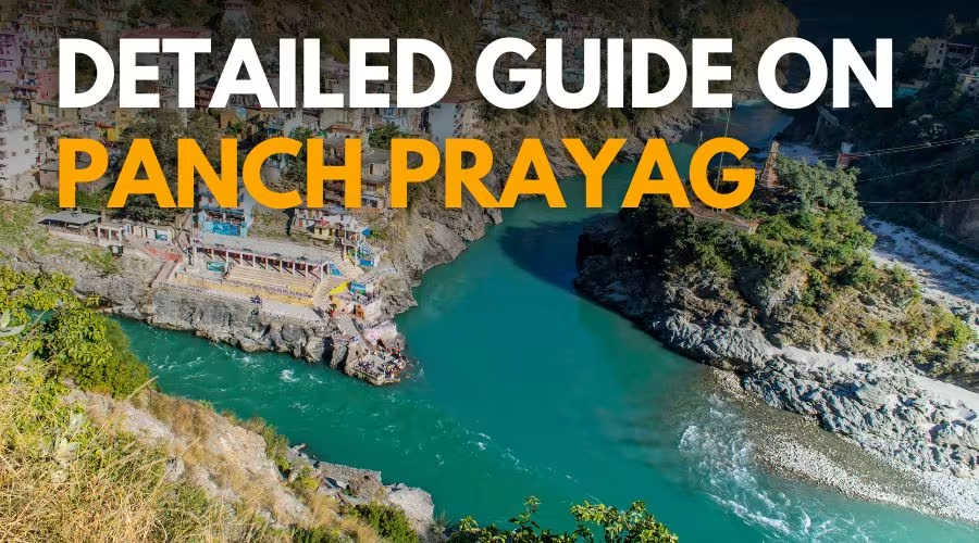
The best thing about driving from Rishikesh to Joshimath is that you’ll get to see three holy rivers of the state, which are also known as Panch Prayags:
- Devprayag: The holy River Ganga’s origin starts where the Bhagirathi and Alaknanda come together. This means you can stop there, take photographs, and enjoy yourself by the water.
- Rudraprayag: The Alaknanda and Mandakini, two rivers, meet here, surrounded by ancient temples and mountains that have always been coated in a thick fog.
- Karnaprayag: The Pindar River joins the Alaknanda there, from where you can see stunning scenery while relaxing in a peaceful riverside environment.
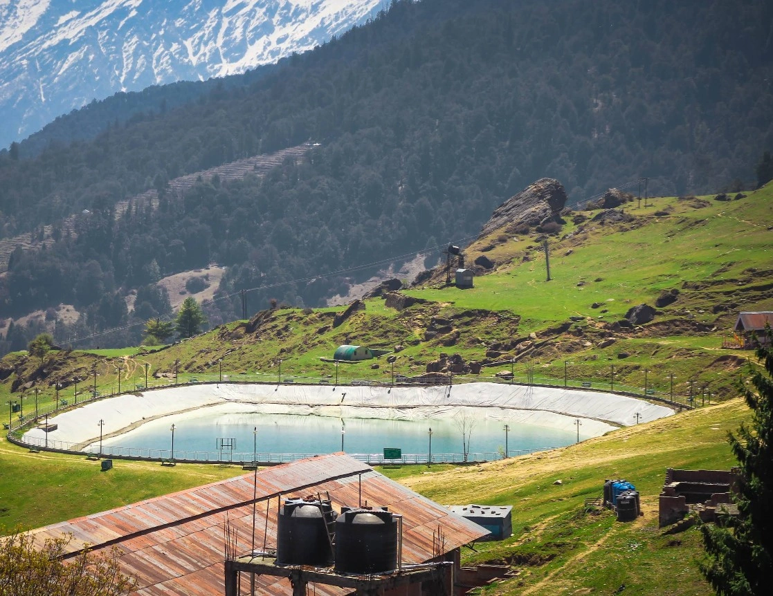
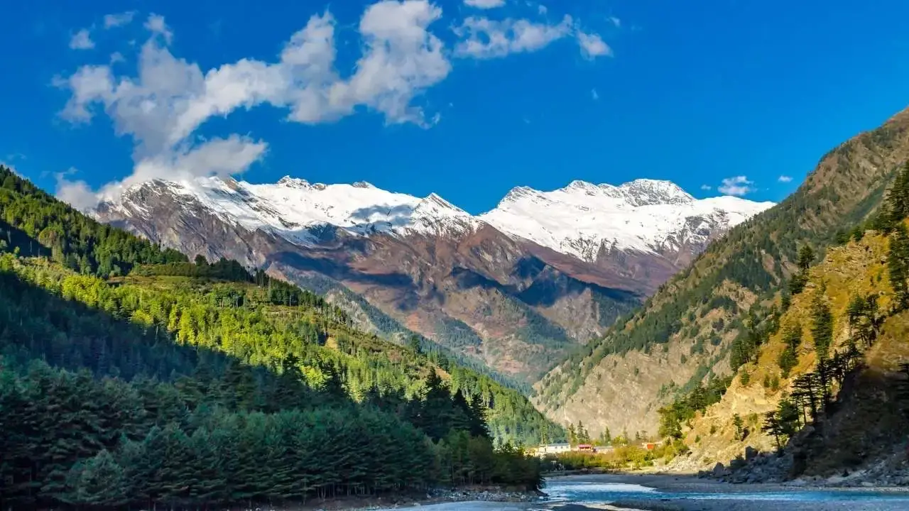
As you approach Joshimath from the highway, you will notice the scenery, and you will be able to spot the snow-capped peaks of both Nanda Devi (7,816 m) and Kamet (7,756 m). Joshimath itself is a holy city and serves as a hub for visiting Badrinath, Auli, and the Nanda Devi Biosphere Reserve.
It is located at an altitude of 1,890 meters and is the last city before entering the isolated interior of Niti Valley. Other than that, you will also find numerous hotels and other accommodations that will help you spend one night before continuing your journey into the valley.
Drive Distance: 82 km
Drive Time: 4-5 hours
Altitude Gain: 1,890 m → 3,200 m
Difficulty: Easy to Moderate
Your day 2 of the trek will start by proceeding towards Tapovan (14 km). Tapovan is famous for its hot water springs. It will be beneficial for you to rest for a while before exploring the bumpiness of the Himalayas. During the drive, you will pass through small villages and apple orchards.
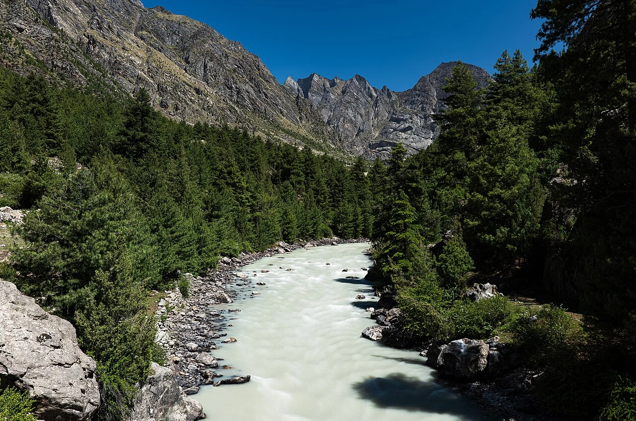
There will be a roar on the way; that is the Dhauli Ganga River, which is famous for having the best photography spots in the world. Another highlight of this trip is the mesmerizing Malari Village (only a few people know about this place). Here, you will see all these stone houses (Indo-Tibetan style), beautiful wooden windows, and traditional life. Apart from this, people still spin yarn on wheels and celebrate festivals in the name of gods.
Night stay at Gamshali.
Trek Distance: 6 km (one way)
Altitude Gain: 3,350 m to 3,600 m (11,000–11,300 ft)
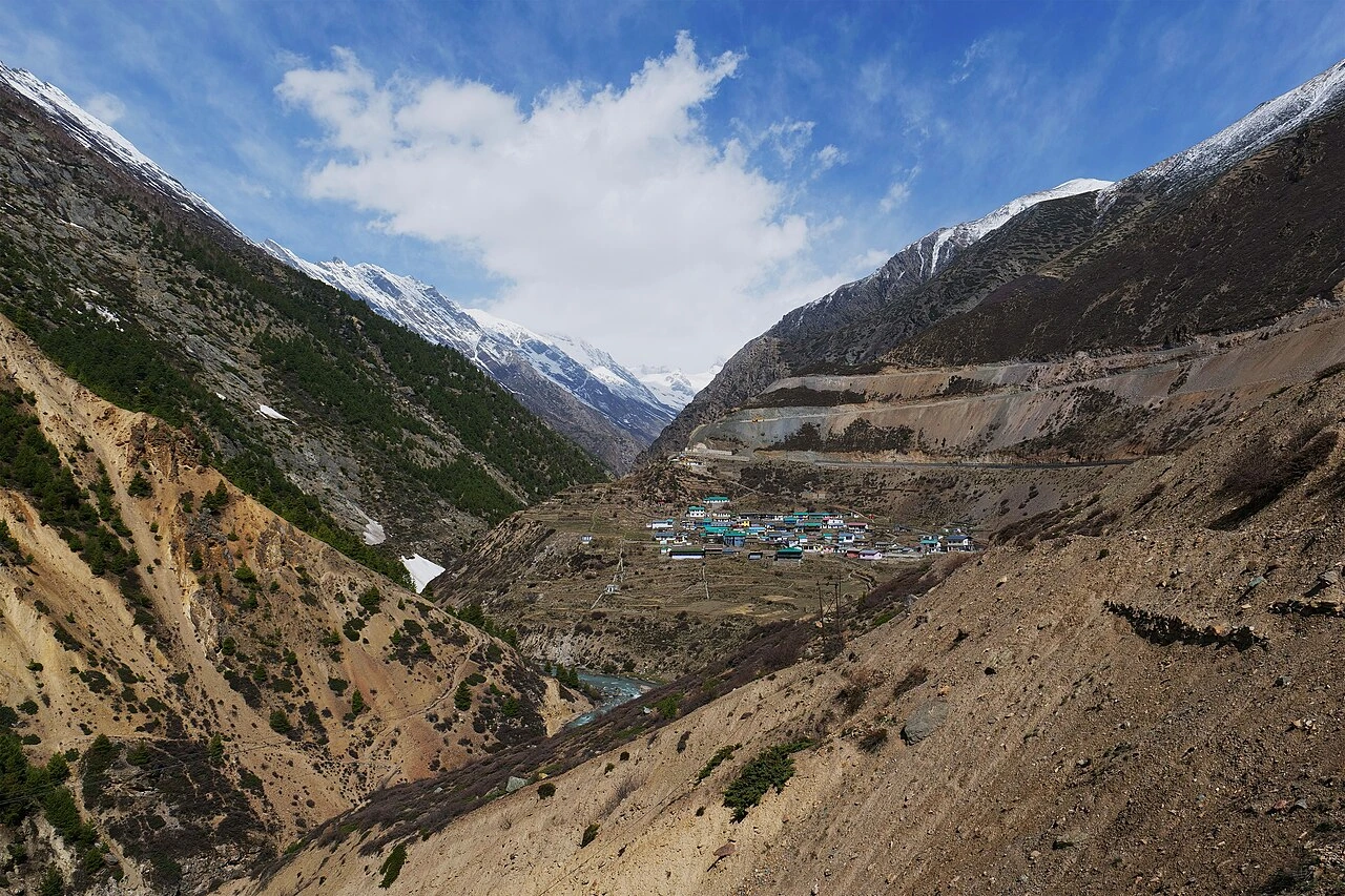
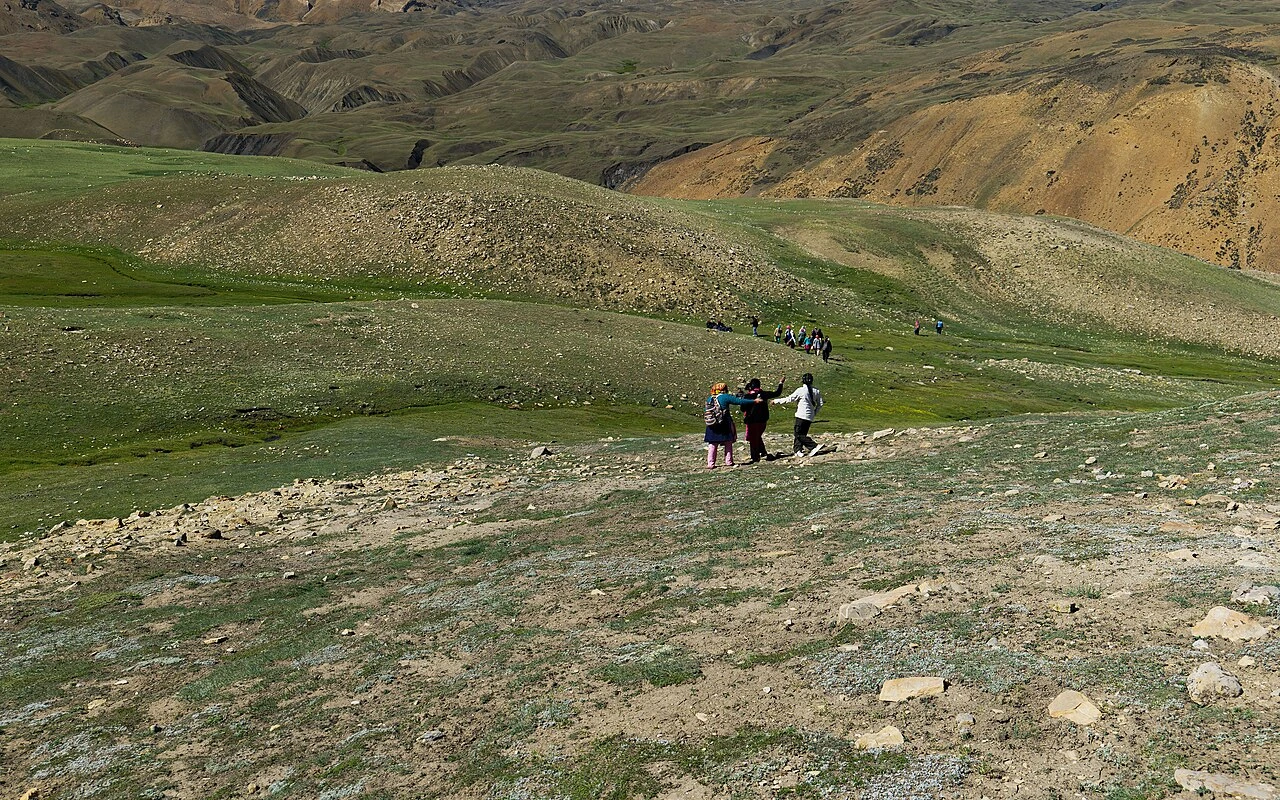
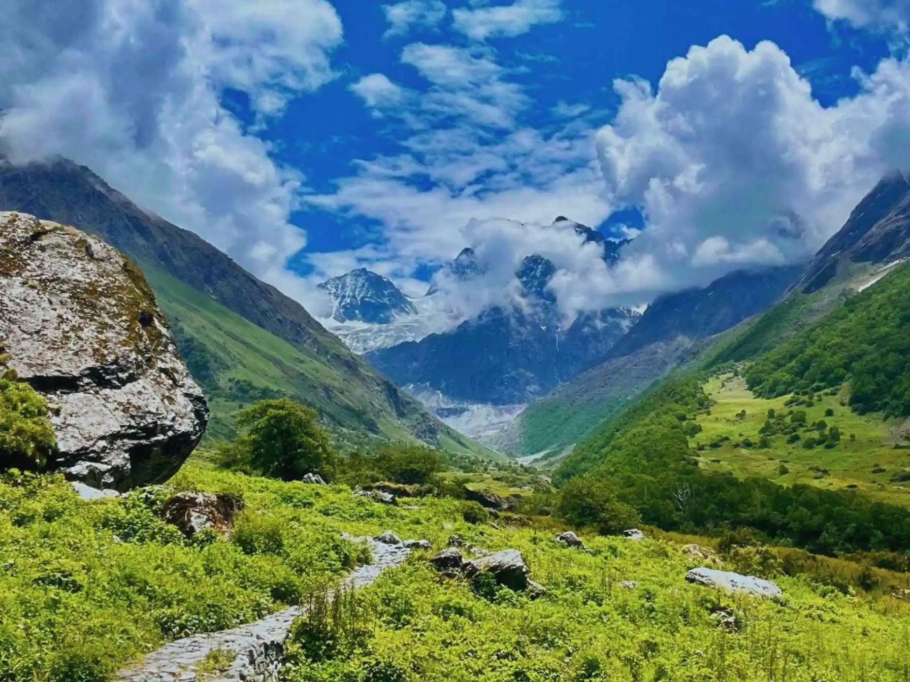
Gamshali Bugyal offers breathtakingly beautiful scenery that will remind you of your passion for mountains once again. Gamshali Village is the second-to-last village in the Niti Valley at an altitude of 3,350 m to 3,600 m. As soon as you start your trek, you will experience the beauty of the place.
After a short period of continuous climbing, the fields of stone houses and the adjacent fields will keep decreasing in size or will completely disappear. During this trek, you will get an eye-pleasing view of vast green areas. You will get a stunning view of the immeasurable green area and the wildflowers surrounding you.
Besides this, the Gamshali Bugyal trek is perfect for experienced and first-time hikers also. All you need to carry along with you is a comfortable pair of shoes and an open heart to experience the beauty of nature.
Drive Distance: 223 km
Today’s Difficulty: Easy
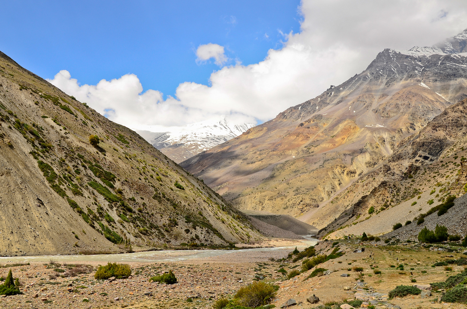
Niti Valley is not just a village but the final settlement of Niti Pass and where the Tibetan border begins. In ancient times, it was an important trade route between India and Tibet, carrying salt, wood, and grains for centuries.
But during the Indo-China War, this route was sealed and has remained sealed since then. Less than 50 families live here, which makes it very quiet, and this silence is only lessened by the river flowing nearby.
When you think you’ve seen it all in Niti Village, there is an incredible experience still waiting to surprise you—the Timmersain Mahadev Cave Temple. It is located 700 meters above the main road up the Timarsain Mountain, 1 km before you arrive at Niti Village via the Joshimath to Niti roadway.
The one thing that most people aren’t aware of is that this temple ice naturally forms in the cave in a Shivling shape. This represents the snowy form of the divine Lord Shiva. Devotees refer to this Shivling as “Baba Barfani.” Following this, the residents and pilgrims visiting call it “Chhota Amarnath”—the “Little Amarnath” of Uttarakhand.
All pilgrims need to stop at Nanda Devi Temple before trekking towards the Timmersain Mahadev Cave temple. During the trek, you will find peace and solitude surrounded by beautiful, unspoiled glacier streams, providing you with a better view of the Himalayan mountain range.
Night stay in Niti Village.
Important Note: A special permit is required from the SDM Office in Joshimath to visit Niti Village. Only Indians can enter the place, while foreigners are prohibited due to the sensitive location. You must carry a valid photo identification, such as an Aadhaar card, PAN card, or driving license, with you at all times.
Drive Distance: 250 km; 9-10 hours
Today’s Difficulty: Easy
As you end your journey, relax and have some breakfast, and then take one last walk around Joshimath, shop for mementos, and create memories of your time spent here. After this, it’s time to make your way back to Rishikesh, Dehradun, or Haridwar. The journey will take approx. 9-10 hours. As you travel back home, remember the beauty of Niti Valley and its atmosphere.
Niti Valley Tour Package
Price Inclusion
Accommodation: 4-night hotel/camp stay. Triple-sharing camps are included. Single or twin-sharing accommodation is available at an additional cost.
Transportation from Rishikesh to Rishikesh: Traveller/ cab during the travel is covered.
Meals: Meal from Day 1 Dinner to Day 5 Breakfast
Permits: All the required toll charges, forest entry permits, and other tickets for Indian nationals are covered.
Sightseeing as per the itinerary.
A local guide or a trip coordinator
First Aid Kit
Price Exclusion
5% GST is excluded.
Extra snacks, lunches and beverages during the hikes are not included.
Any entry ticket for sightseeing which is not mentioned in the inclusions.
Cost of emergency evacuation in case of bad weather, landslides, flooding, etc.
Charges for adventure activities like rafting, skiing, boating, etc. are excluded.
Note: Check the booking procedure here, including details on booking deposits, payment terms, and the cancellation policy.
History of Niti Valley
The 1962 Turning Point
The valley’s fate took a turn after the Sino-Indian War of 1962. The Niti Pass was sealed, and since then, it has been closed to cross-border movement. It is now inhabited by villagers who depend on subsistence farming and seasonal migration.
Life in Niti Valley
Life is hard in Niti Valley because of its extreme weather. During winter, it is too cold, with temperatures falling below the freezing point. This is the reason that makes villagers migrate to lower altitudes. Although in summers they come back to cultivate crops like barley, potatoes, and buckwheat.
Villages as Living Museums
Gamshali and Niti Valley are considered “living museums.” Their ancient architecture is still visible today. Their stone houses, wooden roofs, and farmlands are reminiscent of ancient Himalayan architecture. People still dry meat for winter and make woolen garments, which is part of an ancient tradition that has been followed for generations.
Modern Recognition
At present, Niti Valley is known for its pristine beauty and its rich culture worldwide. Travelers and nature lovers participate in this trek and explore nature’s beauty. Although it is still sealed, Niti Valley is considered to be a symbol of India’s strength and its diverse culture.
About the Rongpa Tribe
Located in the Niti Valley of Uttarakhand, India, the Rongpa people are one of the oldest native tribes in the region. They maintain their own cultural heritage by practicing traditional customs and living an uncomplicated life based on their religious and spiritual beliefs.
Apart from that, they also have the preparation and consumption of food through traditional means—all of which provide visitors to the Himalayas with an authentic experience of the culture of this remote corner of the world.
Culture, Lifestyle, Food, and Traditions
The Rongpa tribe of the Niti Valley is one of the most attractive tribes of Uttarakhand. The tribe is also a subgroup of the Bhotiya tribe. The tribe primarily inhabits places such as Malari, Gamshali, Bampa, and Niti in the Himalayan region near the Indo-Tibet border. Their traditional way of living and the strong spiritual values play a vital role as they create a bridge between localities and tourists.
Origin and Lifestyle of the Rongpa Tribe
The term “Rongpa” refers to “the people of the valley.” It indicates that they are highly associated with mountains. There are subgroups of Rongpa, including Marcha and Tolcha, who have been inhabiting the Niti and Mana valleys for generations.
The Rongpa tribe leads a semi-nomadic lifestyle because of the extreme weather conditions of the Himalayas. In winter, heavy snowfall makes them shift to lower altitudes; during summer, they come back to their places of residence in Niti Valley.
Earlier, they were engaged in trade, agriculture, shepherding, and wool weaving. Before the Indo-China border closure in 1962, they used to exchange goods with Tibetans through high-altitude mountain ranges.
Presently, they depend on agriculture and animal husbandry for their livelihood. They cultivate potatoes, peas, kidney beans, etc., and produce woollen items like shawls and carpets.
Religion and Gods
The life of the Rongpa people is heavily influenced by their religious beliefs, which are mostly from Hinduism. They worship Lord Shiva, Lord Vishnu, and the Pandavas, along with many local gods and spirits. Their rites and festivals are rich in music and dance, combining both the Himalayan religious traditions and their tribal culture.
Traditional Food and Cuisine
Their daily diet consists mostly of Jya, Sattu, rice, and curry; their special occasions consist of more elaborate food such as Arsa (a type of sweet bread) and Geema-Arjiya (a type of meat dish). The use of barley, buckwheat, and noodle dishes can also be found in the Rongpa diet.
Traditional Attire and Dressing Style
Their costume is made from wool and is designed for warmth using layers, such as women’s skirts, coats, and silver/bead jewelry, or men’s woollen gowns/caps. The female members create the warm clothing through hand weaving, which is very important to their culture.
Language Spoken by the Rongpa Community
The people of the Rongpa community speak a dialect that has elements from both Tibetan and Garhwali localisms. The Marcha people speak a mix of Tibetan and Garhwali, while the Tolcha people only speak Garhwali-Rongpa. They also have a good understanding of Hindi.
The Rongpa Tribe has maintained their cultural heritage through their seasonal migration, agriculture, weaving, and religious rituals. Their simple lifestyle and connection with the earth have solidified their continuation in the overall culturally diverse community of Uttarakhand.
Tour Essentials
- Backpack (40-50 ltrs) with rain cover and ergonomic design.
- A 1 ltr refillable water bottle to store warm/cold water (Milton or Borosil)
- Personal medicines and toiletries.
- ID proof and other documents.
- Mobile charger and power bank.
- Extra plastic bags to store your wet clothes.
- Energy bars, ORS, and other snacks.
- Suncap
- U/V-protected sunglasses or photochromic spectacles.
- Woollen cap or ear muffs.
- Water-resistant and insulated hand gloves.
- 3-5 pairs of Cotton socks, hiking socks, and woollen socks
- Body Warmers or Heat Pouches
- For winters, carry full sleeves heavy thermals, padded/hollofil windproof jacket, and fleece inners.
- For summer and autumn, carry full-sleeve light thermals, moisture-wicking quick-dry tees, and a down jacket.
- Hiking pants or leggings.
- Waterproof Poncho
- Woollen jacket or pullover
- 1 Hiking Shoes
- 1 Pair of Floaters
- Hand Sanitizer and Sunscreen Lotion
- Toothbrush and Toothpaste
- Toilet Paper
- Quick Dry Towel
- Lip Balm and Antibacterial Powder
- Moisturizer
- Aadhaar Card, Pan, or Passport for Applying Permit
- Medical Certificate
- Self-Declaration Form
- Sleeping Bag
- Common Tent
- Mattress
- Dining Tent
- Camping Stool
- Walkie Talkie (For Team)
- Utensils
Weather & Temperature
Nearby Attractions
- Malari Village: A scenic Himalayan village known for Indo-Tibetan architecture, traditional lifestyle, and rich local culture.
- Tapovan: Famous for natural hot springs and stunning mountain views, ideal for relaxation and short stops.
- Gamshali: A peaceful high-altitude village offering panoramic Himalayan landscapes and remote charm.
- Valley of Flowers National Park: A UNESCO World Heritage Site known for colorful alpine flowers and trekking routes.
- Nanda Devi National Park: Famous for biodiversity, rare wildlife, and views of Himalayan peaks.
- Joshimath: A major pilgrimage and base town with temples, markets, and scenic viewpoints.


Leave a Comment