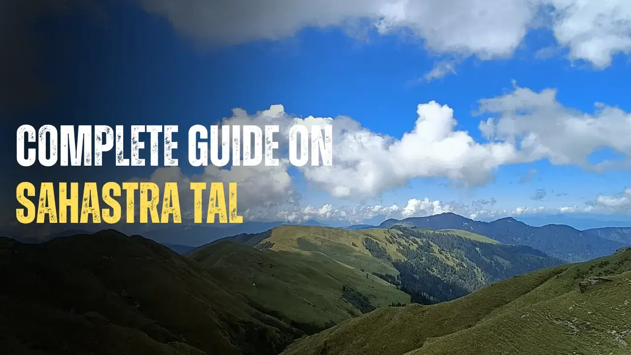
The Sahastra Tal Trek is a high-altitude lake trek in the Tehri Garhwal district of Uttarakhand. It is situated at approximately 4,740 m/ 15,580 ft and covers a trek distance of around 60-65 km from Silla Village. Due to the high altitude and long trek distance, it is advisable for trekkers who have completed a few high-altitude treks before. The trek route features numerous Bugyals (meadows) such as Kush Kalyan and Kyarki Bugyal, forests, and other lakes like Arjun Tal, Pari Tal, Bhim Tal, Draupadi Tal, Lamb Tal, and Mamle Tal.1
This trek is challenging and requires good physical and mental fitness. However, the beautiful path leading to the deepest and largest lake in the region makes the adventure worth every kilometer. In this article, we provide comprehensive information about this trek and related aspects.
Table of Contents
Sahastra Tal, also known as Darshan Tal or Shastru Tal in local dialect is located near the Khatling glacier in the Bhilangana valley. Geographically, the Tal lies northwest of the Bhilangana Range and northeast of the Balganga Range. The Bhilangana River flows to the east, and the Balganga River flows to the south of Sahastra Tal.
Spiritual Significance of Sahastra Tal
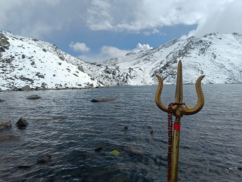
This Tal is believed to be a divine water body, with locals recounting mystical stories about it. They believe that Tal and nearby meadows are places where Aachri Matri (fairies) and Ghandharvs reside. Local people usually undertake this pilgrimage after receiving permission from their deities. Deities like Kelapir, Hari Maharaj, and Naag Devta are worshiped in the area. The local people consider the Tal pure and very sacred hence avoid polluting the Tal.2
People residing in nearby villages consider this place a pilgrimage site, and they come here with their local deities to bathe in the holy water of the lake on special occasions. Residents of Gangi, Pilling, Pinswar, and Ghuttu also offer ‘Pind Daan’ for their deceased relatives at the Tal.
They say that this Tal is dedicated to Lord Vishnu and is known as the Lake of Gods.
- There is a famous tale that once a spiritual king offered 1,000 Brahma Kamal (an intensely fragrant flower grown around the lake) to Lord Vishnu in this specific place. In the Sanskrit language, Sahastra refers to “thousand,” which is the reason behind the name of this special Tal. The people have made a small temple of rocks on the bank of the lake, where they perform their worship rituals.
- Some people believe that this is the path the Pandavas took to reach Swarg (Heaven), so they pray for the salvation of their ancestors at this place.
- Additionally, it is believed that Hindu gods visit the lake on the occasion of Janmashtami, prompting many locales to visit during this festival.
Best Time to Visit Sahastra Tal
The best months to trek Sahastra Tal are late May to June and August to October.
Late May to June (Summers): Due to the high altitude, snow is present until April. After April, and once May commences, the weather becomes favorable for trekking. The entire region, including Bugyals and forests, is covered with wildflowers and greenery during this time, making it a sight to behold. The temperature is also favorable around this time, ranging from 15 degrees Celsius during the day to 0 degrees at night. Make sure to bring proper warm clothes and layers.
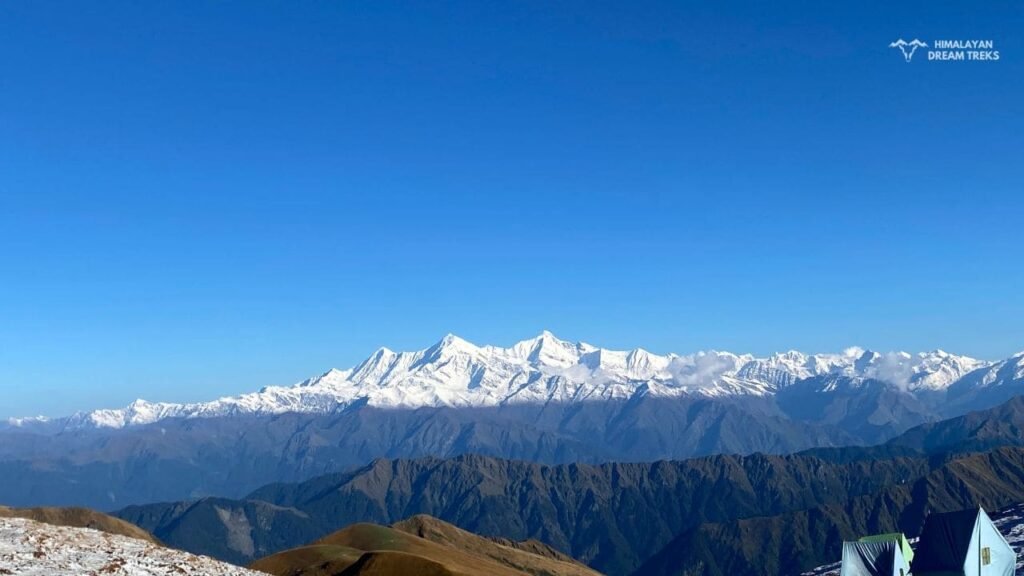
August to October (Post Monsoon): During this time, the vegetation starts to change color from green to brown hues. With the commencement of autumn, the weather also starts to change. The temperature drops, with daytime temperatures around 10 degrees celsius and nighttime temperatures ranging from 0 degrees to -5 degrees celsius. Autumn brings clear skies, making it easy to see peaks like the Bandarpunch ranges and Gangotri ranges.
How to Reach the Starting Point
Before understanding the route to reach the starting point, it is necessary to get an approximate idea of its location.
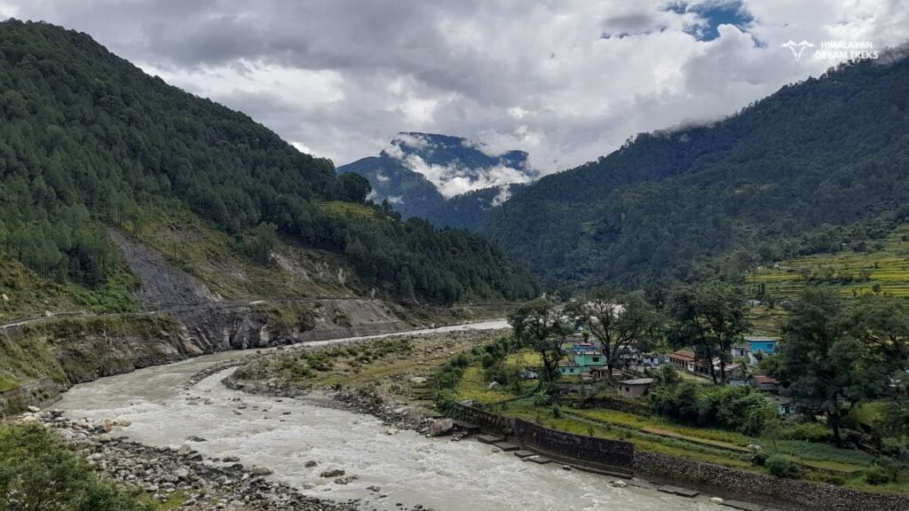
Silla Village, the starting point of this trek is situated before Bhatwari on the Uttarkashi-Gangotri Road.
To reach Uttarkashi, there are two routes from Dehradun. One route is via Landour and Suwakholi, and the other is via Rishikesh. Usually, we prefer the second route, with towns on this route including Landour, Suwakholi, Chinyalisaur, and Uttarkashi. Uttarkashi is 140 km away from Dehradun by this route, and it takes about 6.5 hours to reach there. From Uttarkashi, trekkers can book a taxi to Silla.
Read: How to reach Uttarkashi
Sahastra Tal Trek Routes
Talking about trek routes, there are multiple routes from distinct starting points to trek. These different starting points are Kamad, Ghuttu, Chaurangi Khal, Buda Kedar, and Bhatwari.
- The most popular trek route starts from Bhatwari and passes through Malla and Silla Village.
- The trek starting from Kamad is about 48 km long and goes via Ghodakot and Kush Kalyani.
- Another trail starting from Buda Kedar is also about 45 km long, but it goes via Jaraav Tal and the Balganga range.
- Whereas the Ghuttu trail passes via Gangi and Bhilangana ranges.
- The Chaurangi Khal route is the longest one but also the most exciting of all. The route is as follows: Chaurangi – Harunta – Belak – Jorai Bugyal – Kush Kalyan Bugyal – Kyarki Bugyal – Lam Taal – Sahastra Tal. This route offers a forest trail till Belak, and after that, meadows start.
Sahastra Tal Silla-Kush Kalyan Route
Trek Itinerary
Day 1: From Dehradun to Netala (Uttarkashi)
Drive Distance: 152 Km and Total time taken: 7-8 Hours Drive
On the first day, proceed towards Netala from Dehradun by driving. This journey will take 7 to 8 hours, and you will reach Netala by afternoon or early evening. There we will stay in a pre-booked lodge.
Day 2: Silla to Gairi By Trek
Trek Distance: 7 Km, Time taken: 5 hours, Silla Altitude: 2025 m/ 6600 ft, Gairi Altitude: 3300 m/ 10,800 ft
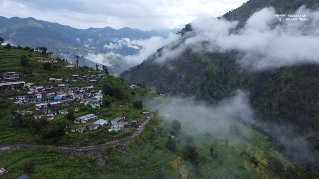
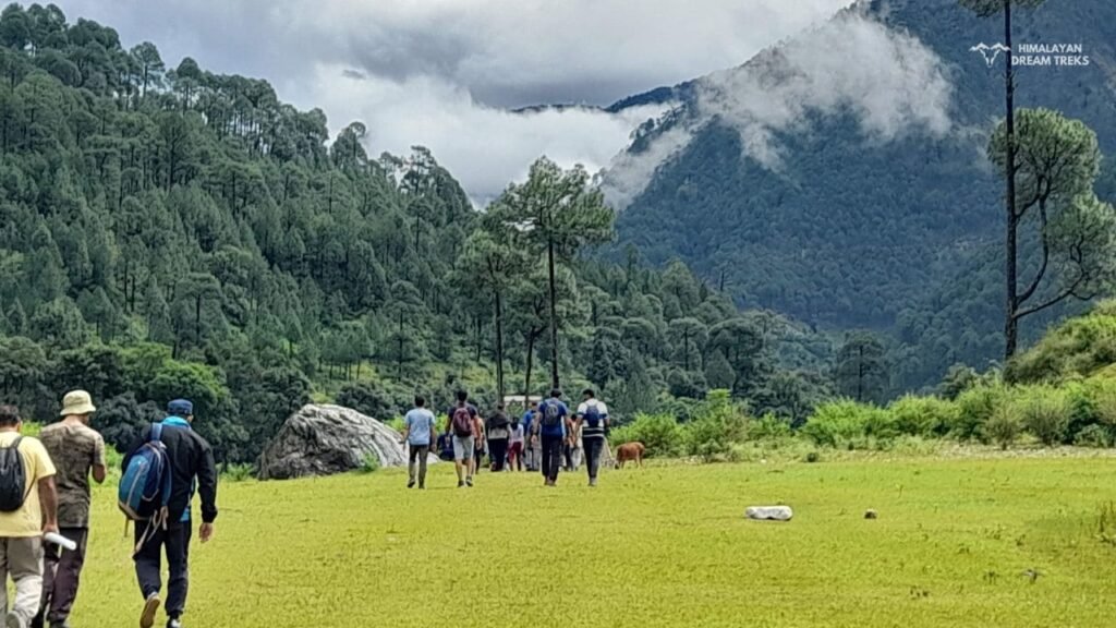
The trek will begin from Silla Village on Day 2. One hour’s drive will take us from Netala to Silla Village. Silla is located on the eastern side of the Uttarkashi-Gangotri route. We will cross the Bhagirathi River and reach Silla Village. From Silla Village onwards, we will trek on an uphill offbeat route to reach Gairi.
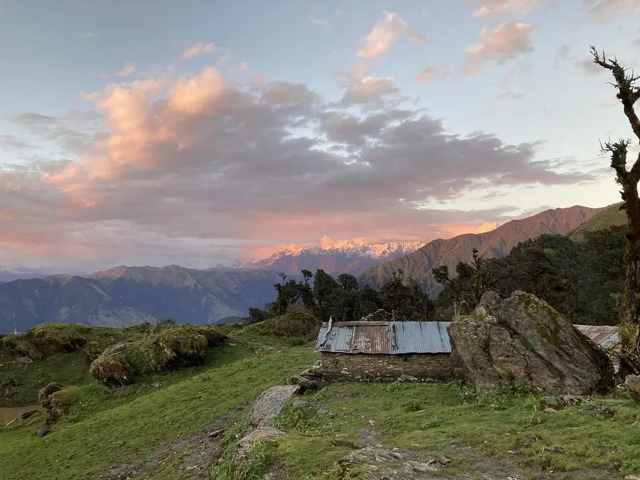
Gairi is a small settlement set up by villagers of Silla. In monsoon, they shift there temporarily with cattle and live in Chaani (wood and stone huts). On the route, you will experience village life, Garhwali culture, farming practices, and the livelihood of local villagers. The trail goes through the forests of Spruce, Juniper, Kharsu, Bhanjh, Moru, Thunder, Burans, and Kafal. We will set up camp at Gairi and spend the rest of the night there.
It will take about 5 hours to reach the campsite. The team will spend the night there in Gairi.
Day 3: From Gairi to Kush Kalyan
Trek Distance: 7-8 Km, Time taken: 6-7 Hours, Kush Kalyan Altitude: 3,500 m/ 11,500 m
On the third day of the trek, we will start hiking towards Chuli La Pass.3 On the way, we will trek through the deciduous and oak forests and will reach the pass after 2 to 4 hours. The trekking trail will appear more challenging before we cross this pass, and after that, it’s relatively easy.
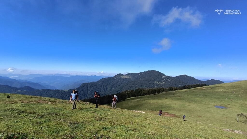
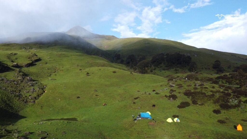
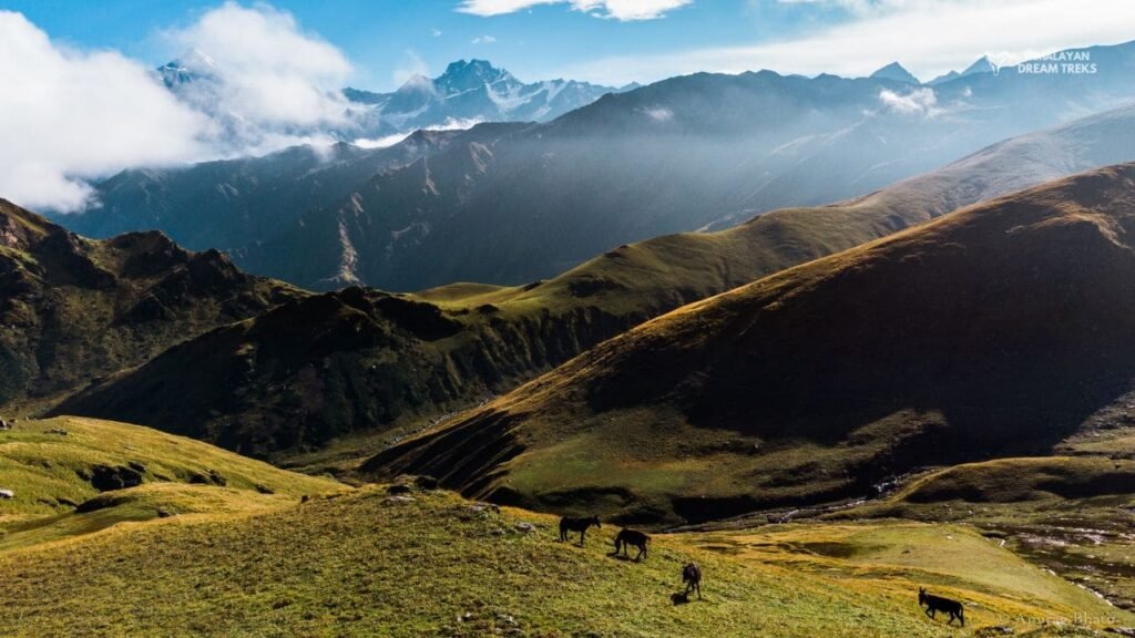
We will take the downhill trail for a certain distance. And then, after crossing the bugyal, we will climb the Kush Kalyan. Overall, after trekking for 6-7 hours, we will reach the peak of Kush Kalyan. And here we will stay the night in the camp on the Kush Kalyan plateau. Kush Kalyan is a huge alpine meadow just like Dayara and Ali Bedni Bugyal. It’s still an unknown place as not many trekkers know about this bugyal. Locals of Silla, Pilung, and Pinswar have their cattle and huts here. Bakrwals and Gujjars of various regions migrate to Kush Kalyan as the grazing area is abundant here. This place also holds spiritual significance to local villagers, and there are various small temples of local deities. Make sure to respect the local culture and customs.
Day 4: From Kush Kalyan to Kyarki
Trek Distance Covered: 7-8 Km, Time taken: 7 hours, Kyarki Bugyal Altitude: 3,900 m
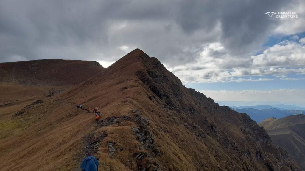
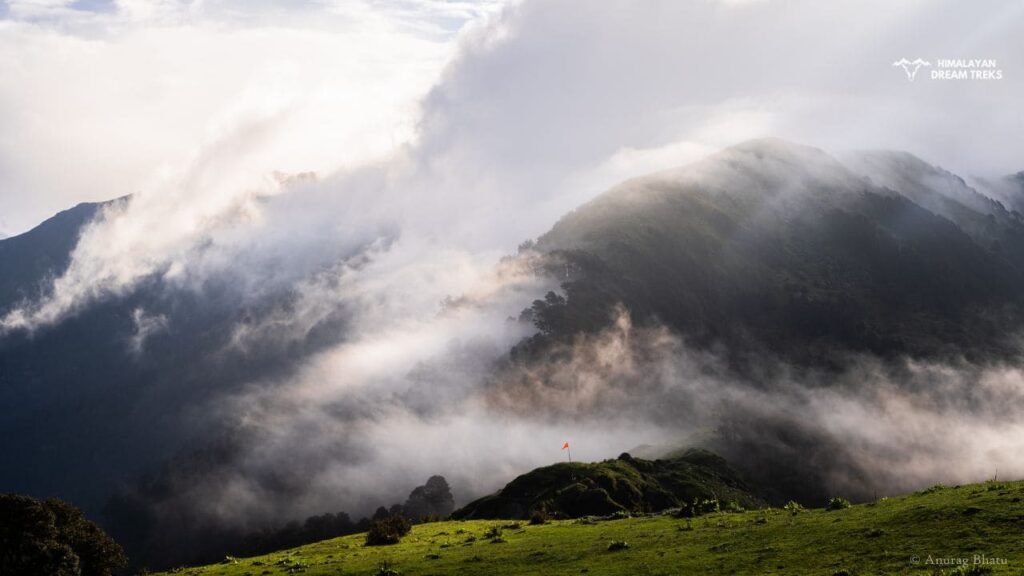
On this day, we will reach Kyarki. The route is steep, and some parts of the route are rocky with meadows all around. From the endpoint of Kush Kalyan, we have to cover the whole Kyarki Bugyal. Kyarki is not as big as Kush Kalyan but is still a big meadow compared to other meadows in the region. Around Kush Kalyan, there are still a few villagers and human encounters, but once you reach Kyarki, you will feel more isolated. This place is at a much higher altitude, and the negligible human interference makes it a great place to encounter wildlife like Bharal, Ibex, Himalayan Bear, Leopard, and Pika.
By evening, we will set up our camp at the end of Kyarki Bugyal. From the Kyarki Bugyal, we can see the popular peaks Draupadi ka Danda, Srikantha, Kalanaag, and Bandarpoonch.
Day 5: From Kyarki to Lamb Tal
Trek Distance: 6-7 Km, Total time taken: 7 to 8 hours, Lamb Tal Campsite Altitude: 4300 m/ 14,100 ft
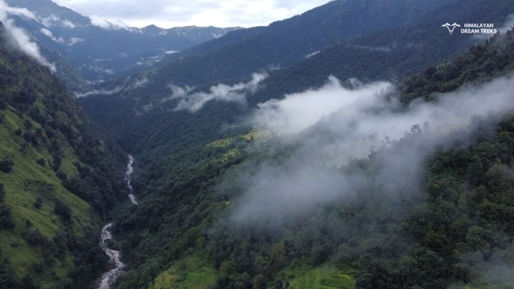
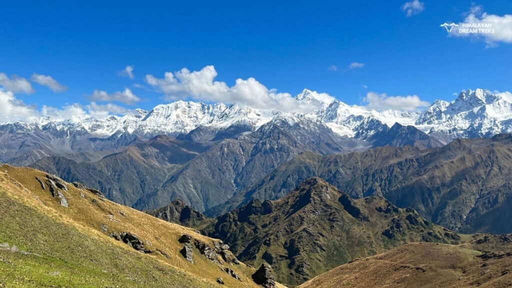
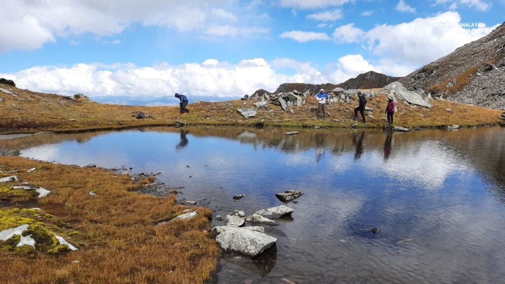
We will start moving towards Lamb Tal on the 5th day of the trek. In the initial hours, we will be walking on the narrow stone ridges via the Dharamshala campsite. After Dharamshala, the meadow will disappear, and the ascent of Kokuli Dhar will start. From Kokuli top, one can easily see Lamb Tal, Khatling Glacier, and multiple lakes around. After Kokuli top, there’s a descent toward Lamb Tal. On the way, one can see Brahma Kamal, Phen Kamal, Neel Kamal, and other Himalayan flora.
“The first lake, Lamb Tal, was hardly a kilometer away, a circular tarn about fifty meters across. A steep climb to Kokuli Dhar passed a second lake with a much more dramatic setting. This was called Kokuli Tal but since it was long and narrow (over 200 yards long) it seemed to be more likely Lamb Tal. On the climb, we saw a Monal browsing on the craggy ridge making a striking silhouette.” – Bill Aitken
Lamb Tal is a small tal compared to Sahastra Tal. We will set up our camp at Lamb Tal for the night.
Day 6: From Lamb Tal to Sahastra Tal and Return to Dharamshala Campsite
Trek Distance: 9-10 Km, Time taken: 8 hours, Dharamsala Campsite Altitude: 4,270 m/ 14,000 ft
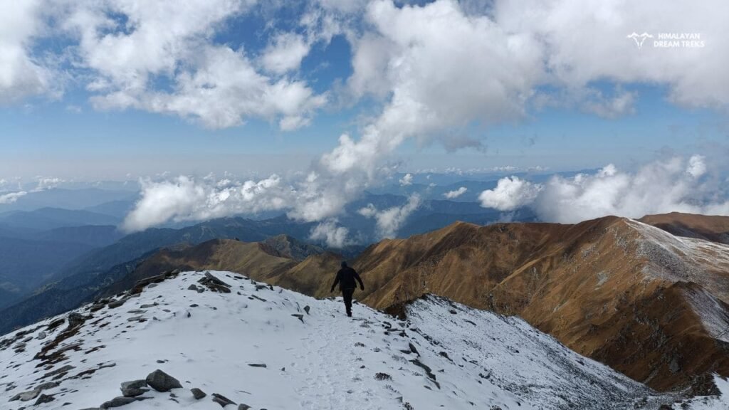
This day will be the final day to reach Sahastra Tal. This ultimate trail will be steeper and more challenging. After crossing Dhoni Tal, we will finally reach Sahastra Tal. Here we will spend a few hours in the spiritual vibes of the lake. After a holy bath, we will return to the Dharamshala campsite.
Day 7: Dharamshala Campsite to Kush Kalyan
Trek Distance: 9-10 Km, Time taken: 6-7 hours, Kush Kalyan Campsite Altitude: 3,900 m
Today we will trek for approximately 8 hours and reach Kush Kalyan. On the trail, we will pass through the Kyarki Bugyal and Kyarki Khal. At night, we will stay in Kush Kalyan by setting up the camps.
Day 8: Return Trek from Kush Kalyan to Silla Village
Trek Distance: 12 Km, Time taken: 8 hours, Silla Village Altitude: 2,025 m
On this day, we will reach Silla Village. After trekking through the Himalayan forests and bugyal, from Silla, we will drive to Netala and have our night stay there.
Day 9: Return From Netala to Dehradun
It’s the last day of the trek when we will return to Dehradun from Netala. Overall, we will spend 7 to 8 hours in the car to reach Dehradun, the end of this Sahastra Tal trek.
Permits and Regulations
This trek is located at a high altitude, so it is compulsory to go through the screening process before the trek starts.
You are required to obtain permits from the Forest and Uttarakhand Tourism Development Board. Permits can be easily applied for via the SWS Uttarkashi portal, with fees of INR 123.07 per individual. Please note that permits can be applied by registered companies only. This trek can’t be done DIY.
Documents required to get the permit are Govt ID, Medical Certificate, and Adventure Insurance.
Accommodation Options During the Trek
In basecamp villages, you can easily find homestays. Their charges range from INR 800-1000 per night. On the trail, tents will be used. There are various campsites during the trek where camps are pitched for the night. Sometimes, you can stay in Chaanis (wood and stone structures) with the locals and the Van Gujjar tribe.
Flora and Fauna on Shastra Tal
About the Flora
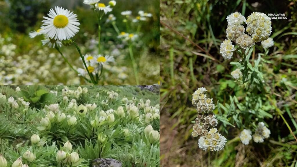
Generally, the trek route is covered with poppy fields, rhododendrons, coniferous trees, oaks, thuner, and several kinds of herbs.
If you trek during the blooming season (summers), you will see the entire trek adorned with colorful flowering plants and herbs. The herbs and shrubs present there are uncommon in other regions, making them truly precious. Here are the names of some of the flora present:
- Brahma Kamal (Sacred Saussurea): a sacred rare flower in Hinduism.
- Jata Mansi (Spikenard): a herb with antioxidant and antifungal properties and used in making dhoop.
- Gokul (Saussurea Obvallata): similar to Brahma Kamal.
- Chirayita (Swertia Angustifolia): a purple flower with antiparasitic properties.
- Katuka (Picrorhiza Kurroa): a herb used for digestive issues; other names include Kadu and Kakuli.
- Pancholi (Himalayan Blue Poppy): a flower used in making dye.
- Atish (Aconitum Heterophyllum): a purple flower plant used in Ayurveda.
- Guggul: a herb used to cure inflammation and make havan samagri.
- Kachal or Rai ke Beej (Abies Spectabilis): a conifer plant with high-quality wood.
- Yellow Jahaan: a bright yellow flower.
- Thuner: species of yew native to the Himalayas.
- Marcha: an agricultural plant that is also consumed.
- Ladu: a plant with small purple flowers used for flavoring.


About the Fauna
Here is a list of fauna present around Sahastra Tal:
Birds’ Names in Local Language
Monal, Himalayan Ghatu, Raja Gidh, Pahadi Pari, Pahadi Papiha, Nilkanth, Kaal Chough, Peele Chough
Animals in the Region
Himalayan Bear, Goral (goat), Red Fox, Bharal (sheep), Deer, Musk Deer, Jharal (Himalayan Tahr), Jular
Safety Tips and Precautions
This trek comes under moderately challenging treks, so you need to consider some safety tips and precautions before going on this trek.
- First of all, you should go for full-body checkups and consult a doctor before the trip starts. Have proper acclimatization in the basecamp village to avoid AMS.
- Secondly, people with anemia, asthma, and cardiac issues should avoid trekking to this high-altitude lake.
- You and other trekkers willing to go on this trek must learn some life-saving skills such as weather prediction, first aid, geography, rope knots, and basic rock climbing. Besides this, you must understand the trek route map and the overall map around Sahastra Tal.
- There are not enough potable water resources on the trek route, so it’s better to store water in large cans. Along with that, you should drink water at regular intervals to avoid dehydration.
- During the trek, you should follow the guidelines given by your guide sincerely.
- You should keep a whistle, lighter, map, and laser torch in your pocket so that if you get separated from your group, you can find them by blowing the whistle and using the laser torch.
The recent tragic incident at Sahastra Tal, where 9 trekkers lost their lives, should be a wake-up call for all trekkers to come prepared and do all the due diligence before booking a trek.4
What Essentials Should You Bring on the Trek?
We have made a list of certain items that will make your trek experience better:
- Waterproof Rucksack
- Trekking Pole
- Umbrella
- First Aid Kit
- Headlamp
- Camping Tent
- Rain Suit
- Trekking Shoes
- Heat Pouches
- Water Filter Bottle
- Gas Stove
- Power Bank
- Portable Folding Chair
- Camping Utensils
- Compass
Cultural Insights and Local Communities
The area around Sahastra Tal is an interior region of Uttarkashi and Tehri Garhwal, so relatively population is on the lesser side as compared to the nearby villages of Uttarkashi and Ghansali. Villagers here spend their lives with minimal resources. For their livelihood, they rear cattle (cows, buffaloes, goats, sheep), horses, and mules. Farming is also a major source of income; they sow potatoes, marcha, wheat, and paddy in their fields. The women of the families churn pure buttermilk in a pot made of thuner wood, traditionally, and it is consumed with the meal. Locals also earn money by offering cooked food, shelter, and horses to trekkers. Some of the men work as trek guides as well.
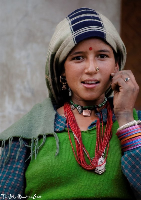
The women wear plain salwar suits, dhoti, nath, timaniya, and tie a scarf on their heads, representing the Pahadi culture. Last but not least, these communities speak local Garhwali but understand Hindi very well.
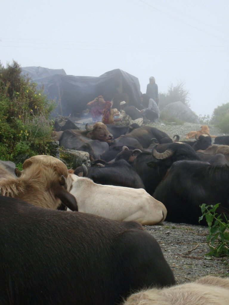
The Van Gujjar Tribe is found in the nearby bugyals. They are a semi-nomadic tribe. In summer, they migrate to bugyals with their families and cattle, and with the start of autumn, they descend to the foothills of Uttarakhand. Their main livelihood is selling milk products. Locals of Uttarkashi and travelers are very fond of Gujjar buffalo (Gujari Bhaisi as said in Garhwali) milk, as it is very rich in nutrients and flavor.

Summary
This article was about the Sahastra Tal Trek of Uttarkashi. It’s one of the beautiful treks you will do in your life. It has everything from glaciers to lakes, forests to meadows, wildlife to absolute wilderness. Due to its beauty, Bill Aitken named the seven lakes ‘The Lake District of Garhwal’.5 Good fitness and mental strength is the key. Previous high altitude trek experience will come in handy.
We hope you found this article helpful. Still, if you have any doubts related to this trek, just let us know.
- The Himalayan Journal – Expedition and Notes (https://www.himalayanclub.org/hj/49/18/expeditions-and-notes-49/#point16) ↩︎
- Page 171, 172, 173 – Himalaya Through The Lens of a Sadhu (https://archive.org/details/HimalayaThroughTheLensOfASadhuSwamiSundaranand/page/n172/mode/1up?view=theater) ↩︎
- The Freedom Walk – A Trek in Lake District of Garhwal 1997 (https://www.harishkapadia.com/climbs-explorations/garhwal/freedom-walk/) ↩︎
- Sahastra Tal Tradegy (https://www.thehindu.com/news/national/karnataka/we-could-not-see-anything-that-was-even-one-foot-ahead-of-us-recalls-survivor-of-uttarakhand-trekking-tragedy/article68256583.ece) ↩︎
- Monsoon and Madness – William McKay Aitken (https://www.himalayanclub.org/hj/42/21/expeditions-and-notes-42/#point7) ↩︎
Leave a Comment