Gidara Bugyal Trek | Details, Cost, Itinerary & More
Region: Uttarakhand
Base Camp: Raithal
Days: 8 Days
Altitude: 14,000 ft
Grade: Moderate
Distance: 40 km
Min Age: 16 Years+
Meals: Included
Best Season: Summer and Autumn
Trek Description
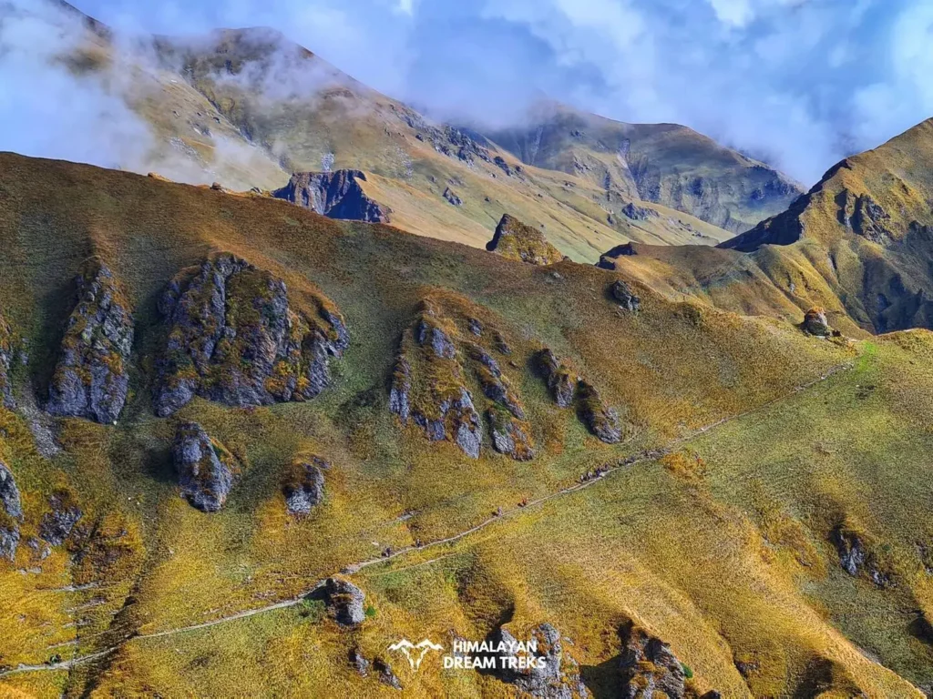
Gidara Bugyal is an alpine meadow trek nestled in the Garhwal Himalayas of Uttarakhand, India. It stands at altitudes ranging from over 12,000 feet to nearly 14,000 feet, making it one of the highest alpine meadows in the region.
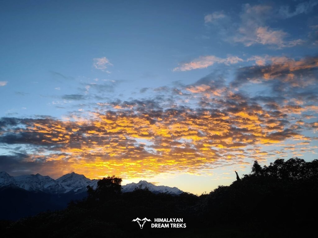
This trek offers expansive meadows against the backdrop of snow-capped peaks, creating a visually stunning experience for nature lovers. However, Gidara Bugyal is not for the faint of heart, as it presents challenges such as rugged terrain, high altitudes, and unpredictable weather conditions.
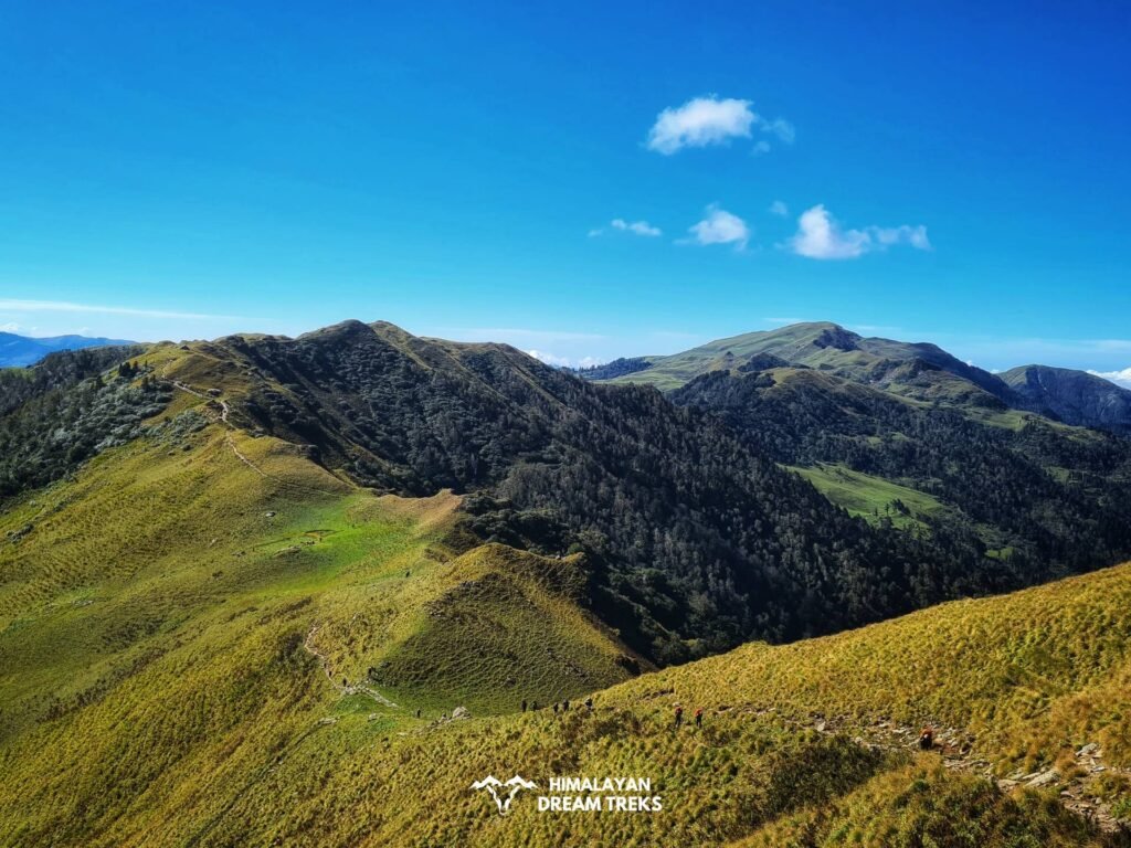
What sets Gidara apart is its double ridge walk, a rare feature in trekking. Trekking above 13,200 feet, you’ll witness clouds swirling around you as you make your way to Gidara Top. This unique altitude is also where the rare Brahma Kamal flower blooms.
Throughout the trek, you’ll enjoy close-up views of the Gangotri Massif and the Yamnotri Range. The three-hour ridge walk provides a rare opportunity to witness the Greater Himalayas up close.
Gidara Bugyal offers diverse campsites, including riverbanks, mountain valleys, forest clearings, and mountain slopes. Notably, you won’t camp at the same site twice, adding variety to your experience.
Typically spanning eight days, the trek covers locations like Raithal, Chilapada, Devkund, Pailutna, and Gidara Bugyal. Each day presents its own unique challenges and rewards.
Itinerary
Drive Distance: N/A
Altitude: N/A
- Your adventure begins in the quaint village of Raithal, located in Uttarkashi district.
- After a hearty breakfast, you’ll start your trek, passing through lush forests and picturesque landscapes.
- The day’s journey leads you to Chilapada, a charming campsite where you’ll set up your tents.
- It’s a relatively easy trek today, allowing you to acclimatize to the altitude and soak in the natural beauty.
Trek Distance: N/A
Altitude Gain: N/A
- Today’s trek will take you through the enchanting Dayara Bugyal, a sprawling alpine meadow that’s a treat for the eyes.
- You’ll trek amidst a sea of wildflowers and rolling meadows.
- Continue your journey to reach Devkund, known for its crystal-clear lake, where you’ll camp for the night.
- The trek today is moderate, offering stunning vistas of the surrounding peaks.
Trek Distance: N/A
Altitude: N/A
- As you leave Devkund behind, the trail will lead you through dense forests and gentle ascents.
- Pailutna, your destination for the day, is a serene campsite nestled amidst the wilderness.
- Enjoy the tranquility of the Himalayan forest and rest up for the adventures ahead.
Time: N/A
Drive Time: N/A
- Brace yourself for an exciting day as you make your way to Gidara Bugyal.
- The trek involves some steep ascents, but the breathtaking views make it all worth it.
- Upon reaching Gidara Bugyal, you’ll be greeted by the vast expanse of meadows against the backdrop of towering peaks.
- This will be your campsite for the night, and it’s bound to be a memorable one.
Time: N/A
Drive Time: N/A
- Today’s trek takes you to Gidara Top, one of the highlights of this journey.
- You’ll trek along a ridge with panoramic views all around.
- The high altitude and the thrill of being on a summit are sure to invigorate your spirits.
- After enjoying the views and capturing memories, you’ll descend back to Gidara Bugyal to camp for the night.
Time: N/A
Drive Time: N/A
- Begin your descent from Gidara Bugyal, following the trail through dense forests.
- You’ll arrive at Gujjar Hut, a simple yet cozy spot nestled in the mountains.
- The day’s trek is moderate, allowing you to enjoy the natural surroundings and the sounds of the forest.
Time: N/A
Drive Time: N/A
- Your trek today will lead you to Bhangeli, a picturesque village in the Uttarkashi district.
- From Bhangeli, you’ll head to Uttarkashi, where you’ll wrap up your trek.
- Take some time to explore Uttarkashi and reflect on the incredible journey you’ve had over the past week.
Time: N/A
Drive Time: N/A
- After a restful night in Uttarkashi, it’s time to bid farewell to this beautiful region.
- You can choose to explore Uttarkashi further or head to your onward destination.
- Your Gidara Bugyal trek adventure officially comes to an end, leaving you with memories of the stunning Himalayan landscapes.
What’s Included?
Price Inclusion
- Hotel stay and Camping
- Meals from day 1 dinner to day 8 breakfast
- All the required forest and camping permits
- Sleeping bag, mattress, tent, gaiters and spikes (if required)
- First aid kit
- Certified trek leader
Price Exclusion
- Travel Insurance
- Meals during the transportation
- 5% GST is not included
- Any expenses or items not mentioned in the inclusion section are not covered
- Any expenses arising from emergencies during the trek
- Transportation from Dehradun to the base camp and back to Dehradun is not included
- Any personal expenses
Things to Carry
- 45-60 Ltr Bag Pack With Rain Cover & Comfortable Straps
- Hot & Cold Water Bottle Like Borosil & Milton
- Energy Bar, Dry Fruits & ORS
- Personal Medical Kit
- 2/3 Full Sleeves (Non-Cotton)
- 1 Full Fleece T-Shirt
- 1 Fleece Jacket (Woollen Or Sweater)
- 1 Down Feather/Hollofil Jacket
- 1 Waterproof Jacket/Poncho
- 1 Pair Thermal Inners (Upper And Lower)
- 2 Trek Pants (Avoid Shorts & Denim Pants)
- 1 Pair of Waterproof Gloves
- 1 Pair of Woollen Gloves
- Sun Cap
- Woollen Cap
- 4 Pairs Of Cotton Socks
- 1 Pair Of Woollen Socks
- 1 Pairs Of Sunglasses (U/V Protected)
- 1 Neck Gaiters (Buff)
- Tiffin Box
- 1 Waterproof & High Ankle Trekking Shoes
- 1 Pair Of Floaters
- Hand Sanitizer & Sunscreen Lotion
- Toothbrush And Toothpaste
- Toilet Paper And Wet Wipes
- Quick Dry Towel
- Lip Balm & Antibacterial Powder
- Moisturizer
How To Reach Raithal
Flight is the quickest and easiest means to reach Raithal in Uttarakhand. Booking a flight to this destination is not a hard job, you can get a flight from most metro cities in India.
The nearest airport to Raithal is Dehradun’s Jolly Grant Airport which is located approximately 25 kilometers from the city center. Several flight operators like Air India, Akasa Air, Vistara, and others operate flights to Dehradun, which makes your transportation easy and comfortable.
It is recommended to book a flight at least a month before traveling since the last moment flight booking is comparatively higher than the standard price. Considering the cost, we recommend you to take flights to Delhi, capital of India first. From there, you can take UTC, HRTC, buses, railway or hire a taxi to reach Dehradun.
Dehradun is one of the major cities in India and it is well-connected to other cities by train. So traveling here via train is another easiest way.
Your train transportation is served by the Dehradun Railway Station, which brings you directly to the destination from your hometown. You also can opt for Haridwar Railway Station to reach Dehradun. It is advised to make advanced bookings for trains but there are no issues in getting the service from any places like Delhi, Mumbai, Kolkata, and more.
Road trip is one of the most exciting journeys to reach Dehradun. It should not be any challenging matter since the city is connected with other major cities like Delhi and Chandigarh by National Highways.
It might be time consuming but the serene beauty of the Himalayan foothills will offer you a enjoyable experience.
Raithal is the point where we start our Gidara Bugyal Trek. It is approximately 183 kilometers away from Dehradun, which takes around 6 to 7 hours by public transportation. To reach Raithal you have to reach Uttarkashi first.
The bus to Uttarkashi leaves early in the morning around 5:30 am from Dehradun Hill station. You can also book your ticket online via the UTC portal. The average cost of the ticket is around 350 to 400 INR. A shared taxi option is also available.
If you are traveling via taxi, you will be charged around 400 to 500. You can hire a taxi from Rispana Pul or Parade Ground to Uttarkashi. Upon reaching Uttarkashi, you can rent another taxi to Raithal from Uttarkashi Taxi Stand. You must pay 100 to 150 INR to hire the taxi.
Note | Transportation Service: We also arrange transportation services for our trekkers, with the pickup point being Prince Chowk, Dehradun and pick-up time between 6 am and 7 am. An add on of INR 1,500 will be charged from trekkers.
Difficulty Level
The Gidara Bugyal trek presents a moderately challenging adventure. While it may not be the most demanding trek in the Himalayas, it is certainly not a walk in the park. Trekkers should be prepared for varying altitudes, with the meadows starting at around 12,000 feet and reaching close to 14,000 feet.
The terrain can be uneven, and the weather can change rapidly, so being physically fit and mentally prepared is essential. The highlight of the trek is the double ridge walk, a unique and thrilling experience.
Overall, Gidara Bugyal offers a rewarding challenge for those who seek to explore the high-altitude meadows and breathtaking vistas of the Garhwal Himalayas.
Best Time for this Trek
The best time to visit Gidara Bugyal is during the summer and early autumn months, from June to October. During this period, the weather is relatively pleasant, and the meadows are in full bloom with vibrant wildflowers.
The snow has melted, allowing for comfortable trekking conditions and clear views of the surrounding peaks, including the Gangotri Massif. Avoid visiting during the winter months as the region experiences heavy snowfall, making the trek inaccessible and challenging.
Summer and early autumn offer the perfect window to explore the enchanting beauty of Gidara Bugyal.
More Info of Gidara Bugyal
Gidara Bugyal holds historical and cultural significance deeply rooted in the traditions of the Garhwal region of Uttarakhand, India. Here are some aspects of its historical and cultural importance:
Gidara Bugyal is situated in close proximity to several pilgrimage routes that have been traversed by devotees for centuries. Pilgrims traveling to sacred sites like Gangotri and Yamunotri often pass through or near Gidara Bugyal, making it a part of their spiritual journey.
The Garhwal region is rich in folklore and legends, and Gidara Bugyal is no exception.
The local communities have stories and myths associated with these high-altitude meadows, often depicting the mystical and divine qualities of the mountains and meadows. These tales have been passed down through generations and are an integral part of the cultural heritage.
In the story of Gidara Bugyal trek, there’s a fascinating tale that’s been shared for a long time. It’s about a shepherd named Gambhir Singh Rana. He used to take his sheep to the beautiful Gidara Bugyal, not far from Dayara. While looking after his sheep on the grassy meadows, Gambhir Singh liked to play the flute. Shepherds often played music when they were alone in the stunning wilderness.
One fateful day, as Gambhir Singh played his flute, something magical happened. The fairies who lived in the nearby forest were enchanted by his lovely music. They were so drawn to him that they decided to take his spirit with them to their magical world.
But Gambhir Singh was worried about his family. He asked the fairies if he could see his family one last time to bid farewell to his beloved family. Touched by his sincerity and the love he held for his kin, the fairies relented, allowing him to return to his family one final time.
He explained to them that the time had come for him to leave his mortal body behind, embarking on a journey with the fairies beyond the realms of the visible world. This story about Gambhir Singh Rana and the forest fairies adds a touch of magic to the history of Gidara Bugyal.
The shepherds and Gujjar communities of the region have been using the meadows of Gidara for centuries as grazing grounds for their livestock. Their traditional practices, including the seasonal migration of cattle, are deeply intertwined with the landscape.
This symbiotic relationship between the locals and the meadows reflects the cultural significance of Gidara.
The region surrounding Gidara Bugyal is dotted with small temples and shrines dedicated to various deities. These temples serve as focal points for religious gatherings and cultural festivities. They also reflect the spiritual connection that the local people have with the natural landscape.
Gidara Bugyal is a natural wonderland brimming with diverse flora and fauna. Its alpine meadows showcase a vibrant tapestry of wildflowers, as you ascend, you’ll discover the enchanting Jacobaea Mill, Himalayan geranium, and Geranium ‘Kelly Anne,‘ each contributing to the visual splendor of the landscape.
Bistorta affinis, Fen Kamal, Kasturi Kamal, and the elusive Brahma Kamal further enhance the trek’s botanical allure.
Spotting the resplendent Himalayan Monal, elusive Himalayan Musk Deer, and robust Himalayan Tahr adds to the trek’s charm. Keep an eye on the skies for the majestic Himalayan Griffon Vulture.
Vibrant butterflies and insects fill the meadows, and encounters with local shepherds and their livestock offer insights into the symbiosis between nature and humanity in this pristine Himalayan region.
Gidara Bugyal trek is not just about the meadows and mountains; it also offers a plethora of nearby attractions and adventures to explore. Starting with Raithal Village, the trek’s base camp, you can immerse yourself in the local culture and witness the traditional way of life. Uttarkashi, a nearby town, is known for its religious significance and serves as a gateway to many other treks.
Harshil, nestled amidst the stunning Garhwal Himalayas, is a picturesque village known for its apple orchards and serene landscapes. Nelong Valley, a restricted area, is a hidden gem for adventure enthusiasts, offering an offbeat experience.
Bamsaru Tal, a high-altitude lake, is a serene spot for a day’s excursion. Sailum Ridge offers panoramic views and an opportunity for ridge-walking. Bandarpuch Basecamp is an excellent spot for those looking to explore more peaks.
Devkund Campsite, situated on the trek, provides a beautiful camping experience by a gushing stream. Sukhi Top and Surya Top are vantage points offering stunning vistas of the surrounding peaks.
For some relaxation, the hot water springs at Gangnani provide a soothing dip. With these attractions and adventures around Gidara Bugyal, your trekking experience is bound to be enriched with cultural encounters and natural wonders.
Gallery


Maps
FAQs
Gidara Bugyal is in the Garhwal Himalayas (Uttarkashi district) of Uttarakhand, India.
From Gidara Bugyal, you can enjoy breathtaking views of peaks like Bandarpuch, Srikanth, and several other majestic peaks of the Garhwal Himalayas.
Gidara Bugyal trek is moderately challenging, featuring varying terrain, high altitudes, and changing weather conditions. Trekking experience and physical fitness are important factors for this adventure.
Mobile network connectivity may be limited or absent during the trek, so it’s advisable to inform friends and family before starting the trek. Charging points for electronic devices may also be scarce, so it’s essential to conserve battery.
The nearest ATM to the Gidara trek is typically located in the town of Uttarkashi, which serves as a base for many treks in the region. However, it’s advisable to carry sufficient cash before heading to the trekking location.
18,999
/ Per Person
5% GST & + 1,500 INR Transportation Cost
Book NowAvailable Dates
Call Us
Call Us
Call Us
Call Us


Leave a Comment