Overview
If you are looking for a trekking adventure that takes you to the heart of the Indian Himalayas but without the crowds, Bali Pass Trek in Uttarakhand is your answer! And if adventure is your calling then this trek should be at the top of your list. Located in the Govind Pashu Vihar National Park, this offbeat spans 60km long. It connects Yamunotri and Har ki Dun, and treats you to high and rugged passes like the Bali pass which sits at 16,200 feet. As you trek higher, you will be in a constant state of jaw drop witnessing peaks like Swargarohini, Bandarpunch, and Kala Nag rise in all their glory.
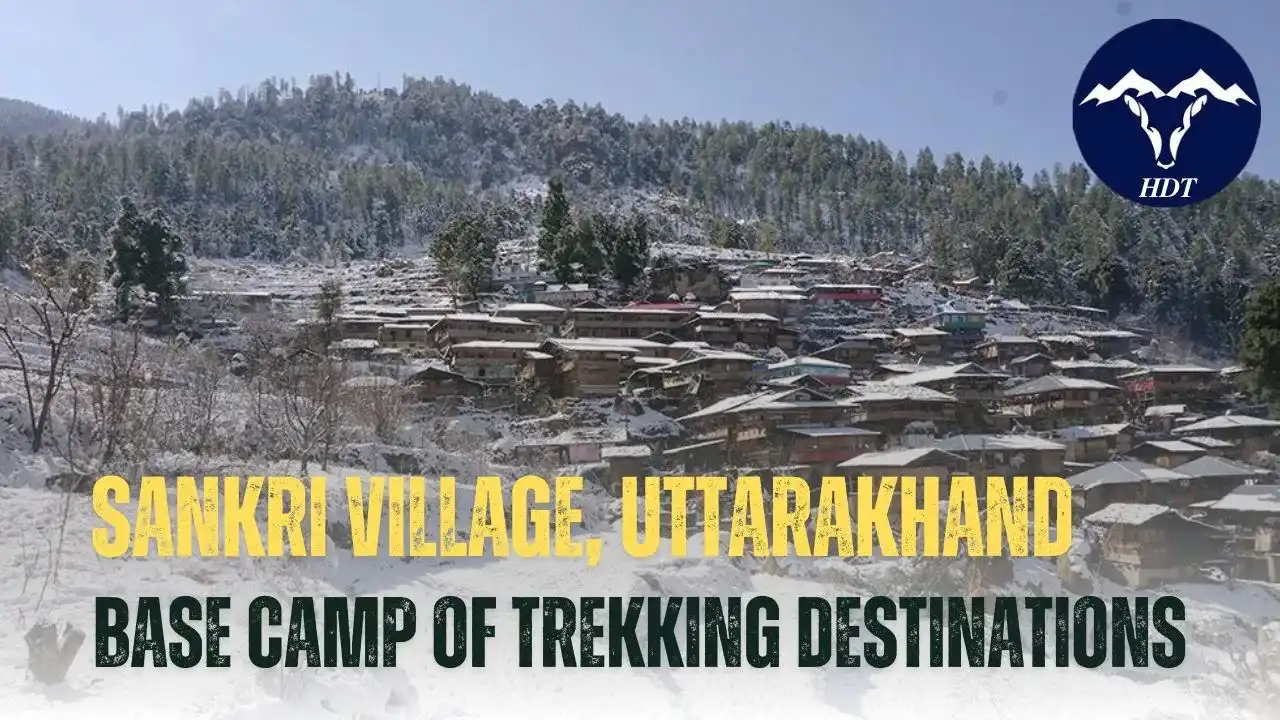
The Bali Pass Trek begins at the Sankri Village, a 8 hour drive from Dehradun and ends at Janki Chatti. The trek takes 8 days to complete, taking you on a journey through some of the most remote Himalayan villages, like Osla and Gangad. It also gives you a chance to visit the spiritual sites like Saptarishi Lake and Yamunotri Dham.
The trek follows a navigable route passing through challenging terrains, with steep ascents and descents as you traverse steep slopes and walk along mountain ridges to the top. As you cross high mountain passes and alpine meadows, the landscape changes dramatically showing glimpses of snowy passes, snow clad peaks, and dense forests. The route is still finding its way to popularity, which makes it perfect for those who want to trek off the beaten path. These paths were once taken by the sacred deities and sages, and now you can get to call them your own, making it more mystical! It is believed that path was taken by the Pandavas in the Mahabharata epic during their way to heaven, marked by the Swargarohini Peak.
Trekking in Uttarakhand is not for the weak hearted and the Bali Pass Trek is no exception. The route involves steep ascents and descents, narrow trails, and risky terrain sections that require a high level of physical and mental endurance. This trek is difficult and best suited for experienced trekkers who have priorly trekked at high altitudes and are equipped with the required skills and preparation. For the effort you put in over all the days, this trek rewards you well with magnificent views of the surrounding peaks and valleys. So, lace up your boots and make sure your muscles are trained.
So, if you’re ready to embark on a journey through some of the most rugged, remote, and beautiful landscapes, this unexplored Trek awaits you. This article puts together all the information you need about the Bali Pass Trek.
5 Reasons why you must trek the Bali Pass
Offbeat Trekking Experience: The Bali Pass Trek is one of Uttarakhand’s offbeat trekking experiences, far away from the crowds. This lesser-known trail gives trekkers the chance to walk down amongst the remote valleys, untouched landscapes, and hidden villages. This trek is a peek into the pristine beauty of the Himalayas, an escape that cuts you out from the noise and gives you the solitude you have been looking for long!
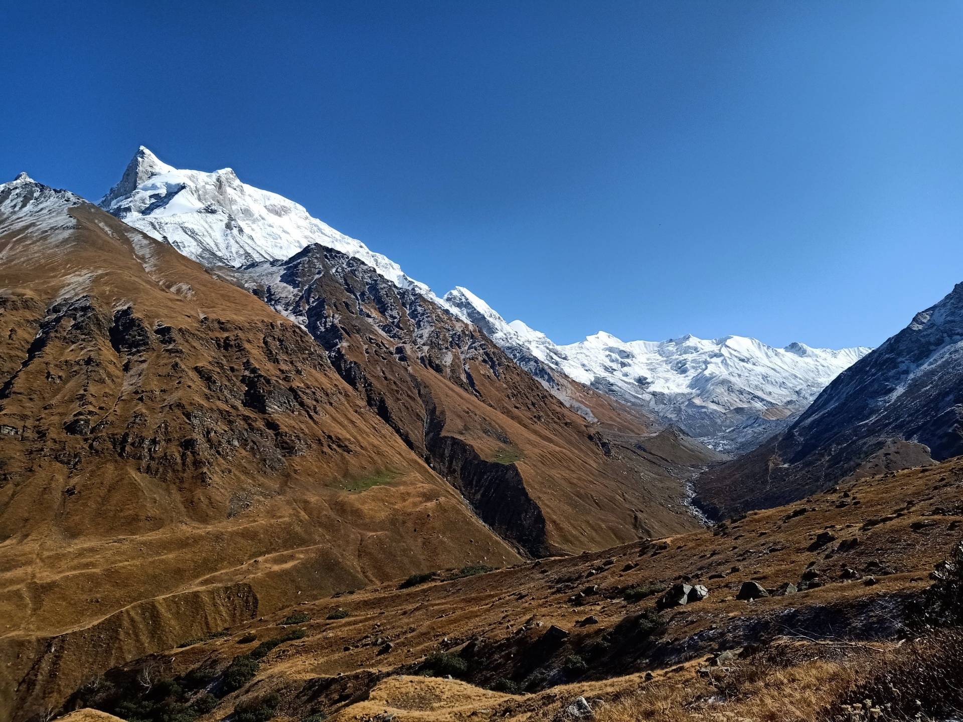
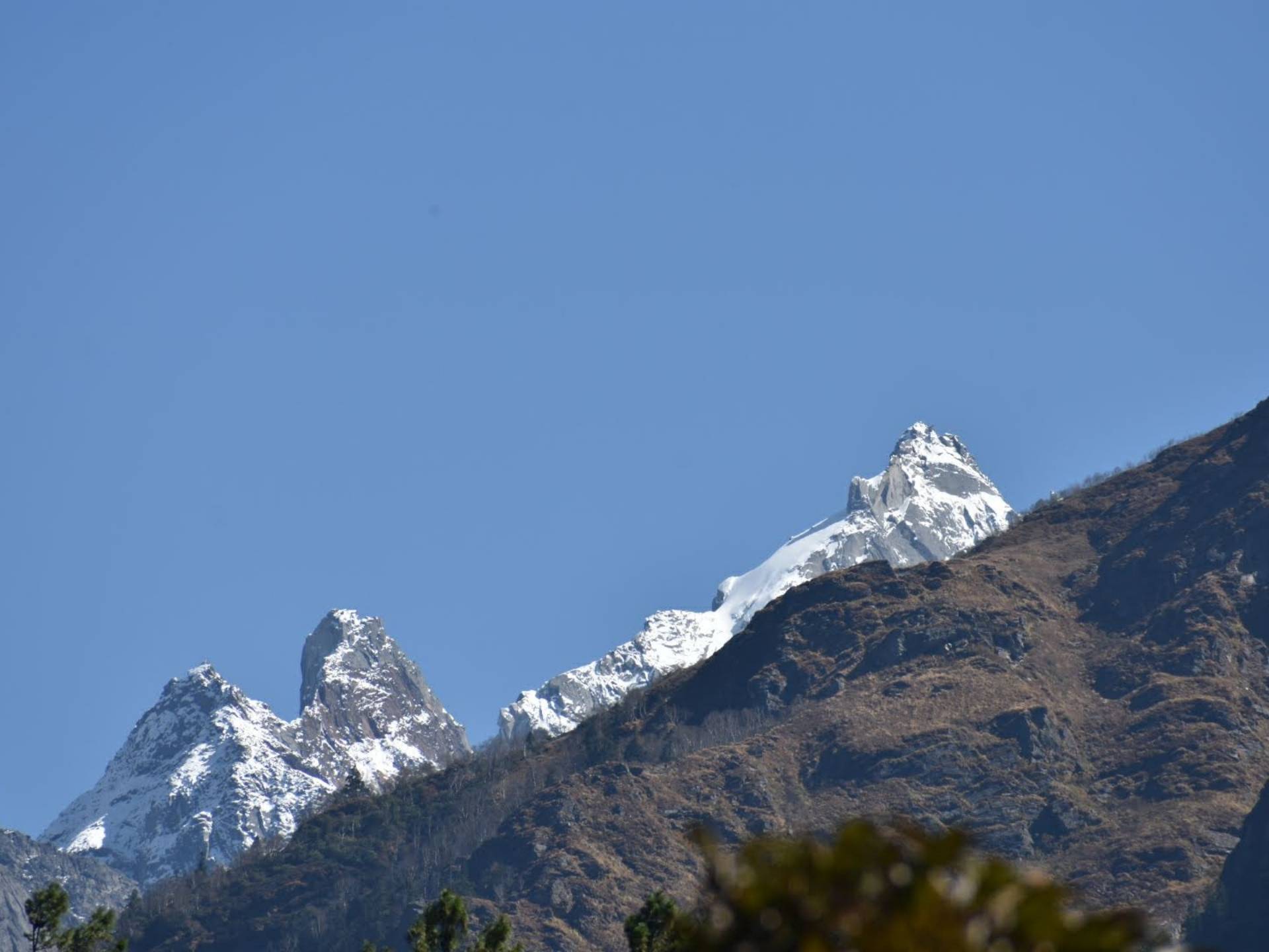
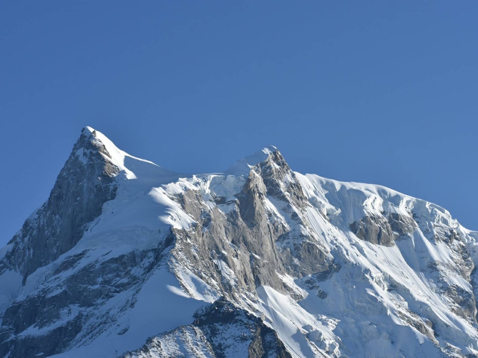
Breathtaking Landscapes: The word Spectacular also falls short to express the beauty of this trek. The trek leaves you in wonder with its breathtaking landscapes, from alpine meadows filled with wildflowers bursting with colour, high-altitude lakes, mountain peaks like Swargarohini, rugged ridges and many such that will leave you wanting for more!
Spiritual Attractions: This trek is a spiritual and scenic journey, taking you to Yamunotri Dham along the way. Saptarishi Lake is a sacred high-altitude lake, believed to be associated with the seven great sages (Saptarishis). Yamunotri Dham, the source of the Yamuna River, is another highlight with a temple dedicated to Goddess Yamuna and is a part of the popular Chota Char Dham Yatra. You will also stumble upon Ruinsara Lake, with beautiful reflections of the mountain peaks in its clear waters. Sit by the lake for some self reflections.
Cultural Exploration: The trek takes you through ancient Himalayan villages like Osla and Gangad, where you can immerse yourself in the region’s rich cultural heritage. These offbeat villages give you a glimpse into the traditional lives of the Garhwali people. Crossing paths with the locals and experiencing their hospitality makes the trek more memorable.
Beautiful Campsites: Imagine sleeping under clear skies sparkling with stars and galaxies, with the peaks watching you over. It also makes for a wonderful opportunity for Astrophotography. Campsites set near the crystal waters of the alpine lakes, it gives you a peaceful atmosphere, making you wish the night stays young and still.
Trek Itinerary
Day 1: Dehradun to Sankri
Drive Distance: 220 km/ 9-10 hours
Altitude: 6,400 ft
The trek begins at the Sankri Village located in the Govind Pashu National Park region. A comfortable drive from Dehradun passing through Mussoorie, Kempty Falls, and villages like Purola, and Mori, will get you to Sankri. You will have the pristine sacred waters of the Yamuna river and Tons River, for company through the journey.
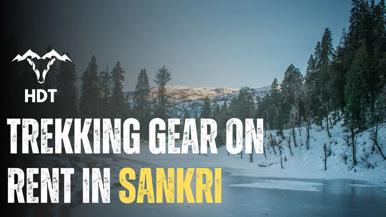
This village serves as the base camp for many other popular treks like Kedarkantha, Har ki Dun. This is the last village where you can buy or rent trekking gear, in case you need some last minute fixes. You will spend the night here at a guesthouse or a camp, and gear up for the trek ahead.
Drive Distance & Time: 12 km/ 1 hour
Trek Distance & Time: 12 km/ 7-8 hours
Altitude: 8,500 ft
After a delicious breakfast, a 12km jeep ride will take you from Sankri to Taluka from where you will begin trekking. This is a landslide-prone route and is usually closed during monsoon season. The trek begins with a gentle 4km climb through Deodar and Rhododendron forests. From Taluka, the trail descends to the river valley of Supin on the right and forests to your left. You will spot two bridges on your way from where you can fill up your water bottles. So, make sure to hydrate well to avoid being hit by AMS.
Continuing downhill, trekkers will encounter a tributary of the Supin River, crossed via a wooden bridge. The river then drains the upper reaches of Swargarohini and merges with Rupin River and forms Tons River. After a brief climb, the path splits—opt for the straight route, avoiding the upward trail. The terrain becomes challenging as it is prone to landslides, and hence requires careful navigation. The trail then brings you to forested areas with a few ascents.
You will then arrive at the quaint Gangad Village which is inhabited by the Bhotiya Tribe, who are mostly shepherds. This village is known for its unique architecture and gives you a chance to experience the authentic Garhwali culture. You will cross a bridge Chelud Gad to reach the other side of the river. The route from here will take you to Seema village, which is an uphill trek. This is where you will camp for the night. In case there is no camping spot available here, you could camp at Chelud Gad only instead.
Trek Distance: 10 km/ 6-7 hours
Altitude: 10,124 ft
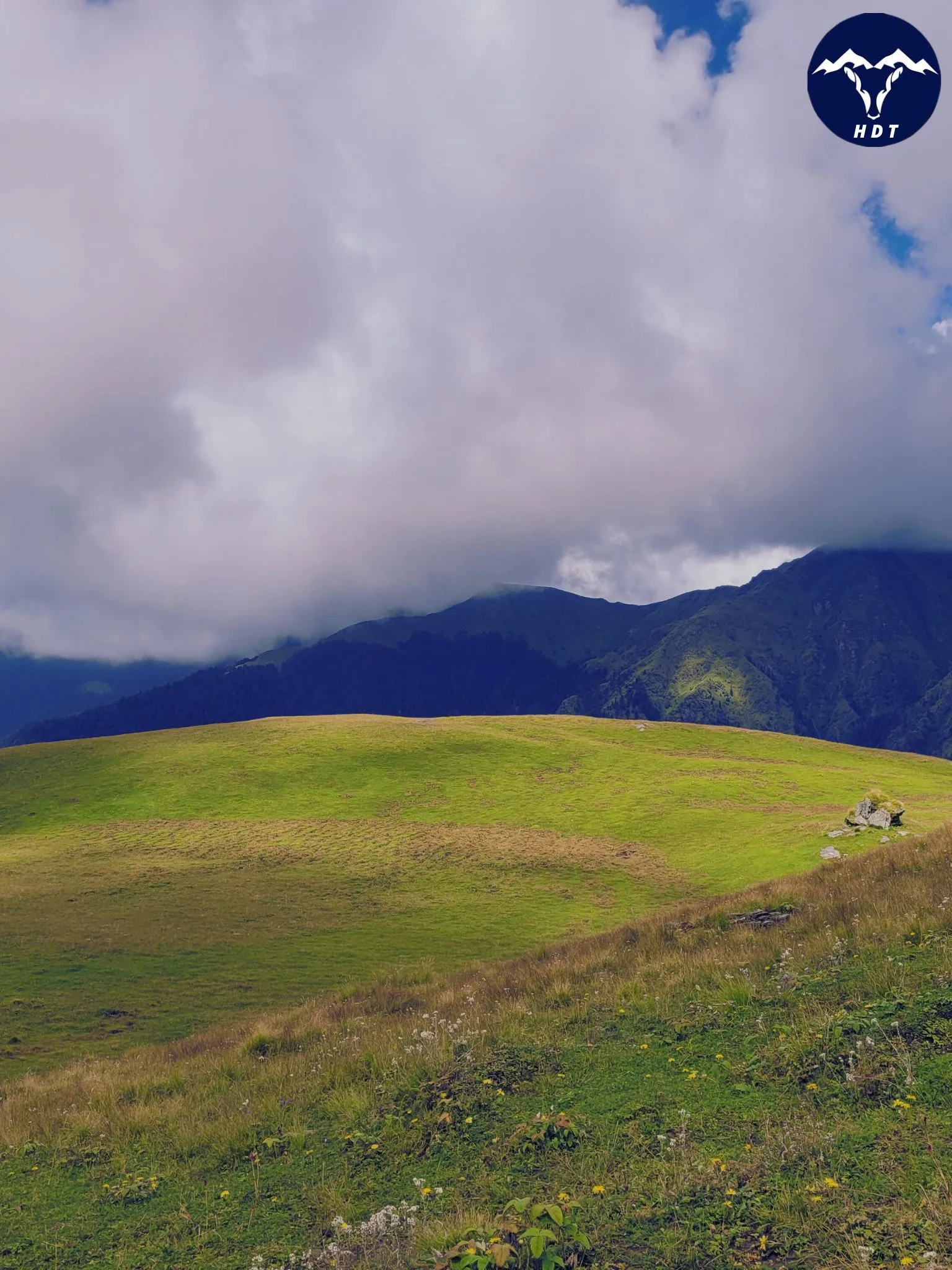
On Day 3 you will take the trail going down with River Supin on your left. From here the trail brings you to the entry point of Ruinsara Valley, and will pass by a series of streams and boulders as you enter the Ruinsara Forest. You will see Osla village behind you. After 30 minutes of walking later, you will find yourself at the Devsu Bugyal, a meadow which is 2 km long. Towards your left you will see the stunning Har Ki Dun Valley, and you will also get the magnificent views of the majestic Kala Nag Peak (Black Peak).
Take a midday break at the Devsu Bugyal admiring the beauty around, before you continue further.
From here the path descends into the slippery riverbed and then climbs up. The final 2 km to Rain Basera involves traversing a vertical slope with loose stones, so tread cautiously while maintaining your balance. The campsite is pitched at Rainbasera, the name rightfully translates to ‘resting place of the night’. You can spot Himalayan griffons and Himalayan marmots on this stretch. Do not leave any food unattended due to the risk of Himalayan black bears roaming at night. You don’t want to get into a bear fight, do you?
Trek distance & Time: 7 km/ 5 hours
Altitude: 11,700 ft
The day starts with a steady descent to the Ruinsara river to begin with. After crossing a wooden bridge, the trail follows the river through the valley with moderately challenging terrain for about an hour. From here you will be treated to spectacular views of the Ruinsara Valley.
After navigating difficult sections on the trail for another 1.5 hours you will pass a waterfall and ascend to meadows covered with glacial snow. The path continues through a large meadow bordered by birch forests and requires a small river. Make a pit stop here to rest your muscles, before you take on the final leg of the trek for the day.
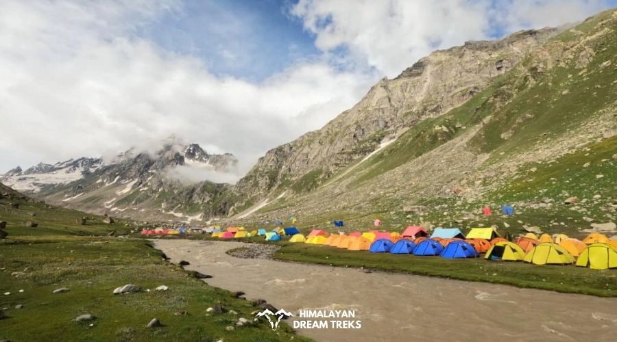
Trekking for 45 minutes through birch forests along the left side of the river will bring you to Ruinsara Tal. After exiting the forest and traversing a boulder zone you will spot the Ruinsara Lake surrounded by meadows and rhododendrons which is suitable for camping. You will also pass by a shepherd’s hut, that is a temporary shelter during summer grazing months. The hut with a simple stone structure gives insight into the transhumance practice, seasonal movement of livestock.
This campsite is one of the most beautiful sites on this trek. The lake is at the foot of Mt. Kala Nag (Black Peak). You will also be amazed by the views of Yamuna Kanta on the southwest, the pass that will take you to Yamunotri, Bandarpunch on the east.
Trek distance & Time: 4 km/ 3-4 hours
Altitude: 13,150 ft
This day has the shortest trekking distance. The trek starts with a descent to the Supin River.After crossing the river with ice cold water, through a bridge, you will descend to a small meadow and continue the trek along the river. A further walk for about an hour will bring you to Odari.
Odari means a naturally made rock cave and as per the local legends, they believe that Bali spent a night here. This campsite offers some stunning views of Swargarohini peaks 2 and 3. If luck is on your side, you might spot a Himalayan Bear.
You will reach the campsite by afternoon, and will have the rest of the day to relax your body and mind, to prepare for the crucial and adventurous trek days ahead.
Trek distance & Time: 5 km/ 6 hours
Altitude: 15,100 ft
Today’s trek begins with a light distance but challenging terrain, where you will be crossing landslide prone zones. We start early to cross the Ruinsara River tributary safely and to avoid rising water levels in the later part of the day. There is no bridge here, so you will have to make your way hopping on the stones (similar to Takeshi’s Castle! Does it ring any bells?). After the crossing, the trail ascends towards snow moraines, and here you will get clear views of the Swargarohini Peak.
After 1–2 hours of trekking, you will find yourself on the top of a ridge. The views of the Kyarkoti Valley will now open up to your left, and Swagarohini standing behind you as you continue your trail ahead. A gradual ascent over slippery snow will get you to Bali Base Camp. You will spot an ice field with small glacial ponds.
You will observe a series of five snow ridges that need to be traversed. After another couple of hours you will reach the top of the fifth ridge. Bali Pass Col camp will be towards your left.
It is advised to carry microspikes to help you navigate slippery terrain.Carry atleast 2 litres of water as there are no water points on this section of the trek.
Trek distance & Time: 14 km/ 10 hours
Altitude: 16,200 ft
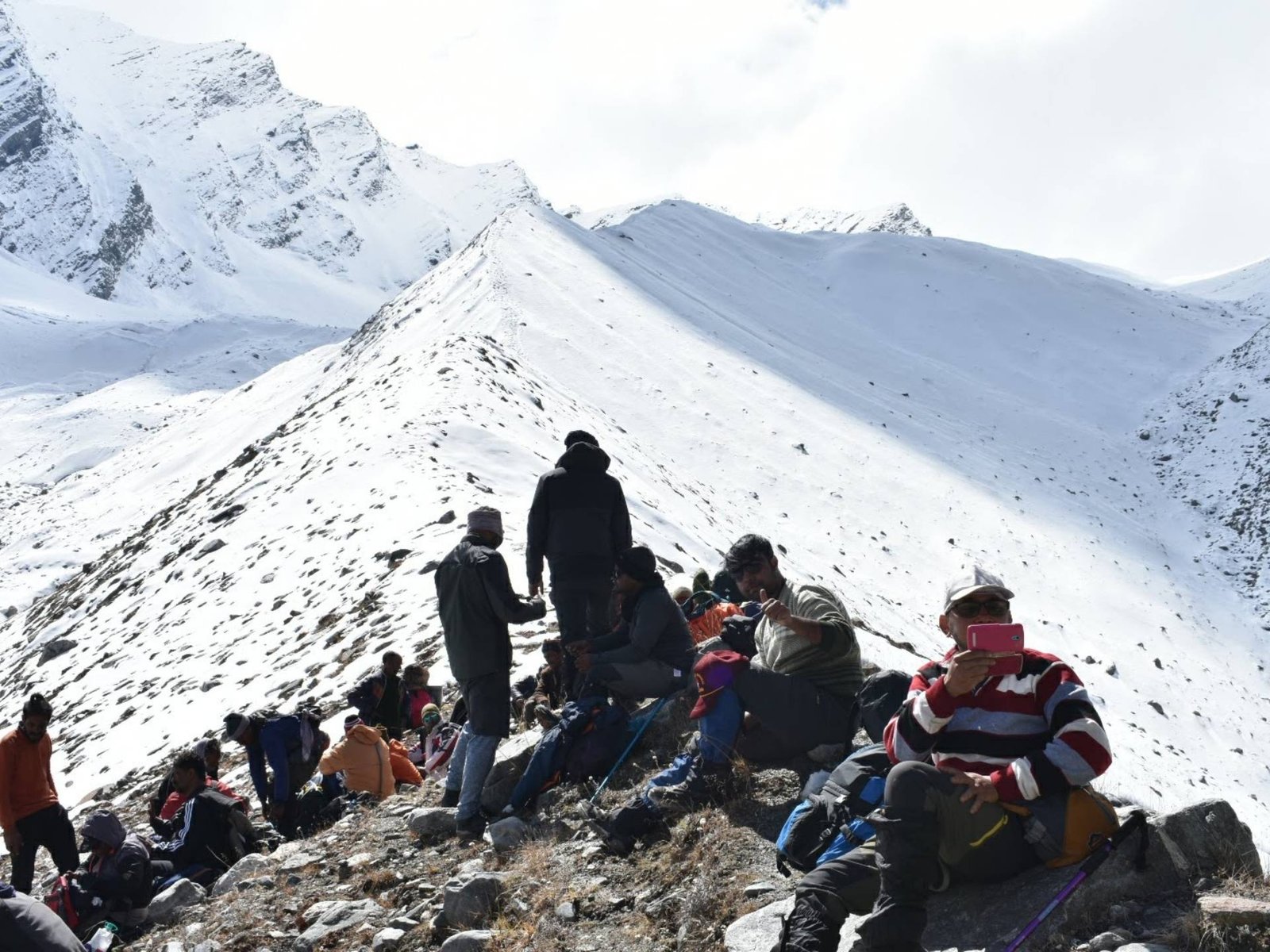
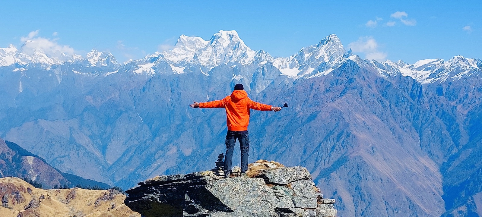
This is hands down the most exciting (and tiring) day of this 8 day trek, where you will finally be summiting Bali Pass. The trek starts early in the morning, preferably at 6 am given the long trekking distance. The climb to Bali Pass is steep, and takes 2-3 hours to reach from the Base Camp. As there tends to be a lot of snow, it is recommended to use an ice axe to ensure safe footing. As you reach the top, you can see the beautiful Yamunotri Valley. The pass is narrow and requires careful climbing. But, once you reach there, you will be rewarded with the majestic views of Bandarpunch, Kalanag, Garhwal ranges, and also the route that leads to Saptarishikund.
After soaking in the views, you will descend along a vertical path filled with scree and stones. A snow ridge on the Yamunotri side will help you get down the pass. Fixed ropes need to be placed here. There are several routes here to descend, your trek leader will choose the best suited one for you.
If you thought the difficult part ends here, my friend you are wrong. Well, it begins here! You will see the Dhamni forest ridge. There are no marked trails, with the width of some being less than 6 inches, and so you need to trek through huge patches of snow and big boulders. This stretch is like a zigzag maze, and needs very cautious trekking. It will take around 2 hours to safely cross this. Given the complexity of the terrain, it is advised to use equipments like ice axe and pulley throughout this trail. We at Himalayan Dream Treks, provide high quality helmets and trekking equipment to ensure your safety.
After a tiring journey, you will reach Upper Dhamni and after a short rest, you will continue your trek to the Lower Dhamni camp. You will lose altitude as well, as you come down from 16,000 to 10,000 feet.
The paths on this day are confusing, hence it is advised for the group to stick together. Getting lost in the mountains is a situation you wouldn’t even want to imagine!
Trek distance & Time: 8 km/ 4 hours
This is the last day of your trek and is relatively easy. A 30 minutes of ascent on a well established trail will get you to the old Yamunotri Trail. With a 4 km trek from here, you will reach the Yamunotri Temple. At the temple, you can take a dip in the Sulphur hot water springs, and seek blessings of the Goddess. From there you will descend to Janaki Chatti. If you don’t wish to go to the temple, take the trail that connects the new Yamunotri trail with the Janaki Chatti.
From there, a drive will get you back to Dehradun.
Bali Pass Trek Package
Price Inclusion
Stay: Accommodation is included for all days of the trek. Tents will be provided on a triple-sharing basis. Single and double sharing available at extra cost.
Transport: Transportation from Dehradun to the basecamp and back to Dehradun is included in the package.
Meals: We provide nourishing and delicious vegetarian meals. Our meals are designed to keep you energized throughout the trek.
Trek Equipment: We provide essential trekking equipment, including dining tents, kitchen tents, sleeping tents with mattresses, and sleeping bags. Utensils, ropes, micro-spikes, and gaiters (if required) are also part of our equipment offerings.
Forest Entry and Permits: All required fuel charges, tolls, forest entry fees, and permits are covered.
Trek Staff: A qualified, professional team, including a mountaineering-certified trek leader, guide, cook, and support staff, will accompany you.
Emergency Kit: First aid medical kits, oxygen cylinders, and stretchers are provided for safety.
Trek Certificate & HDT Badges: Receive a trek certificate and HDT badges to celebrate your adventure.
Price Exclusion
Meals during Transfer: Meals are not included while traveling to and from the trek starting points.
GST: A 5% Goods and Services Tax (GST) is applicable and not included in the package.
Emergency Evacuations: Any charges related to emergency evacuation are not included
Personal Expenses: Any meals or accommodations outside of the provided itinerary or additional services not listed in the inclusions.
Personal Luggage Carrying: Charges for mules or porters to offload personal luggage are not included in the package.
Best Time to Visit Bali Pass
As much as the preparation for the trek, it is also important to time the trek well. Bali Pass trek is best done during the Summer and Autumn Seasons. During these seasons, trekkers are greeted with favourable weather conditions, stunning alpine meadows, lush valleys, and blooming wildflowers.
Summer Season:
| Weather | Pleasant, Warm, Sunny |
| Temperature | 12 to 17 degrees celsius during the day, Around 0 degrees at night. |
| Clothing Layers | Atleast 3 Layers. Light clothing and warm jackets recommended. |
| Scenery | Snow-covered peaks, alpine meadows, blooming wildflowers, lush valleys. |
Summer season offers the best conditions for the Bali Pass Trek with clear weather, and relatively mild temperatures. This is the season where the wildflowers are in full bloom, making it the perfect opportunity to walk through colourful flower carpets. The clear skies and lush green valleys create a scenic landscape, with snow-clad peaks standing majestically. However, nights in the mountains are cold, so please cover yourself in warm layers. The level of the trek is moderate to difficult during this time. But trekkers should be cautious and well prepared for sudden weather changes and strong winds at higher altitudes. If the winter season for the year has had heavy snowfall, you can expect snow patches on the ridge for the first few weeks of May.
Autumn Season:
| Weather | Pleasant, Clear Skies |
| Temperature | 10 to 14 degrees during the day, 0 to -3 C. during the night. |
| Clothing Layers | Atleast 4 Layers. Thermal layers, warm jackets are a must. |
| Scenery | Snow-covered peaks, post-monsoon lush meadows and valleys. |
Autumn is another time you could consider for this trek. The landscape in the region changes to the dramatic colours of autumn dipping you in its orange and yellow hues. The after showers from the monsoon make the trails lush green, and thick with vegetation. The clear weather makes the trek pleasant and enjoyable. You will also be rewarded with the views of the mountains during this season. Watch out for slippery trails given the monsoon pourdowns. You may encounter the season’s first snow during the last weeks of November.
Difficulty Level of the Trek
The Bali Pass Trek is considered difficult and a challenging trek due to its high altitude, steep ascents and descents, varied terrain, and significant altitude gain. The trek reaches its highest point at 16,200 feet, connecting the Yamunotri and Har Ki Dun Valleys. The trek’s technical nature, including navigating challenging terrains like narrow ridges and glacial moraines, requires prior trekking experience and good physical fitness and endurance.
Difficulty Analysis with Factors that Put it into the Challenging Level of Difficulty
Terrain:
The Bali Pass Trek features a diverse and demanding terrain, including steep ascents, rocky pathways, and snow-covered stretches. The trail involves climbing up to the summit and descending to Lower Dhamni, which is the longest trekking day, covering challenging sections like the Bali Pass itself. The climb to Bali Pass is steep and requires an expert guide to help you safely navigate it. Also the entire Bali Pass – Ruinsara Tal stretch is laid out with river crossings, and sometimes bridges may have been washed off too. In those cases you will have to cross using a rope and pulley system.
Walking Distance and Altitude Gain:
The trek spans approximately 60 km over 8 days, with an average daily distance of about 8-10 km. The trek starts at 8,100 ft and goes to 16,200 ft without any day set aside for acclimatization. The altitude gain is significant which requires careful acclimatization to avoid altitude sickness. Don’t make the mistake of thinking you will not be hit with AMS if you are an experienced trekker. The trek is physically demanding and mentally challenging, so ensure you are well prepared and trained to tackle the situations. However, if you see symptoms of AMS like mild headache, loss of appetite, nausea, or inability to sleep at night, it is advised to cut your trek short and walk back. You can always come back again! But, due to the terrain of the Bali Pass trek, it is extremely difficult to make a quick exit. But your best bet is to exit before crossing the Bali pass, retrace your way back to Taluka and then Sankri, or at the last point at Janki Chatti where you can hire a jeep to Rajgarhi. Medical assistance can be found at Mori and Purola.
Weather & Temperature:
Weather conditions at higher altitudes are mostly unpredictable which significantly impact the trek’s difficulty. Trekkers may face extreme cold temperatures, especially at night, and unpredictable weather changes, including rain and snow. These conditions require you to have proper gear, such as waterproof clothing and thermal layers for your safety and comfort. Rain or snow at high altitudes mean that new paths have to be made, and can alter the trekking duration, for which you need to be mentally prepared.
Preparation for the Trek [Physical Fitness, AMS]
Treks are all about fun, adventure, finding yourself, etc, but only for those who are mentally and physically fit. Because activities like treks, especially a Himalayan trek, challenge you on different levels in unimaginable ways and situations.
Mental preparation includes thorough research of the trek you want to do or decide to. Understand the terrain, difficulty level, and the ways to get fit for it, look up for sudden situations that may happen, and how to tackle them. Being prepared gives you an edge to keep calm & handle a difficult situation.
1. Exercises to achieve the goal
- Cardiovascular Training: Running, cycling, and swimming to boost stamina.
- Strength Training: Focus on leg exercises like squats, lunges, and step-ups for endurance.
- Core Strength: Planks, mountain climbers, and Russian twists to maintain balance on uneven trails.
- Flexibility Exercises: Stretching, yoga, and dynamic warm-ups to prevent injuries.
- Mental Conditioning: Visualisation techniques, breathing exercises, and meditation to strengthen focus and manage stress on difficult days.
2. Extra Tips related to the diet, muscle recovery, and healthy lifestyle routine
Diet: Incorporate proteins like lentils, chicken, eggs, tofu, etc for fast recovery after a strenuous trek. Whole grains like wheat, quinoa, barley, etc for sustained energy, and leafy greens like spinach, bitter guard, and any seasonal veggie for those extra nutrients and building the immunity system.
Muscle Recovery: Plan rest days and add stretching, relaxing yoga poses or foam rolling after every workout.
3. Lifestyle Routine:
- Limit alcohol and caffeine consumption.
- Start sleeping up to 8 hours.
- Stay hydrated – drink 2 to 3 liters of water. To incorporate more nutrients, including coconut water, fruit, and vegetable juices.
Altitude Sickness happens when your body cannot adjust to lower oxygen levels at higher altitudes. This happens mainly because your body doesn’t have enough time to acclimatize to a higher altitude or not enough time to get used to lower oxygen levels.
How to Prevent AMS –
- Gradual Ascent: Climb slowly to give your body time to adjust.
- Hydration: Drink plenty of water to prevent dehydration.
- Rest and Sleep: Ensure ample rest, especially as you reach higher camps.
- Avoid Alcohol: Limit alcohol and caffeine, which can lead to dehydration.
What to do –
- Most Important – Inform your trek leader as well-trained leaders and experience they can assess the situation better and find solutions faster.
- Stop and Rest: Pause your trek to recover.
- Descend if Necessary: Descend immediately to Raithal Basecamp, our team with the vehicle and necessary help will be there for further action.
- Stay Hydrated: Drink water and avoid strenuous activity.
- Seek Medical Help: After descending our team will take you to the nearest hospitals if needed. If solo, then descend and seek the closest medical help.
Trek Essentials [What to Pack]
- 45-60 Ltr Bag Pack With Rain Cover & Comfortable Straps
- Hot and Cold Water Bottle Like Borosil and Milton
- Energy Bar, Dry Fruits, and ORS
- Personal Medical Kit
- 1 Pair of Sunglasses (UV Protected)
- 1 Neck Gaiters (Buff)
- Tiffin Box
- 2/3 Full Sleeves (Non-Cotton)
- 1 Full Fleece T-Shirt
- 1 Fleece Jacket (Woolen or Sweater)
- 1 Down Feather/ Hollofil Jacket
- 1 Waterproof Jacket/ Poncho
- 1 Pair of Thermal Inners (Upper and Lower)
- 2 Trek Pants (Avoid Shorts and Denim Pants)
- 1 Pair of Waterproof Gloves
- 1 Pair of Woolen Gloves
- Sun Cap
- Woolen Cap
- 4 Pairs of Cotton Socks
- 1 Pair of Woollen Socks
- 1 Waterproof and High Ankle Trekking Shoes
- 1 Pair of Floaters
- Hand Sanitizer and Sunscreen Lotion
- Toothbrush and Toothpaste
- Toilet Paper
- Quick Dry Towel
- Lip Balm and Antibacterial Powder
- Moisturizer
- Aadhaar Card, Pan, or Passport for Applying Permit
- Trek Insurance
- Medical Certificate
- Self-Declaration Form
- Sleeping Bag
- Common Tent
- Mattress
- Dining Tent
- Camping Stool
- Walkie Talkie (For Team)
- Utensils
How To Reach Base Camp
If you’re arriving by air, the nearest airport to Sankri village is Jolly Grant, near Rishikesh. From there, you can arrange a separate taxi or board a bus that will take you Dehradun and then other Bus to Sankri, which serves as the starting point for the trek.
Dehradun and Rishikesh are the closest railway stations to Sankri. You can easily find a taxi or bus from either of these stations that will transport you directly to Sankri.
To reach Sankri via bus, you can catch a bus at the Mussoorie bus stand near Dehradun Railway station. These buses from Dehradun follow the following schedule: The first bus departs at 5:30 a.m. The second bus leaves at 6:30 a.m. The third bus departs at 7:30 a.m. During this journey, you’ll pass through several checkpoints, including Mussoorie, Naugaon, Purola, Mori, and eventually, Sankri village.
Raithal is the point where we start our Dayara Bugyal Trek in Uttarakhand. It is approximately 183 kilometers away from Dehradun, which takes around 6 to 7 hours by public transportation. To reach Raithal you have to reach Uttarkashi first.
The bus to Uttarkashi leaves early in the morning around 5:30 am from Dehradun Hill station. You can also book your ticket online via the UTC portal. The average cost of the ticket is around 350 to 400 INR. Shared taxi option is also available.
If you are traveling via taxi, you will be charged around 400 to 500. You can hire a taxi from Rispana Pul and Parade Ground to Uttarkashi. Upon reaching Uttarkashi, you can rent another taxi to Raithal from Uttarkashi Taxi Stand. You must pay 100 to 150 INR to hire the taxi.
Bali Pass Trek Map
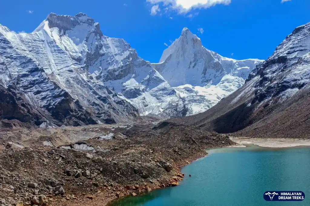
Peaks Visible From Bali Pass
Current Weather & Temperature
More Info about Bali Pass Trek
Story behind the Name: The trek is named after Bali, the monkey king of Kishkinda kingdom, who was known for immense strength and warrior capabilities. Despite Kishkindha being in south India, the pass in Uttarakhand is named after Bali due to local belief that he crossed these mountains and defeated a demon at Odari.
Trading Route: The Bali Pass has been used as a trading route between the Tons and Yamuna Valleys for centuries. Locals have used this path to move cattle and supplies.
Religious Significance: The trek connects the Har Ki Dun Valley and Yamunotri Valley, both significant in Hindu mythology. Har Ki Dun is known as the “Valley of the Gods,” and Yamunotri Temple is a sacred pilgrimage site and is considered a part of the popular Chota Char Dham Yatra
Cultural Significance: Trek offers a rich cultural experience, allowing trekkers to visit traditional villages like Osla and Gangad. These villages provide insights into the local way of life, including farming practices and spiritual traditions.
Local traditions: The Bhotiya tribe practice transhumance, migrating with their livestock to high pastures during summer. This gives trekkers a peek into the Garhwali culture and tradition high up in the mountains.
The trek offers a beautiful and diverse range of flora and fauna.
Flora: The trek begins in dense forests of deodar, cedar, and rhododendron, and takes you to the alpine meadows at Devsu Bugyal. These meadows are home to a variety of wildflowers, including the Brahma Kamal, which is offered to the deities and is believed to be sacred.
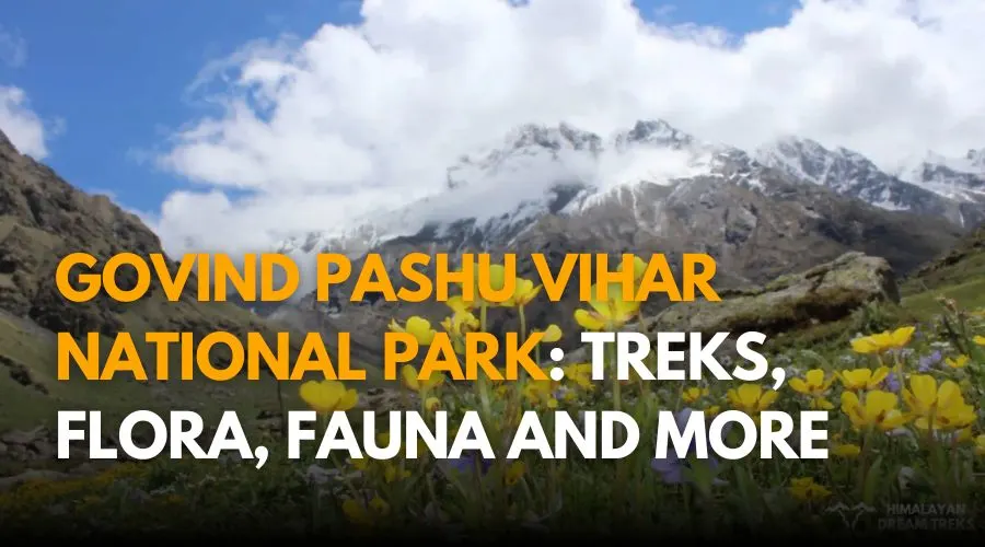
Fauna: The trek is part of the Govind Pashu Vihar National Park which protects rare species and their habitats. You will have the chance to spot Himalayan black bears, the graceful Himalayan Monal pheasants, Himalayan marmots, and Griffons.
Mussoorie and Dehradun
The trek begins and ends at Dehradun. So you can wind down by relaxing at Dehradun seeing popular sights there and head to Mussoorie known as the “Queen of the Hills”. For lesser crowds and offbeat experience head to Landour, and give your muscles rest by soaking in the mountain views.
Rishikesh: A short drive from Dehradun, Rishikesh is culture and adventure rolled into one. From its temples, cafes and river rafting, it has got everything you can indulge in!
Har ki Dun Valley: By now you know this trek connects this valley, so you can take some time to admire the beauty of this valley which once was a place where Pandavas from the Mahabharata walked down.
Yamunotri: This is located near the trek’s endpoint and a popular pilgrimage site. Pay a visit to the Yamunotri Temple after completing the trek, to seek blessings and safety for your future treks!
SCI, Foreign Permit & Vehicle
HDT is registered with the IMF, and we can cater to the needs of SCL for Government Employees. According to the rule, the government of India provides its employees with a prospect where they’re allowed to apply for a 30-day special casual leave in a calendar year to do trekking, hiking, or whatever adventure pleases them.
Mail us at info@himalayandreamtreks.in or call us at +91 80896 93825, if you want to avail SCL.
For foreign nationals, permit charges are different, and hence the overall package price is different for foreign trekkers. Connect with us before booking your trek.
- For 4-6 people Ertiga/Bolero or equivalent vehicle.
- For 7 or more people, Force Traveller.
Booking Confirmation, Payment, Reschedule, Cancellation, and Refund Policy
- Click the Book Now button and fill in the required details.
- Complete the payment by choosing from the available payment options.
- Once the initial booking amount is paid, you will receive an email confirmation with all trek details.
- The booking is considered confirmed only after receipt of the initial payment.
Booking Amount: 30% of the trek package at the time of booking.
Balance Payment: Remaining 70% to be paid at least 7 days before departure.
Payment Modes Accepted:
- UPI
- Bank Transfer (NEFT/IMPS/RTGS)
- Credit/Debit Cards (with applicable processing charges) – Temporarily Unavailable
- International Transfers via Wise / PayPal / Bank Transfer (processing fees apply)
Payment Partners: Razorpay, PhonePe Business, State Bank of India, Wise, PayPal, Payoneer
Transaction Charges:
- Razorpay: 1%–4% depending on payment method (UPI, card, wallet, net banking, etc.)
- PayPal: Flat 5% transaction fee
- Free rescheduling up to 30 days before trek start date.
- 10% rescheduling fee (of paid amount) for requests made 29–7 days before trek.
- No rescheduling within 7 days of trek start; booking will be canceled with no voucher issued.
- Itinerary Adjustments: Himalayan Dreamtreks may adjust the schedule due to safety or unexpected conditions.
- Early Departure: If a trekker leaves before scheduled dates, food, stay, and transport costs will be borne by the trekker.
Cancellation by Trekker:
- More than 30 days before departure → 90% trek voucher (valid 1 year)
- 21–30 days before departure → 75% trek voucher (valid 1 year)
- 11–20 days before departure → 50% trek voucher (valid 1 year)
- Less than 10 days before departure → No voucher
- No-show → No refund or voucher
Cancellation by Himalayan Dreamtreks (HDT):
- In case of natural disasters, government restrictions, or adverse weather → 100% trek voucher (valid 1 year, usable for any HDT trek).
Dropout During Trek:
- If a trekker leaves due to health, fitness, or personal reasons → No refund.
- Trekker must bear all costs for return/retreat.
Refund Terms:
- Refunds are provided only as trek vouchers (valid for 1 year).
- Vouchers can be redeemed for any Himalayan Dreamtreks trek.
- No cash refunds will be issued.
FAQs
The temperature at Bali Pass varies with the season. During the trekking season (May to October), daytime temperatures range from 10°C to 20°C (50°F to 68°F) but can drop below freezing at night, especially at higher altitudes. When hiking in this region, be prepared for a wide temperature range.
The Bali Pass trek offers stunning views of several prominent Himalayan peaks: Swargarohini, Bandarpunch, and Kalanag( Black Peak).
The closest ATM to Sankri is located in the town of Purola, which is about 25 kilometers away. It’s a good idea to have enough cash with you before heading to Sankri, as access to banking services can be limited in this area.
However, cash availability can be limited, so it’s wise to make last-minute cash withdrawals in Dehradun before starting the trek.
Bali Pass Trek is not beginner-friendly as it is very challenging and technical. In fact, it’s a moderate plus level trek, so you should have the experience to go at that much altitude of 16,200 ft.
Yes, a permit is required for the Bali Pass Trek. The trek falls under the Govind Wildlife Sanctuary; hence, the trekkers must obtain necessary permits from the Uttarakhand Forest Department or relevant authorities.
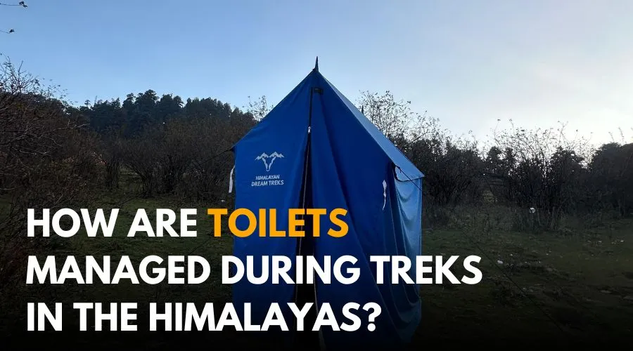
Every campsite during this trek features dry pit toilets. You must carry your own toilet papers and hygiene essentials.
Sankri, the starting point of Bali Pass Trek, is also the last point for charging your gadgets. You must carry your own power banks or extra batteries. Trekking mostly comes with the activities like photography and videography, so it is advised to carry extra power banks and charge them in Sankri before you head towards Dayara Top.


Leave a Comment