Overview
The Sandakphu Trek ranks as India’s top trekking destination because it leads tourists into the breathtaking mountains of Singalila National Park within West Bengal. Standing at 3,636 meters above sea level (11,930 feet) Sandakphu holds the title as the highest point in West Bengal. The Sandakphu Phalut trek offers adventurers an exclusive Himalayan journey combining challenging paths, diverse wildlife, cultural experiences, and breathtaking panoramas.
The Sandakphu Trek stands apart from all other Nepal & Indian Himalayan paths because it showcases amazing panoramic perspectives. The Kangchenjunga massif presents itself as a sleeping Buddha image from Sandakphu thus creating a characteristic figure which symbolizes this trek. A typical Sandakphu Trek itinerary spans 6 to 8 days, beginning at Manebhanjan and covering key spots like Tumling, Kalipokhri, and Phalut.
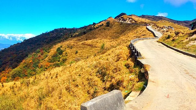
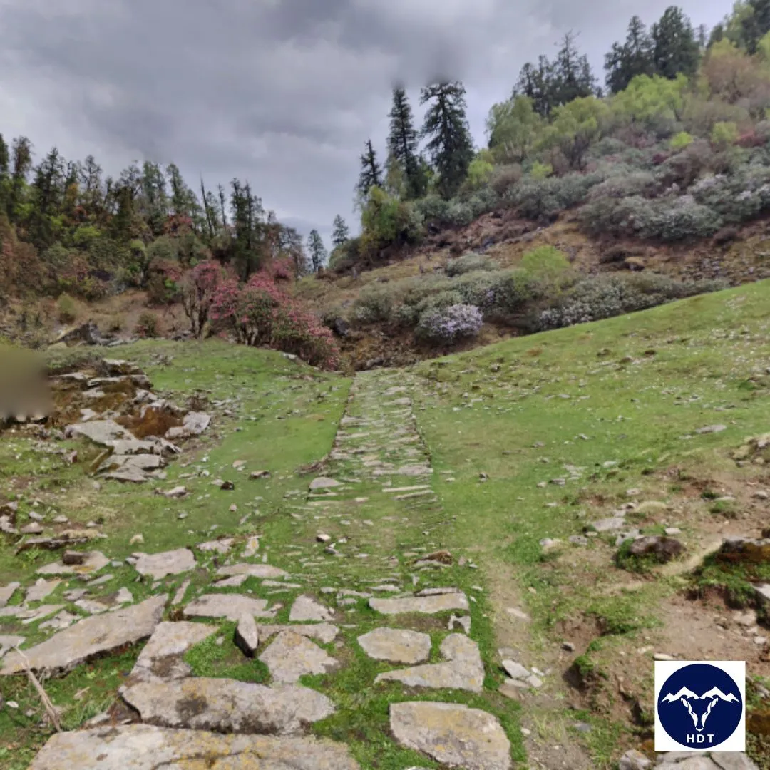
What truly distinguishes the Sandakphu phalut trek from other Himalayan journeys is its incomparable vistas. The trail runs along the well-mapped Sandakphu trek route which begins from Manebhanjan at 2,150 meters above sea level which represents a small settlement that lies 26 kilometers southeast of Darjeeling. The trek starts from Manebhanjan at 2,150m followed by past mountain passes Tonglu at 3,070m and Kalipokhri at 3,186m before reaching the thrilling final ascent to Sandakphu summit.
Adventure enthusiasts experience different levels of challenging conditions based on the season and path selection when they participate in the trek. The trek can be reached by moderately fit hikers yet it necessitates appropriate mountain-awareness and requires adequate preparation because it requires navigating treacherous elevation changes and variable weather patterns.
A truly outstanding diversity of biodiversity appears throughout the journey. The hills’ entire appearance changes in spring because numerous rhododendron and magnolia and many wildflowers from the season spread across alpine meadows. The forested regions inside Singalila National Park serve as a habitat for endangered red pandas and Himalayan black bears and cambodian pangolins together with different deer species. Birdwatching enthusiasts will find pure joy on this trek because it features more than 300 recorded species that include blood pheasants, satyr tragopans, various eagles and the exclusive Himalayan monal. This creates an ideal environment for wildlife enthusiasts and photographers.
Weather conditions determine the essential character of traveling through the Sandakphu trek. The optimal period to visit Sandakphu exists during the two periods of March to May for rhododendron blooming and October to December for optimal mountain views. Autumn following the monsoon is the preferred time for visitors because the skies remain clear enough to show the complete Himalayan view.
Complex travellers can find shelter at basic teahouses (local term “trekkers’ huts”) together with homestays located in the settlements of Tumling, Kalipokhri and Bikheybhanjang. These humble facilities offer basic amenities which provide shelter along with traditional food and cultural experiences among the community members who mostly consist of Sherpa and Lepcha people. Exploring the traditional mountain communities during trekking becomes a captivating essential part because locals have perfected their lifestyle techniques through hundreds of years in hazardous conditions.
A proper outfit for the Sandakphu trek consists of multi-layered clothes and waterproof sturdy hiking boots with a waterproof backpack featuring a protective bag cover along with a trekking stick and a high-quality raincoat or shell jacket for weather protection. The trails’ snow conditions during winter seasons require trekkers to use thermal layers and proper gloves together with possible microspikes. The Sandakphu Trek experience is unforgettable, featuring panoramic mountain vistas, cultural interactions, and serene landscapes.
What Makes Sandakphu Trek a Must-Visit Trek
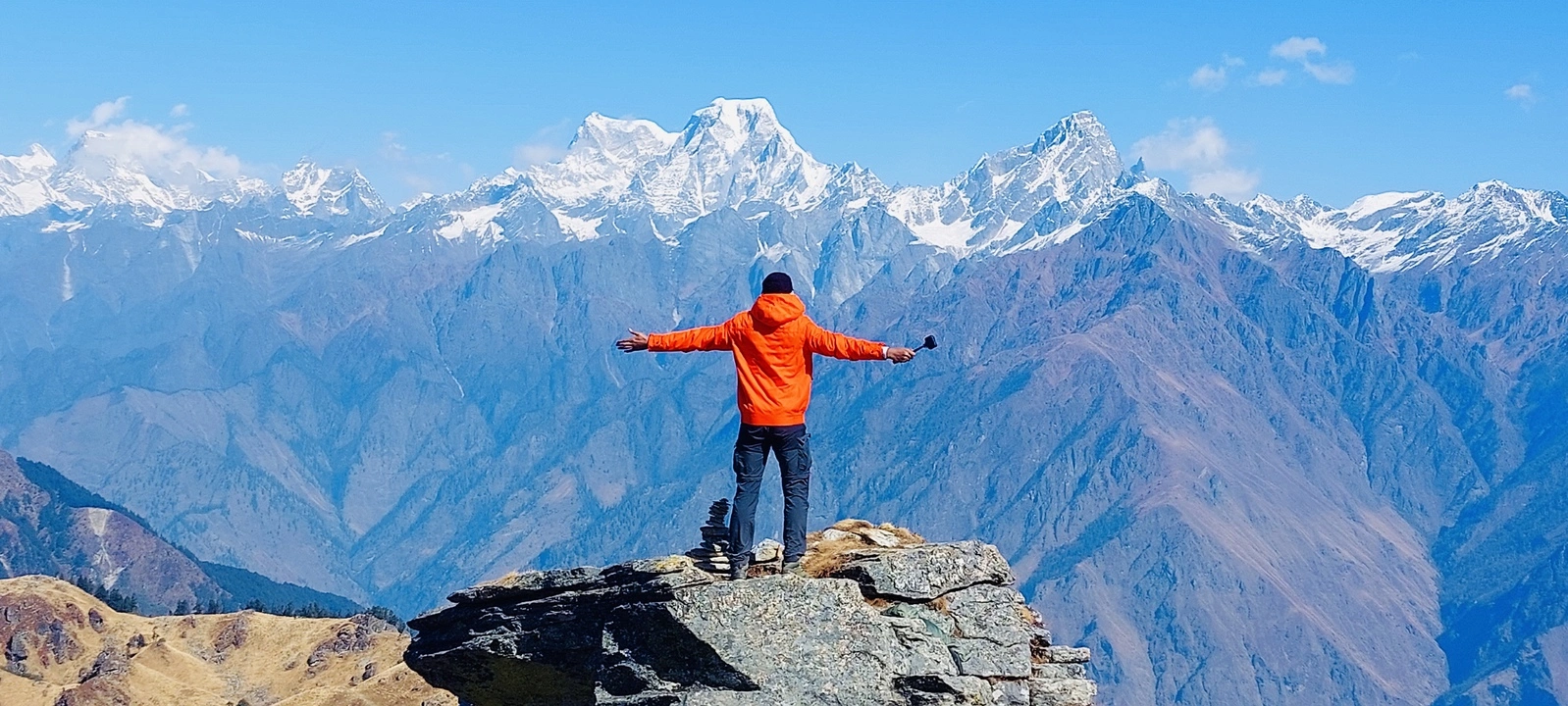
1. The Magnificent View of Four 8000m Peaks
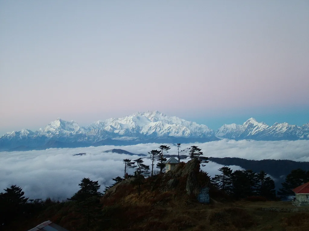
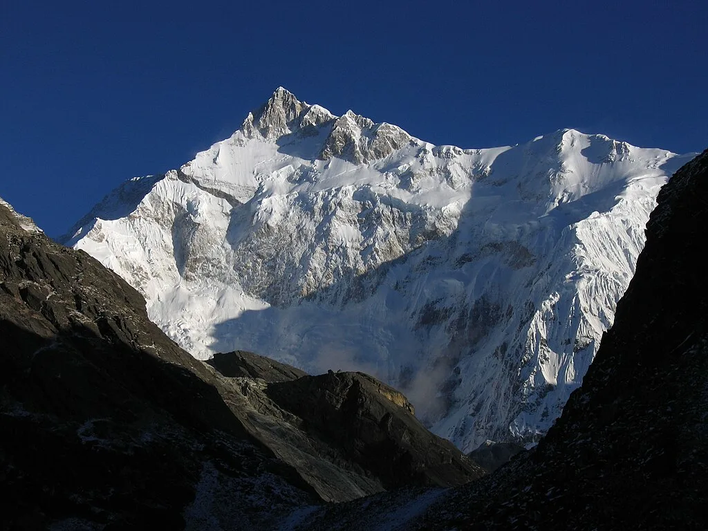
The summit of Sandakphu Trek provides trekkers with a spectacular view of four higher peaks on the global ranking. The viewpoint provides an opportunity to view Mount Everest (8,848m) and Kangchenjunga (8,586m) collectively with Lhotse (8,516m) and Makalu (8,485m), which form a sleeping Buddha appearance.
2. Traversing the Historic Singalila Ridge
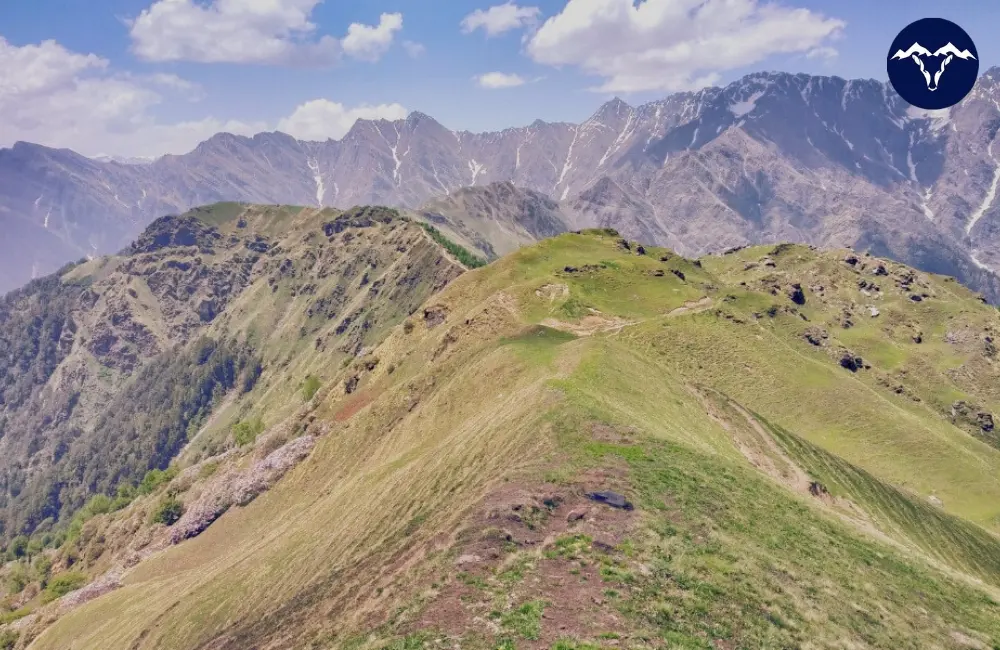
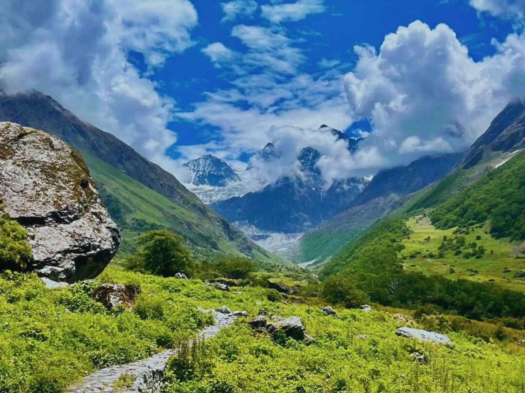
The Singalila Ridge allows travelers an extraordinary experience to cross from nation to nation in real-time. Travelers benefit from discovering two nations through one continuous trail as this historic mountain ridge serves as the natural border of India and Nepal. The ridge walk exposes trekkers to 180-degree panoramic views as they cross through different terrains during the entire trek. Due to its special topographical features the ridge area maintains a distinctive microclimate producing alpine meadows and forests which cannot be found across the surrounding territory.
3. Blooming Rhododendron Forests
Spring months bring a magnificent color festival to the Sandakphu Trek because its celebrated rhododendron forests flower at this time. The background of snowy summits combined with colorful flowers provides photographers with perfect opportunities to document Himalayan biodiversity through their lenses.
4. Rich Biodiversity and Wildlife Encounters
Trekking groups fortunate enough will encounter the scarce red panda as they view different types of deer and sometimes they may see a leopard. The geographical area provides exceptional birdwatching opportunities because scientists have recorded more than 300 bird species which range from Himalayan griffons to colorful pheasants and eagles.
5. Cultural Immersion in Mountain Villages
Personalities and Life exists in the multiple authentic mountain villages through which the Sandakphu Trek route passes. Local communities living in high-altitude regions preserve their traditional lifestyles through settlements which show the way Nepali, Sherpa and Bengali populations live in these areas. Tourists visiting such regions get to talk with local people while tasting regional food and observing traditional customs that have developed independently during countless years. Small local Buddhist sanctuaries with wilderness prayer flags located throughout the trekway provide religious significance that pays tribute to the Buddhist traditions of the area.
6. Varied Terrain and Changing Landscapes
Tourists find the trek particularly appealing because it features an impressive range of geographic features during the journey. Walkers will find abundant changes in scenery because they start in lower oak and bamboo forest areas and walk up to alpine meadows alongside rocky mountaintops. The trekking plan provides journeys across different terrains as it guides climbers through mountainside changes so they can adapt to higher elevations.
7. Accessible Yet Challenging Adventure
The Sandakphu Trek provides travelers with an excellent mix between elevation exploration and manageable trekking conditions. The established pathways of the trail welcome middle-level trekking groups but mountain heights and challenging terrain make it a real adventure destination. A combination of teahouses and lodges located throughout the trek allows anyone to complete this journey without heavy camping gear thereby expanding participation from various groups of enthusiasts.
Trek Itinerary
Drive Distance and Time: 110 km, 4-5 hours
Altitude Gain: From 150m (NJP) to 2,100m (Sepi)
Today’s Difficulty: Easy
Highlights: Beautiful road through the tea estates of Darjeeling, Initial views of the Eastern foothills of the Himalayas, Cultural shift between mountain and lowland communities, and Getting over the Teesta River valley
The path starts a gradual ascent following the tea plantation rows which display West Bengal’s colonial history as it leaves the plains region behind. Crossing the town of Ghoom opens a swift transition toward transformating from lowland terrain to mountain territories within a few brief minutes. Journeying toward Sepi you will encounter the pleasant settlement which sits within forested areas where local Himalayan lifestyles become your starting destination.
Trek Distance and Time: 11 km; 6-7 hours
Altitude Gain: From 2,100 m to 2,600 m
Today’s Difficulty: Moderate
Highlights: The first day of hiking on mountain paths, Thick oak and rhododendron woodlands, Getting across the Ramam River and Kanchenjunga views starting to appear
The authentic journey of your trek starts today because you will walk under unspoiled forests found throughout the Eastern Himalayas. You will spend an hour trekking until you arrive at the clearing to finally observe your first authentic mountain views. The path gradually descends until it reaches the Ramam River where you must cross before your journey takes its main momentum.
The final stretch to Samanden involves hiking over path that alternates between forest cover and small meadows.
Trek Distance and Time: 17 km; 8-9 hours
Altitude Gain: From 2,600m to 3,600m
Today’s Difficulty: Challenging
Highlights: Significant altitude gain, Crossing from West Bengal into Nepal and back, First sightings of major Himalayan peaks, and Charming Gorkhey village
This day features both the toughest and most gratifying experience during the entire journey. You must begin your journey at dawn because you need to handle long distances together with substantial elevation increase. The route commences with wooded footpaths before it rises progressively above the tree line. The area surrounding Samanden becomes less dense in vegetation when you cross it and reveals larger and larger scenery views.
The route changes from forest trails to exposed high-altitude terrains because of your climbing elevation. One reaches the Phalut trekkers’ hut at 3,600m elevation while climbing the last stretch since this location provides amazing views of Kanchenjunga alongside Everest and several leading peaks. There exists a campsite at this location where visitors can enjoy spectacular mountain views across the whole Himalayan range.
Trek Distance and Time: 10 km; 5-6 hours
Altitude Gain: From 3,600m to 3,000m
Today’s Difficulty: Moderate
Highlights: Ridge walking with views on both sides, Alpine meadows with seasonal wildflowers, Continuous panoramic mountain views and Quiet forest campsite at Thokum
The day offers a smooth trekking experience accompanied by panoramic ridge views that extend across the entire distance. From Phalut the trail begins showing you the prominent Singalila Ridge that rules the border zone between India and Nepal. You can witness both Nepal and India during your walk on this raised pathway at the same time since one country rests on each side of the path. Open meadows dominate this particular region while providing unobstructed views that highlight the Himalayan giants at shorter distances compared to their usual appearance.
A few hours of ridge walking leads you to enter the descent into Thokum. The small clearing at Thokum emerges after traversing through the forest boundaries. We will create our overnight base camp in this location among the tall tree growth while hearing occasional running water in the distance.
Trek Distance and Time: 13 km; 6 -7 hours
Altitude Gain and Loss: Descent to 2,600m, then ascent to 2,900m
Today’s Difficulty: Moderate
Highlights: Mixed terrain with forests and clearings, Crossing mountain streams, Rich birdwatching opportunities and Views of lower Himalayan ranges
The hiking path starts at Thokum by descending through forested regions which require trail mindfulness because of slippery terrain. After several minutes inside the forest zone you reach spots that display the hills typical of Himalayan middle elevation regions.
Along your progression the landscapes shift between sections of wooded area and areas without trees. At the end of one hour along the path you reach several tiny streams that can be traversed through primitive log bridges or natural stepping stones. Birdwatchers will discover multiple excellent observation sites in this elevation because it contains many endemic Himalayan bird species. From this point the trail follows a gradual upward slope to Aal while offering bamboo corridors that produce natural passageways.
Your hike towards Aal takes you through a gradual incline across a path where forest vegetation becomes more and more scarce. After a last stretch of walking you will reach the settlement of Aal which stands on a hilltop where you can view deep valleys extending below. Aal reveals breathtaking sunset views of the lower Himalayan mountain range since its peaks reflect fading sunlight in the evening.
Trek Distance and Time: 16 km; 9-10 hours
Altitude Gain and Loss: Climb to 3,636m, then descend to 2,400m
Today’s Difficulty: Challenging
Highlights: Day of the summit at Sandakphu, Everest, Kanchenjunga, Lhotse, and Makalu in a panoramic view, The well-known “Sleeping Buddha” structure and lengthy journey across shifting environments
On this day, go to the top of Sandakphu to enjoy the famous panoramic views from the highest point of the journey. Before approaching the alpine zone, hikers must take a trail that steadily and gradually climbs to the area with little flora. You begin your last ascent to Sandakphu Peak after an hour of walking. After several hours of climbing, you eventually arrive at the last ridge stretch leading to Sandakphu.
A unique panorama of four towering peaks, including Everest, Kanchenjunga, Lhotse, and Makalu, which combine to form the well-known “Sleeping Buddha” pattern, is the finest reward for adventurous hikers who reach the 3,636-meter summit of Sandakphu. As you drop to lower elevations, the falling terrain changes from alpine meadows to rhododendron forests and finally becomes mixed woods. After many hours of trekking downhill, you reach the community of Timburey, which is situated inside a forested valley.
Trek Distance and Time: 6 km; 3-4 hours
Drive Time: 5-6 hours
Altitude Loss: From 2,400m to 1,900m, then to 150m (NJP)
Today’s Difficulty: Easy
Highlights: Last experience on a woodland trail, Getting across the Srikhola River, Return of culture to lowland villages and Considering the adventure that has been done
When traversing through the remaining forest portions you will arrive at Srikhola which is an attractive village situated by its homonymous river. You shall spend your last mountain meal at this stop before taking vehicles to NJP.
The last trek day starts with an easy descent leading from Timburey toward Srikhola. You begin your hike following breakfast across a path that descends gently downhill among attractive forests which harbor various avian species. The border of your campsite leads you straight into dense forest vegetation which stands out dramatically from the more exposed mountain terrains from the prior days.
The total Sandakphu trek distance spans approximately 70 kilometers over the entire circuit, with daily treks ranging from 6 to 17 kilometers. During this transition period you can reflect upon the extraordinary scenery that you have seen along with all the new experiences acquired during your journey.
Package Details
Price Inclusion
Accommodation for 6 nights:
Transportation from New Jalpaiguri
Meals: Meals from dinner on Day 1 to breakfast at Day 7 are included.
Trek Equipment: All essential trek equipment is included, such as sleeping bags, kitchen and dining tents, utensils, mattresses, personal tents, toilet tents, and crampons (if needed).
Forest Entry and Permits: All required fuel charges, tolls, forest entry fees, and permits are covered.
Experienced and Certified Guides: A qualified, professional team, including a mountaineering-certified trek leader, guide, cook, and support staff, will accompany you.
Emergency Kit: First aid medical kits, oxygen cylinders, and stretchers are provided to ensure the safety, comfort and well-being of all participants.
Trek Certificate & HDT Badges: Receive a trek certificate and HDT badges to celebrate your adventure.
Price Exclusion
Meals during Transfer: Meals are not included while traveling to and from the trek starting points.
Emergency Evacuations: Any charges related to emergency evacuation are not included.
Personal Expenses: Any meals or accommodations outside of the provided itinerary or additional services not listed in the inclusions.
Personal Luggage Carrying: Charges for mules or porters to carry personal luggage are NOT included in fees.
GST (5%)
Best Time to Visit for this Trek
The timing of your participation in the Sandakphu Trek determines completely different kinds of experiences you will encounter.
| Weather | Temperature | Clothing Required | Scenery |
| Mild with occasional showers | Daytime: 10-15°C, Night: 0-5°C | 3-4 layers including waterproof outer layer | Rhododendron blooms, clear mountain views |
The spring season transforms Sandakphu Trek into a botanical masterpiece because the famous rhododendron forests become vibrant in red, pink and white colors. The daytime temperatures are pleasant but individuals need proper insulation items for nighttime protection. This time offers peak visibility of nearby peaks throughout early mornings but late-day cumulus clouds sometimes form. Throughout the trail many locations blossom with a wide array of wildflowers which spread colorful blooms across the terrain.
| Weather | Temperature | Clothing Required | Scenery |
| Clear and dry with stable conditions | Daytime: 8-12°C, Night: -2 to 3°C | 3-4 layers including warm mid-layer | Crystal clear mountain views, golden meadows |
Autumn brings dependable weather alongside superb visibility of Himalayan peaks so photographers prefer this season for taking photos of their preferred mountain sights. Extreme visibility of Makalu and Lhotse and Kanchenjunga along with Everest becomes possible after the monsoon season clears dust and pollution from the post-monsoon air.
| Weather | Temperature | Clothing Required | Scenery |
| Cold and snowy with occasional clear days | Daytime: -2 to 5°C, Night: -10 to -5°C | 4-5 layers including heavy insulation | Snow-covered landscape, dramatic cloud formations |
The wintertime brings an enchanting spell of snowfall which presents awe-inspiring sights but proves to be an arduous journey at Sandakphu. Serious cold-weather gear consisting of multiple insulation layers and quality gloves and suitable footwear becomes necessary because of the extreme temperature drop. The difficulty of the journey escalates because snow and ice conditions render some areas difficult to navigate. The number of available lodging options becomes constrained since several small teahouses shut down during the wintertime. During winter treks one needs to prepare thoroughly through advance planning to possibly carry microspikes or equivalent traction systems to maintain safety when walking on ice.
| Weather | Temperature | Clothing Required | Scenery |
| Wet with heavy rainfall and persistent fog | Daytime: 10-18°C, Night: 5-10°C | Waterproof layers and quick-dry clothing | limited mountain views,Lush green landscapes |
Airfall during monsoon season makes Sandakphu landscapes into beautiful green landscapes but it makes the trekking routes increasingly difficult to navigate.Effects of mist and clouds hinder visibility of mountains during this season which renders the trek unsatisfactory for peak watchers. The peak monsoon weeks lead to reduced availability of accommodation facilities in the area. Experienced trekkers who possess adaptability when faced with challenging weather conditions find Sandakphu most suitable during this season.
Difficulty Level of this Trek
Moderate to Challenging
Fit individuals can participate in the Sandakphu trek because it is considered medium to challenging while delivering genuine altitude difficulties. Several elements make up the Sandakphu trek’s challenging nature including:
Difficulty Analysis with Factors
Terrain
- Different parts of the trail contain forest areas with steep inclines
- Mid-height ridges with exposure to strong winds
- Steep uphill sections at Phalut (3,600m) and Sandakphu (3,636m)
The combination of winter conditions produces extreme trek difficulty because of snow and ice accumulation in the mountain trails.
Walking Distance and Altitude Gain
- Distance traveled each day: 6–17 kilometers
- The 16-kilometer track from Aal to Timburey via Sandakphu is the most difficult part (long descent after high rise).
- Walking for five to nine hours every day for several days in a row
- At the highest elevations, oxygen levels are 64% of sea level.
- Acclimatization: Increasing height gradually aids in adaptation, although hikers who are sensitive to altitude should speak with doctors.
Weather & Temperature
- Range of Temperatures: Spring/Autumn: 8–15°C day, -2–5°C night; Winter: Below freezing day, -10°C or less at night
- Uncertain Conditions: In any season, unexpected fog, rain, and temperature dips are conceivable.
- Wind Exposure: Ridge segments are especially vulnerable to heavy winds that intensify the cold.
Combined Impact: The physical difficulties are greatly increased by weather conditions, going beyond what distance and elevation data indicate.
Preparation for the Trek [Physical Fitness, AMS]
–
Trek Essentials
The best time for Kedarkantha Trek is during the winter months, especially from December to April, when the entire trail is covered with snow.
- 45-60 Ltr Bag Pack With Rain Cover & Comfortable Straps
- 20-30 Ltr Day Pack with Rain Cover
- Head Torch
- Waterproof Trekking Shoes
- Trek Pant
- 1-2 Trekking Pole
- Down Jacket
- 1 Poncho or Rain Coat
- Tiffin Box for Packed Lunches
- 1 Hydration Pack / Hot & Cold Water Bottle Like Borosil & Milton
Tab 1 content.
How To Reach Base Camp
Bagdogra Airport (IXB) operates as the nearest airport which serves the trek area and positions itself 16 km northwest of Siliguri.
The airport provides a taxi booking service between the airport and NJP or Siliguri stations which take approximately 30-45 minutes.
Travelers use New Jalpaiguri (NJP) railway station as their main entry point into the territory through trains.
Regular bus transportation connects the city to Kolkata (with a journey time of approximately 12 hours) and Guwahati (traveling for about 8 hours) together with various northeastern towns.
Private Transportation:
- Your trekking operator should provide private transportation as the safest option.
- The road leading from NJP to Sepi involves a 4-5 hour trip (110 km) that winds through the hills.
Public Transportation (Multi-Stage):
Budget travelers can achieve their journey by using shared jeeps but need to face several transit stops.
- From NJP/Siliguri to Darjeeling/Manebhanjan (3-4 hours)
- From Manebhanjan to Rimbik (2 hours)
- The journey from Rimbik to Sepi lasts one hour and contains restricted scheduling.
Important Considerations:
An early departure from NJP will enable you to reach Sepi before dark because mountain roadway conditions become more hazardous in decreased lighting conditions.
Road conditions show deterioration during June-September activities which could lead to time delays.
Travelers should load necessary supplies before reaching Sepi since the mountain road paths between locations become sparse with available facilities.
Trek Map
Weather & Temperature
More Info About this Trek
The cultural heritage of the Sandakphu area keeps great importance because it stands where Nepalese customs intersect with both Indian practices and Tibetan cultural elements. The name Sandakphu consists of two parts where “Sandak” derives from the Nepali word for toxic monkhood plant and “phu” comes from the Nepali and Tibetan languages meaning highland peak.
Historical Trade Routes
The Sandakphu trek routes carried historical commercial significance by uniting distant Himalayan communities before modern times. Throughout centuries ancient trade routes enabled Tibet to exchange goods with both Nepal and the territories of India while carrying spiritual knowledge and cultural practices between these places. The Sherpa, Lepcha and Rai settlers who live in this area have managed to maintain their cultural heritage while resisting modernization changes.
Religious and Colonial Influences
Multiple Buddhist elements strongly affect the area through:
- The passing breezes carry prayer flags that hang aloft at mountain passes.
- Local people erected traditional stone cairns throughout the region since these structures are thought to shelter mountain spirits.
- The landscape features numerous small monasteries together with gompas which extend across the whole region.
The old colonial buildings constructed during the British Raj can still be observed along the route’s path specifically in Darjeeling and Tumling. During the 1800s when the British founded Darjeeling as their summer retreat they simultaneously enabled Western explorers to capture and introduce worldwide the awe-inspiring Himalayan scenery through their trail mapping activities.
The Sandakphu trek route passes through Singalila National Park, a biodiversity hotspot with remarkable ecological variety:
Flora
- From 2,000 to 2,800 meters above sea level one finds regal forests consisting of silver fir trees and magnolias together with rhododendron stands. From March through May the slopes become a magnificent colorful spectacle when over 36 species of rhododendrons bloom in varying shades of deep crimson and pink to pure white.
- The territory of the Higher Altitude Zone (2,800-3,636m) displays an open landscape decorated by common medicinal plants together with dwarf rhododendrons and primulas. The silver fir and hemlock forests in misty conditions form a magical forest environment.
- Dangerous plant species have given the journey its name because the poisonous Aconitum plant (monkshood) appears in high numbers near the peak. People from local areas traditionally use this plant as medicine at measured amounts yet one can die from consuming it incorrectly.
Fauna
The remarkable wildlife of the Singalila National Park becomes visible only after being patient and fortunate enough for these sightings:
- Red Panda: Endangered species known as the Red Panda remains the centerpiece of the region and can sometimes be sighted within bamboo thickets and the forests of rhododendron.
- Himalayan Black Bear: They chooses to live its life between the dense forest networks located at lower elevation zones.
- Clouded Leopard: These majestic creatures represent the top predatory position in the region because they exist as extremely shy creatures which are also extremely rare.
- Avian Life: The trek area hosts over 300 recorded bird species which include two hallmark species such as the Satyr Tragopan and Blood Pheasant along with numerous eagles and griffons that perform aerial displays above the ridges.
Small Mammals: During trail walks small mammals become visible because Himalayan palm civets share space with martens as well as pangolins, while various squirrel species also exist.
After completing the Sandakphu trek, several remarkable destinations are worth exploring:
- Darjeeling (78 km from Sandakphu)
- Phalut (21 km from Sandakphu)
- Srikhola and Rimbik (42 km from Sandakphu)
- Ilam (27 km from Sandakphu)
The Himalayan trek at Sandakphu gives adventurers an exclusive mountain journey through demanding paths, diverse fauna, cultural sightseeing and breathtaking views across the eastern Himalayas.
SCI, Foreign Permit & Vehicle
During this time, thick snow covers the trail, and trekkers can enjoy fresh snowfall. Sometimes the path becomes a bit difficult due to heavy snowfall, but it is very much liked by trekkers as it adds thrill and challenge to the trek. Trekkers can enjoy walking on the snow and see the snow-capped peaks visible from a distance. The sunrise from the mesmerizing peak is breathtaking, offering views of the mighty Himalayan peaks under bright, clear skies.
Although the months between December to February are the coldest and the temperature remains below zero at night, this is the time when the landscape around the trail turns into a wonderful paradise.
Though these months are mostly cloudy, if you are lucky, you can enjoy the bright landscapes under clear skies. The campsites are covered in a blanket of snow, and near Judha Ka Talab, trekkers can even walk on the frozen lake.


Leave a Comment