Overview
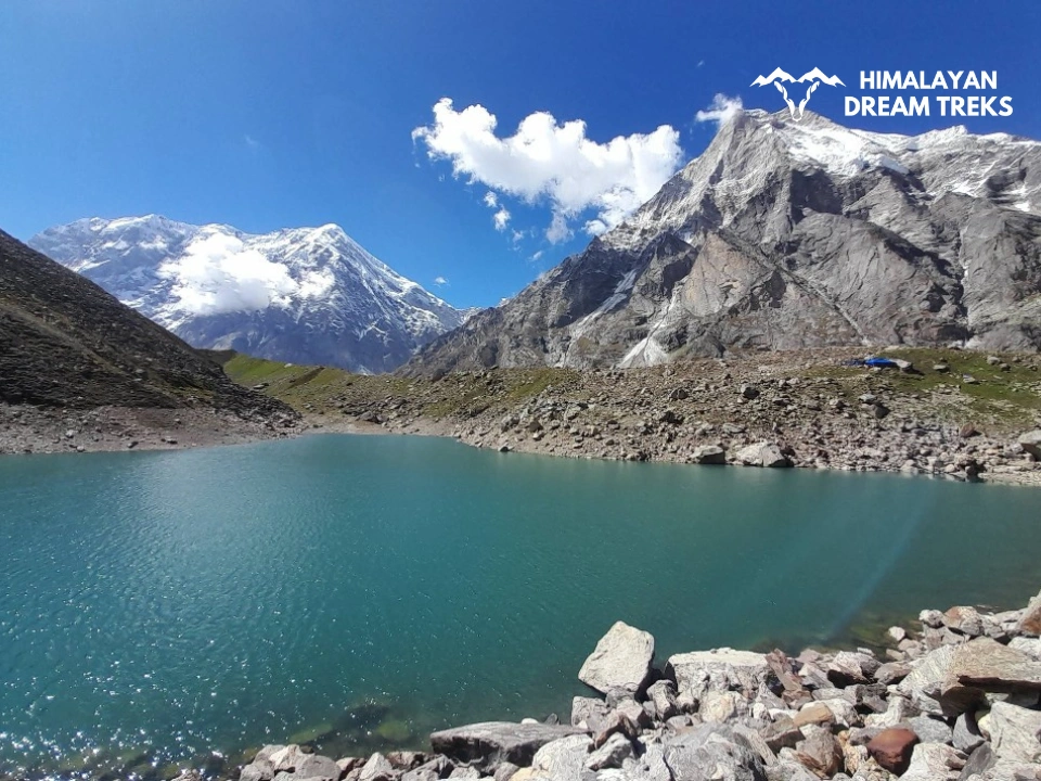
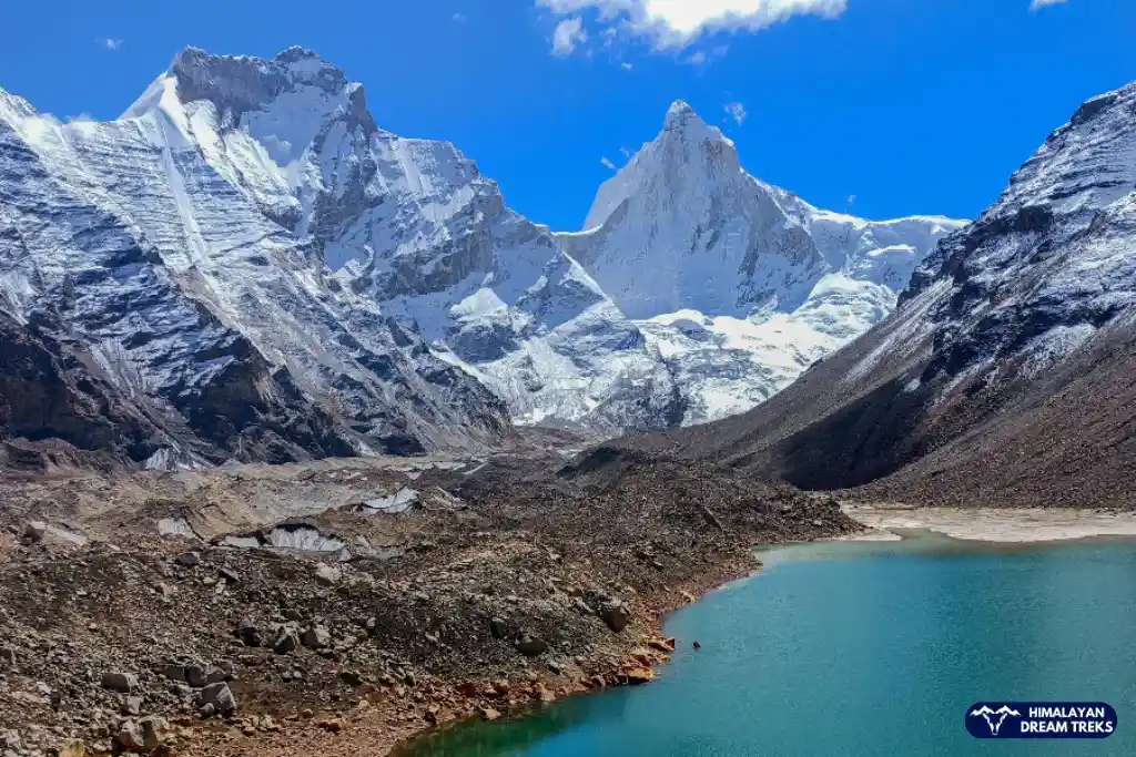
Hidden in the mighty Garhwal Himalayas lies a crystal-clear lake shaped like a perfect triangle – Satopanth Tal. At 15,100 feet above sea level, this mystical lake isn’t just another high-altitude wonder; but an interesting combination of mythology and trekking. According to legend, the Hindu Trinity – Brahma, Vishnu, and Mahesh – meditate at its three corners, giving the lake its name “Satopanth” – the Path of Truth.
This 7-day journey takes you through some of the most spectacular landscapes, starting from the yoga capital Rishikesh and passing through the sacred town of Badrinath. Along the way, you’ll witness the confluence of mighty Himalayan rivers, trek past the last Indian village of Mana, and discover the healing waters of Vasudhara Falls. All of this unfolds against the dramatic backdrop of towering peaks such as Mt. Neelkanth and Mt. Chaukhamba, making it one of the most memorable experiences of trekking in Uttarakhand.
A moderate to challenging trek, Satopanth demands respect and hard work. Whether you’re drawn by its spiritual significance, the challenge of high-altitude trekking, or the allure of pristine Himalayan wilderness, this trek offers a profound experience that goes beyond just reaching a destination.
This trek is best. It is done during the summer months of May to mid-July or the post-monsoon period from September to October; this trek promises not just adventure but also a chance to walk the same paths that, according to legend, the Pandavas took on their final journey to heaven.
Trek Itinerary
Drive Distance and Time: 247.4 km; 8 hours
Altitude Gain: 5,020 ft
Altitude: 6,150 ft
Highlights: A scenic drive with a view of the Uttarakhand Himalayas
Today, we will start our day by traveling from the Yoga Capital of the World, Rishikesh, to the Gateway of various Himalayan treks, Joshimath. Our package includes pickup from Natraj Square, Rishikesh. Ensure you are ready early in the morning so we can reach Joshimath by late evening.
The drive will consist of mesmerising scenery, with four out of five Prayags (confluences of snow-capped Himalayan mountain peaks in the background, coiling roads, and mighty rivers as your companions. On our way, we will pass 4 out of 5 Prayags (confluence of rivers).
The first is Devprayag, where river Alaknanda meets the Bhagirathi river to form the holy river Ganga. Then, we will come across Rudraprayag, where the Mandakini River joins the Alaknanda. In the third, Karnaprayag, Pindar River meets Alaknanda. Lastly, at Nandprayag, Nandakini meet Alakhnanda. The site where these fierce rivers join is a site to behold.
By late evening, we will reach Joshimath, where you will be free to explore the surroundings.
Drive Distance and Time: 45 km; 2-3 hours
Altitude Gain: 4,680 ft
Altitude: 10,830 ft
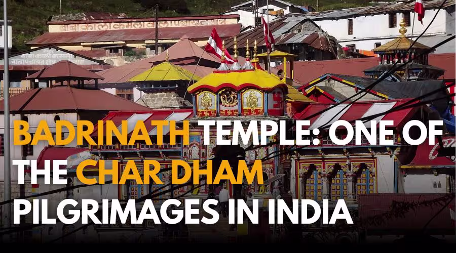
Our day will begin with a tasty breakfast, and then we will depart for Badrinath Dham.
It is a famous Hindu pilgrimage site known as one of the Chhota Char Dham. The other temples/sites are Gangotri, Yamunotri, and Kedarnath. Badrinath temple is dedicated to Lord Vishnu and is of great significance to Hindus.
After reaching Badrinath we will spend the rest of the day acclimating our bodies to higher altitudes and take proper rest.
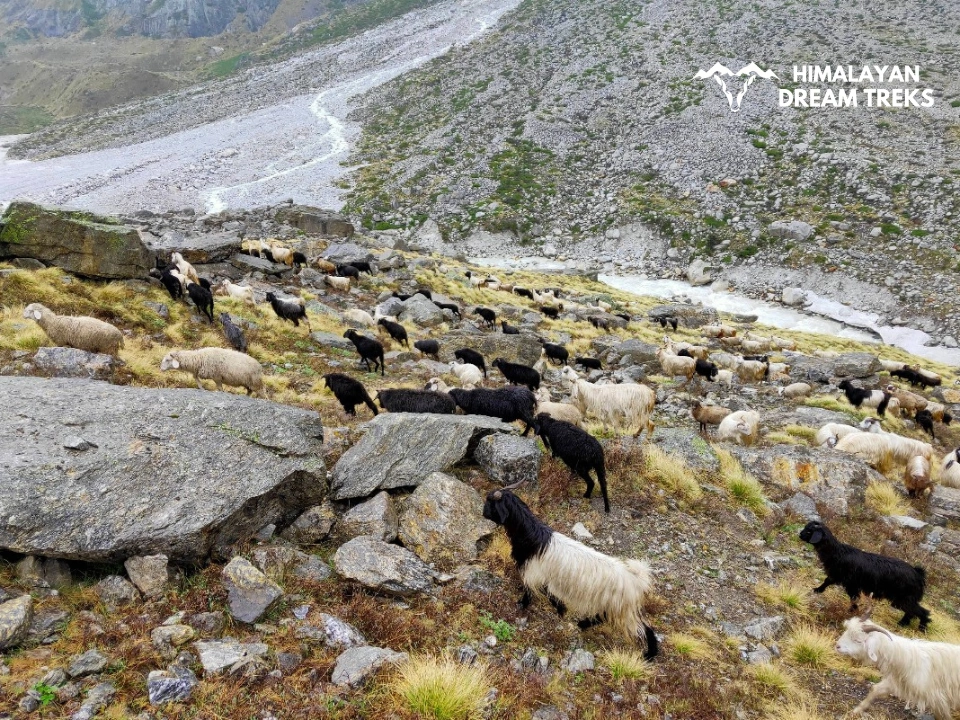
Interestingly, India’s last village, “Mana”, is just 4 km away from Badrinath; the village is closer to the Indo-Tibetan Border. We can walk up there for better acclimatisation and come back to Badrinath.
Mana village is also the only place from where you can see the Saraswati River. It is said that the river goes into Patal Lok from there and reappears in Prayagraj, Uttar Pradesh. There, it merges with the other two major rivers of the country – Ganga and Yamuna, forming the Triveni Sangam.
Trek Distance and Time: 9 km, 4-5 hours
Altitude: 11,900 ft
Altitude Gain: 1,070 ft
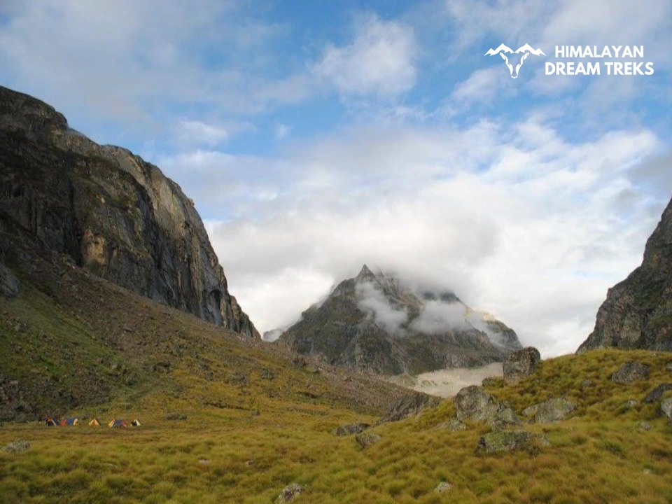
Today marks the first day of the trek, as we are going to start walking. Laxmi Van or Laxmi Ban is a campsite with the backdrop of Balakun Peak.
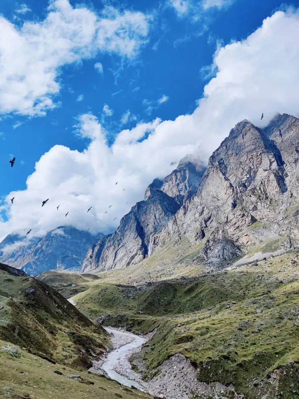
First, we will walk up to Mana village, and from there, the trail deviates towards the left with a man-made clear trail. On the right side, the Alaknanda River will accompany you in its purest form as you are walking closer to its origin – Satopanth Glacier. Alaknanda’s first confluence with another river Uttarganga takes place in Alkapuri.
After walking for about 3 to 4 kilometers, you will start hearing the faint sound of a waterfall gushing. This is Vasudhara Waterfall, a bewitching site to behold at a height of 400 ft. Locally, it is believed that the water does not fall or touch the sinners. So if it sprinkles on you consider yourself a pure soul.
It is believed that the presence of medicinal herbs near the waterfall makes water medicinal and has healing properties.
After a short break and with refilled bottles, we will start walking again. The walk from here will be short but a little challenging as many boulders and a slight incline will make it difficult.
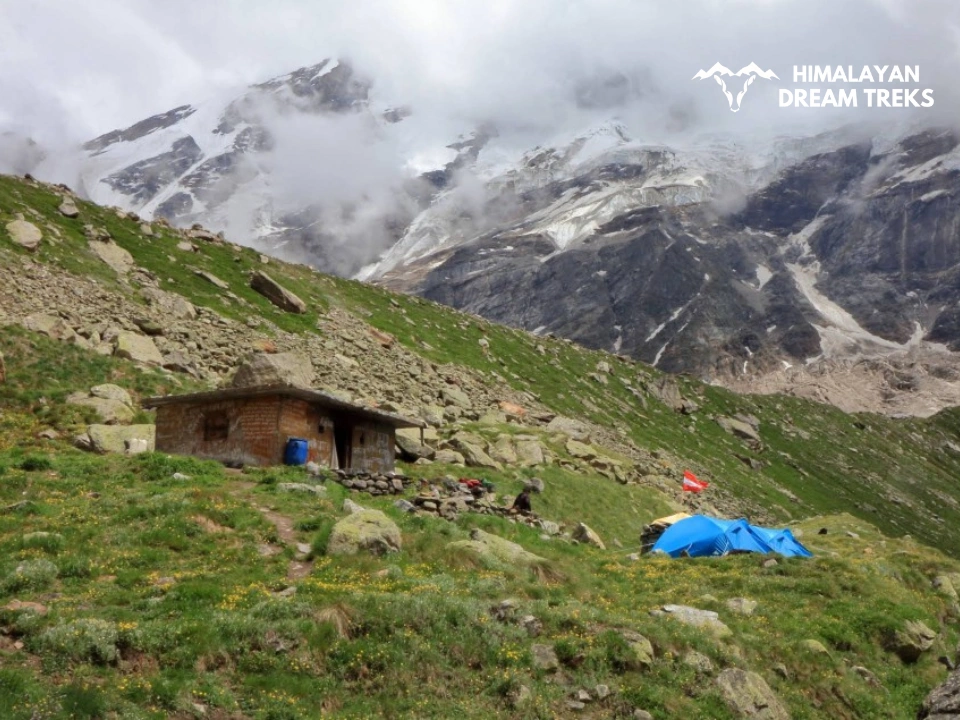
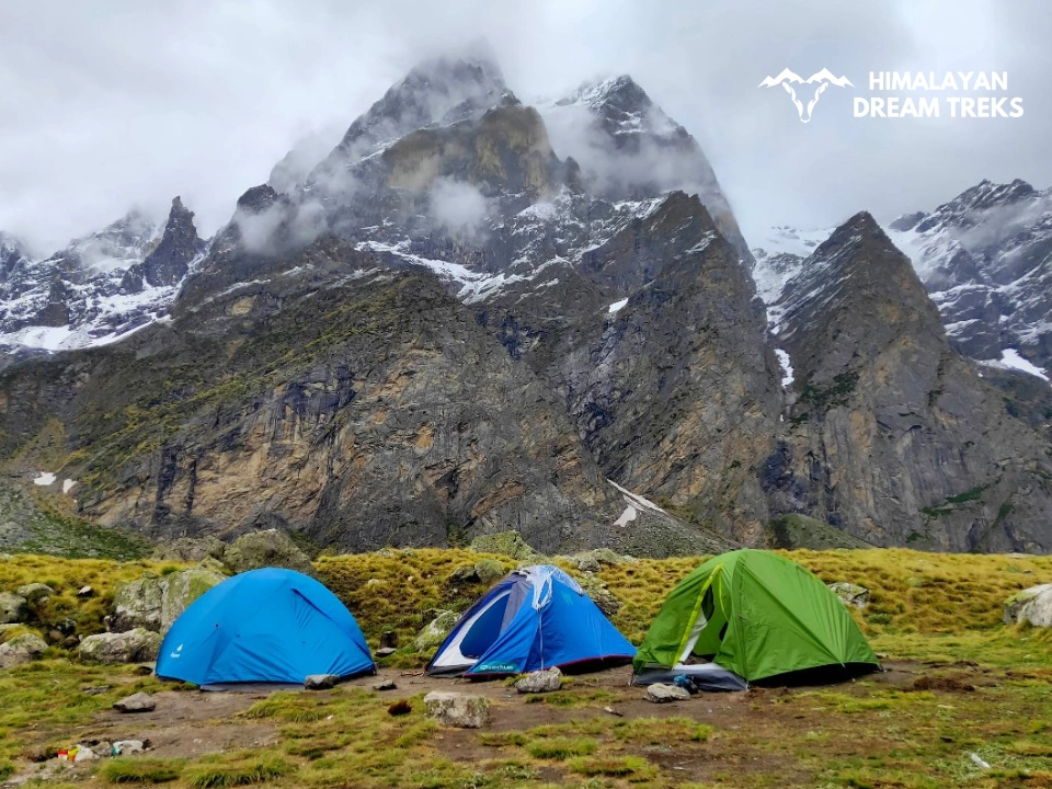
With the campsite closing, you will start seeing many Bhoj Patra (Himalayan Birch) trees along the way. Soon, we will reach our campsite and take a well-deserved rest.
Trek Distance: 7 km; 3-4 hours
Altitude: 13,658 ft
Altitude Gain: 1,758 ft
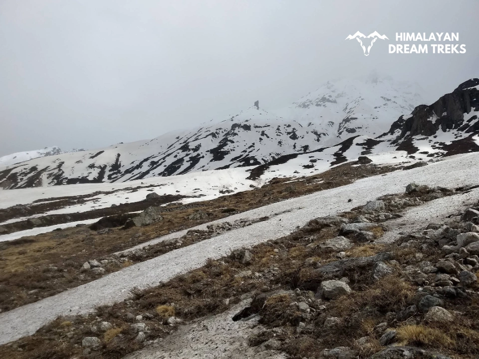
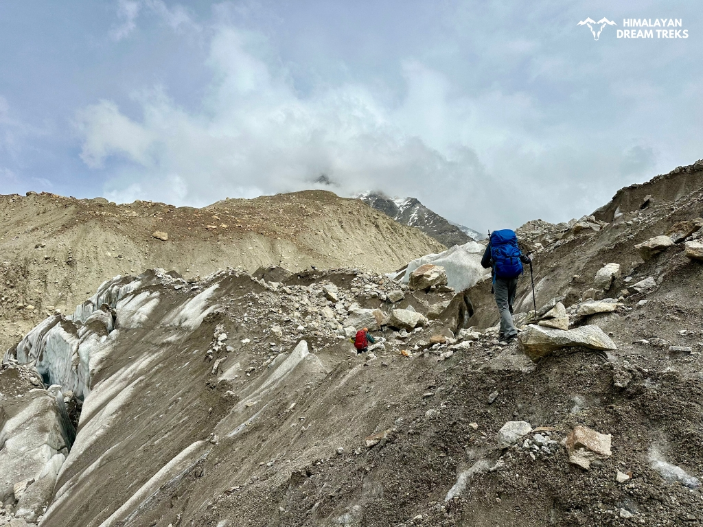
Today’s trek will be more challenging than yesterday so make sure to eat properly and carry some healthy snacks with you. The highlight of today’s route is Sahastradhara or Shastradhara, it is the magnificent site of 100s of waterfalls running down, all at once.
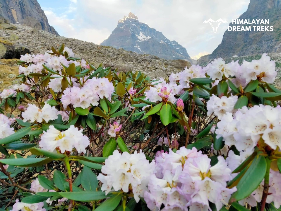
After crossing Sahastradhara, the path becomes inclined and filled with lateral moraines of the Dhano glacier. This way, you will need all your focus and energy to traverse through it. Watch out for beautiful alpine flowers, which you will not find anywhere else.
After a short level walk, we will reach our campsite for the Chakrateerth, which is a plain meadow-like space best for camping.
Note: Weather in the mountains is unpredictable, especially at a height of approximately 14,000 ft. Carry proper layers and cover your head after reaching the campsite.
Trek Distance: 10 km (5 km one way)
Trek Time: 8 to 9 hours
Altitude: 15,100 ft
Altitude Gain: 1,442 ft
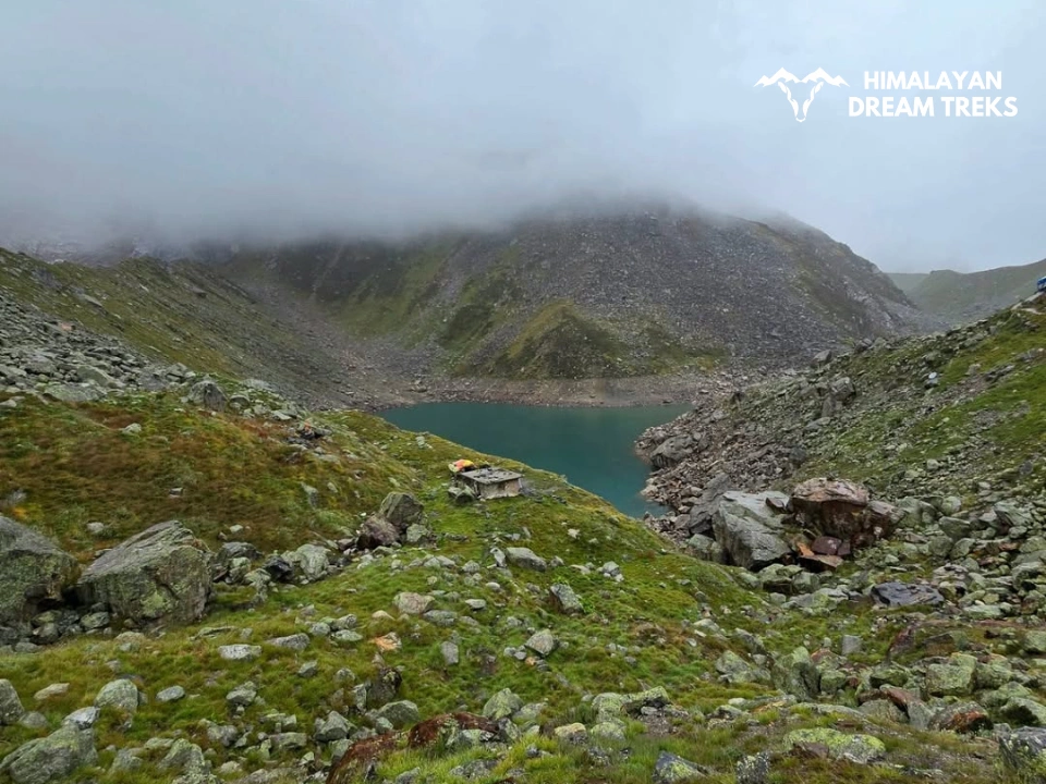
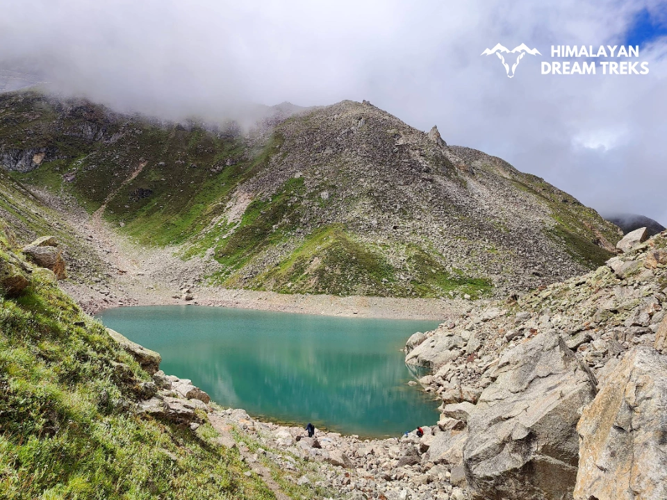
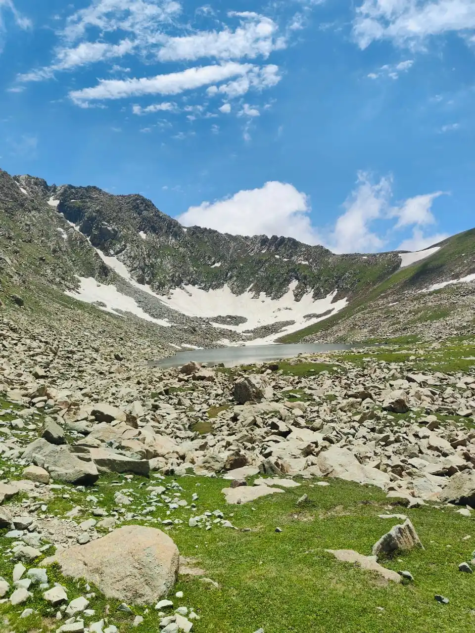
Today, you will finally reap the fruit of all your hard work. It is the day to witness the mystical Satopanth Tal. The trek will begin with a slight ascent and a twisted path filled with boulders and moraines; tread cautiously through it.
After a while, a ridge awaits you as a final climb to finally spectate the grandiose of Satopanth Tal. The lake will leave past all your expectations from the photos as it will be similar but way more magnificent with its vastness. The triangular lake is said to be the place where the holy trinity – Brahma, Vishnu, and Mahesh meditated on each corner. And the crystal clear blue water will leave you wondering as it remains clean throughout the year.
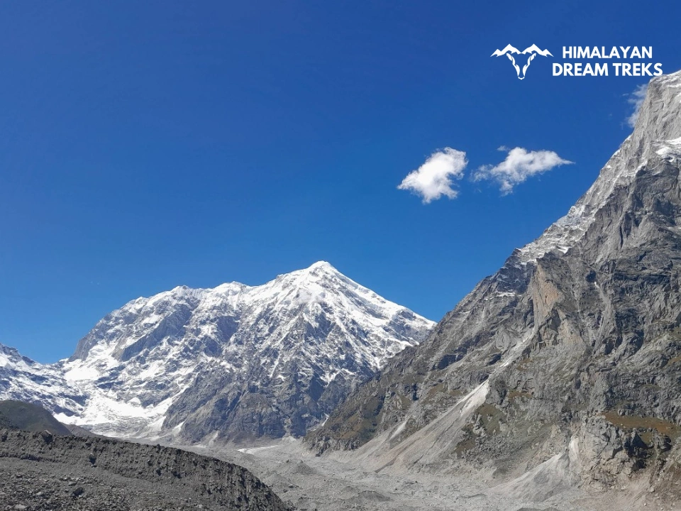
In the surrounding spot, Mt.Swargrohini will be on your left, Chaukhamba in the centre, Balkun on the right, and Neelkanth just behind you slightly towards your left.
If it’s a clear day, you can also spot 3 steps out of 7 Swargrohini glaciers, which are believed to be the same steps the Pandavas used to go to heaven.
After some time here and clicking many photos, we will head down to our campsite, Chakrateerth.
Drive Distance: 16 km; 6-7 hours
Altitude Loss: 2,828 ft
Today marks the last day of our trek, as we will be heading down. The path will remain the same in reverse order as we came up. From Chakrateerth to Laxmi Van, then to Mana village, and lastly a short walk to Badrinath.
After the full descent, trekkers are free to explore the area, visit the temple or they can even take a relaxing bath in the hot springs of Tapt Kund.
Drive Distance and Time: 286 km, 10-12 km
Highlights: A scenic drive with the view of Uttarakhand Himalayas
Finally, it is the last day of our journey marking the end of an epic trek. The drive will be long, passing through the same beautiful sceneries you came by seeing.
We will reach Rishikesh by the late evening the trekkers are free to look around, extend the trip, or head back home. Our team will bid you farewell with a promise to return back soon.
Package Details
Price Inclusion
Accommodation: Stay is included from Day 1 to Day 6 (base camp to base camp).
Transportation from Dehradun to Dehradun): Transport from Dehradun to Sankri base camp and back is included.
Meals: Meals from dinner Day 1 to breakfast on Day 7 are included.
Trek Equipment: All essential trek equipment is included, such as sleeping bags, kitchen and dining tents, utensils, mattresses, personal tents, toilet tents, and crampons (if needed).
Forest Entry and Permits: All required fuel charges, tolls, forest entry fees, and permits are covered.
Experienced and Certified Guides: A qualified, professional team, including a mountaineering-certified trek leader, guide, cook, and support staff, will accompany you.
Emergency Kit: First aid medical kits, oxygen cylinders, and stretchers are provided to ensure the safety, comfort and well-being of all participants.
Trek Certificate & HDT Badges: Receive a trek certificate and HDT badges to celebrate your adventure.
GST (5%): Included in the package cost.
Price Exclusion
Meals during Transfer: Meals are not included while traveling to and from the trek starting points.
Emergency Evacuations: Any charges related to emergency evacuation are not included.
Personal Expenses: Any meals or accommodations outside of the provided itinerary or additional services not listed in the inclusions.
Personal Luggage Carrying: Charges for mules or porters to carry personal luggage are NOT included in fees.
The Best Season to do Satopanth Trek
| Attribute | Details |
| Months | May to Mid-July |
| Temperature | May – Min: 5℃ | Max:12℃ |
| June – Min: 10℃ | Max: 20℃ | |
| Weather | Cool breezes with a comfortable temperature |
| Clothing Layer Required | Thermal innerwear, quick dry long sleeve t-shirts & pants, and a padded jacket |
| Ideal For | Clear views of peaks like Mt. Neelkanth, Mt. Chaukhamba. And dry trails for an easy & better hike. |
| Special Feature | A path full of glacial moraines and mystical waterfalls like Vasudhara and Sahstradhara. |
Summer is the perfect time to enjoy this trek. The trail, fresh out of cold winter snow, will be full of life and make you feel alive with its charm. To experience the clear blue skies that make it easier for you to spot various peaks like Mt. Neelkantha, Kuber Top, Balakun, etc do this trek in summer. As the terrain of the trek is rugged, the summer season makes soil lose its moisture, making it hard and easy to walk on.
| Attribute | Details |
| Months | September to October |
| Temperature | Sep – Min: 5℃ | Max: 13℃ |
| Oct – Min: 0℃ | Max: 10℃ | |
| Weather | Cool breezes with a comfortable temperature |
| Clothing Layer Required | Heavy thermal innerwear, quick dry long-sleeve t-shirts, and trek pants with a windproof down jacket. |
| Ideal For | Witness Alaknanda in its full glory, along with Vasudhara and Sahastradhara waterfalls gushing in their almighty. |
| Special Feature | A trail full of glacial moraines, mystical waterfalls, trail bursting with colourful alpine flowers. |
As monsoon becomes too risky to commence on this trek, post-monsoon is the best time to experience monsoon-like weather minus the danger of cloudbursts, flash floods, and landslides. Through September, the whole area will be covered in the greenery and blooms of colourful alpine flowers. You may get showered with sudden rains giving you the full effect of monsoon.
For a trek filled with colours, with waterfalls thundering with water, then post-monsoon and autumn are the best time for the Satopanth tal trek.
*Only for experienced trekkers
| Attribute | Details |
| Months | November |
| Temperature | Min: (-3)℃ | Max: 4℃ |
| Weather | Starting of snowfall. Chilly winds and freezing temperatures. |
| Clothing Layer Required | Heavy thermal inner wear, quick dry long sleeve t-shirts & pants with fleece under, a (-10°) down jacket. Proper snow equipment. |
| Ideal For | Challenging snow-covered trails full of glacial moraines and boulders. |
| Special Feature | Trail dusted with snow |
Trek to Satopanth Tal in November is not recommended for beginners/less experienced trekkers. It is strictly for experienced and qualified trekkers.
For an experienced trekker, the Satopanth trek in November is a paradise with its white beauty. Full of challenges, this trek will teach you life lessons and harden you for more challenging treks.
Difficulty Level of this Trek
Satopanth Tal Trek is a moderate level trek. Though beginners can do it, prior Himalayan trek experience is appreciated. Given the condition, the individual is fit and follows a workout routine consisting of both cardio and strength training.
Satopanth trek is filled with boulders and moraines on its twisted, ups-and-down trail, making it difficult to walk on. Ascents like the one in the beginning from Laxmi Van to Chakrateertha and the final ascent to the Tal take a toll on your body if not prepared well.
Being fit helps you walk long distances, adjust to gaining altitude, and maintain balance and the pace of your trek. All this results in a cheerful trek that you will enjoy.
Let’s discuss various factors like terrain, altitude gain, etc, to make it easier for you to understand and prepare well for it.
The terrain of the Satopanth Tal trek is full of boulders and glacial moraines making it a rocky terrain. While the trail in the beginning is well marked as it is man-made but later nature takes over. The natural course is a meandering path full of steep ascents and descents. On your way to Laxmi Van, you will encounter the first ascent of your trek. Later, the final ascent to Satopanth Tal is more difficult as it is steep, sharp, and full of huge stones, gravel, and moraines.
The trek is not technical but requires you to maintain balance while walking and crossing a ridge. Descending from these high points puts pressure on your knees and ankles a lot. The rugged terrain looks cool in pictures, but in reality, walking through it is a challenge in itself.
You will be walking approx 42 kilometres on the Satopanth Tal trek, spanning over 4 days. The trek will be challenging as you will be gaining approx 1500 ft altitude every day, going for a higher altitude of 15,100 ft on roughened-boulder full terrain. We won’t be walking more than 6 hours a day, and will take proper breaks and more if required. With the terrain condition explained above, traversing through a rugged terrain is a demanding activity.
As for altitude gain, you have already gained more than 9000 ft in 2 days by coming to Badrinath. You will gain approx 5000 ft in 4 days, with the highest point at 15,000 ft at the lake. The higher altitude combined with the exertion of hiking will challenge you both mentally and physically.
We take acclimatisation seriously, and adequate time will be given to get used to the higher altitude.
Every season presents its own colour and beauty features though some may result in more risks than others. Satopanth Lake is situated at a high altitude giving you the chance to experience less explored areas of the Himalayas.
Summer – Summer is the perfect weather with comfortable temperatures to commence on this trek. Though trekking will make you sweat but, you won’t feel the heat of busy cities, rather cool breezes will cool you down. Clear skies with bright sunshine will create an ideal condition to gaze upon the mighty Himalayas.
This is also a peak season, attracting many trekkers to witness it all. So make sure to make an advance booking.
Post Monsoon – Fields looking all fresh after thrilling rains will refresh you with greenery and colourful blooms. Though you face post-rainy showers and, the path may remain slippery, making it a tad strenuous to hike on. Weather is unpredictable in the mountains and more at higher altitudes. So make sure to pack raincoats and ponchos.
Autumn – The transition from greenery to the browns of leaves shedding and the beginning of winter will all occur between mid-September through November. Be prepared for sudden rain showers and cold temperatures at this time.
No doubt the trail will look magnificent during monsoon season, with waterfalls rolling down with full force and water, but it becomes too risky to venture out. During winter, a white snow blanket takes over the place with freezing temperatures, and the trek remains close.
Preparation for the Trek [Physical Fitness, AMS]
–
Trek Essentials
The best time for Kedarkantha Trek is during the winter months, especially from December to April, when the entire trail is covered with snow.
- 45-60 Ltr Bag Pack With Rain Cover & Comfortable Straps
- 20-30 Ltr Day Pack with Rain Cover
- Head Torch
- Waterproof Trekking Shoes
- Trek Pant
- 1-2 Trekking Pole
- Down Jacket
- 1 Poncho or Rain Coat
- Tiffin Box for Packed Lunches
- 1 Hydration Pack / Hot & Cold Water Bottle Like Borosil & Milton
Tab 1 content.
How To Reach Base Camp
The nearest airport is Dehradun’s Jolly Grant Airport, which is just 15.8 km away from Rishikesh.
From here, you have two options.
- Hire a private taxi or shared one if it is convenient for you to direct Rishikesh itself.
- From the airport, the main city of Dehradun is 1.5 km away; walk till there or hail a shared auto/taxi.
You can book a direct train to Rishikesh railway station, which is named Yog Nagri Rishikesh Station, Rishikesh being the Yoga Capital of the world.
Option 2 is to book train tickets to Dehradun, which is 38.4 km away with a 1-hour drive time.
Similarly, you can book tickets for Haridwar, which is 44 km away and has a 1-1.5 hour drive time.
Note: Book a train that reaches Rishikesh early in the morning on Day 0. It will give you time to acclimatise to the weather, and a short tour of the city can also be done.
Rishikesh is well connected to motorable roads, so you can directly drive here in your private vehicle.
Another option is to reach Delhi, the capital of the country. The city is well-connected with all parts of the country. From Delhi, you can book a bus ticket directly from the Kashmiri Gate bus stop or use online booking platforms like Redbus.
Take an early morning bus from ISBT Rishikesh to Karnprayag or Joshimath. From Joshimath, take a shared taxi to Badrinath. UTC buses will cost you around INR 400-500.
Trek Map
Weather & Temperature
More Info About this Trek
More info about Satopanth Lake
The word Sat-o means Truth in Sanskrit, and Panth is way/path; together, it makes the path of truth.
Locals here believe that the water of Vasudhara Falls has medicinal properties and many take it home with them to keep it. Another belief is that the water of this fall does not touch a sinner. It is also said that Rish Vedvyas divided the Vedas here into 4 parts – Rig, Yajur, Sama & Atharva.
As per mythology, it is believed that the Pandavas from Mahabharata took the same route for their ascension to heaven for Mt. Swargrohini.
On the way, each of them falls, and Yudhishthira tells each of their sins and wrong deeds.
The wife of Pandavas, Draupadi, gave her body near the Mana village and cited that she was partial to Arjuna.
The youngest brother, Sahadev, resigned his body near Vasudhara Falls for his pride in wisdom.
Nakul, full of pride for his beauty, relinquished his body near Sahstradhara Falls.
Ever the boastful and arrogant Arjun resigned near Chakrateerth.
Bheem passed away near the edge of Satopanth Tal, where his elder brother told him about his sin of gluttony.
Only Yudhishthir continued his walk and reached Swargrohini glacier (where, on a clear day we can still see three steps). He was the only one who went to Heaven in a human form.
Another belief is the stone above the Sarswati River between two mountains was placed by Bheem himself. When the Pandavas were crossing Mana village, Draupadi couldn’t cross the river, so the powerful Bheem placed the stone there, forming a bridge. Later, it came to be known as Bheem Pul.
One more belief is that Lord Vishnu and Goddess Laxmi did tough penance in Laxmi Van and Chakrateerth. Interestingly, people say that once Lord Vishnu kept his Sudarshan Chakra here in this valley. Due to its weighted valley, it sunken a bit and created a shallow meadow which we today call Chakrateerth.
In flora, you will find various alpine flowers like Anemone flowers, also known as “wind flowers”, which are available in vibrant colours. Gentiana Kurroo is a pretty blue flower with the word Kurroo getting its reference from the local term “Karu,” which means bitter.
Another flower species of beautiful red and yellow in velvety texture is the Himalayan cinquefoil, commonly known as Vajradanti (you must have heard of its medicinal qualities used for treating teeth). Primula is another beautiful flower variety found in the Himalayas.
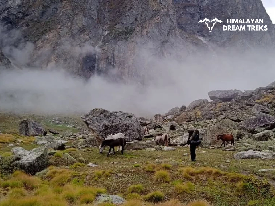
In Fauna, you can spot Himalayan Tahr, Himalayan Goat, Snow Leopard, Blue Sheep, etc, on this trek. Though the animals keep to themselves, but if you happen to spot an,y just the view from afar. Do not try to touch them or get close.
SCI, Foreign Permit & Vehicle
During this time, thick snow covers the trail, and trekkers can enjoy fresh snowfall. Sometimes the path becomes a bit difficult due to heavy snowfall, but it is very much liked by trekkers as it adds thrill and challenge to the trek. Trekkers can enjoy walking on the snow and see the snow-capped peaks visible from a distance. The sunrise from the mesmerizing peak is breathtaking, offering views of the mighty Himalayan peaks under bright, clear skies.
Although the months between December to February are the coldest and the temperature remains below zero at night, this is the time when the landscape around the trail turns into a wonderful paradise.
Though these months are mostly cloudy, if you are lucky, you can enjoy the bright landscapes under clear skies. The campsites are covered in a blanket of snow, and near Judha Ka Talab, trekkers can even walk on the frozen lake.
FAQs
Satopanth is a moderate trek that reaches an altitude of 15,100 feet. While beginners can attempt it, prior Himalayan trekking experience is highly recommended.
The trail has boulders on the way, moraine crossing, and steep ascents, particularly between Laxmi Van and Chakrateerth, and the final climb to the lake. You should maintain a regular fitness routine, including both cardio and strength training before attempting this trek.
Special permits are required to do this trek. These permits must be arranged in advance from Joshimath. It is recommended 8to trek with an authorised operator who can handle the permit arrangements, as individual trekkers may face difficulties obtaining them.
The permit for the Satopanth Tal trek is issued by the Divisional Forest Office of Nanda Devi Biosphere Reserve, Joshimath. You can also apply online for the e-permit through the Indian Mountaineering Foundation Portal.
Typically 5–6 days from Badrinath to Badrinath.
The risk of AMS (Acute Mountain Sickness) is real due to the high altitude. Acclimatization at Badrinath, slow ascent, and proper hydration are necessary. Carry Diamox if advised by your doctor.
Camping is usually done at Chakrateertha, just before the lake. Some sadhus live near the lake, but trekkers generally return the same day.
No, beginners are not advised. The terrain, altitude, and remoteness make it better for trekkers with prior Himalayan experience.
The lake is said to remain naturally clean. Locals believe birds remove any dirt that falls into it. Scientifically, the water quality has been found to be excellent.


Leave a Comment