
Whether you are seeking peace, adventure, or enjoyment, a trip to the mountains comes first in your mind. Mountains have always been a wonder’s paradise and a place to find yourself. Here’s a list of mountain words for you to understand them better, their situation, and to feel more connected with them. Knowing mountain words isn’t just about expanding your vocabulary but going there unprepared may become a life challenge.
Refer to this guide to understand one of the greeted creations of nature on earth.
Table of Contents
1. Mountain Topography
Understanding mountain topography allows you to truly know what you are looking for, trekking on, or choosing. It helps to navigate through its diverse terrain.
Peak
The highest point of a mountain. They are often pointy in an upside-down “V”, while some mountains have a flat top. Other words are used interchangeably, such as summit, mountaintop, pinnacle, vertex point, etc.
Example – Mt Shivling, Nanda Devi, Kamet, Mana Peak, etc.

Col
Derived from French col, meaning collar or neck, and Latin collum – neck, col is the lowest ridge point between 2 peaks. Not strictly, but col is often used for being in rugged terrain and higher altitudes that need more technical assistance to cross.
Example – Auden’ Col in Uttarakhand

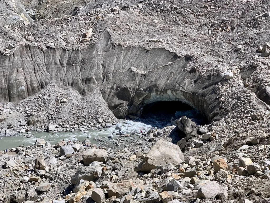
Glacier
A large piece of snow, ice, rocks, sediments, and liquid water frozen over a perennial. Glaciers move slowly downwards under their weight and gravity.
Example- Gaumukh Glacier
Snowline
A boundary above which snow remains throughout the year, marking it a permanent snow place.
Example – Himalayas in summer season
Winterline
As air with different temperatures meets, it gives rise to a sharp line where the lower part appears dark, and the cooler air above is a lighter blue. This phenomenon is visible from many places throughout the Himalayas and is particularly prominent in Uttarakhand and Himachal Pradesh in India, typically between October and February.
Example –Winterline in Mussoorie
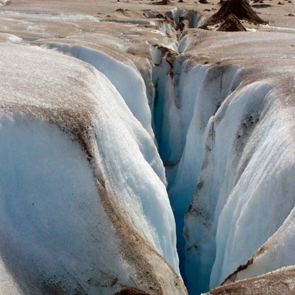
Crevasse
Deep vertical crack in a glacier or ice sheet.
Example – Khatling glacier is cracked by a crevasse.
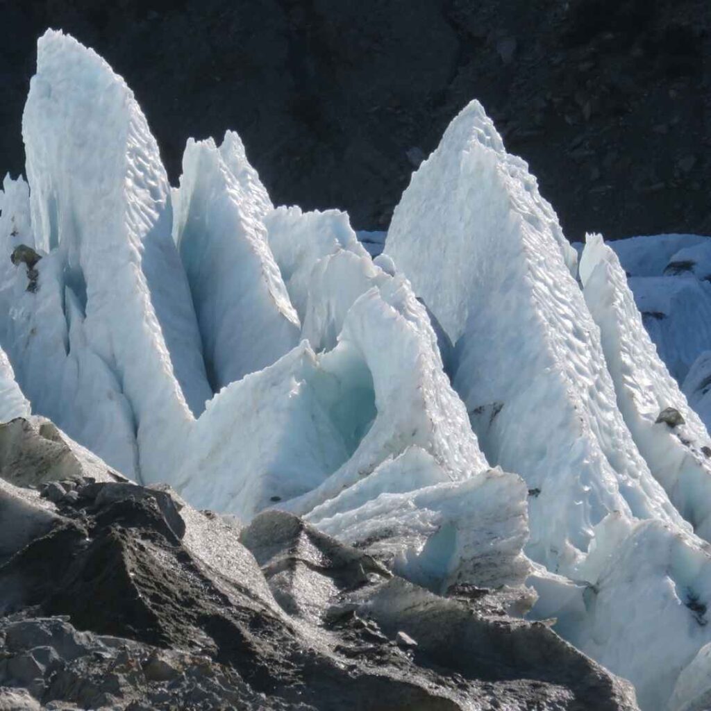
Serac
A pinnacle point formed by crevasses’ intersection or by a glacier’s terminal end. Serac is highly unstable and may topple over anytime without warning, making them dangerous for mountaineers.
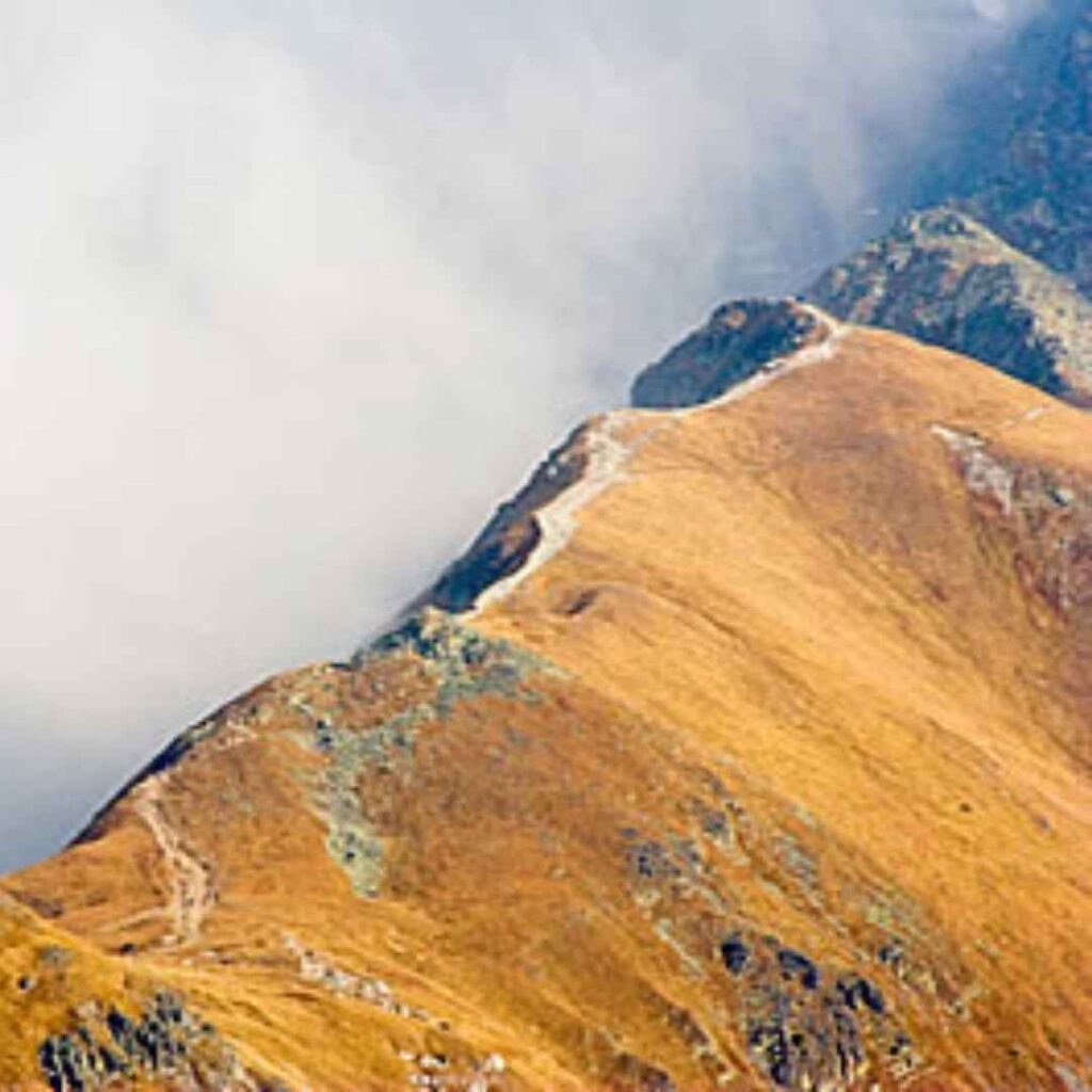
Ridge
A narrow, long, and elevated section forming the spine of a mountain range. It is not the highest point but a continuous line marking two sides of a mountain.
Example – Phulara Ridge
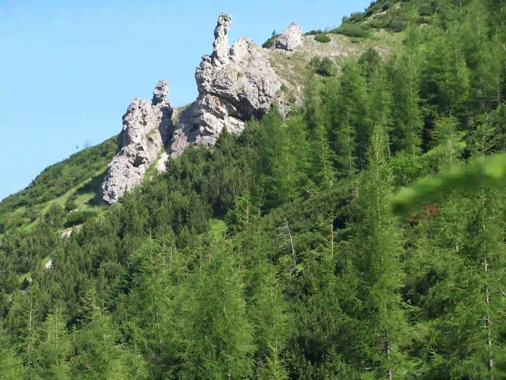
Spur
A smaller ridge like a tongue branching off from a main ridge or mountain.
Example – A spur in the Tatra Mountains
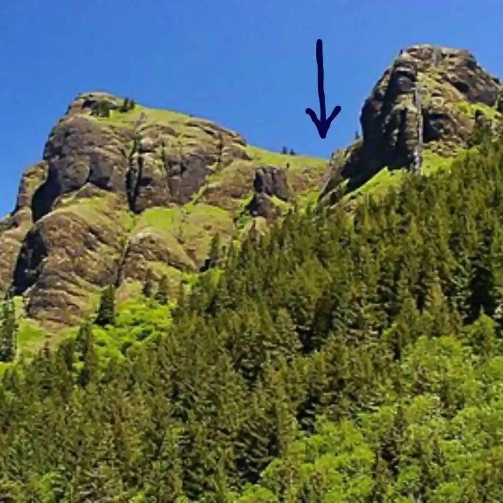
Saddle
The lowest point between two peaks or ridges but is higher than a valley, forming a saddle-like shape. In higher altitudes and rougher terrains, it is known as “col.”
Pass
A gap between mountain ranges or ridges makes navigation in between easy, which is otherwise impossible. Passes are usually formed due to glacial movement or by stream erosion. Traditionally useful in trade, immigration, and wars.
Example – Pir Panjal Pass
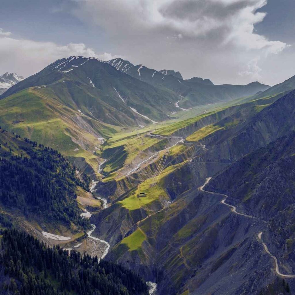
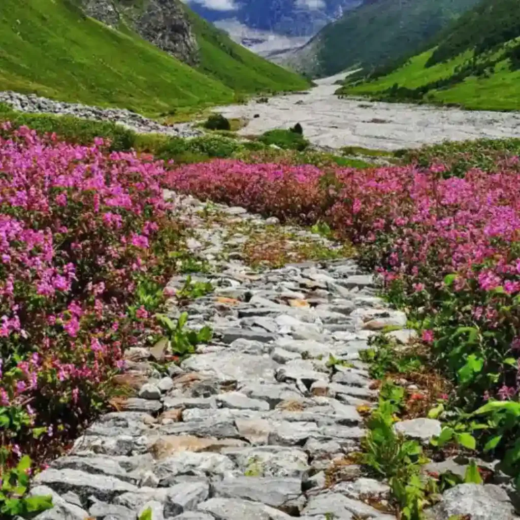
Valley
An elongated low area between mountains, usually formed by flowing rivers, streams, or a moving glacier.
Example – The “Valley of Flowers” in Uttarakhand
Gorge
A deeper valley that is narrower and has steep walls of mountains or hills. Usually formed by fast-flowing rivers cutting through rocks.
Cirque
A starting point of a valley often formed by glacial movement. Shaped like a deep sunken bowl with steep or concave-like walls. Also known as corrie.
Plateau
A flat elevated area that rises above the surrounding terrain. E.g., The Deccan Plateau of Central India.
Escarpment
Is a steep slope or cliff separating two areas of different elevations, more like a dividing line. For example, Western Ghats is one of the world’s largest escarpments, being approximately 15,000 km long.
Moarine
An accumulation of debris deposits left behind a glacier movement. Mainly formed of rock, gravel, clay, etc, also known as “glacial till.” The 4 types of moraines are –
1. Lateral Moarine
Parallel deposition of moraines along the sides of a glacier as it scrapes out the rocks while moving.
2. Medial Moraine
A ridge of moraine formed when two lateral glaciers are pushed together.
Note – Both lateral and medial moraines are known as “superglacial moraine.”
3. Ground Moraine
Made up of sediments underneath the glacier, often due to melting or moving. They usually occur as plains of rolling grasslands.
4. Terminal Moraine
As the name suggests, it is formed at the glacier’s end.
2. Mountain Formation
Without mountains, trekking is impossible, but how did these vast creations come into existence? Mountains are formed due to various geological reasons, but tectonic plate activity is a significant reason.
Fold Mountains
Created by the collision of two or more tectonic plates, which leads to the bending and folding of rocks in an uprising form, creating mountains or hills.
Fault-Block Mountains
These mountains are created along the fault line of tectonic plates. Usually, when these plates move either horizontally or away from each other, they create tension in the earth’s crust. This activity leads some parts of the earth to rise above, creating “Horst Mountains,” and some to sunken, creating “Garben (rift valley).”
Examples: Horst – Satpuda Ranges in India | Narmada Garben dividing Malwa and Bundelkhand Plateau.
Volcanic Mountains
Built by the tectonic plate’s activity, like plates moving apart, making a divergent zone or one plate sinking in the earth’s mantle. Magma erupts as lava from the earth’s crust, which later cools down and creates these mountains.
Examples – Mt. Fuji, Japan | Mount St. Helens, U.S
Dome Mountains
These are created when hot magma from the earth’s crust pushes hard rock upwards but not with great force to make a volcano. So, beneath the hard outer layer of rock, the magma cools down, creating a dome-like mountain.
Example – Kedar Dome Peaks of Garhwal Himalayas in Uttarakhand.
3. Weather and Environmental Factors
The first crucial step before planning any trip is to check weather updates. And Preparing according to environmental factors immensely helps in a smooth trek. Here’s some terminology related to these factors to look out for.
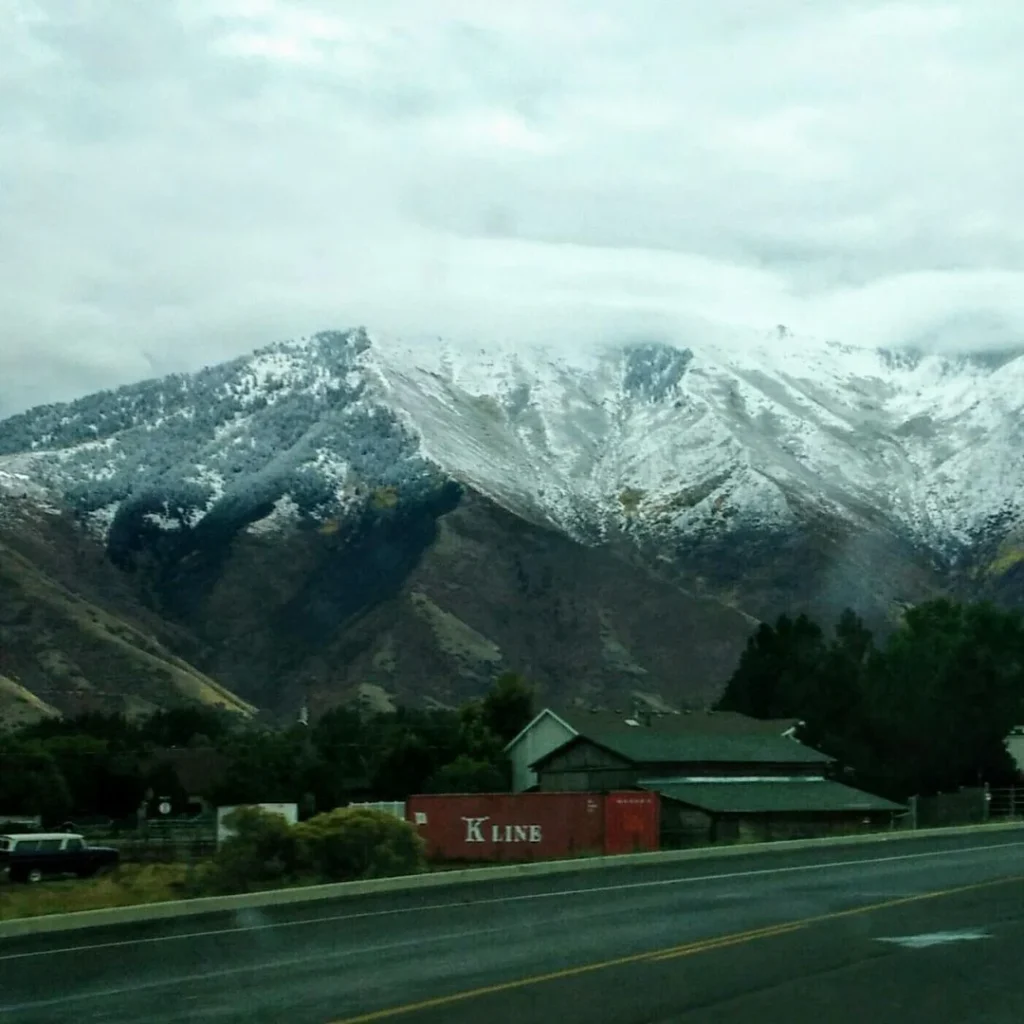
Altitude
Vertical distance above the earth’s surface or sea level. This affects oxygen levels and temperatures.
Windward and Leeward
These are two sides of a mountain. The windward side faces most winds; hence more rain and moisture, making it a fertile side. Leeward is the opposite, more drier and arid region.
Example, the Himalayas faces windward, whereas the Tibetan Plateau is on the leeward side.
Altitudinal Zones
Mountains can be divided into various parts vertically depending on climatic conditions, vegetation, temperature, precipitation, etc. These levels are – Foothill zone, Montane level, Sub-Alpine level, Alpine level, Nivel or Snow Zone. Not every mountain has each level.
Montane Level – The area between 500 and 4000 m marks the tree line, with dense forests.
Alpine Level – Starting from the tree line till the snow line. Here, you will find fewer trees but shrubs, alpine meadows, cold weather, etc.
Nivel Level – The area of the mountains (peaks) which remains covered in snow throughout the year.
Temperature Lapse Rate
The rate at which temperature decreases by gaining altitude. Usually, with every 1000 m, 10 degrees decreases.
Permafrost
The area of land which remains completely frozen for two years straight.
Example – The high mountains of the Tibetan Plateau and the Himalayas.
4. Climbing and Trekking Terms
Base Camp
The starting point of a trek, usually a village or town, providing necessities.
Ascend
The act of climbing, walking, or hiking upwards towards a higher point or a peak.
Descend
The act of hiking downwards from a higher point.
Traverse
Crossing a section horizontally or laterally instead of upward approach. Usually, a ridge or a pass.
Scrambling
Ascending on steep terrains using your hands for hold and balancing. It is a difficult technique to use when hiking and rock climbing.
Rappelling
Descending a steep slope using ropes and harnesses. Also known as “abseiling.”
Belay
It is a climbing technique where one person, the belayer, remains at one point with a rope system in place. Belayer then ensures the climber has enough rope by adjusting it so the climber does not fall.
Free Climbing
It is a climbing technique; here, the climber uses only natural holds. They use climbing equipment as a precaution, not an aid.
Aid Climbing
A climbing technique where climbers use equipment to help them climb and progress.
High camp
A camp positioned close to a summit or highest point of the trek for final ascents.
Route
The planned path to ascend or descend on any trek.
5. Safety and Equipment
Crampons
Spiked footwear attachments for walking on ice or hard snow.
Ice Axe
A multi-purpose tool used for climbing and balancing on snow or hard frozen terrain.
Harness
It is a Personal Protection Equipment (PPE) used to secure ropes, carabiners, etc to prevent injuries and falls.
Rope
A essential for ascent, descent, rappelling, etc.
Carabiner
A metal loop with a spring-loaded gate used for securing ropes.
Avalanche Beacon
A device to locate individuals buried under snow.
First Aid Kit
A must-have essential kit of medicines, anti-septics, band-aids, etc, used in injuries.
Bivouac or Bivvy
A temporary shelter to protect from bad weather or rest for a while.
6. Flora and Fauna
Endemic Species
Species that cannot be found naturally in any other region of the world.
Example, the Orange Bullfinch, Kashmir Flycatcher, Red Panda, etc, are endemic to the Himalayas.
Migratory Patterns
Seasonal movements of flora, fauna, and humans due to changes in weather.
In harsh winters, humans and animals move downwards, while some thrive in it like Snow Leopard, yaks, etc.
7. Cultural and Regional Terms
Sherpa
The word “Sherpa” has many meanings –
1. Sherpa is an ethnic group from Tibet, residing in many parts of the world, like Tibet, India, Nepal, China, etc, but mostly near the Himalayas.
2. “Sherpa” is a language that is mainly spoken in Nepal and is the official language of India’s state, Sikkim. In the language, the sherpa word translates to “easterners” or “east people.”
3. Sherpas are known as highly skilled mountaineers, guides/leaders. The term is now “generalised” for every guide, irrespective of ethnicity.
Yaks
Yaks are domesticated animals or cattle commonly found in hilly regions like the Himalayas in India, the Altai range of Magolia, Tibet, etc.
Yaks are well adapted to higher altitudes with larger lungs, which helps them with air and blood circulation. Yaks are mainly used for transport, milk, wool, cashmere like clothing, etc.
Fact – In the Tibetan language, Yak is used only for the male gender, and “dri” is used for females.
Sacred Mountains
Some mountains and peaks are considered holy and are revered in many religions, and they are also part of legends and mythology.
For example, Mt. Kailash is considered sacred in Hinduism, Buddhism, Jainism, and Bon religions.
Nomadic Traditions
It is a way of life by nomad community. They move from one place to another without the intention of staying in one place for a longer period of time.
8. Scientific and Geological Terms
Rock Types
There are mainly 3 types of rocks, though they can be further divided into various types.
1. Igneous
Rock formed due to cooling and then solidification of the magma or lava.
- Intrusive rocks are made when magma cools down within the earth’s crust, forming crystalised blocks.
Example – Granite. - Extrusive rocks, also known as “volcanic rocks,” are formed when lava cools down on the earth’s surface, either on land or underwater.
Example – Basalt.
2. Sedimentary
These rocks are formed from the accumulation of pre-existing rocks, sediment,s, and one living organism through the process of lithification and weathering.
Example – Limestone & Shale.
3. Metamorphic
Rocks are formed when different rocks, like igneous, sedimentary, and even older metamorphic rocks, go under pressure and temperature, changing the original rock’s characteristics.
Example – Sandstone to Quartzite, Shale to Schist.
Erosion
The process of wearing down rocks by natural forces like wind, water, and ice.
Example– Erosion in Chopta and Dayara Bugyal
Tectonic Activity
According to Alfred Wegener’s continental drift theory, the earth’s lithosphere (hard outermost layer, including upper mantle and crust) was once a single mass of land known as Pangea.
Later, Pangea started to break, creating 7 to 8 plates, and drifted away, creating the world we know today. To date, these plates are moving, and the movements can be classified as –
Divergent: Plates move apart
Convergent: Plates move toward each other and collide
Transform: Plates slide past each other
This process took millions of years, and the plates still move 0.6 inches every year. These movements are one of the biggest causes of forming mountains, ridges, rifts, etc. And also natural calamities like earthquakes, tsunamis, landslides, and volcanic eruptions.
Seismology
The scientific study of earthquakes and the movement of waves through the earth.
9. Climatic and Environmental Terms
Snowfield
It is a place of permanent accumulation of snow and ice.
Icefall
When a portion of a glacier moves fast, it turns into conical, jaded points. This process makes crevasses that look like waterfalls.
Avalanche
Sudden snow slide down a mountain or hill, triggered by natural or human activity. A slab avalanche is when a whole block of ice moves because of a weak underlying snow sheet. When powdery snow is triggered, it is called a loose avalanche.
Frost line
Also known as freezing depth, it is a point underground till underground water and soil get frozen.
Scree
Loose rock debris on slopes.
Talus
A slope with larger loose rocks and boulders.
Note – Scree and talus can be used interchangeably, but talus sometimes gets considered as the slope itself, while scree is debris.
10. Fun Facts and Unique Terminology
Nunatak
It is a mountain peak emerging from a glacier. Derived from Inuit (Greenland), it means “lonely mountain.”
Arete
A sharp ridge created when two glaciers erode parallel to each other in a “U” shape. The ridge gets contoured with wind and time, looking like the back of a dragon.
Sastrugi
These are wind-formed snow patterns, like dunes in desserts.
Glissade
It is a climbing down-the-slope technique for a more controlled yet fast descent.
Thalweg
A line marked in the deepest points of a river bed or valley to define the deepest channel.
Cairn
Derived from the Scottish Gaelic “càrn,” which means a pile of stones is used to mark trails or landmarks on a trek.
Corrie
When glaciers move away, they leave behind a deep bowl-shaped hallow, which is known as “corrie.”
11. Words Related to Health Issues in the Mountains
Mountains pose unique health challenges due to extreme environmental conditions and physical exertion.
- Altitude Sickness (Acute Mountain Sickness): Caused by reduced oxygen levels at high altitudes, symptoms include headache, nausea, and fatigue.
- Hypothermia: A dangerous drop in body temperature due to prolonged exposure to cold.
- Frostbite: Freezing of skin and underlying tissues, usually affecting extremities like fingers and toes.
- Dehydration: Common due to dry air, increased exertion, and inadequate water intake.
- Snow Blindness: Temporary vision loss caused by intense UV reflection off snow.
- Pulmonary Edema (HAPE): Fluid buildup in the lungs caused by low oxygen levels at high altitudes.
- Cerebral Edema (HACE): A life-threatening condition where fluid builds up in the brain.
- Exhaustion: Physical and mental fatigue from prolonged exertion.
Final Thoughts
Understanding mountain words or terminology immensely enriches your trekking, expedition, or climbing experience. Whether you are a beginner or an experienced trekker/climber, knowing the full wealth of situations, geography, and weather conditions helps you to assess future possibilities. These words also help you connect with nature and mountains with more understanding, thus adding more to your epic trip.
Leave a Comment