
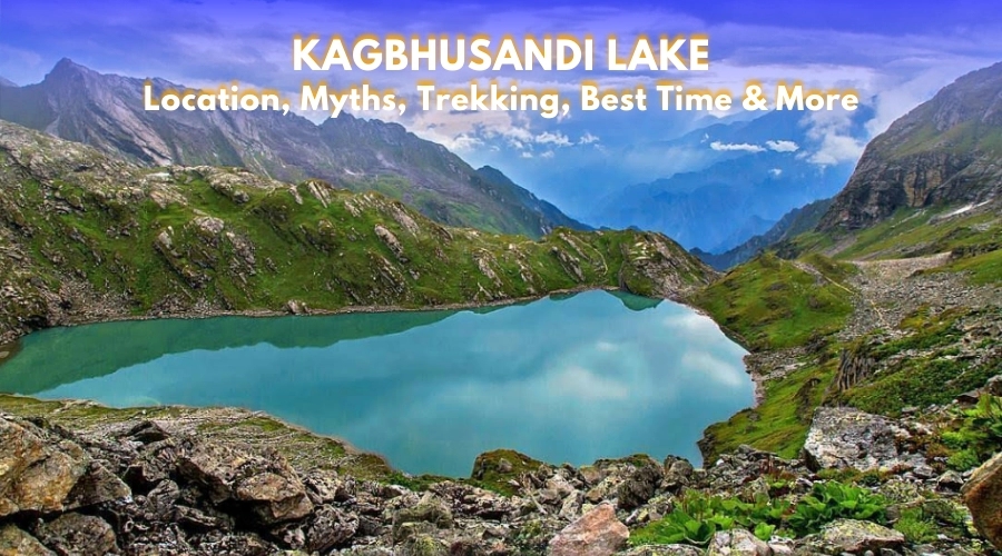
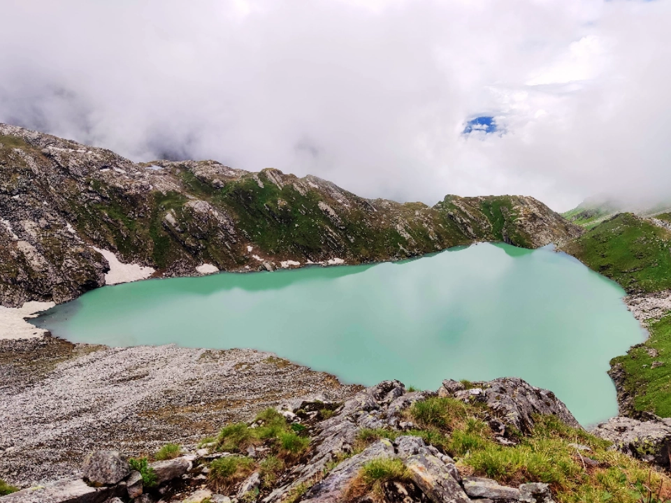
High in the Garhwal Himalayas of Uttarakhand lies a lake that remains relatively unknown compared to its more famous neighbors like Hemkund Sahib and the Valley of Flowers. This lake is Kagbhusandi Tal, a remote alpine water body that sits at an altitude of about 4,363 meters (14,314 feet) above sea level. Located in the Chamoli district, within the boundaries of the Nanda Devi Biosphere Reserve (NDBR), the lake is not only a natural wonder but also a place of deep spiritual significance and geological importance.
Unlike popular trekking routes that attract thousands of visitors every season, Kagbhusandi Tal demands commitment, patience, and endurance from those who wish to see it. Its trails are challenging, unmarked in many sections, and often exposed to unpredictable weather. Yet for the few who make it there, the experience is unforgettable.
Location and Geography
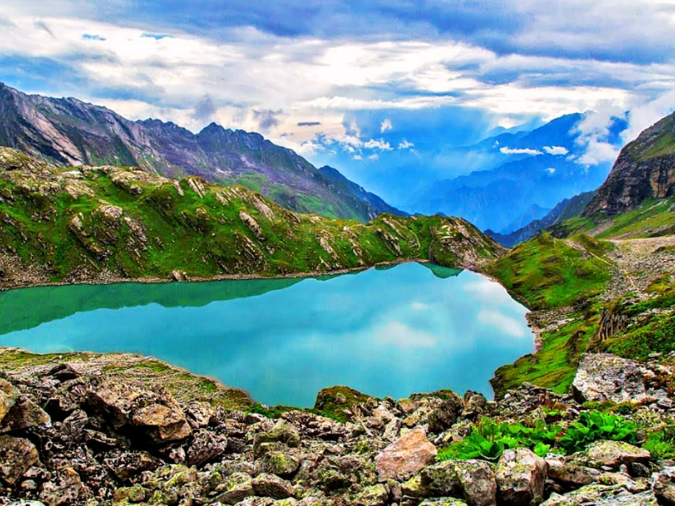
Kagbhusandi Lake is located near Kankul Pass in the Chamoli district of Uttarakhand. The lake is nestled between some of the prominent Himalayan peaks such as Hathi Parvat (6727 m), Ghori Parvat (6709 m), Neelkanth, Chaukhamba, and Nar-Narayan. From its banks, trekkers often get wide and clear views of these peaks, especially during the post-monsoon months when the skies are clearer.
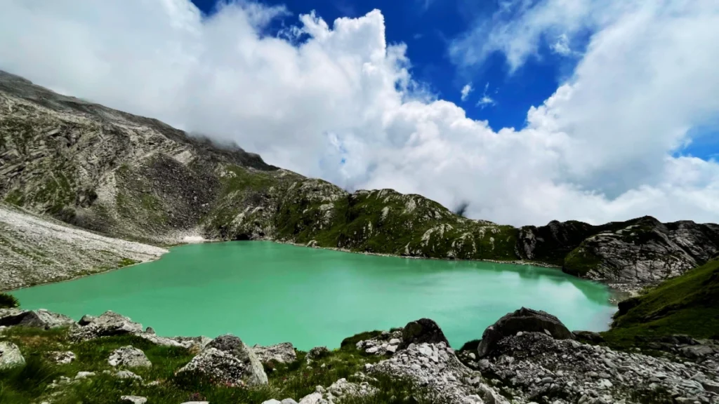
The lake lies inside the Nanda Devi National Park and Biosphere Reserve, which is a UNESCO World Heritage Site. This reserve is known for its strict conservation rules and extraordinary biodiversity. Kagbhusandi Tal itself is categorized as a cirque-type glacial lake. Cirque lakes are formed in bowl-shaped hollows created by the erosive action of glaciers. The basin fills with water after the glaciers retreat, and over time, they often grow or shrink depending on climatic conditions.
In terms of size, Kagbhusandi Lake has an area of about 80,868 square meters, making it one of the larger high-altitude lakes in the region. For comparison:
- The unnamed lake on East Kamet Glacier is the largest in the biosphere reserve, with over 531,028 square meters.
- Hemkund Lake, another famous one nearby, covers 109,344 square meters.
- Sitkeng and Geldhura are other bigger lakes than Kagbhusandi, and are spreading rapidly.
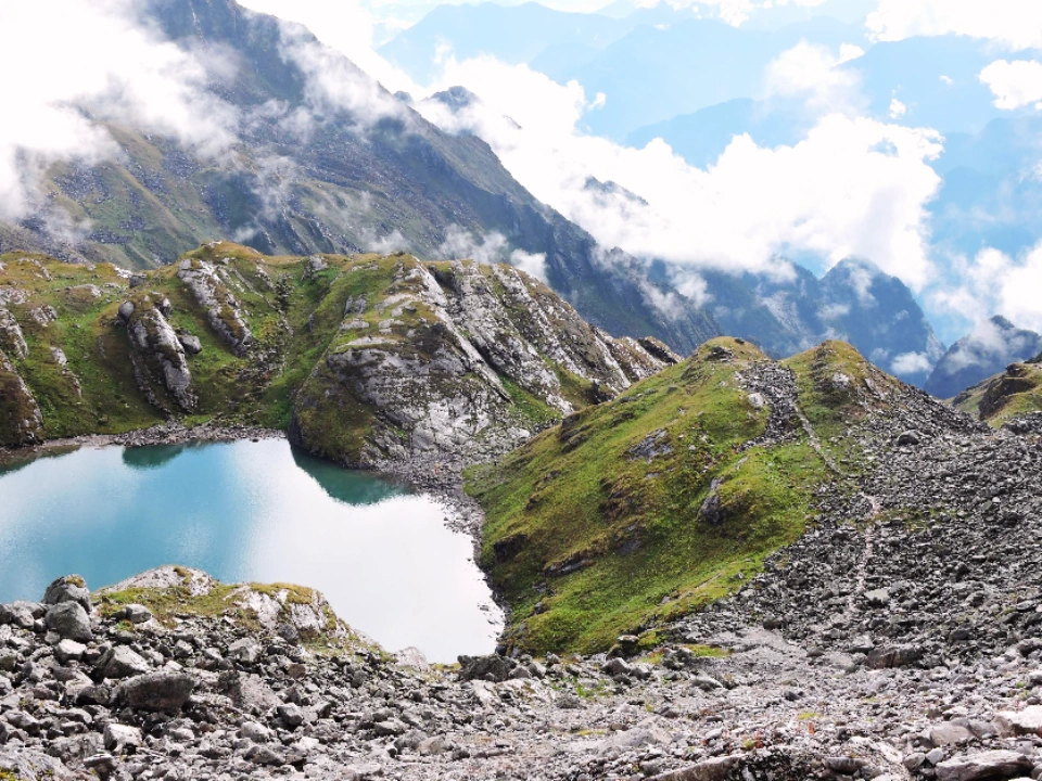
Kagbhusandi has shown only a modest expansion in recent decades. As per the report, from 1976 to 2010, its surface area grew by about 6,573 square meters, which is relatively small compared to the tens of thousands of square meters added by other lakes in the region. This slower rate of growth, however, does not mean it is entirely stable. Like other Himalayan glacial lakes, it remains vulnerable to natural hazards such as avalanches and potential outburst floods.
Geological and Environmental Context
The formation of Kagbhusandi Lake is closely tied to the larger story of glacial retreat in the Indian Himalayas. Studies have shown that climate change has accelerated glacier melting, which in turn feeds glacial lakes with more water than usual. Over time, this increased supply expands the lakes and puts pressure on their natural barriers, such as moraine walls.
Lakes in the Nanda Devi Biosphere Reserve are distributed according to altitude. Research shows:
- 3 lakes are above 5000 meters,
- 11 lakes are between 4500–5000 meters,
- 14 lakes lie between 4000–4500 meters,
- 7 lakes are below 4000 meters.
Kagbhusandi falls in the 4000–4500 meters range. trekkers This discrepancy comes from the different surveys and reference points, but the consensus remains that it is among the higher-altitude lakes of the Garhwal Himalayas.
The lake is frequently affected by avalanches, which can create large waves inside the water body. If these waves overtop the natural outlet or weaken it, the chances of flooding increase. Similar events have already been recorded in the region, though many remain undocumented.
Legends and Myths
Like many places in the Himalayas, Kagbhusandi Tal is not just about natural beauty, it carries strong mythological associations. The name itself gives a clue. “Kag” means crow, and “Bhusandi” refers to a sage.
According to one story, Sage Lomash cursed a Brahmin from Ayodhya, who was then transformed into a crow. This crow came to live near the lake, and thus the lake came to be known as Kagbhusandi Tal. Another legend tells of a crow and an eagle (Garuda) seen on nearby peaks, engaged in a deep spiritual conversation. The locals believe that these birds are not ordinary creatures but divine beings.
There is also a tale about a Garuda listening secretly to Vedanta being recited by a sage near the lake. When the sage discovered this, he cursed the Garuda to be frozen into a peak of stone, and at the same time cursed all crows to die, leaving only their wings behind. This story connects the nearby Kagbhusand Peak (5830 m) with the lake. The peak, with its sharp features, is said to resemble the form of a Garuda.
Such legends give the lake a sacred character. For many locals and pilgrims, it is not just another trekking spot but a place where nature and divinity meet.
Trekking to Kagbhusandi Lake
Reaching Kagbhusandi Tal is not easy. It’s a moderate level trek. Unlike the Valley of Flowers or Hemkund Sahib, which have marked trails and facilities for pilgrims, Kagbhusandi remains remote and challenging.
Base Points
There are two main routes to the lake:
- From Govindghat via Bhyundar Village – This is the more commonly used trail. The path first follows the route to the Valley of Flowers and Hemkund Sahib. At Bhyundar Village, the trail splits: the left path continues toward the Valley of Flowers, while the right trail climbs toward Kagbhusandi Tal.
- From Vishnuprayag via Painka Village – This is an alternate approach, less frequented and more rugged.
Trail Features
- Distance: Around 60–65 km round trip
- Altitude: 4,363 m (14,314 feet)
- Difficulty: Moderately Challenging, suitable only for experienced trekkers
- Terrain: Mix of rocky paths, alpine meadows, glaciers, dense forests, and river boulders
- Campsites: Popular stops include Bhyundar, Kargila, Semartoli, Bankbara, Dang Khark, and Raj Khark.
Trek Itinerary
- Day 1: Govindghat to Bhyundar Village; Trek- 12 km
- Day 2: Bhyundhar Village to Raj Kharak via Samartoli: Trek- 14 km
- Day 3: Raj Kharak to Kagbhusandi Lake via Kankul Pass: Trek- 8 km
- Day 4: Kagbhusandi Lake to Gouncha Udiyar; Trek- 8 km
- Day 5: Gouncha Udiyar to Painka Village and drive to Govind Ghat; Trek- 10 km, and a short drive
The trek requires good acclimatization. The steepness, unpredictable snow conditions, and lack of defined trails make it unsuitable for beginners.
Best Time to Visit Kagbhusandi Lake
The best months are May–June and September–October to visit Kagbhusandi Lake. In May and early June, the meadows are blooming with alpine flowers, while in September and October, the skies are clearer, and the views of the peaks are sharper. During July and August, the monsoon makes the trails slippery and risky. In winter, the region remains snowbound and inaccessible.
Flora and Fauna
Because the trail passes through the Nanda Devi Biosphere Reserve, the biodiversity is extraordinary.
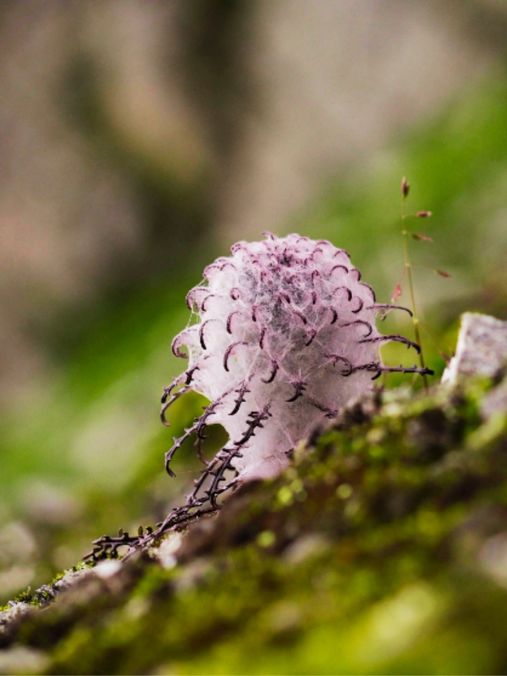
- Flora: Alpine flowers such as Brahma Kamal and Phen Kamal, wild rhododendrons, nettles, deodars, and oak trees dominate different sections of the trail. Meadows are often carpeted with wildflowers in summer.
- Fauna: The area is home to the Himalayan black bear, brown bear, and the elusive snow leopard. Smaller mammals such as musk deer also inhabit the region.
- Birds: High-altitude birds like the Himalayan snowcock and Himalayan monal (the state bird of Uttarakhand) can be spotted with some luck.
Mountaineering and Exploration
The Kagbhusandi Valley has attracted not only trekkers but also mountaineers. Peaks like Hathi Parvat and Ghori Parvat dominate the skyline and provide climbing opportunities. Expeditions in the 2000s explored routes to these peaks, often facing deep snow and unpredictable weather.
Historical accounts go back further. Shipton and Holdsworth, while returning from their first ascent of Kamet in 1931, attempted Kagbhusand Peak and reached within 300 feet of the summit before retreating. Eric Shipton described the climb as severe, though he managed to summit the following day with the help of Nima Sherpa. Only one more ascent was recorded later in 1970 by the Indo-Tibetan Border Police.
Risks and Precautions
Kagbhusandi Tal is not a trek for casual hikers. The risks are real:
- Altitude sickness due to the lake’s high elevation.
- Avalanches during the early summer.
- Landslides and floods triggered by sudden weather changes.
- The possibility of lake outburst floods that threaten downstream villages.
Trekkers need proper gear, acclimatization days, and local guides who know the terrain. Unlike Hemkund Sahib, there are no regular shelters, tea stalls, or pony services along the way.
Why Visit Kagbhusandi Lake?
Despite the challenges, Kagbhusandi Lake holds unique value:
- It is part of a World Heritage Site with strict protection, ensuring its wilderness remains intact.
- Views of the Garhwal peaks from the valley are some of the best in the region.
- The trail passes through untouched meadows and forests, making it a true Himalayan wilderness experience.
- The lake combines mythology, adventure, and science, offering something for trekkers, researchers, and spiritual seekers alike.
- For those who believe in Pitr Tarpan (ritual offerings to ancestors), this is considered one of the most sacred places to perform the ritual. According to Hindu scriptures, ancestors are believed to come in the form of crows to accept offerings made by their descendants. This lake holds special significance because of its connection to crows. It is also believed that crows gather near the lake when their time of death approaches.
For those seeking a trek that is not commercialized, Kagbhusandi Tal offers that rare opportunity. It demands effort but rewards with solitude and raw Himalayan beauty.
Summery
Kagbhusandi Lake is more than a body of water in the high Himalayas. It is a witness to climate change, a guardian of legends, a hazard in times of instability, and a sanctuary for biodiversity. Its story is not just about trekking or landscapes, but about the delicate balance between nature, culture, and survival in the mountains.
Visiting it requires respect, not only for the physical difficulty but also for the environment and the myths that surround it. For those who are prepared, this high altitude lake remains one of the most rewarding journeys in the Garhwal Himalayas.
Leave a Comment