
The Indian Himalayas have been a center of attraction for mountain lovers all over the world. From lush valleys to rugged high-altitude deserts, there’s a trek for every level.
Having completed all the famous winter treks of Uttarakhand, the last on my list was Kuari Pass. Kuari Pass is a great winter trek but we had already completed many treks of the same difficulty in the past. Thus we put some higher stakes and decided to attempt Pangarchulla Peak.
Pangarchulla Peak has a very small window during the year because of its dangerous summit climb. The peak season to attempt this trek starts from March and ends by May.
Why Pangarchulla? If you look at the list of summit treks in the Indian Himalayas, you will see a major gap between the difficulty levels. Either you see the Chandrashila and Kedarkantha Peak as the beginner treks or you find high altitude expeditions such as Friendship Peak, Yunam Peak, etc, which go beyond 5000m ASL.
Pangarchulla Peak is the perfect midpoint between beginner treks and expeditions. The maximum altitude is 15,069 ft above sea level and the whole trek takes one week to complete from Rishikesh to Rishikesh. It is not a technical peak and is considered a moderate to difficult trek.
Pangarchulla Peak is located very close to the Kuari Pass which was discovered by Lord Curzon in 1900. Lord Curzon, the Viceroy of India, was an avid trekker and explorer and he popularised this trail to the people. Almost 80% of the trail to Kuari Pass is the same for Pangarchulla Peak too!
Trek Preparation
We planned our trek 30 days prior to the date of departure. You have to do this trek with a certified guide and a company because this trek comes in the Nanda Devi wildlife sanctuary and a permit is required to trek in this region. The fitness routine for the same wasn’t very complicated. A 10 km run to be completed within an hour at least once a week for endurance and stamina. Strength training used to include pushups, pullups and squats. Core exercises such as leg raises and planks were performed 3-4 times a week. I had watched some videos before to understand the terrain, and I knew that it would be more of a mental challenge than physical.
Trek Starts
Day 0 – New Delhi to Rishikesh
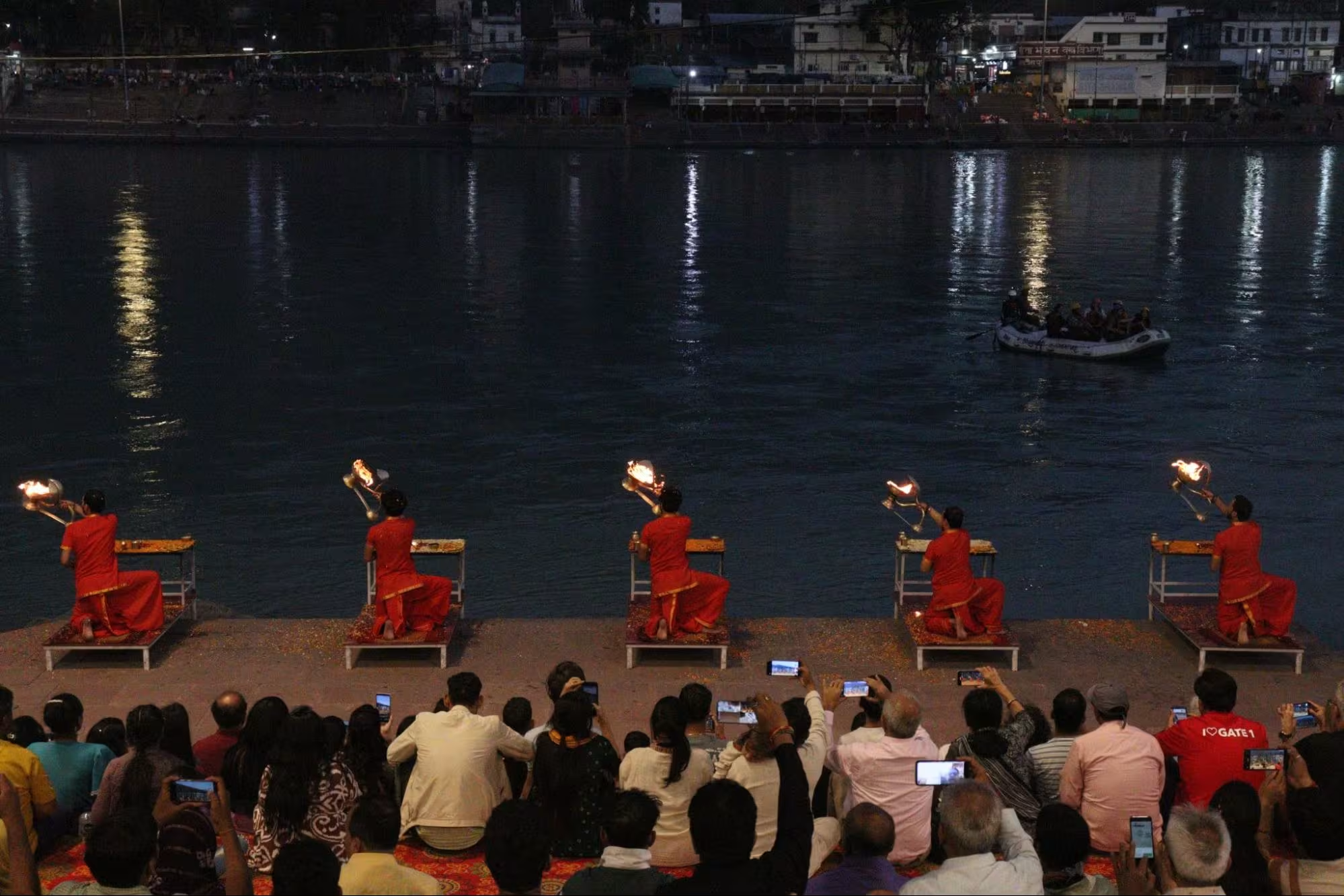
The team consisted of 5 members and a guide. The plan was to meet the guide in Tugasi village (starting point of the trek). We reached Rishikesh from New Delhi by an overnight bus and then spent a full day in Rishikesh. Rafting cannot be missed when you’re in Rishikesh and then we explored the Beatles Ashram, cafes, attended the Ganga Aarti and called it a day.
Day 1 – Rishikesh to Tugasi Village
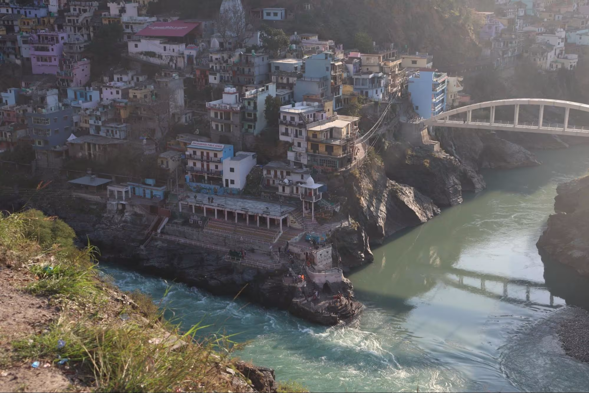
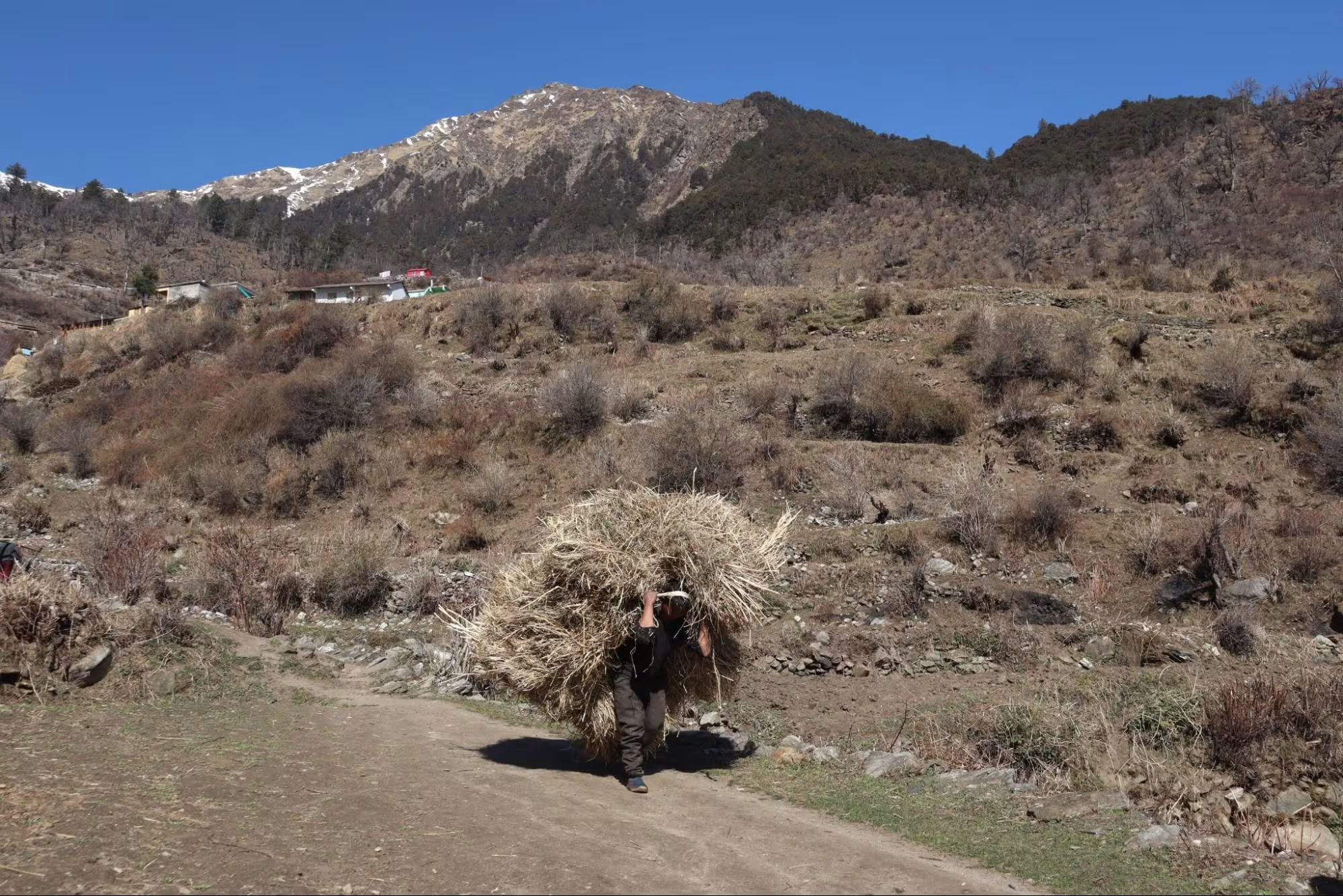
Today marked the start of our journey to the higher regions of Uttarakhand. Our target for the day was to reach Tugasi Village near Joshimath. It was a 265 km journey from Rishikesh and took 7-8 hours. Our timing was such that the state was preparing the infrastructure for the upcoming Chardham Yatra 2025. Our route included the famous sangams of Panch Prayag, which resulted in the formation of the river Ganga. These were DevPrayag, RudraPrayag, KarnaPrayag and NandPrayag. VishnuPrayag was not included in our route.
We departed from Rishikesh in an Ertiga at 5:30 am. The first pitstop was at Devprayag where we witnessed the sangam of Alaknanda and Bhagirathi and from hereon the river is known as Ganga.
There were multiple sights where roadwork was being done and it delayed our journey slightly. After crossing Nandprayag, our second pitstop was at Pipalkoti where our medical examination had to be done. It was the rule from the forest officials to get yourself medically examined before the trek. They took 50 rupees per person and checked our BP, sugar, heart rate, oxygen level and our blood group.
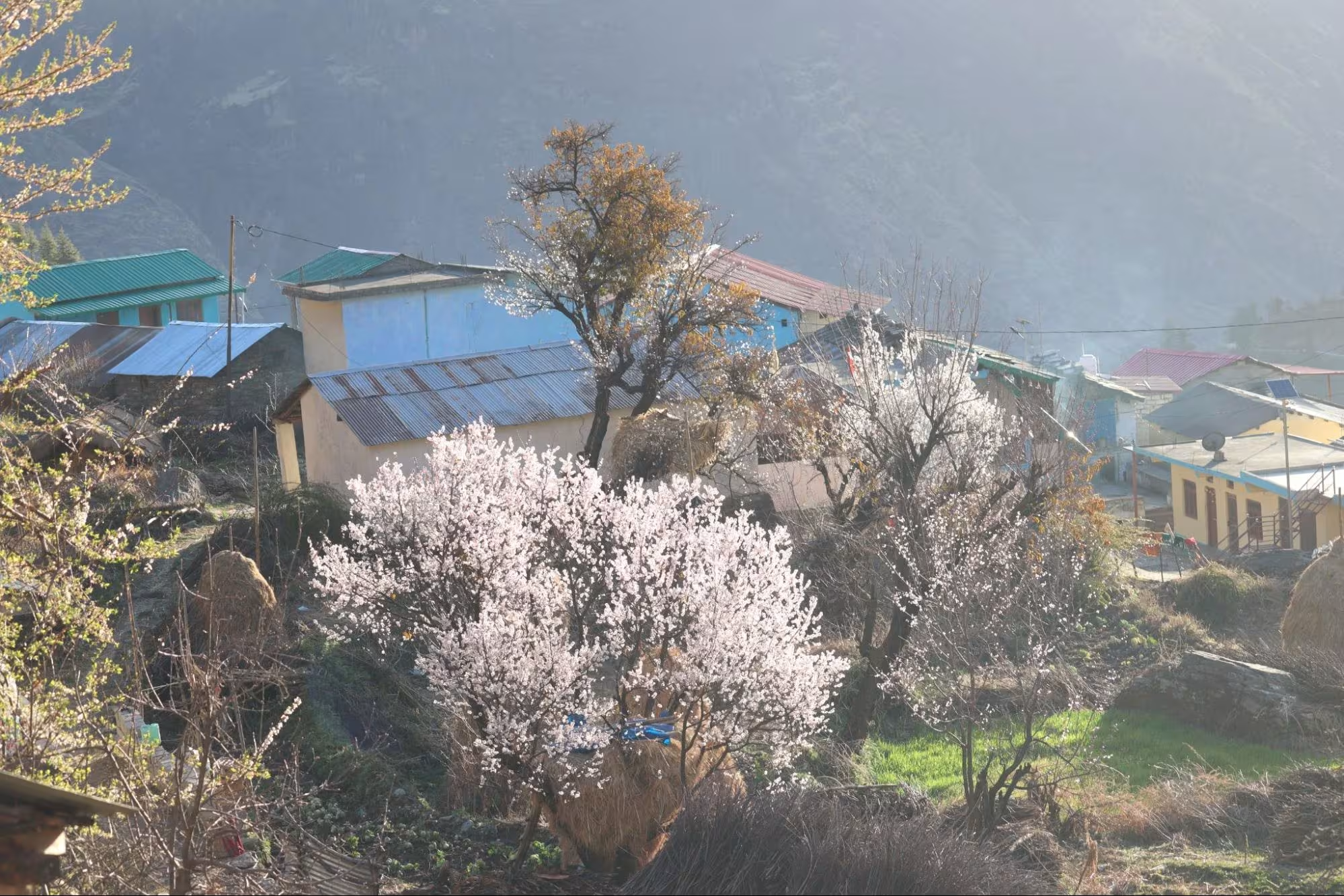
The medical officer gave a written receipt stating “Fit for trekking” after which we got our permit. We reached Tugasi at 3:00 pm and had some snacks at the “Pangarchulla homestay”. That was our stay for the night and the trail started right from it. Tugasi was a pretty village, and we observed such a magnificent sunset.
Day 2 – Tugasi Village to Gulling Campsite
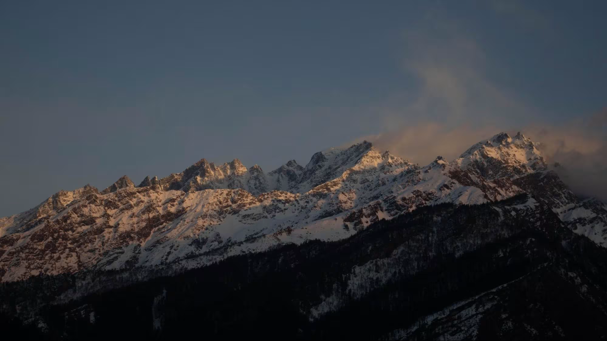
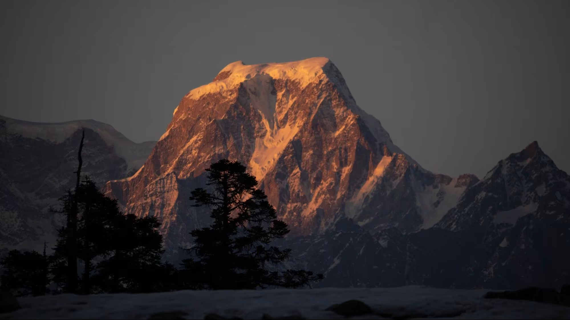
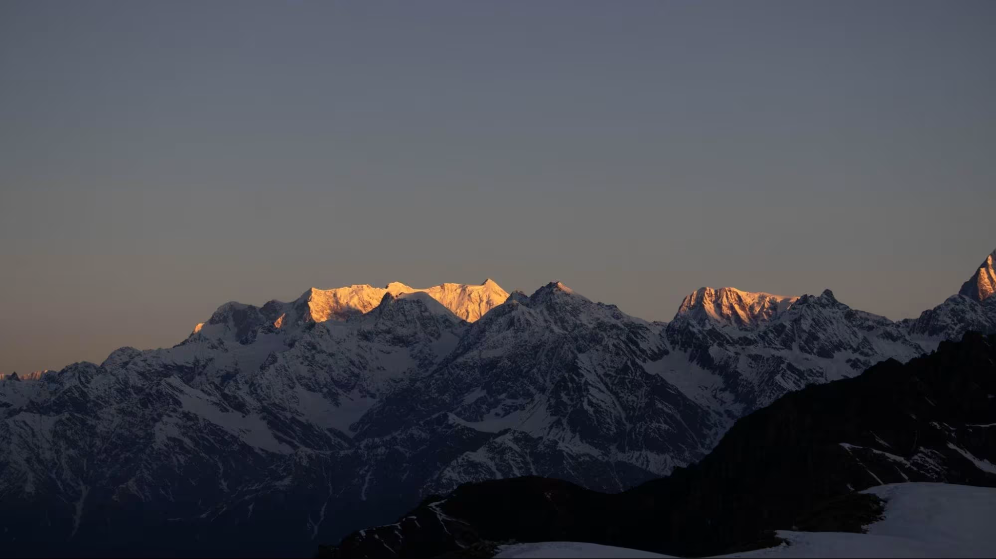
Our day started at 6 am. We got up and came out to see the sunrise and it was such a pretty sight. The sun rising behind Mt Hanuman and its rays passing from the shoulder of Mt Dronagiri.
Our destination for the day was Guling which was not far from Tugasi. It was hardly a couple of hours away. There was no hurry and it was such a relaxing morning. The sun was shining bright and not a pinch of cloud anywhere. We had our morning tea and breakfast and started our trek around 10:00 am. We crossed Tugasi and reached Upper Tugasi.
We crossed Upper Tugasi and reached the only dhaba on the way. We took a water break there and our guide started narrating the story of Mt Dronagiri.
Mt. Dronagiri is believed to be the mountain that Lord Hanuman took away from the Himalayas to cure wounds of Lord Lakshman. It carried the “sanjeevani booti” which helped in the recovery of Lord Lakshman. It is said that this mountain still has the same curvature marks from where it was uprooted.
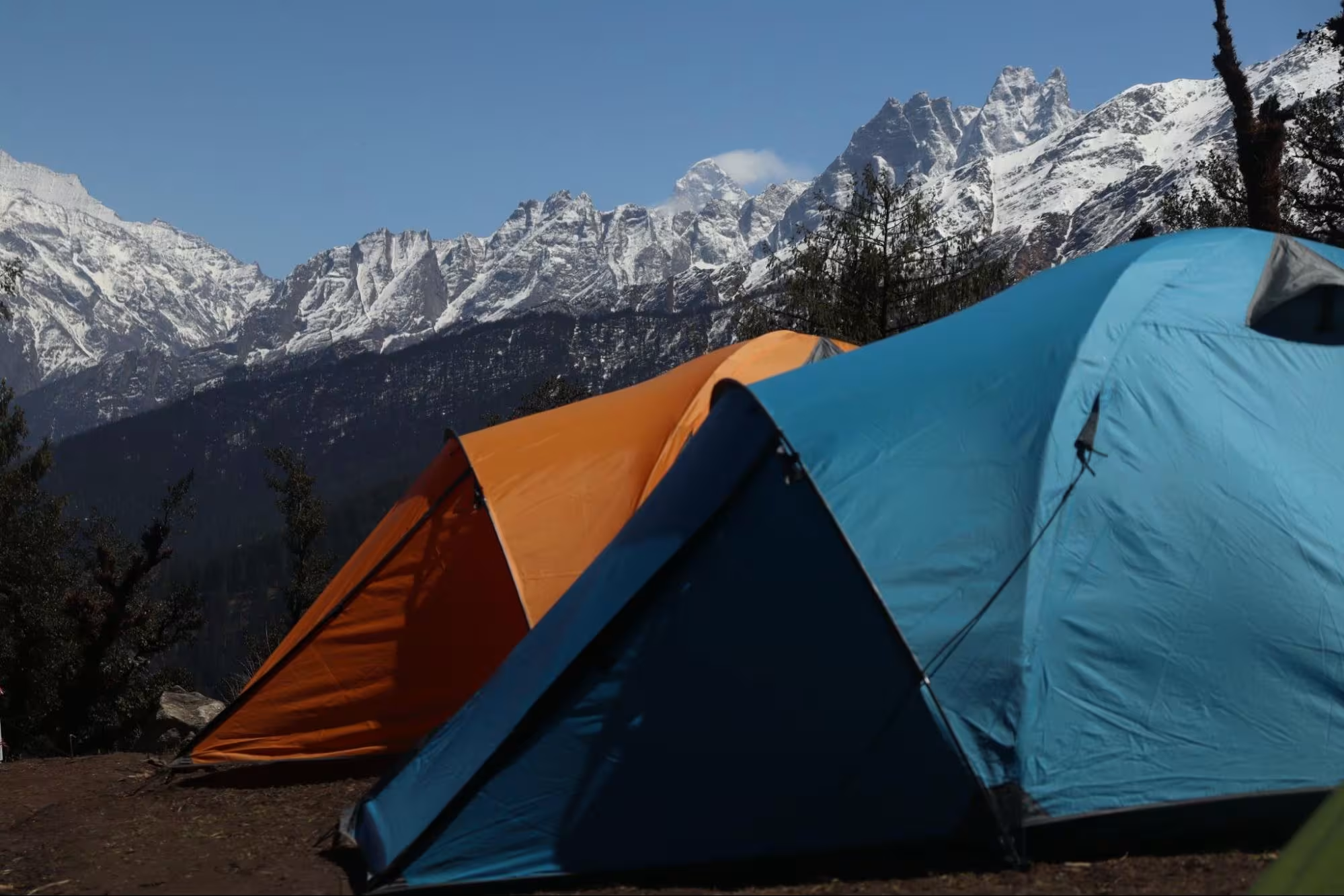
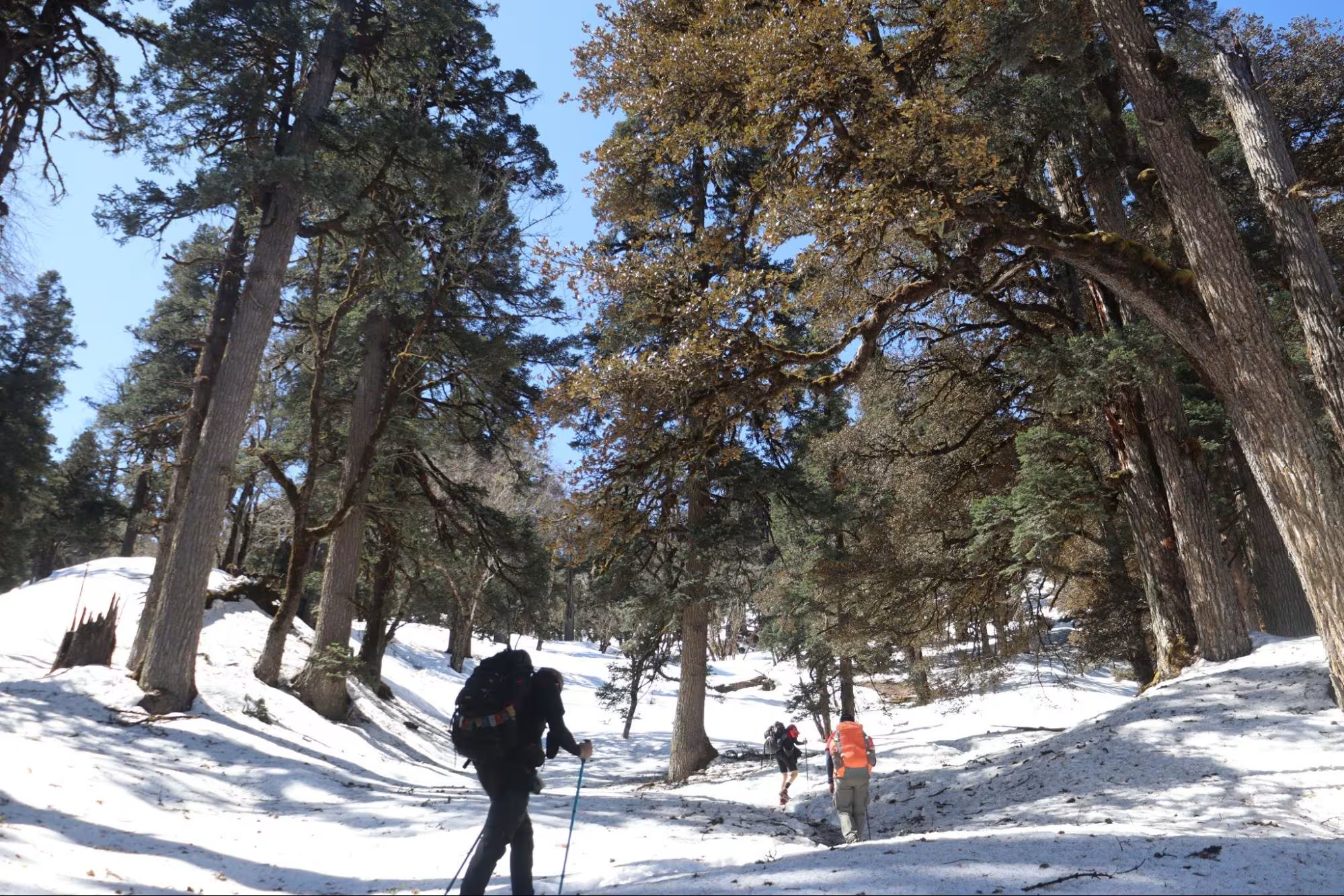
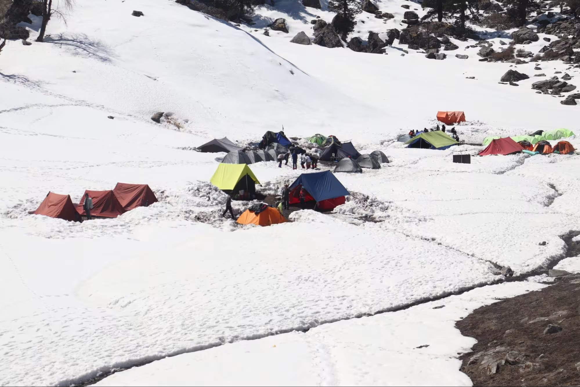
After a while, we resumed our trek and the forest officials joined us on the way to Guling. We chatted with them for a while in the golden oak and pine forest until we reached Guling. We had to camp a little away from the main meadow because the space was already taken up by other companies.
We kept our bags, took out our mattresses and laid down in the sunlight. It was a windy afternoon and after a couple of hours, it was normal. We had lunch and took out a frisbee and started playing with other trekkers. As we approached the golden hours, we took out our cameras and literally saw the colours changing from white to golden to orange to pink.
We had dinner around 7:30 pm and went into our sleeping bags by 9 pm. We wanted to witness the night sky so we came out of the tents at 1:00 am, and it was a clear night with plenty of constellations.
Day 3 – Gulling to Khulara
The next morning started at 7:00 am and we had our breakfast by 8:00. Today we had to move to Khulara, our last campsite for the trek. The distance from Guling to Khulara is 4-5 km and it took us 3 hours to cover that.
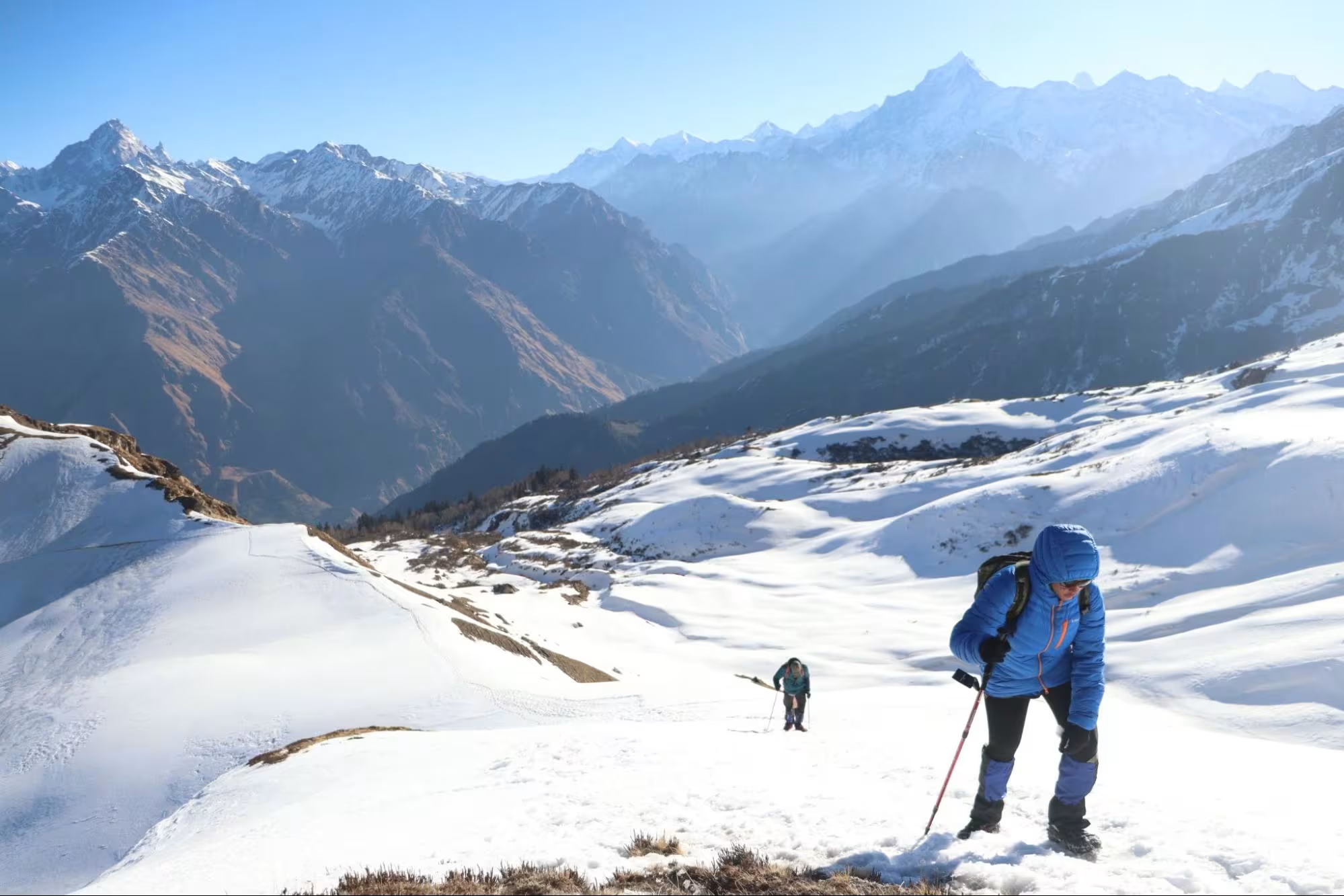
We were provided with microspikes and gaiters at Guling because snowy patches had started just 200 m from there. A fellow trekker returning from Khulara informed that there is more than three feet of snow in Khulara. We started our trek and soon and again we entered a forest section. It was full of Bhojpatra trees. Little snow patches converted into a full snowy trail and the trail had some serious steep ascents in between.
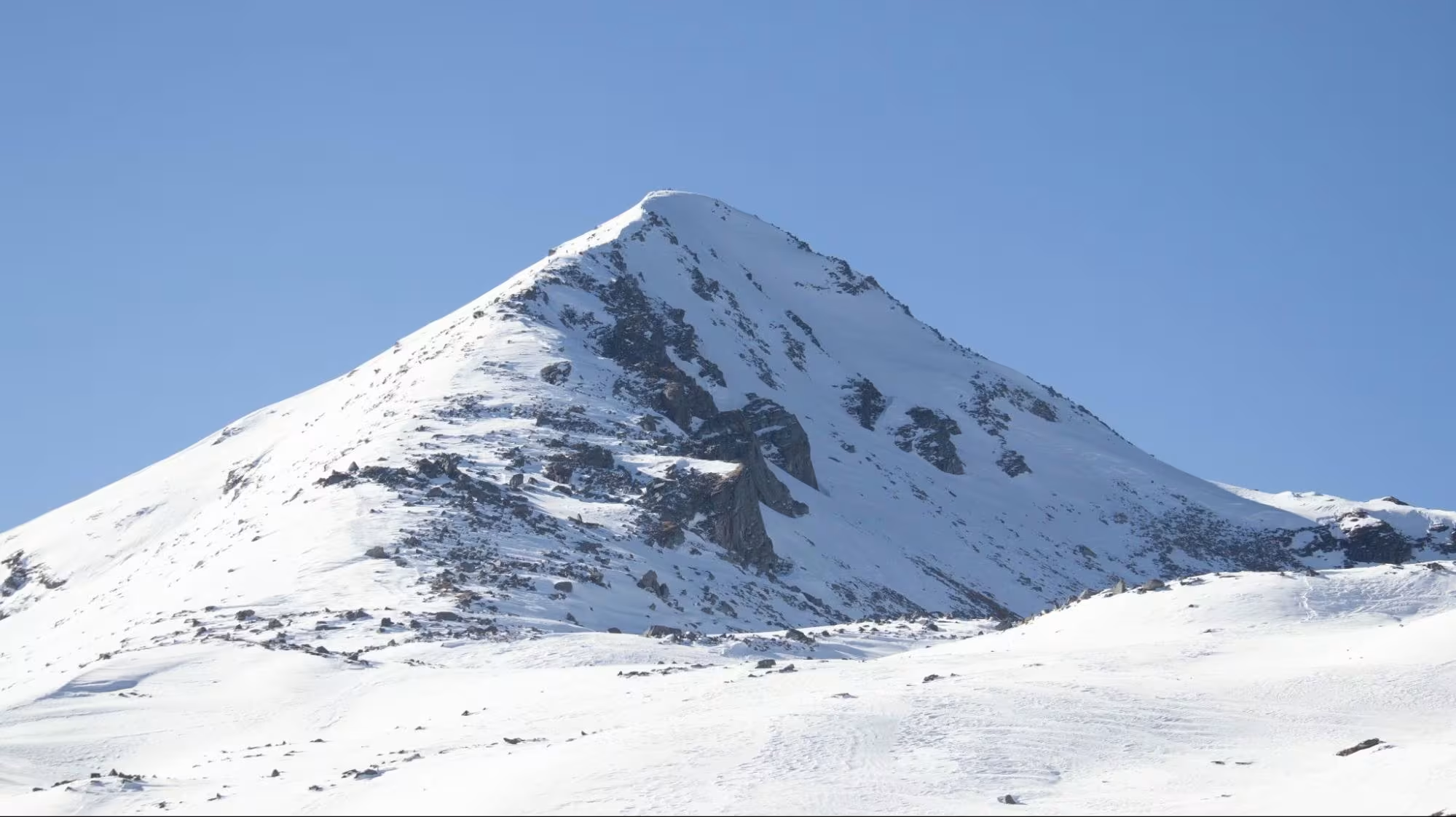
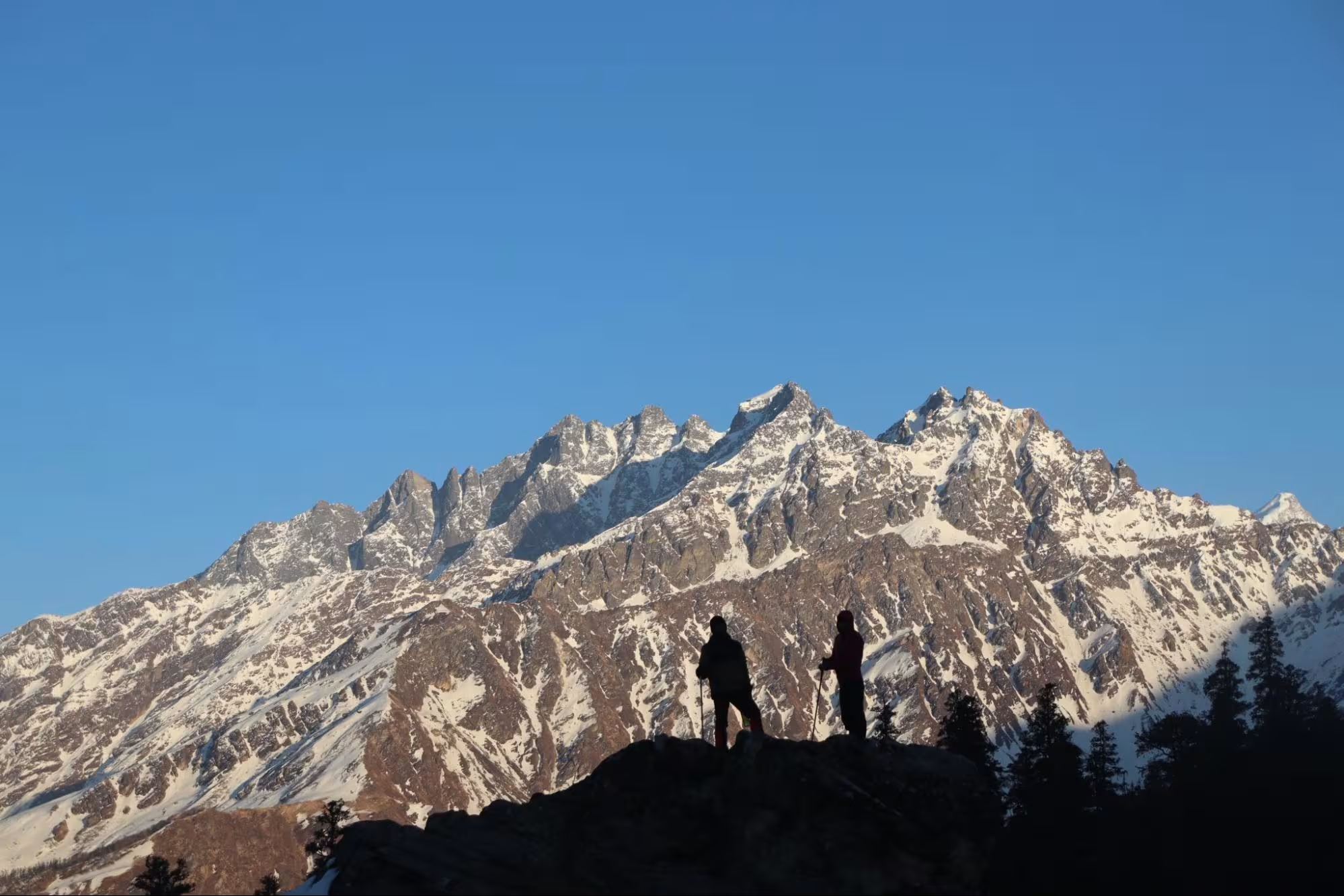
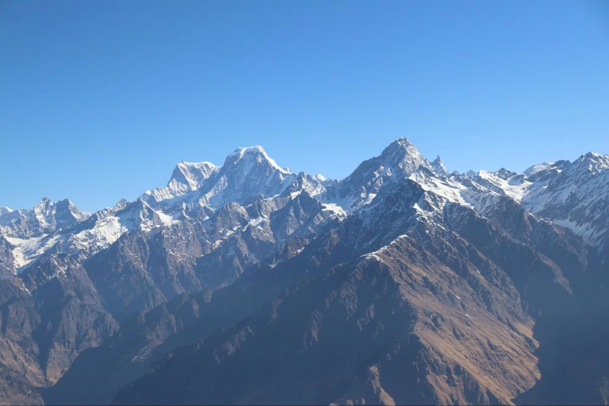
We reached Khulara in 3 hours and it was already covered with a deep blanket of snow. It was 4 ft deep at some points and the tents were set up in between the snow. Khulara was a very crowded campsite and the snow was melting at a fast rate due to high heat. As a result, it was muddy all around and there were too many bees in the campsite. We had lunch in Khulara and started to explore the clearing. We could see some snow slides, there was a huge boulder on one end of Khulara and we thought that it might be a good spot for photography. We went up the hill and sat upon the rock to witness one of the best views of the Nanda Devi range. It was a 180 degree viewpoint and there were no other trekkers at that time.
Generally, the winters get over by February end but this year, Himachal Pradesh and Uttarakhand received snow showers in mid-March. The Guling campsite was so windy and we later got to know that the weather went extreme in Khulara and above. Irresistible winds did not allow anyone to go beyond the Jhandi Top and as a result, there was no Pangarchulla summit till now in 2025. Nobody even attempted the summit due to harsh weather and thus there was no trail after a certain point. So we decided to leave for the summit at 5:00 am and trek as far as we could.
Day 4 – Khulara to Mini Pangarchulla and back to Tugasi
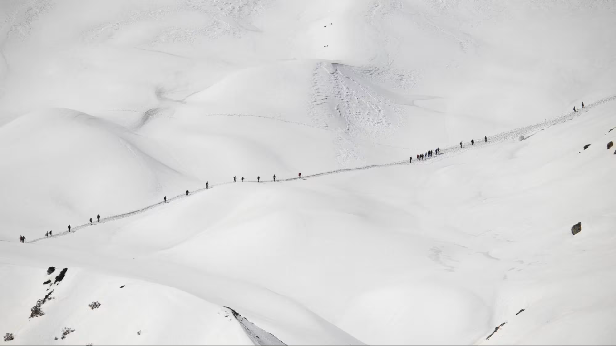
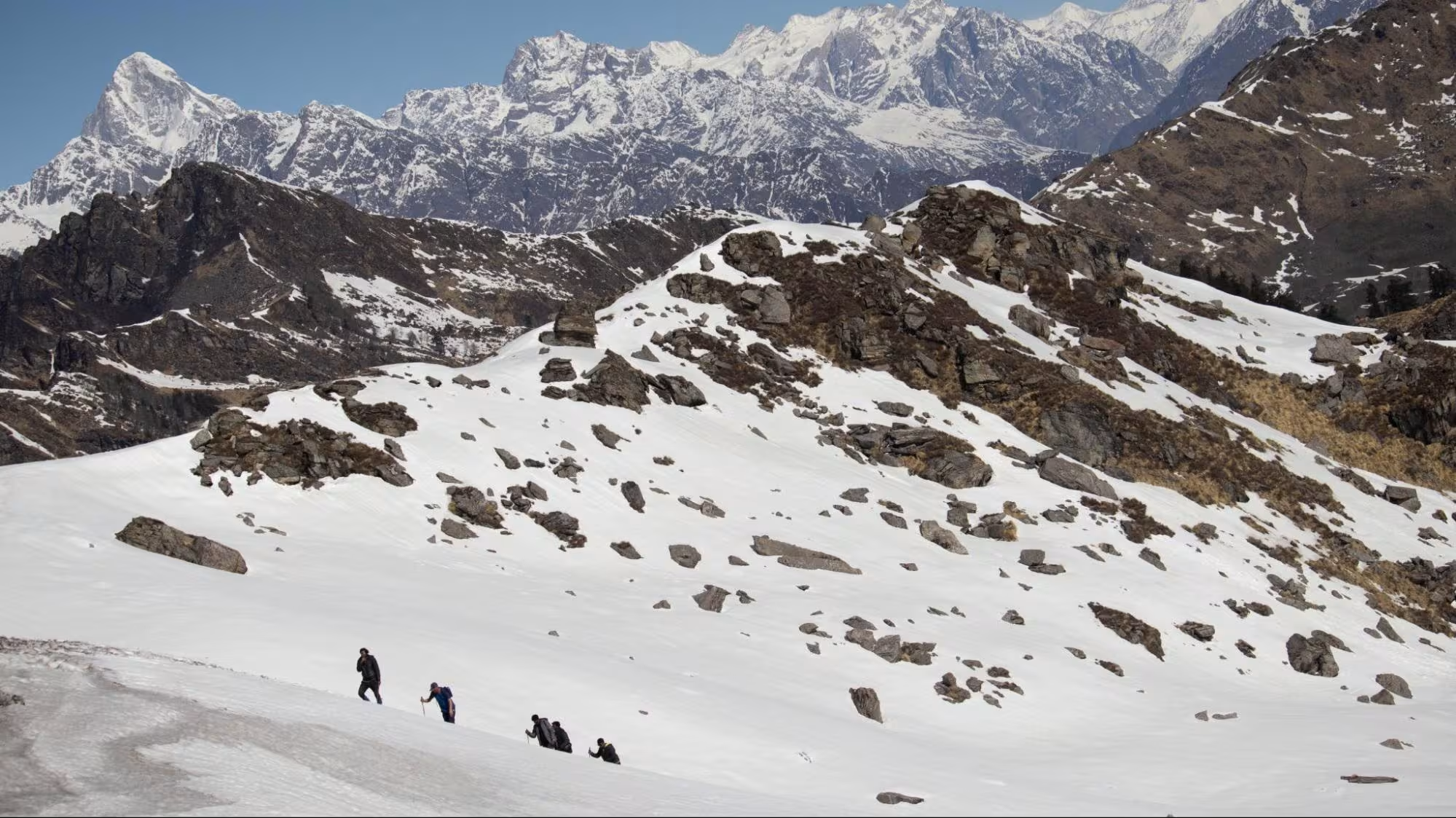
We woke up at 4:00 am and had our breakfast in the chilly weather. We started our trek to the summit by 5:00 am. Wearing our headlamps and trekking poles in our hands, step by step, we started gaining altitude with every step. The major pitstop after Khulara is the Jhandi Top.
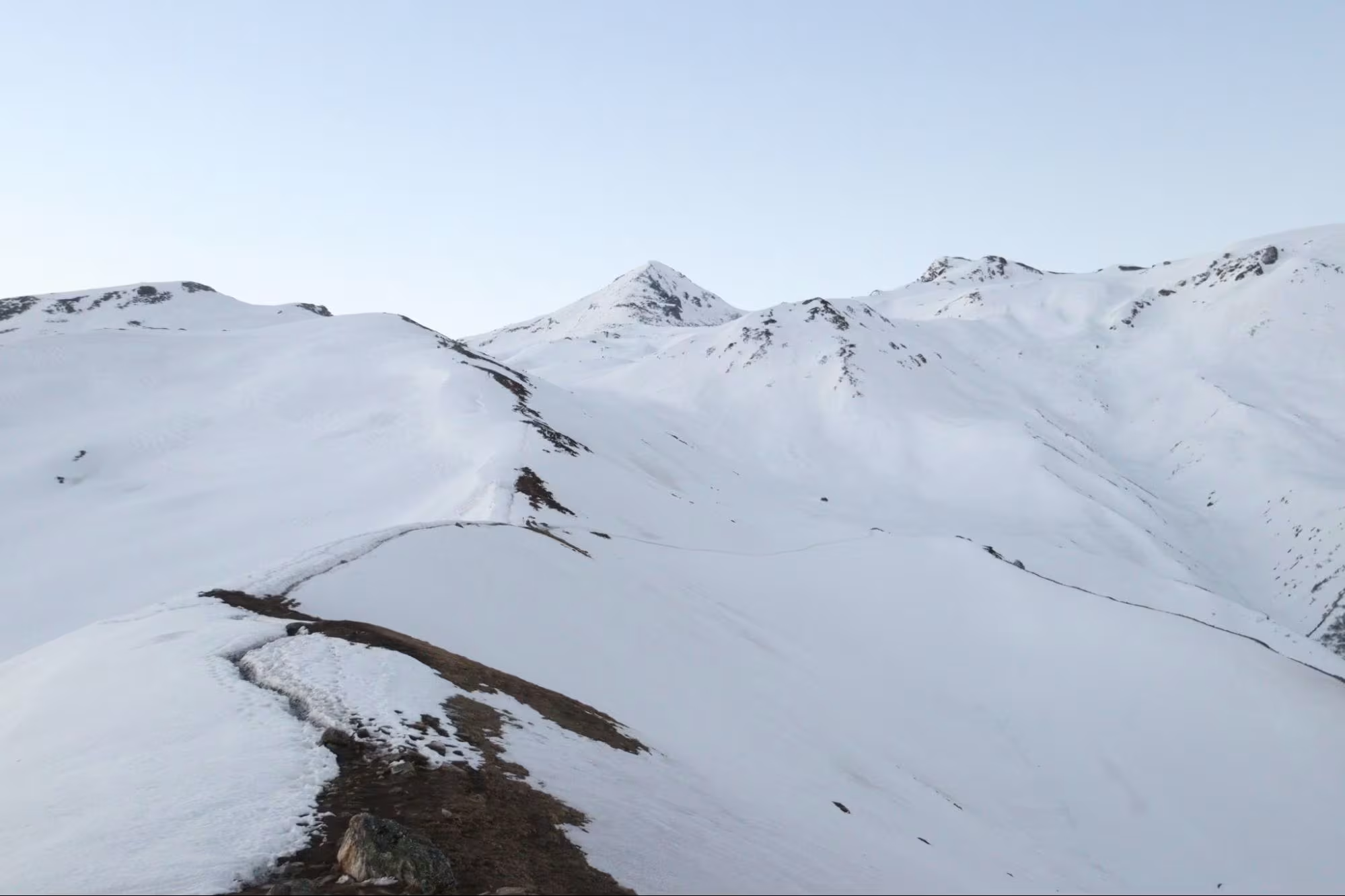
We reached the Jhandi Top in an hour and witnessed one of the best sunrises from there. The view opens up to 270 degrees of Himalayan peaks. We were resting and my eyes saw a team which had departed at 1:00 am for Pangarchulla Peak. They had just crossed Mini Pangarchulla and it took them 5 hours to do so. We continued our trek and climbed ridge after ridge.
The sun was already up and snow had started getting softer with every passing minute. We climbed some more and then realised that every step was sinking more than a foot.
Thus it was sensible to stop continuing forward from here because descending down on that snow was risky. We summited Mini Pangarchulla at 9:00 am and stayed there for a while admiring the Himalayan range. We could clearly see Mt. Nanda Ghunti, Mt. Dronagiri, Mt. Rishikot, Mt. Trisuli west, Gorur Parbat, Lampak I & II, Mt Deoban, Mt Nilgiri, Hathi and Gauri Parbat, Mt Deoban, Mt. Kamet and Mana Peak, Mt Neelkanth and the Chaukhamba Massif. We stayed up there for more than an hour and then started our descent.
The descent was tough at some points because the harsh winds had made the snow at some sections so hard that the microspikes were not useful on it. We reached the Jhandi Top shortly and saw other teams moving towards the Kuari Pass. We ate some snacks at the top while admiring the traffic on the way to Kuari Pass.
We reached Khulara after doing some snow slides and packed up our bags. We descended all the way to Tugasi within three hours and straight away went into a waterfall to beat the heat. We spent the night at the Pangarchulla homestay and then departed for Rishikesh the next day.
Trek Outcome
Pangarchulla Peak trek was surely one of the treks till date simply because of its views. We don’t get to see so many peaks on a single trek that close! The difficulty level of the trek would be moderate to difficult depending upon the snow conditions.
The summit day was the longest and the toughest. One has to climb up 7 km and gain almost 4,000 ft of altitude and then descend back the same distance. The effort-to-reward ratio of this trek was also great.
There were water sources on the trek till Khulara and the trail was also well laid. There was a lot of traffic on the trek because companies bring up large groups and unfit trekkers slow down the pace of the whole group. Overall, our experience of the Pangarchulla peak was very good. We were content, although we couldn’t reach the summit.
In the end, it is always the mountain that allows us to conquer. I would highly recommend this trek to anyone who is looking for mountain views.
Leave a Comment